Malapais Mountain
TRAIL STATS
Malapais Mountain overlooks the Superstition Wilderness, and while the views from the top can’t be beat, the hike there is quite unforgiving. You’ll be off trail more than half the time, and there are steep, catclaw-ridden slopes to ascend. It’s kind of a torture fest.
Trail Description
Oh Malapais, you were so grand and imposing when we saw you from La Barge Creek and Battleship Mountain. There you stood, out of reach, wild, and daunting, drawing us in with your stony aura. We would stand upon your crown one day. We had to.
Wow, I’m waxing poetic over this rugged and unforgiving beast of a hike. Sounds so romantic, doesn’t it? Like we’re desperate fools chasing after something we couldn’t have. What made us fools was thinking it was easily within reach, actually. The information we had said it was around 9 miles with 4000 feet of elevation gain. Hey, that’s no worse than ridgeline. We can do that and be home for dinner!
Um, no.
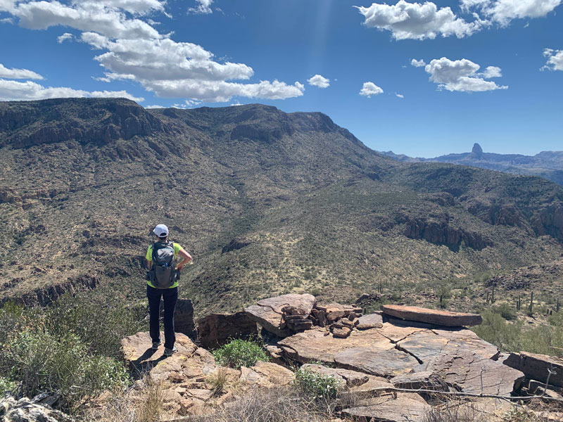
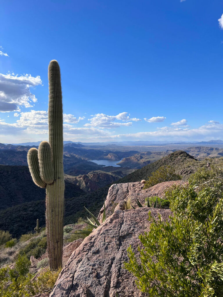
It starts off deceiving. I had been there the week prior and found a trail to the base of Geronimo Head that gave me false hope that it would continue on to the summit of Malapais. Hillary believed me even after reading trip reports because Hillary wanted to believe me, not because I actually knew anything. We began the trail, captivated by the beauty of the views, the wildflowers, and the saguaro cacti. The going was average, and we had the trail to ourselves.
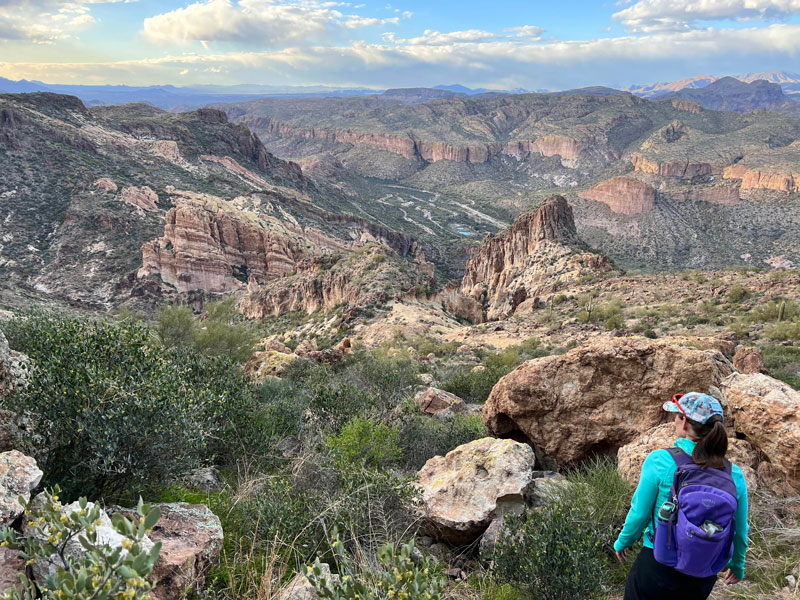
Scenery studded with saguaro cactuses on the way to Malapais Mountain
The Off-trail Section (aka “The Suffer Fest”)
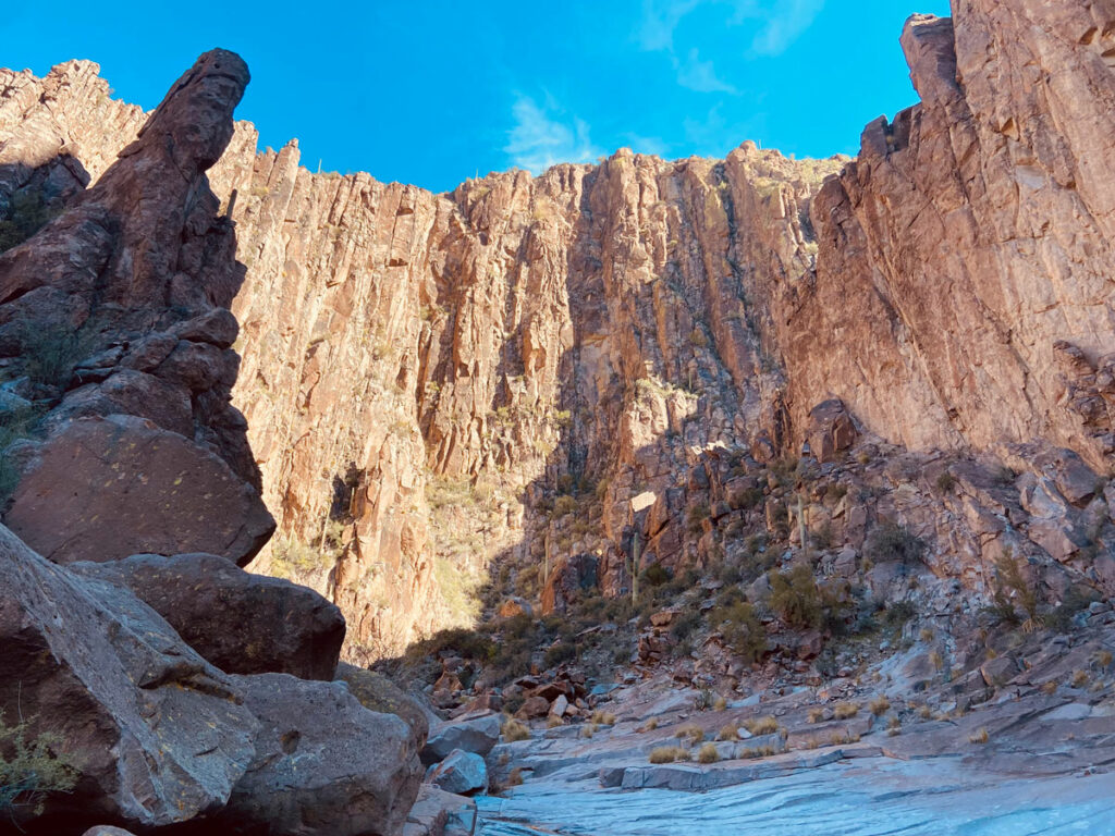
After passing the point where the trail crosses the wash and heads up Geronimo Head, every hope and dream we had for this trail to Malapais was absolutely crushed. At times we thought we found faint traces of a trail only for them to disappear after only a few feet. Other times we could follow the wash until it turned into a giant bed of catclaw, and that is no bed you want to be in. It was cruel. But that was just the beginning.
The route then led us up a hill that gave us hope we were making progress toward the top, and I have to admit the views were pretty awesome up there, so it helped keep our spirits high. But after crossing to the other side of that high point, we for the first time saw what Malapais Mountain was really going to be all about. We would descend from this point only to ascend again, steeply, without any trail.
Realizing our dinner plans were in jeopardy, we decided to eat our lunch while walking across a section that was somewhat flat and not too bushy. It was the calm before the storm.
As we approached the push up to Malapais, the brush got thicker, the climb got steeper, and our pseudo swearing got more frequent. It was full tilt adventure time, you know the type that hurts and isn’t actually that fun? Not sure if I can call it type 2 fun yet, but I was laughing in the videos, so it must have been satisfying in some way. Still too soon.
The topographical map made it look like the mountain was somewhat flat on top, so I figured as long as we could see to the other side, we would call it good. And that was the next cruel trick. When we finally topped out on our arduous climb, there was more mountain blocking our view. We had to press on. Heartless mountain, you!
The Summit
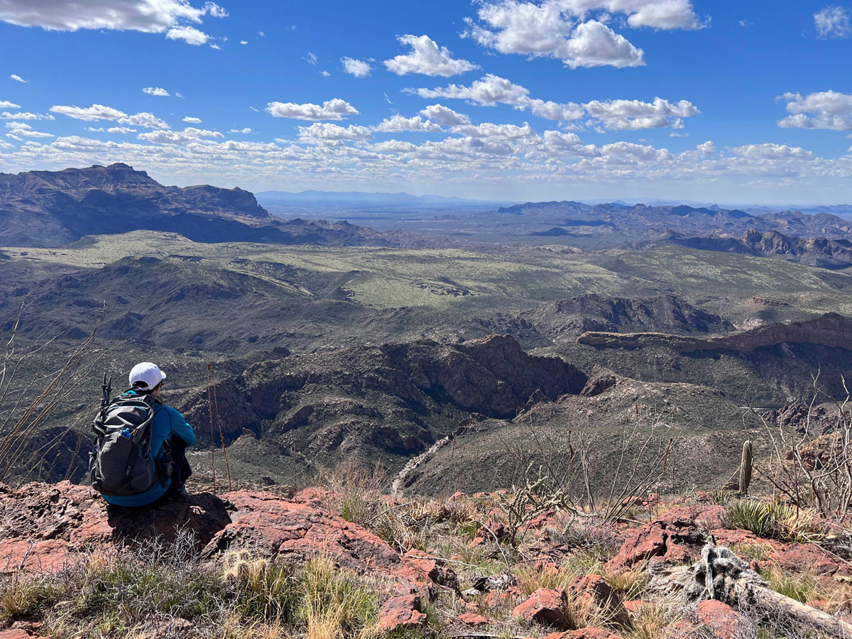
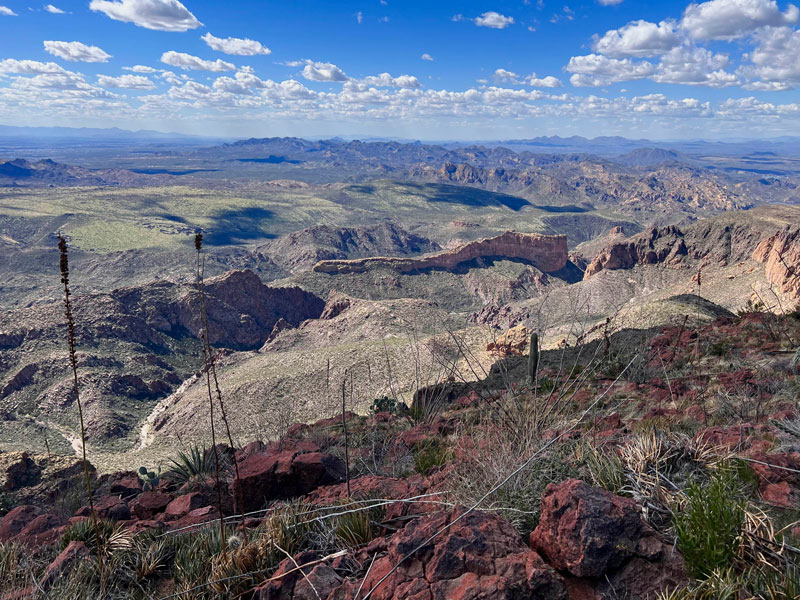
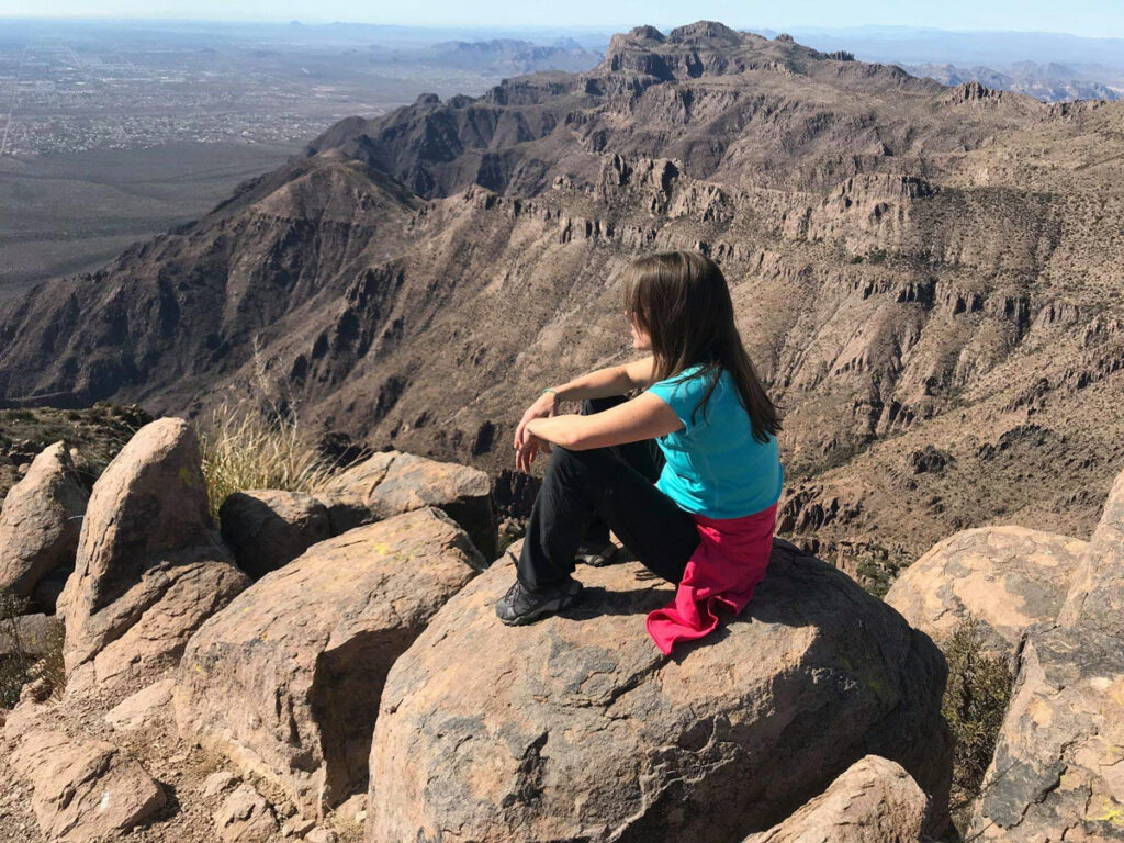
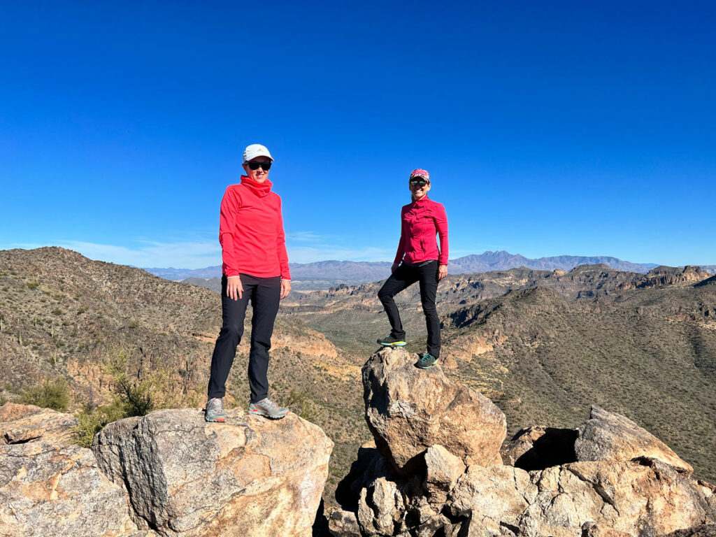
By now the going was much easier, though, and we made it to what we will call the top within about twenty minutes. If you want to get to the summit proper, you’re going to have to push on a little farther, but the views from where we stopped were very satisfying, and we could see all our favorite hikes in the Superstitions: Weaver’s Needle, Peak 5057, Ridgeline, and Battleship. We felt like we conquered the beast.
Except it was only half over. On the way back, we were reminded again of all the pain that we had blocked out. There is no defined route for this adventure, so just make your way in the general direction as best you can, trying to avoid cactus and bushes where possible.
If it starts sucking too badly for your taste (because you’re a normal, rational human, of course), you can go to Geronimo Head instead or just enjoy the first view from the high point and tell your friends you conquered Malapais. They’ll never know.
Plus, this is the only view you need anyway, right?
Map & Directions
Location Superstition Wilderness, Tonto National Forest, Tortilla Flat, Arizona
From the US60, take the exit for Idaho Road. Go north on Idaho Road to State Route 88 and turn right. Follow that road to Tortilla Flat. Just past the town, but before you cross the creek, there is a dirt parking lot on the right.
Trailhead Facilities None. Tortilla Flat is nearby and has a restaurant.
Preview this Hike
Recommendations for you
Five Epic Hikes in the Superstitions
Ten Awesome Arizona Peaks that Aren’t Humphrey’s
La Barge Box Canyon | Superstitions
Leave a Reply