Paradox Arch
TRAIL STATS
At Paradox Arch, you’ll not only enjoy Superstition Mountain views from inside the cool shade of the arch, but you’ll also enjoy a unique rock formation nearby. The trail out to the arch is steep and gravelly at times and can be hard to follow. Bring navigation and good shoes!
Trail Description
Paradox Arch used to be one of those secret places you could only go if you were in the know, but its recent publication on AllTrails means it’s gaining in popularity. If I’m being honest, we have gone looking for it before and never found it, although now I realize just how close we were. The fact is, it’s hard to spot until you’re right up next to it. So, if you were planning to hit the trail without a GPS route downloaded, don’t bother!
Paradox Arch Trailhead
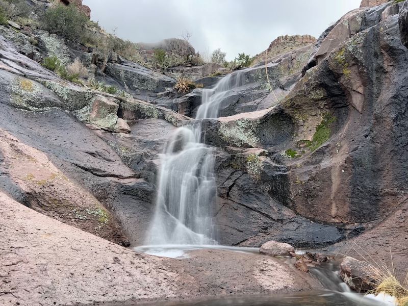
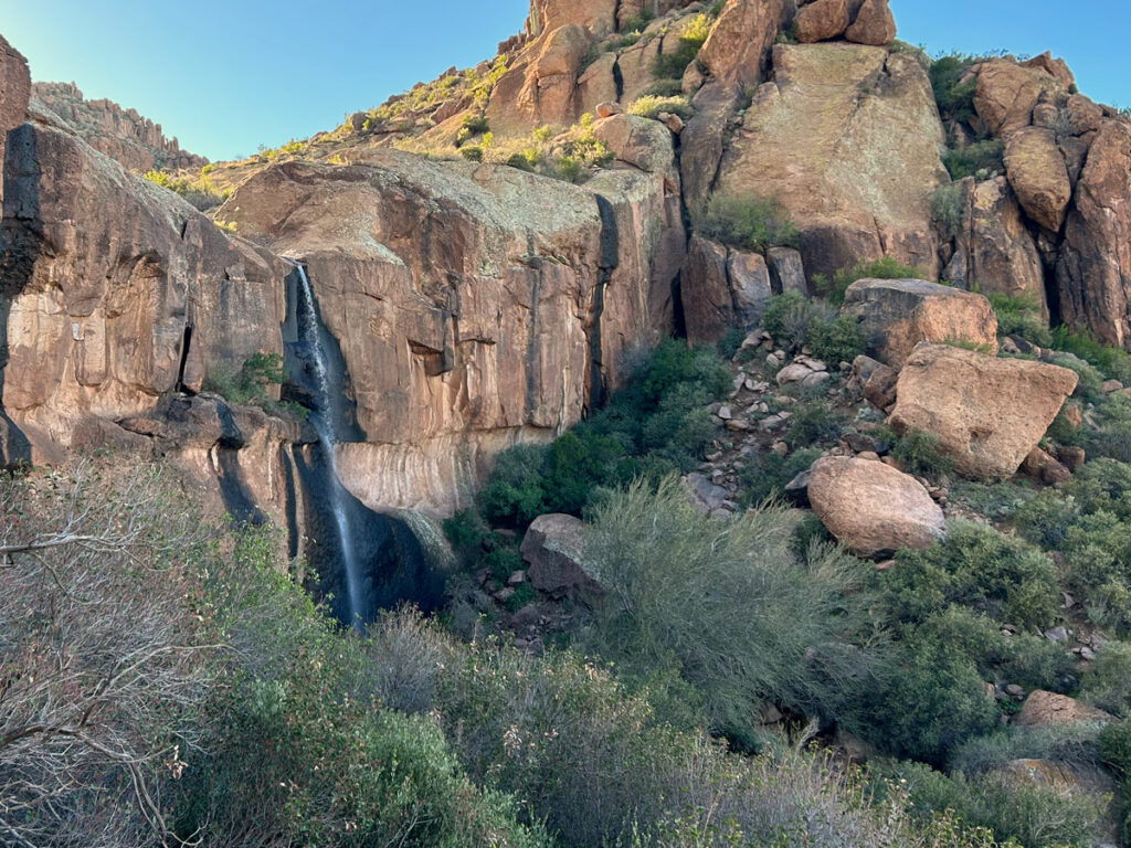
The parking area is the same one you would use for Praying Hands and Slot Rock or Canyon of the Waterfalls, and in fact, you easily can make a little side trip to any of those along the way. Note that Canyon of the Waterfalls only runs after significant rainfall. This is a desert, after all.
From the trailhead, you’ll be heading toward the mountains on what looks like was once a dirt road. If you find yourself on Jacob’s Crosscut Trail or any other trail that doesn’t look wide enough for a car, you’re probably not on the “right” trail. There are a bunch of trails crisscrossing all over out there, so any given trail might get you there eventually, but stick to the wide one for the most efficient route.
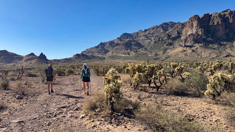
The trail will slowly and steadily gain in elevation here. For a while, the desert isn’t terribly scenic, but it gets better as you pass through some groups of cholla and saguaros.
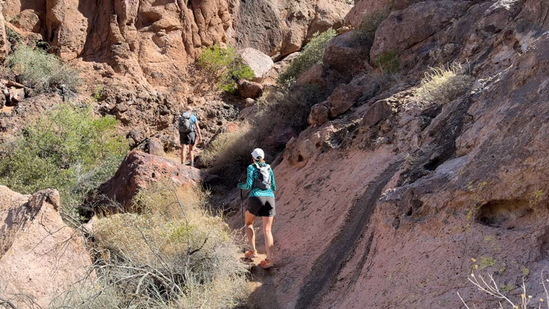
After about a mile-and-a-half, the trail begins to narrow and starts working its way up toward some cool rock formations. You have the choice to go through the narrow passage of Slot Rock or skirt around it up to a saddle.
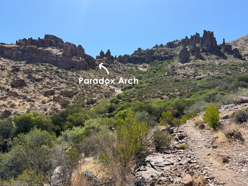
Up until now, you’ve been following the same trail that goes to Canyon of the Waterfalls, but soon it’s time to break left toward Paradox Arch. I took this picture at what I call “Paradox Arch Junction” on the map I provided below, and it gives you an idea where you’re headed.
One trail continues on the right side of the drainage toward Canyon of the Waterfalls, but you will want to find the trail that branches left and crosses the drainage. The trail in this area has a lot of steep, loose terrain, so even though two of us weren’t smart enough to bring hiking poles, you should.
When you get to a narrow ravine, you’ll probably start to wonder if you’re still on the right track. Well, the good news is you’re practically there.
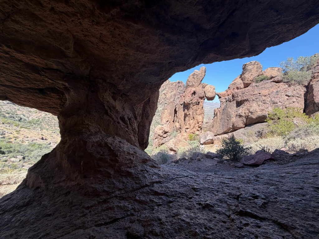
Go up. Yep, up there. Now look up and to your right. It’s Paradox Arch!
Paradox Arch
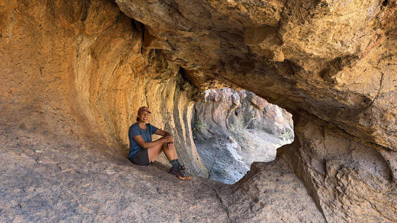
It’s a nice little spot to stop and have a snack. If it’s a hot day, you’ll be happy to know that the breeze flows through nicely.
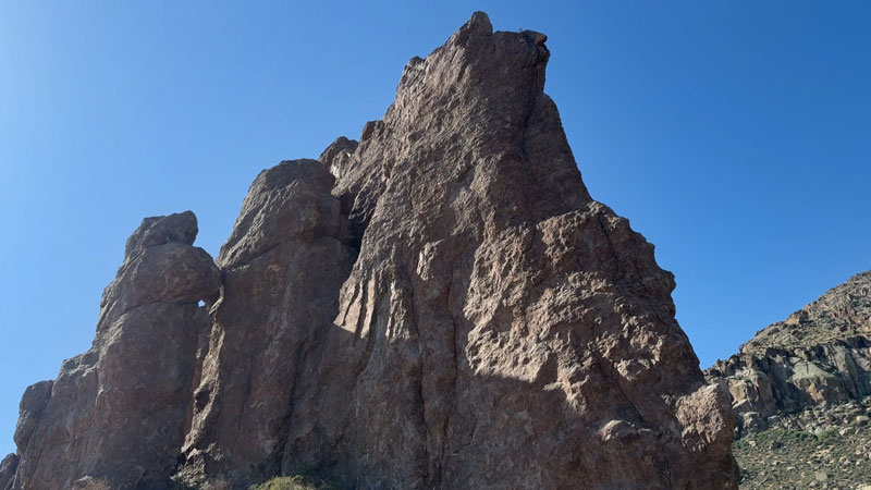
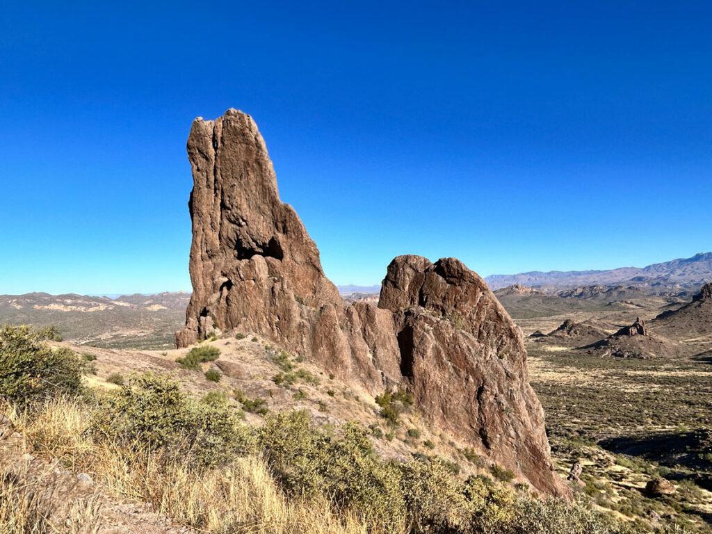
Across from the arch is this funny little Quasimodo rock formation. Or is it a crazy bunny with an eye tumor? Maybe a dolphin holding a ball with its flippers? Or. . . a whale? (That’s an inside joke, but when I finish the YouTube video for this post, you’ll understand.)
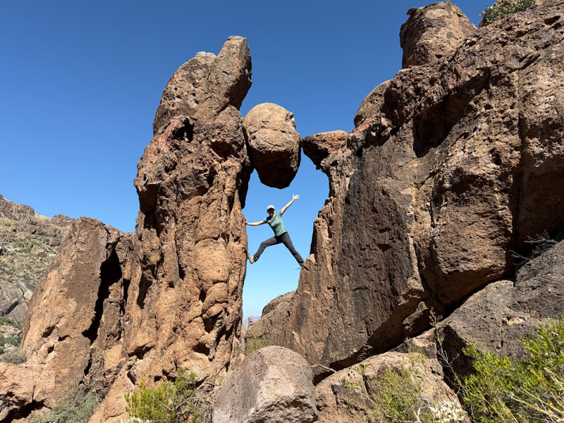
Geez, I really hope that rock doesn’t come dislodged while I’m in there. It doesn’t look like it would take much.
On your way down, you’re really going to understand why I recommend poles. For the fools like us who didn’t. . . good luck to you. Have fun!
Map & Directions
Location Superstition Wilderness, Apache Junction, Arizona
From the US60 take the exit for Idaho Road. Go north on Idaho Road to state route 88 and turn right. Follow this road past the Lost Dutchman State Park to the turn for First Water Trailhead. Turn right and follow the dirt road 4/10 of a mile to the parking area on the right. It is not marked, so GPS can be helpful. The road is usually passable in a passenger vehicle.
Fees/Passes None
Trailhead Facilities None
Recommendations for you
Canyon of the Waterfalls | Superstition Mountains
Praying Hands to Slot Rock | Superstition Mountains
Massacre Falls | Superstition Mountains
Leave a Reply