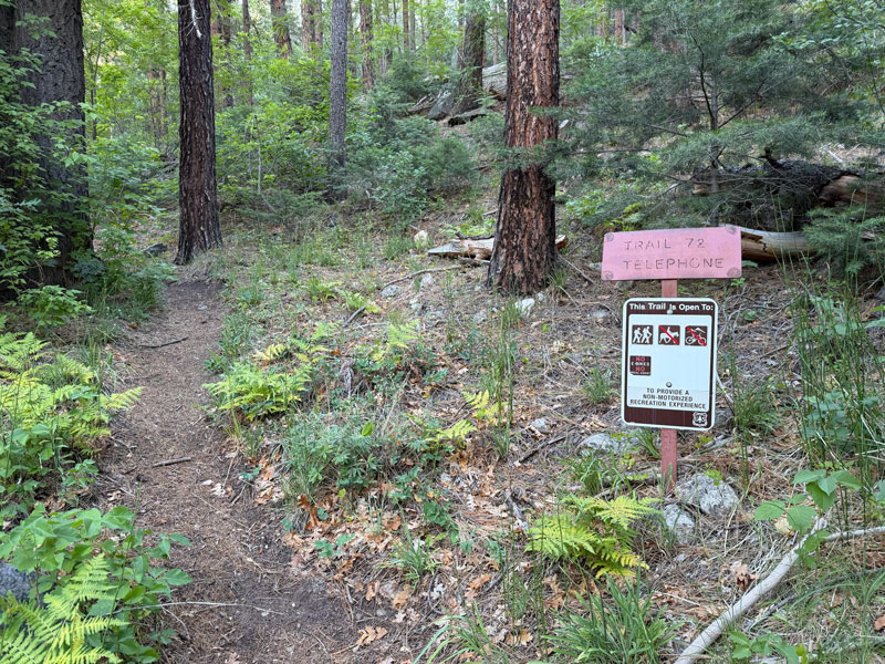
Telephone Trail
TRAIL STATS
Away from the crowds at West Fork Canyon, Telephone Trail take you up a ridge to a nice view of Oak Creek Canyon. The trail is steep and requires use of your hands at times, and hiking poles are highly recommended for the descent. An interesting set of small arches about halfway up makes a good turn around point for those who aren’t up for hiking all the way to the top.
Trail Description
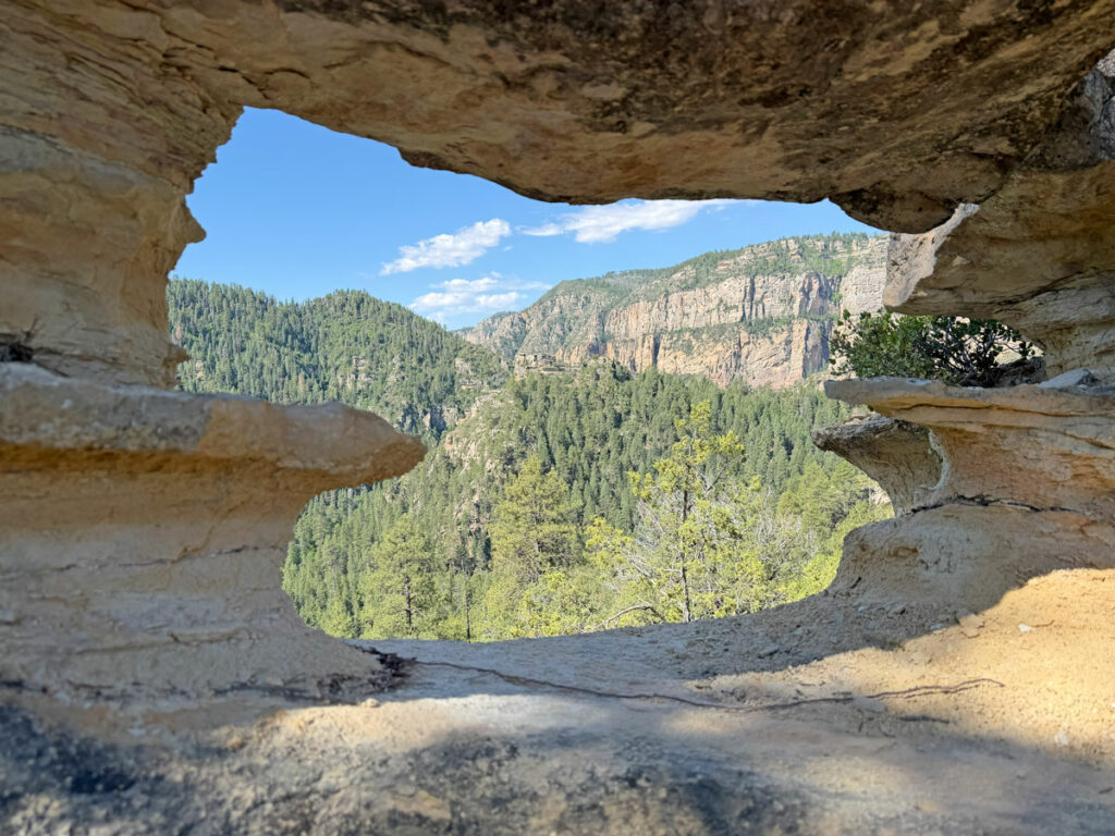
First off, if you were imagining walking under the arch shown in the cover photo like I was when I saw pictures of this hike, forget about it. This arch and the ones next to it are cool little formations, but they’re only about a foot tall, and you’d be hard pressed just to slink through like a worm. (Am I the only one who thought these were huge?)
Just tryin’ to set your expectations before you go to all the effort to get up there. You’re welcome. It’s still a decent hike if you like ridges, views, and a good calf-burning hike.
Telephone Trailhead
Telephone trailhead doesn’t have any parking, but there is a pullout about 300 feet south with space for maybe half a dozen cars. I got there before 8am, and there were no other cars there, but by the time I got back before 10am, it was pretty full. If you can’t find parking there, you can try using the pullout farther north on Highway 89.
From the parking area, walk about 300 feet to the start of Telephone Trail. A sign about 100 feet from the parking points you in the right direction, and there’s also a sign at the trailhead.
By the way, the topographical map on my Garmin had this labeled as Telegraph Trail, but the signs say Telephone Trail. I’ll let someone else figure out who’s right.
Telephone Trail
The trail starts off gently rolling through a nice forested area. It feels so peaceful, but don’t get too comfortable because in less than a quarter mile, the trail starts heading steeply up onto a ridge. You’ll need your hands to help you get up some of the rocky parts, and maybe a stick to clear all the webs if you’re the leader of the group.
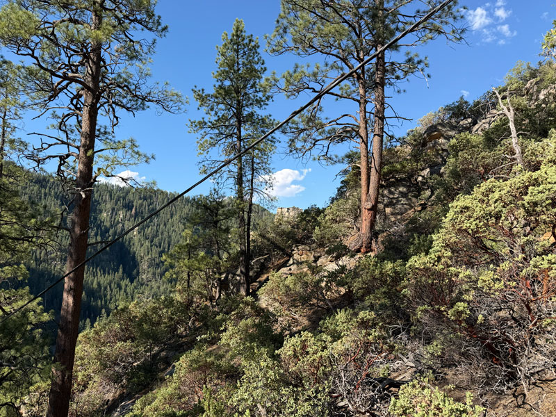
If you look above you, you will see the remains of an old wire and at least one telephone pole, which is where I assume this trail got its name.
For the next third of a mile, the trail goes steeply up about 400 feet of elevation to get up on top of the ridge. One of the reviews I read recommended bringing an inhaler even if you don’t have asthma. I had a good chuckle at that one. Yeah, it’s steep, but you can tell the complainers in your group that it will level out soon, and you’ll be at the arches before you know it.
Once atop the ridge, you’ll head right and walk along a narrow path with views to your left and right. When the ridge you’re on looks like it drops off at a dead end, it doesn’t. Go to the edge and you’ll see that you can get down to where the trail continues.
Arches
About half way through this hike, at the 0.6 mile mark, you’ll come to a skinny ridge with several arches in it.
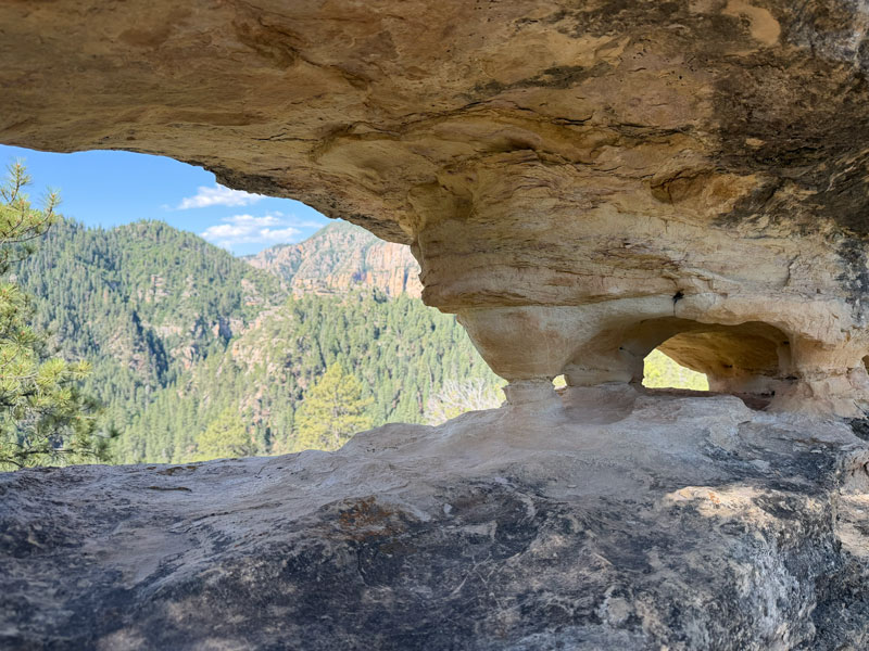
You know when you order something online, and it’s much smaller than you thought when it arrives? Yeah, they’re kinda like that. I thought I would be sitting inside this. The best you can do is step up and peek through them at the view beyond.
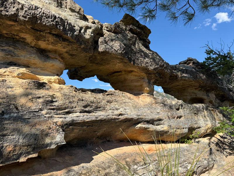
They’re still cool, just not THAT cool. Barbie would probably give this hike 5 stars, though.
The trail continues to be relatively level for a short time before heading uphill basically nonstop. When you reach a saddle where you can see to the other side, you’re still not there. Nope, turn right and keep hoofing it up the section I like to call Heartbreak Hill.
This is where you’ll think someone must have made this trail before switchbacks were invented. It’s a real calf-burner, and it’s just as fun on the way down, but in a different way (especially if you didn’t bring poles).
Viewpoint
If you make it up Heartbreak Hill, it’s just a short distance to the turnoff for the viewpoint. Watch for cairns because the trail does continue past it. I didn’t have time to explore the trail beyond the viewpoint, but if you do, let us know how it went in the comments.
The viewpoint is a rocky outcropping with open views into the canyon below.
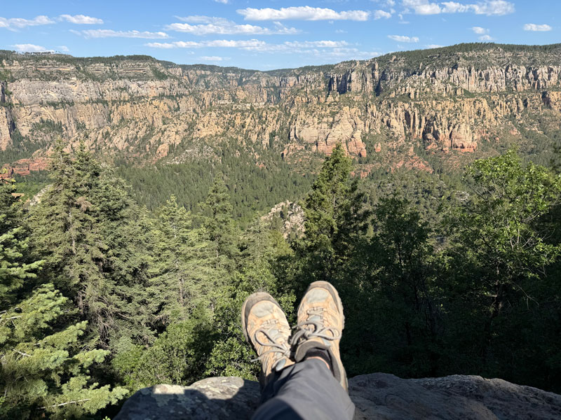
This trail doesn’t appear to be used very often, so you’ll probably have it all to yourself, other than a little noise pollution from the road below. I couldn’t help but think of the crowds at West Fork and be happy to be sitting all alone in this beautiful space.
Not long after, I was headed down and wishing I brought hiking poles. Don’t forget them!
Map & Directions
Location Oak Creek Canyon, Sedona
Heading north on Highway 89 out of Sedona, go about 0.4 miles past the West Fork Trailhead and look for a parking pullout on the right next to an overhanging rock. If you get to Cave Springs Campground, you’ve gone too far. Park here, and walk north on Highway 89 for 300 feet to the Telephone Trailhead.
Fees/Passes None
Trailhead Facilities None
Recommendations for you

Snoopy Rock | Sedona

Merry Go Round Rock | Sedona

Bell Rock Climb | Sedona
Leave a Reply