Bell Rock Climb
TRAIL STATS
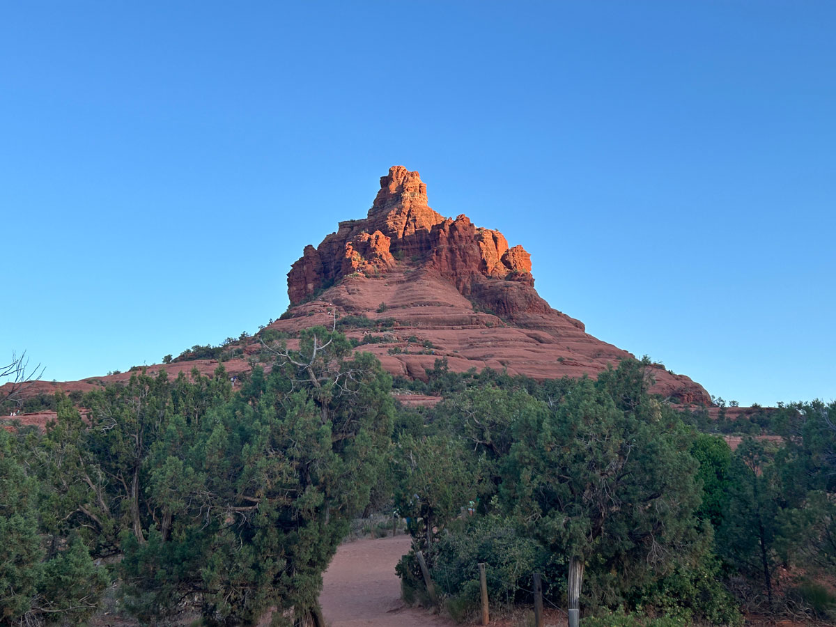
One of the most recognizable landmarks in Sedona, Bell Rock offers a short hike to a nice viewpoint. People who are craving more adventure can try to climb up higher on the rock to some of the spires that surround the top. This is a very popular trail, and parking may be challenging.
Trail Description
Parking. It seems like I’m always talking about the parking situation for trails in Sedona. An easy hike to a special place like this will always draw the crowds, and this one seems to be one of the more popular spots.
We saw some people parked in tow away zones, which I don’t recommend, but there is overflow parking at the Yavapai Point Trailhead, about half a mile north on the highway on the left side. The satellite map shows a path along the highway to get back, but sheesh.
Good luck to you. Turnover is high, so if you’re patient, you could score a spot within about 15 minutes or so—less time than it takes to walk from Yavapai. Just sayin’.
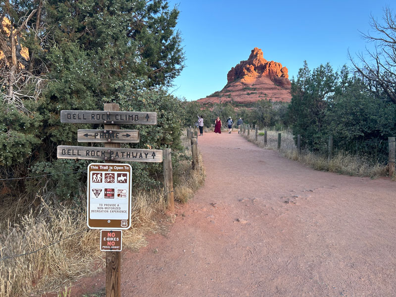
Bell Rock Access Trail
From the trailhead, you’ll want to follow the Bell Rock Access Trail. It’s easy to spot because it’s wide, marked with signs, and probably already has a bunch of other people on it.
It’s a popular place for photography, so you might see some folks dressed to the nines on the trail. Don’t worry, you’re not underdressed. You came ready to tackle that climb, baby!
As you get closer, you’ll come to another junction. Luckily, there are lots of signs and cairns out here, so it’s hard to get lost. Keep following the sign for “Bell Rock Climb.”
This sign can be a tiny bit confusing because there’s also a trail called “Bell Rock Path,” which goes along the side of the rock. To actually get onto the rock, you want to follow the signs for the climb.
Bell Rock Climb
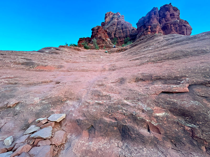
Beyond that sign, the terrain gets more rugged, but there are plenty of large cairns to guide you along your way.
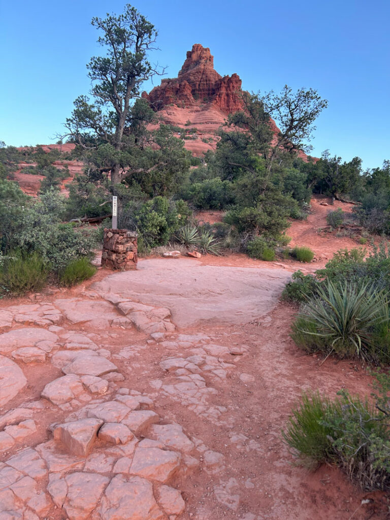
And plenty of people around to let you know you’re still going the right way.
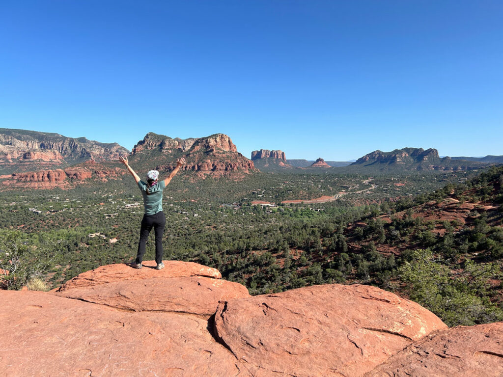
Eventually, the trail gets up on top of a rock platform, and this is where the unofficial trail ends on most maps. But you’ll see people way up high near the top, and those who can’t resist a challenge will be itching to find their way up.
Do it.
The most obvious way to go is to head straight up a rounded bowl. When we went, there were rocks piled up to assist you, but I found it a little to sketchy for my liking.
Going around to the right of it was not a viable option, so we went over to the left of it and found a spot where we just needed a little boost to get to the next level. Luckily, there were people there questioning their life choices who were willing to assist.
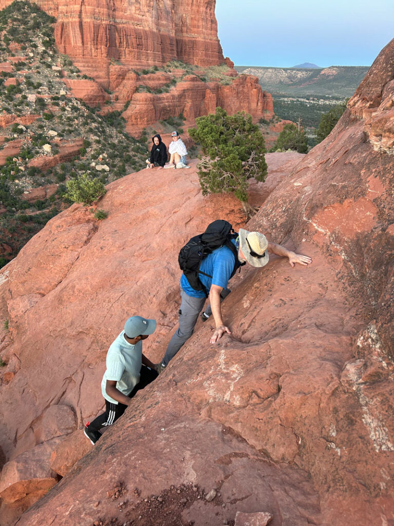
We kind of hoped they’d still be there when we got back, but that was a problem for later.
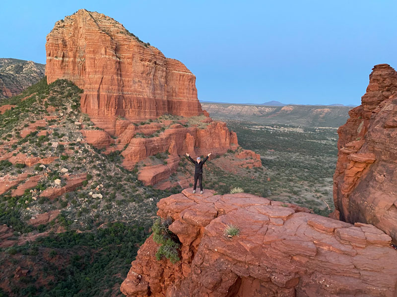
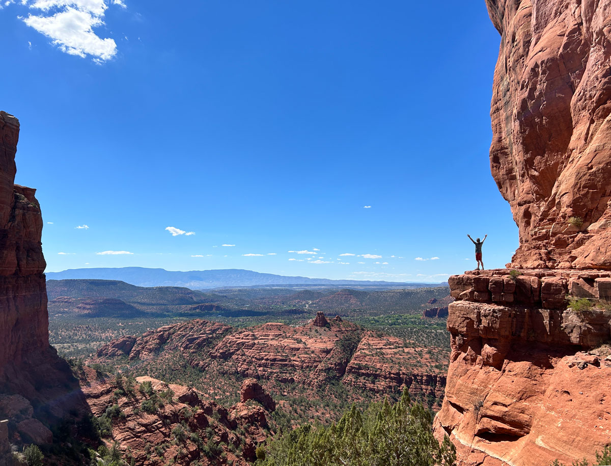
On the next level, there were obvious use trails that we could follow around to the upper part of the sketchy bowl that we avoided earlier. Of course, by the time we put the effort in to get to that point, we knew we had to go all the way. From there, it was pretty easy to get up onto the spires that surround the summit.
We did not go to the actual summit, and we don’t even know if that’s possible, but the views from the spires were plenty awesome.
Bonus if you catch a little bit of the sunset.
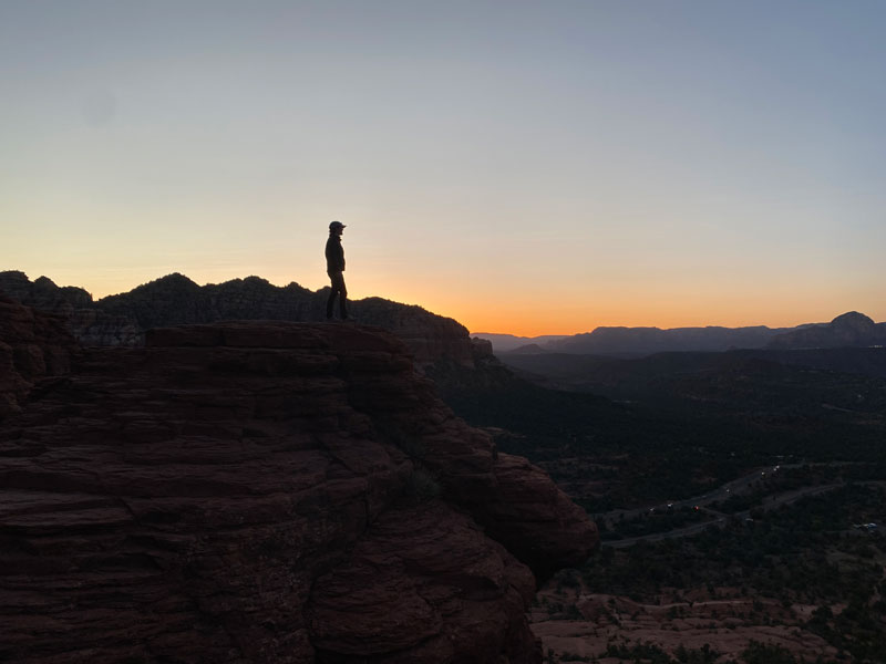
We were the last ones up there, and the waning light was a little concerning since it wasn’t exactly easy to get up there. We headed down quickly and found the place mostly cleared out, but luckily it was easier to get down that tricky section than it was to get up, and we made it no problem.
In the last glimmers of daylight, the big cairns are harder to follow, so GPS really helps if you’re doing it in limited light. We actually saw some older women miss a turn in the trail and head down the wrong way. I worried about their fate for the rest of the hike.
Hope they made it. (Just bring GPS, okay?)
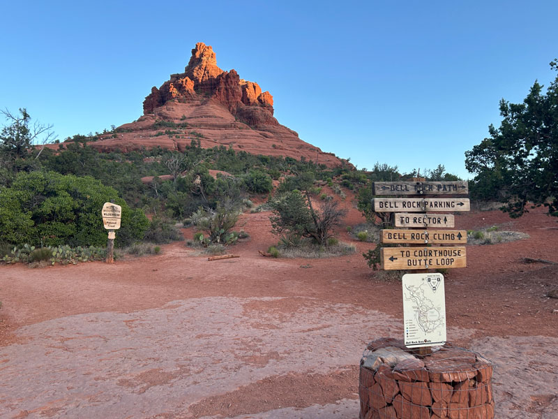
Map & Directions
Location Munds Mountain Wilderness, Sedona, Arizona
Google Maps Courthouse Vista
Fees/Passes A Red Rocks Pass or America the Beautiful Pass is required. Pay kiosk at the trailhead.
Trailhead Facilities Pit toilets
Recommendations for you
Cathedral Rock | Sedona
Airport Loop | Sedona
Birthing Cave | Sedona
Leave a Reply