Barry Goldwater Peak
TRAIL STATS
As the highest point in the White Tank Mountains, Barry Goldwater Peak demands a strenuous hike to the summit. Here you’ll find a typical desert landscape with patches of saguaros and wide open views of the mountains sprawling in every direction. The final summit push is on a dirt road (not our favorite), and the summit and neighboring peaks have antennas, buildings, and other equipment on top. You can’t really get a 360-degree view anywhere, so that makes the destination less satisfying. If you can appreciate expansive views of the desert and distant layers of mountains, you will enjoy yourself well enough.
Trail Description
This was my first visit to the White Tank Mountain Regional Park because I live in east valley, which means I’m spoiled with great hiking spots. I am such a sucker for peak bagging, though, and when I saw that this mountain offers a challenging distance and elevation gain, I decided to try it out.
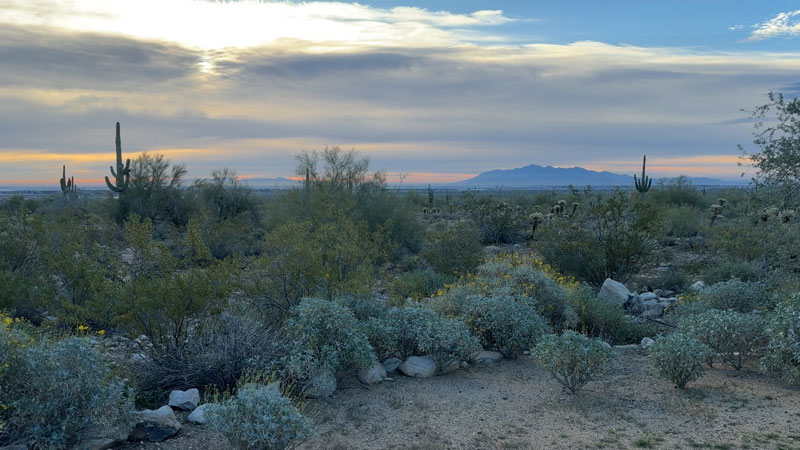
As we arrived at the parking area, I immediately noticed that the trailhead offered a beautiful desert view in the morning light.
We were following a track we got from AllTrails, which started at the South Trailhead. Come to find out later, we could have parked a little farther down by the Goat Camp Trailhead and saved ourselves a quarter mile each way. However, the restrooms were at the South Trailhead, so that was nice.
South Trail
The first part of this hike is relatively flat, so I’m guessing it would be very similar to start on Goat Camp Trail. However, starting at Goat Camp would be shorter and less complicated, so it seems obvious what the right choice is. I’m including both routes in the GPX file below, so you can choose whether to go the long way or the smart way. This hike is long enough without adding extra distance.
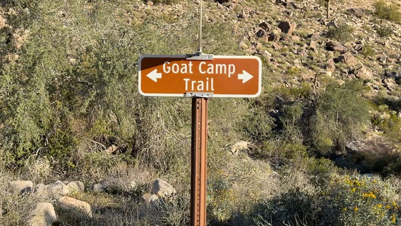
If you’re a fool like us and start at the South Trail, walk along the mostly flat trail for one mile until you see the sign for Goat Camp.
Goat Camp Trail
At the junction, turn left to join the smart people on that trail who started on Goat Camp in the first place and are only 3/4 mile into their hike.
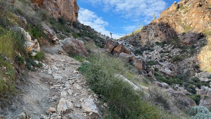
Not long after the junction, the trail makes its first big uphill push. You’ll be ascending about 1400 feet in just under two miles, so get those thighs ready. It’s a burner.
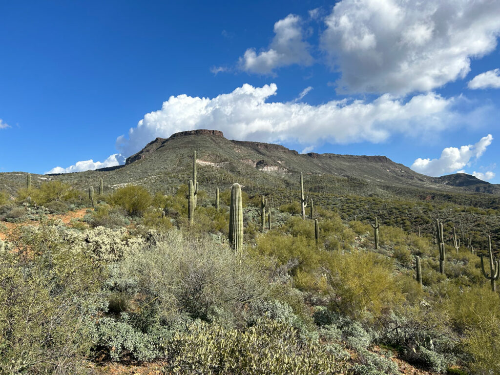
The flora is mostly scrubby desert bushes with majestic saguaros sprinkled throughout. If you come in spring (or in a warm January like we did), the brittlebrush will be blooming. We enjoyed melodic birdsongs, saw butterflies flitting about, and heard the occasional fighter jets flying over from nearby Luke Air Force Base.
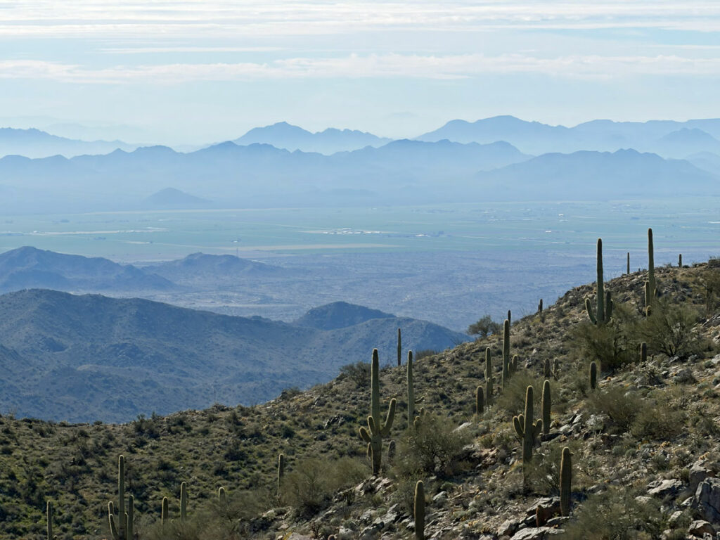
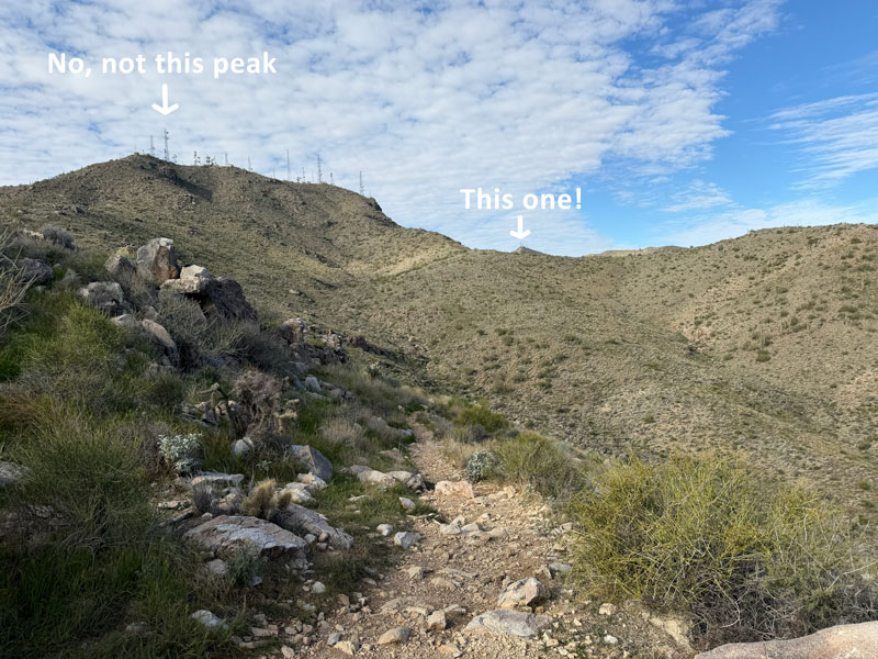
Once you get to the top of the first uphill section, you’ll be able to see more peaks in the distance. No, you’re not headed to that one to the left that looks sort of close. Look waaaaaay out there in the distance. Like, the farthest thing you can see. Bingo! You regretting the extra distance yet?
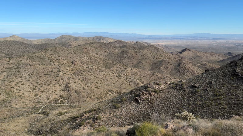
Thankfully, you’ll get a little reprieve from the uphill for the next couple miles as the trail winds along the contours of the next two valleys. The expansive desert views are very impressive along this stretch.
At 5.5 miles in, you’ll get to an unsigned junction with the trail that leads toward Barry Goldwater Peak. The waypoint for the turnoff that we got from AllTrails was wrong, so don’t go bushwhacking up a rocky ravine.
Barry Goldwater Peak Trail
This junction is the start of your second major uphill push that will carry you to the summit, gaining about 1,000 feet in the remaining mile and a half.
Even though this is an unofficial, unnamed trail, it’s actually fairly well-defined. We were pleasantly surprised since we were expecting an off-trail route. The basic idea is to follow the ridgeline for about 3/4 of a mile until you reach a dirt service road.
Service Road
I hate hiking on roads, and this one seems especially insulting given that it’s straight up steep and you’re pretty exhausted by now. However, the views are excellent as you can now see far out to the west now.
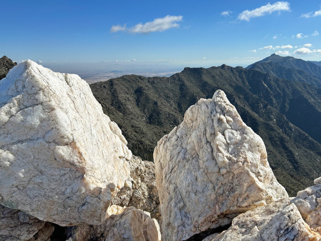
Here’s where I got confused. The AllTrails route shot off to the left, but my Garmin showed the trail continuing. The Garmin showed the highest peak of the White Tanks at 4081, but Barry Goldwater Peak at 4029. Huh? We decided to keep going on the trail Garmin showed, and we ended up at a turn in the road with a railing that served as a nice viewpoint.
From there, we headed up to the peak where there was a warning sign about high levels of radio waves that made continuing farther unsafe. So, we went back down the last hill and around to the other side to have lunch.
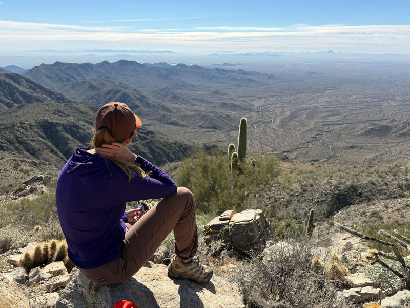
There is nowhere really to get a 360-degree view from the top, so going up to the railing for a view of one side and then going down and around is the best way to get a view of each side. One at a time. It’s a bit of a letdown after all that work, but the views are still great.
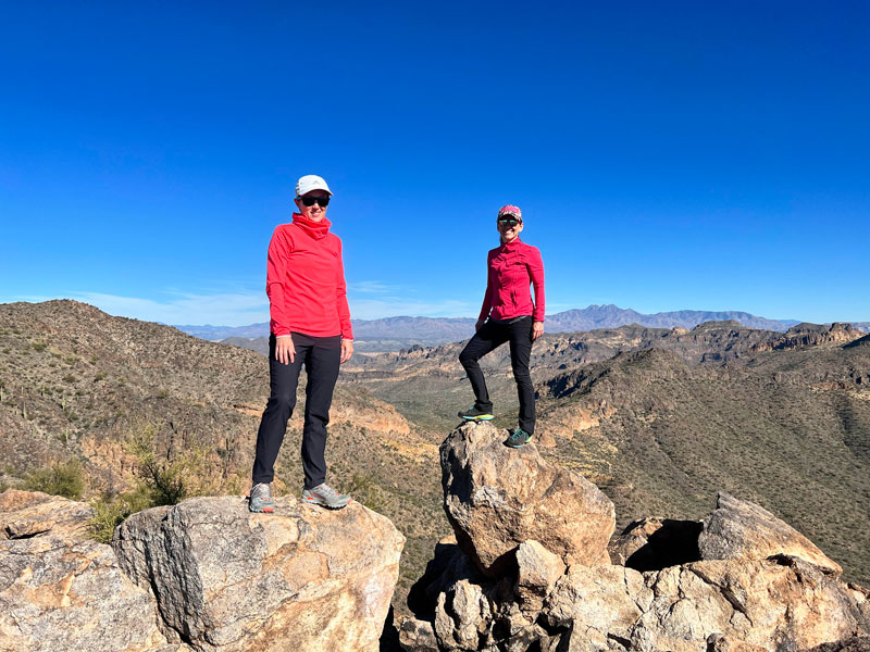
Unfortunately, many of the neighboring peaks also have a bunch of antennas and other equipment on the top. After a less than impressive summit, I decided I can get at least as much (South Mountain) and better (Superstitions) staying closer to home. I won’t be back, but I was glad I gave it a go.
Map & Directions
Location White Tank Mountain Regional Park, Waddell, Arizona
Google Maps South Trailhead
Fees/Passes White Tank Mountain Regional Park charges a fee to enter, or you can use a Maricopa County Parks Pass.
Trailhead Facilities Restrooms with running water
Recommendations for you
Ten Awesome Arizona Peaks that Aren’t Humphrey’s
Spur Cross Full Loop | Cave Creek
Quartz Peak | Sierra Estrellas
Leave a Reply