Goldmine Dynamite Loop
TRAIL STATS
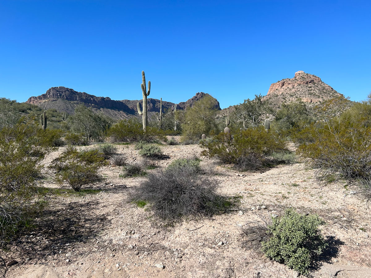
Goldmine Dynamite Loop offers a moderate desert hike with some elevation gain up to a peak and multiple viewpoints. The surrounding mountains and desert vistas provide a lovely backdrop full of saguaro, cholla, palo verde trees, and ocotillo. Visit the graves of Mansel Carter and Marion Kennedy, prospectors and local legends who carved out a life here in the mid-1900s.
Trail Description
I never thought I would include this hike on my blog. With the incredible Superstition Mountains so nearby, we more or less avoided this park (and its fee). But when limited time made it the most convenient option, I gave in. And you know what? I have to admit it’s a decent hike. Not only do you get your heart pounding climbing up to the saddle, but you have the option to go up to a nearby peak, and beautiful views of the desert. The terrain is varied, and it has historical value with the gravesites of those who once lived here. Not bad, not bad at all. (Not the Superstitions, but that’s okay for today.)
There is a fee for parking at this trailhead, and we used to avoid the per car fee and only pay the per person fee by parking on the neighboring street and walking in. People were obviously doing that same thing the day we went, but there were tow away signs all along the street. The park’s website also states that parking along the road is prohibited. We decided to play it safe and pay the per car fee. Hey, it’s cheaper than a tow.
It looks like they are building a nicer, bigger lot with permanent restrooms and paved parking, but that was not open at the time of this writing. The park website said it was supposed to be done late fall 2025, so hopefully it will open soon!
Goldmine Trail
From the temporary dirt parking area, there is a wide path that passes to the right of the area that’s under construction. Follow this straight ahead to the junction with Dynamite Trail.
From here, you can choose which way you’re going to hike the loop:
- Clockwise To hike this in a clockwise direction, stay on the Goldmine Trail. This trail is more steep going up, and I personally prefer to hike UP the steep instead of DOWN. Going in this direction, you’ll see the graves, the peak, and the viewpoints much sooner. It also makes a good choice if you want to shorten the hike without missing the highlights.
- Counter-clockwise To hike this in a counter-clockwise direction, turn right onto the Dynamite Trail. This trail is more moderate and meandering, but it means you’ll have to go DOWN the steep section on Goldmine Trail. It’s also a longer hike to the peak and viewpoints.
Since I always hike this loop in a clockwise direction, the rest of this post will describe the hike in that direction.
Cemetery
Just beyond the junction with the Dynamite Trail, you’ll see a sign pointing to the gravesites. Take the short spur trail to the right to visit the cemetery.
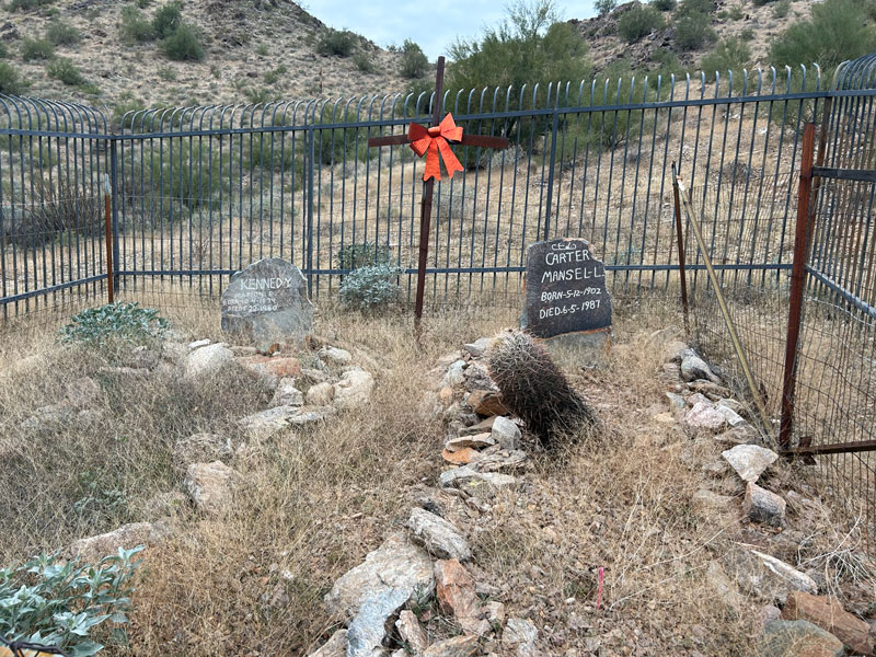
A sign gives information about these men who lived here in the mid-1900s, and a bench provides a place to sit and rest.
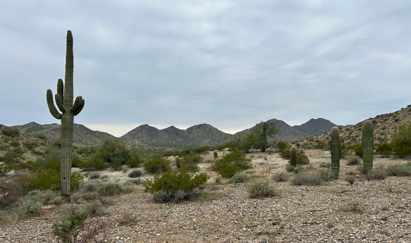
Continuing on Dynamite Trail, you’ll begin heading toward the mountains ahead. The entire length of this hike is on a wide trail that looks like it might have been a road at one time. That always takes a little away from the experience for me, but at least it’s not a road now.
As you get closer to the mountains, the trail steepens significantly. The trail has loose gravel and rocky protrusions, so it’s not great for anyone who’s not sure on their feet.
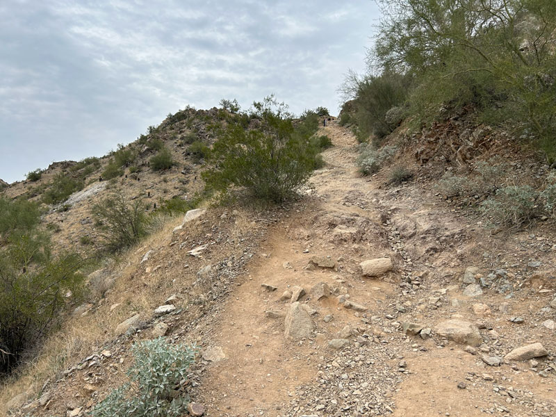
The good news is, this last section up to the saddle is the hardest part of the hike.
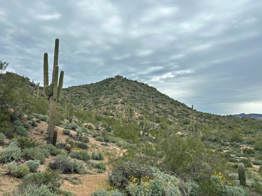
Goldmine Trail Saddle and Peak
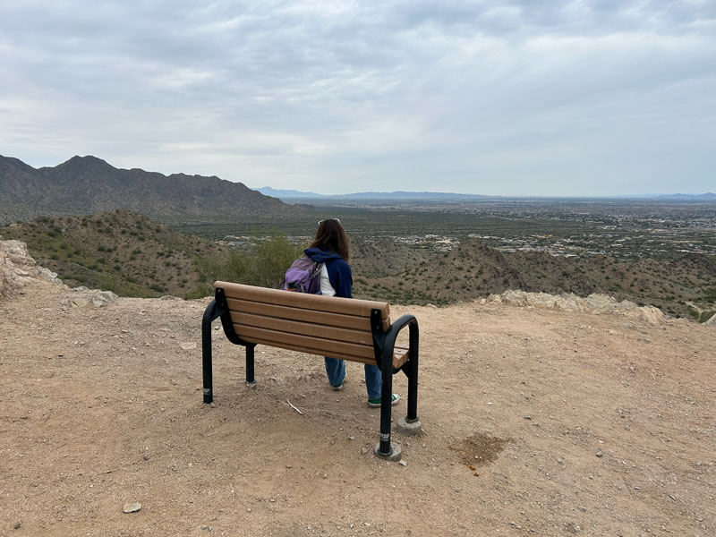
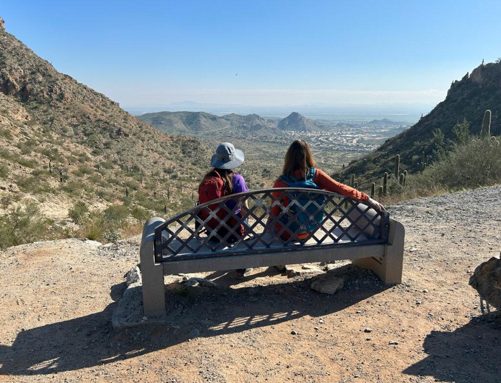
Once atop the saddle, you can sit on the bench up there to take in the view. I always thought this viewpoint was a little dissatisfying because you’re not on a peak, but you can see peaks nearby. Well, good news. Those who came before have blazed a trail up to a peak on your left. The trail to the peak is not part of the official trail system, and it has a sign warning of danger as if it’s more sketchy than the trail you just came up. (It’s not.)
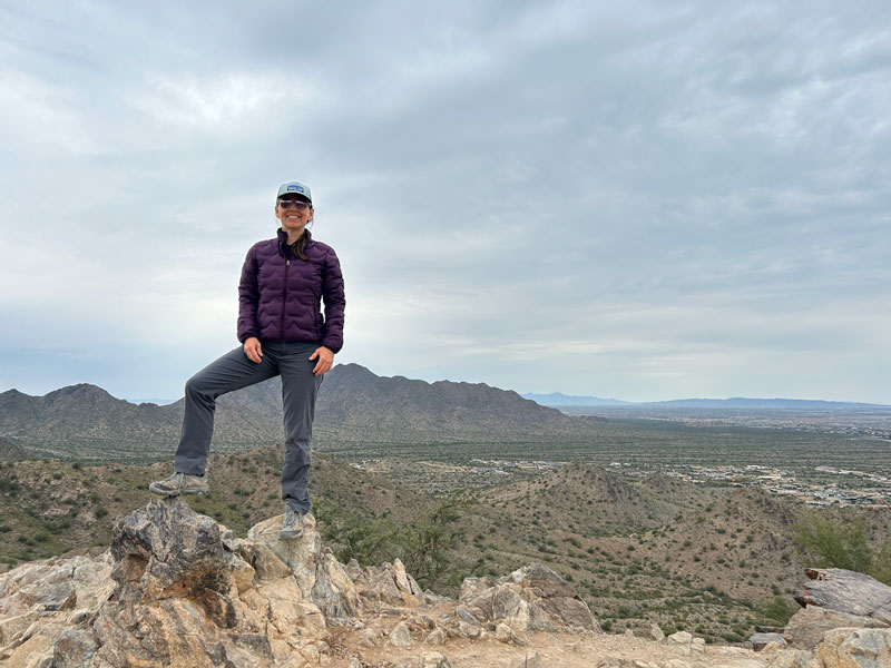
There also appears to be a rough use trail up to the higher peak to the right of the saddle, but that one looked sketchy and difficult. It’s clear almost everyone chooses the shorter peak to the left to get their views. Much more satisfying than the saddle.
Continuing on the Goldmine Trail, you’ll come around the back side of that higher peak and arrive at another viewpoint with a makeshift bench and a viewpoint off to the left. It’s nice to take in this view as well because it looks toward the other side of the mountain.
San Tan Trail
Continue on Goldmine Trail a little farther until the signed junction with San Tan Trail. Turn right to head toward Dynamite Trail. While Goldmine Trail does not seem to attract many bicycles, the San Tan and Dynamite Trails are a different story. Keep an eye and an ear out for them.
From here, the trail begins to flatten more, and you can take in a wide panorama of desert scenery while strolling along. Benches continue to be scattered throughout the area, offering a nice place to sit and rest and take in the view.
I don’t know if it was the cloudy sky or the anticipation of the New Year that enchanted me that day (it was December 31), but I really enjoyed this walk through the desert. It’s not spectacular compared to other desert hikes I’ve been on, but it was nice. My heart (and my attitude toward San Tan) grew at least one size that day.
Dynamite Trail
After a little under half a mile on San Tan Trail, you’ll turn right onto Dynamite Trail at a signed junction. The desert scenery continues as the trail winds its way around the west side of the mountains.
There is a short ascent of about 150 feet not too far into the Dynamite Trail, but then it gradually descends the rest of the way to the parking lot. As you go around turn after turn, you might wonder to yourself at least once if the trail will ever end. Eventually, the trailhead will come into view, and you’ll be heading back to whatever to-do list you have going for the day. And when you do, you might be reminded that a day in the San Tans is better than a day at Costco.
Map & Directions
Location San Tan Mountain Regional Park, Goldmine Trailhead, Queen Creek
Google Maps Goldmine Trailhead
From the San Tan 202, take Power Road south to Hunt Highway and turn left. Then turn right on Wagon Wheel Road and follow it to the trailhead.
Fees/Passes There is a daily per car or per person fee that can be paid at the trailhead (cash in an envelope), or you can use a Maricopa County Parks pass.
Trailhead Facilities Portable toilets (although it looks like permanent restrooms are being installed)
Recommendations for you
Rock Peak Hedgehog Loop | San Tan Regional Park
Lone Mountain (EJ Peak) | Pass Mountain Area
Telegraph Pass | South Mountain
Leave a Reply