Humphreys Weatherford Kachina Loop
TRAIL STATS
Already done Humphreys Peak and want a new challenge? Time to take on the Humphreys Weatherford Kachina loop. This hike goes up to the Humphreys Saddle, travels east past Agassiz and Fremont peaks, then goes down the mountain on the Weatherford Trail to loop around on the Kachina Trail. It’s more than 18 miles of magnificent scenery, outstanding views of the Inner Basin and San Francisco Peaks, and a heavy dose of solitude. Well, after you leave Humphreys Trail, of course. You can add a 2-mile side trip to the summit of Humphreys Peak if you just have to hit the top.
Trail Description
We decided on this hike because we needed some high elevation training for an upcoming adventure. This hike ranged from just under 9,000 feet of elevation to around 12,000 feet at Humphreys Saddle with plenty of ups and downs in between. The scenery was drop dead stunning from start to finish, but it definitely tested our physical stamina as well as our mental toughness. Pounding out those last five miles on Kachina Trail was particularly punishing, and we expected that to be the easy part. No. Turns out that after 16 miles of hiking, you just kind of want the trail to stop going up ever again. Or maybe that’s just us.
Regardless, we loved this hike. Loved. We went from dense forest to high alpine tundra, to burn areas with gobs of wildflowers, to majestic groves of aspen and more. The scenery was always changing, but always captivating. Even the burned areas. No joke. Hard, but worth it.
Clockwise or counterclockwise?
You can do this hike in either direction, but our decision to go clockwise was based on the following points:
- Get most of the elevation out of the way up front
- Be at the highest elevations earlier to avoid storms
- Have a more gradual descent to save our knees
The downside would be that long slog on Kachina Trail at the end, and it was, but I wouldn’t have changed a thing. Except to remember to bring my hiking shoes up from Phoenix so that I wouldn’t have to make an emergency stop at the Flagstaff REI the night before.
Camping Nearby
Which reminds me. You can camp nearby the night before to get an early start and a little more acclimatized before your hike. Some of the forest roads on the east side of Snowbowl Road were closed to camping due to a forest order, so we ended up camping along Forest Road 222 just west of Fort Valley. There were a lot of other people, but there are tons of spots, and the road is accessible to most any vehicle. You can find places to camp elsewhere, but that’s where we went.
Humphreys Trail
Okay, let’s get it! If you’ve ever hiked Humphreys Trail before, you know that you won’t be the only one out there on this trail. Not when the snow is gone anyway. This trail leads to the highest point in Arizona, Humphreys Peak, so it’s a popular hike.
You’ll park in one of the parking lots for Snowbowl and head for the Trailhead at the far end of the parking lot. Portable toilets are available on the low side of the parking lot.
The trail immediately crosses the bunny slopes at the Snowbowl ski area, affording you a nice view of the valley below off to your left. As someone who just recently tried snow skiing for the first time, I had to say “hello” to the lifts I spent so much time on last winter.
Don’t get too comfortable on the easy terrain. It’s just a warmup for the trail ahead. As soon as you enter the forest on the other side of the slopes, you’ll be heading up. It’s not the steepest grade I’ve ever been on (looking at you, Devil’s Chasm), but it’s a climb that’ll get your heart pumping, especially at this elevation.
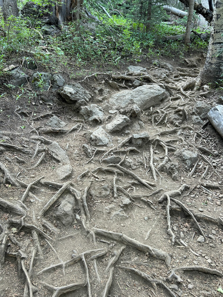
The worst part about the trail is the millions and bazillions of exposed tree roots that are just waiting to trip you up if you look away.
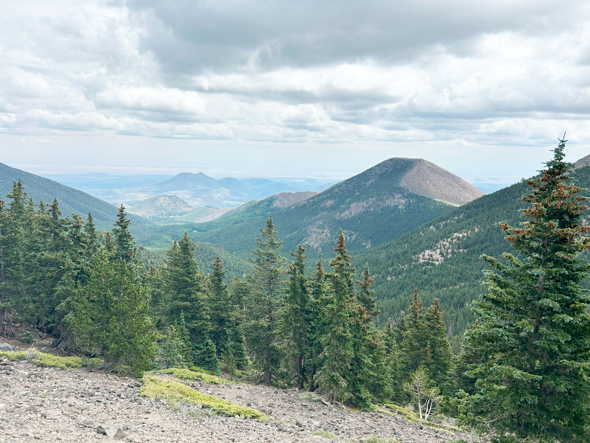
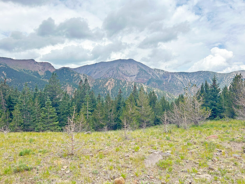
Periodically, the trees will part and you’ll have a nice view of Agassiz Peak (where you see the top of the Arizona Gondola lift at Snowbowl). Behind you, the mountain gives way to the valley below.
The trees start to thin out and get shorter as you go up the switchbacks toward Humphreys Saddle. At 11,400 feet, a sign lets you know you cannot camp above this elevation.
Humphreys Saddle
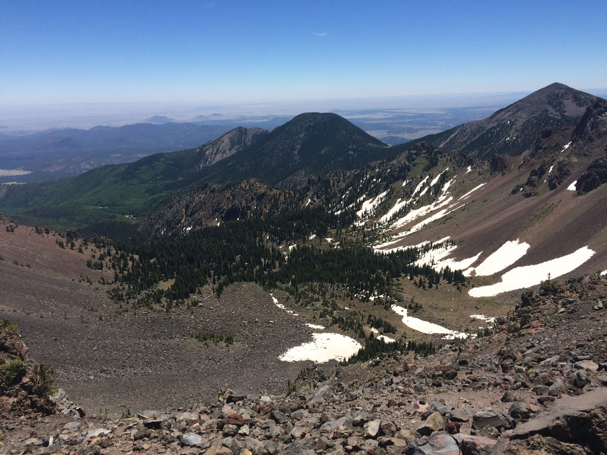
At almost four miles, you’ll arrive at Humphreys Saddle and get your first magnificent view into the Inner Basin.
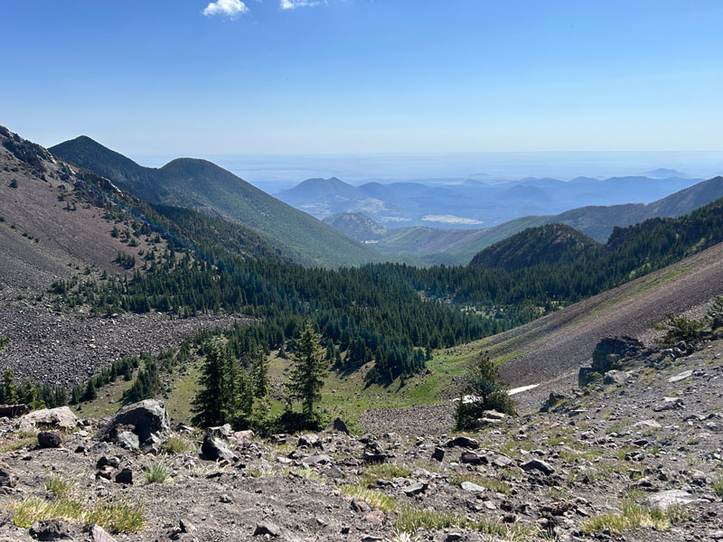
The elevation here is around 12,000 feet, and if you’re not feeling a little lightheaded, count yourself lucky. Be aware of the signs of acute mountain sickness, and be prepared to head down if you need to. I know one person who puked real close to those big boulders that are providing the wind break for your snack break. Just sayin’.
From here, you can choose to add an extra two miles to your hike and go to Humphreys Peak (follow the link for a description of the route to the peak). Think ahead to the remaining 14+ miles before deciding on that. It’s gonna be a long day either way.
Weatherford Trail
Here’s where it gets good. Everyone except for the rare few will be going to Humphreys Peak and completely missing everything Weatherford Trail has to offer. Too bad for them. It felt good to head right at the saddle and continue along the ridgeline toward Agassiz Peak.
At this point, you’re still above the tree line, and that means views upon views! Solitude and spectacular scenery. What more could you want? It’s rather dreamy.
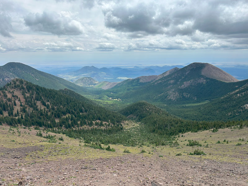
Behind you, you have a great view of Humphreys Peak and can imagine all the little tiny people that must be up there.
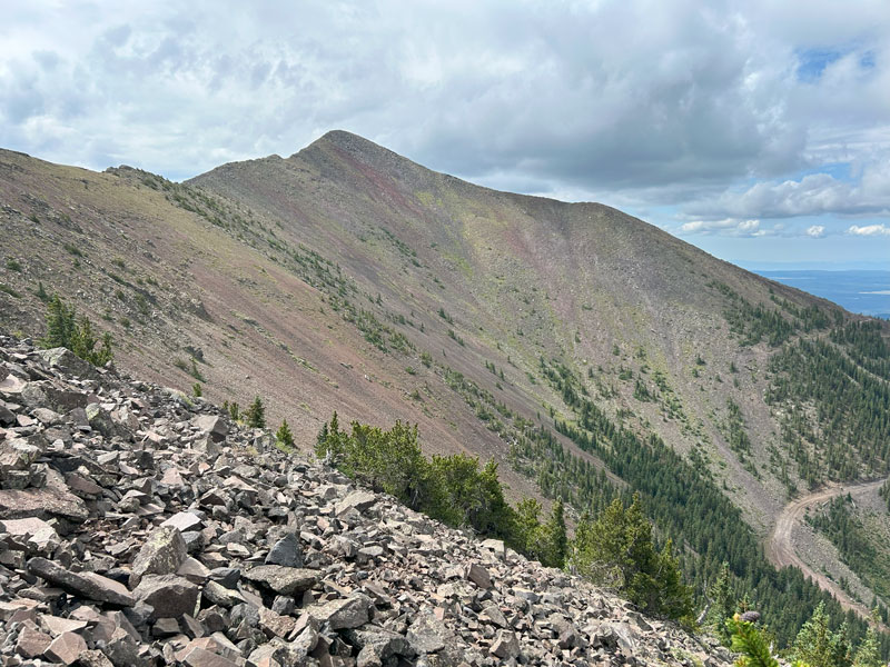
The trail goes down some switchbacks as you make your way past Agassiz Peak on the way to Doyle Saddle.
Doyle Saddle
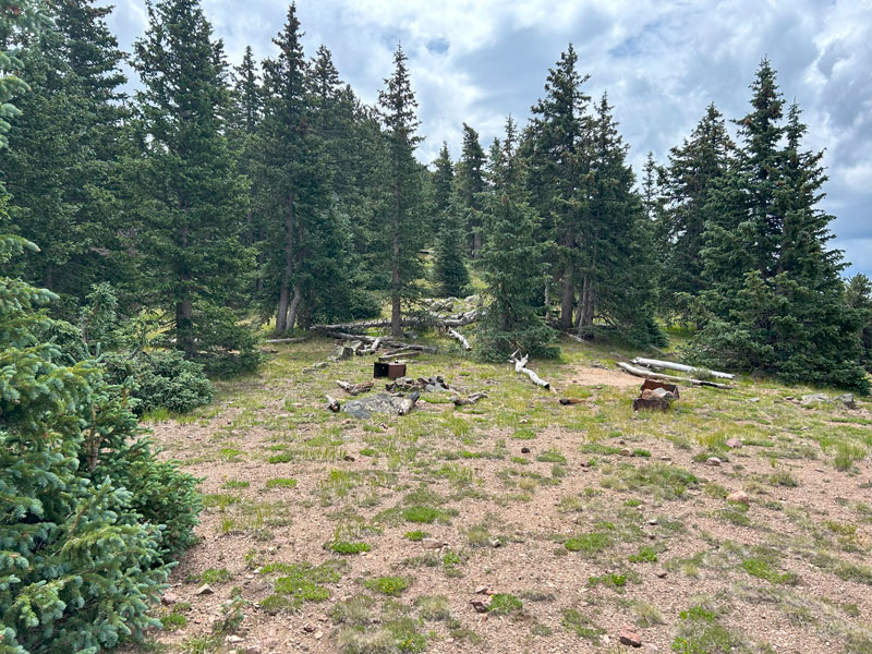
At Doyle Saddle, you’re once again below the tree line, which is a good thing if you’re one of the few backpackers that make it all the way up here. At just below 11,400 feet, camping is allowed, and there’s a campsite with what looks to be old relics from days of yore (aka trash). There are no water sources, however, so plan for that.
Beyond Doyle Saddle, you’ll hike across the flank of Fremont Peak on your way to Fremont Saddle. Even though you’re below the tree line, there are occasional breaks in the trees where you’ll be able to get more views into the basin. Note that camping is NOT ALLOWED in the Inner Basin, so no camping between Doyle and Fremont saddles.
Eventually, the Inner Basin Trail comes in from the left. Continue straight to Fremont Saddle.
Fremont Saddle
Fremont Saddle is where you’ll get your last look at Humphreys Peak before descending. Camping is allowed here, but it is more exposed to the wind than Doyle Saddle.
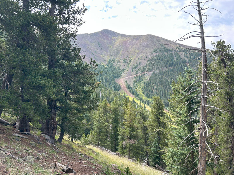
This also marks the boundary of the 2022 Pipeline Fire. There’s a noticeable line between the burned and unburned forest that runs along the saddle and up both Fremont and Doyle peaks.
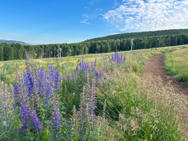
Heading down from the saddle, it’s nothing but burned area with thousands of dead trees.
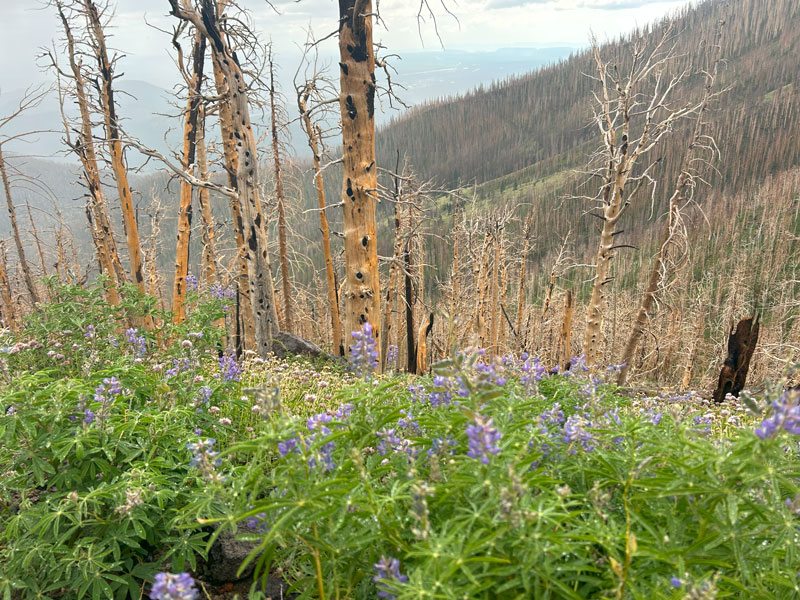
The silver lining is the copious wildflowers that thrive in this treeless environment and the young aspens that remind you life will go on.
The trail now begins to head downhill in earnest, descending around 2000 feet in the next five miles on the way to the junction with Kachina Trail. Don’t worry, it’s less steep than going down Humphreys Trail, and it’s actually rather pleasant.
Fun fact, Weatherford Trail was once a road that was supposed to go all the way to Humphreys Peak. The road went as far as Humphreys Saddle before the project was abandoned when the Great Depression hit. That’s right, cars used to drive it. Old-timey cars. How steep could it be?
Kachina Trail
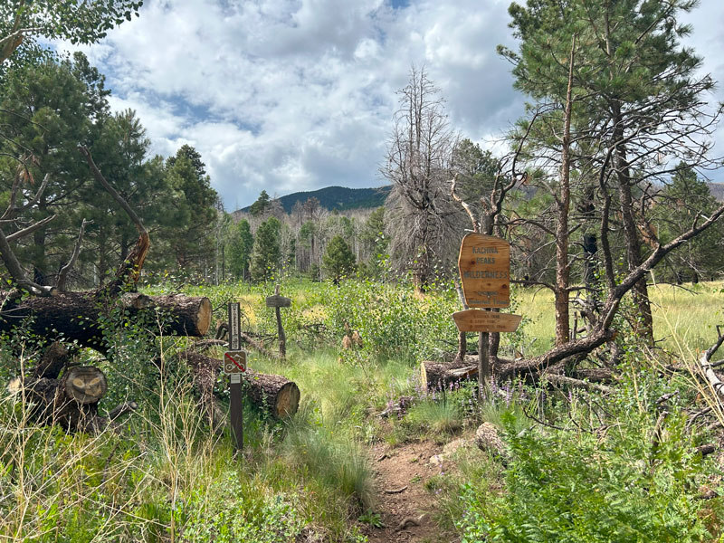
As you get to the base of Weatherford Canyon, you exit the wilderness and end up on a wide multi-use path with ponderosa pines. I know you’re getting tired, but don’t just make a beeline down the mountain (unless you want to catch an Uber). Keep an eye out for the Kachina Trail that branches off to the right. It’s easy to miss, mostly because you felt like you were rolling out of here quickly, and that trail takes you right back in.
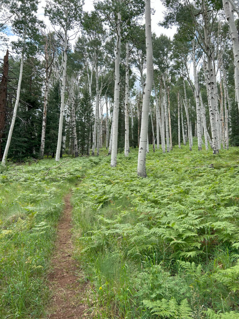
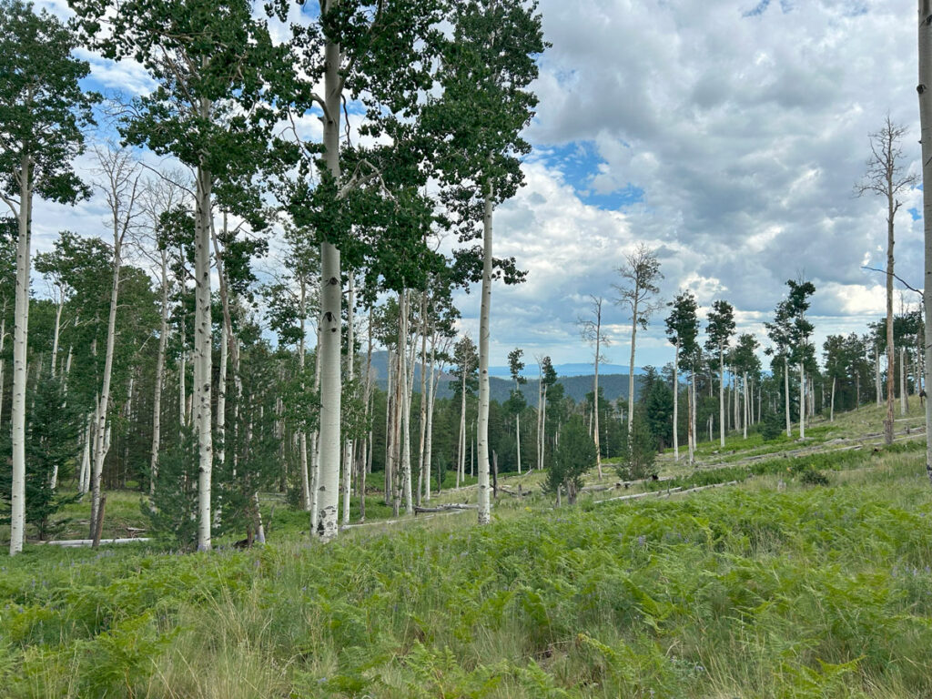
The benefit is that it takes you back into some of the most beautiful forest scenery with trees that are actually still alive. The trail passes through tall pines, fern-covered clearings, and groves of aspen with little woodland creatures scampering about.
Everything would be just about perfect if not for the fact that you have five miles to go on this trail, and it’s concealing another 1000 feet of elevation gain. Yep, those ups and downs just NEVER seem to end. Heard from behind, “We’re going to need to start a GoFundMe for two prosthetic legs for me after this.” Laughter is how we survive those last few miles.
But if you keep walking. And walking. Then walk some more, you’ll start to hear the sound of cars rushing past on Snowbowl Road. That’s when you’ll know you’re just about there. But wait, there’s more! Once you finally hit the parking lot, it’s another quarter mile to go across the street to the Humphreys Peak parking lot. Maybe you can hitchhike or get an Uber to take you over there.
Laughter—it’s the best medicine. Oh, that and some pizza.
Map & Directions
Location Kachina Peaks Wilderness, Coconino National Forest, Flagstaff, Arizona
Google Maps Humphreys Peak Trail
Fees/Passes None
Trailhead Facilities Portable toilets
Recommendations for you
Humphreys Peak | Flagstaff
Kachina Trail | Flagstaff
Weatherford Trail | Flagstaff
Leave a Reply