Humphreys Peak
TRAIL STATS
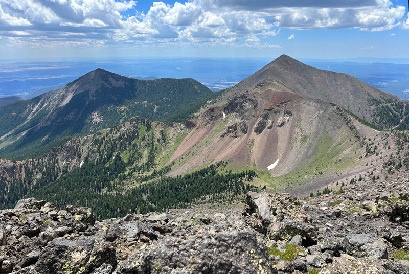
Humphreys Peak is the highest natural point in Arizona with an elevation of 12,637 feet. It is a beautiful sight, and when you get to the summit you can see for miles. Some say you can see the Grand Canyon on a clear day. When the weather is beautiful, the trail can be busy. Have respect for others and LNT. Enjoy the trail and be safe!
Trail Description
Humphreys Trail #151
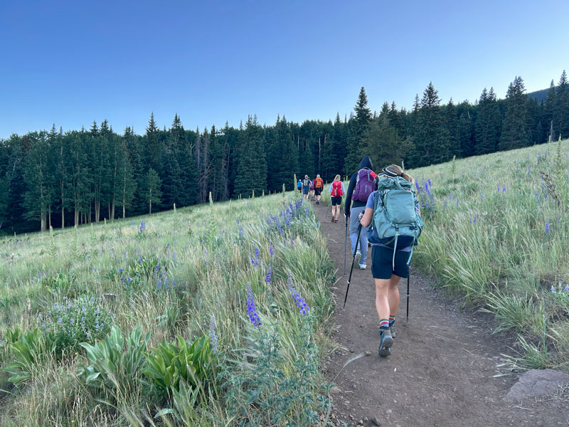
From near the Snowbowl parking lot, the Humphreys Peak Trail starts off nice and easy as you make your way across a scenic meadow, but after a few minutes you start the incline, and it doesn’t stop until the summit.
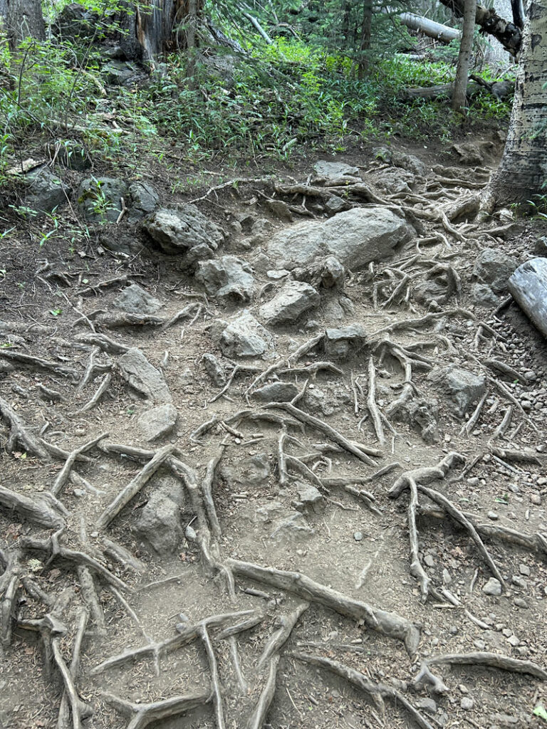
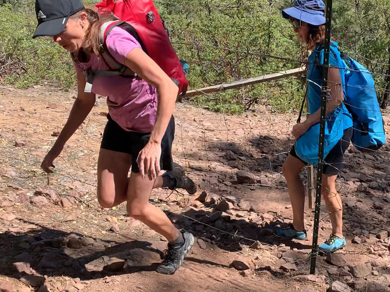
There are a lot of exposed roots and rocks on the lower half of the trail, so watch your step.
If you have hiking poles I suggest that you use them. For about four miles, you will be surrounded by beautiful ponderosa pines.
When you get to the sign that says you can’t camp above that elevation (11,400 feet), you’re almost to the saddle!
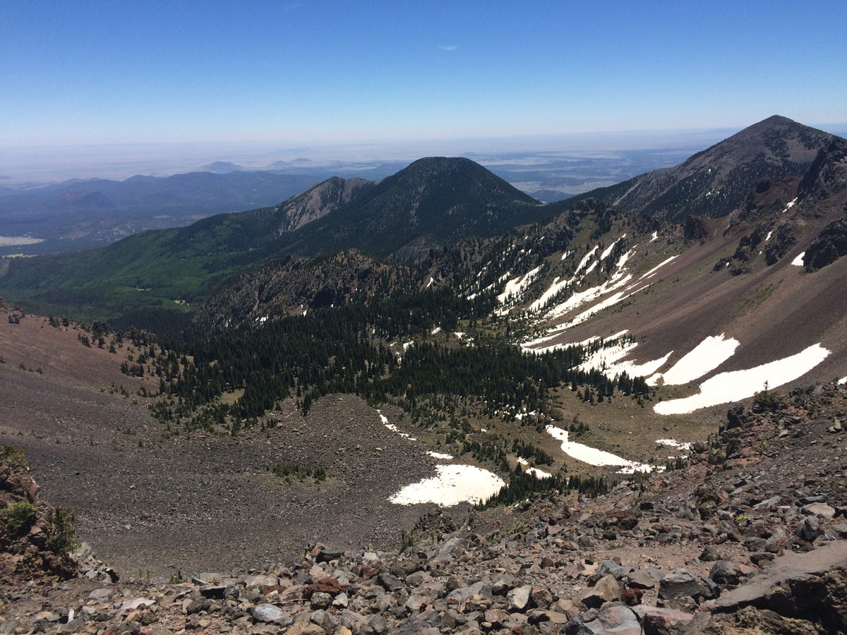
The Saddle
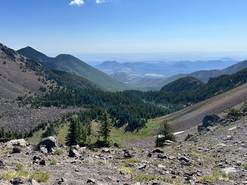
Once you break out of the pines, you come to the saddle, which is a great place to take a break, eat a snack, and enjoy your first view of the inner basin on the other side. Don’t be tempted to claim victory yet because you still have to walk the ridgeline, and at that elevation, you’re not going to win any speed records.
After the saddle, there are some large boulders that might require you to use your hands to get over. If you’re a little dizzy from altitude, well. . . take your time.
The Ridgeline
Just when you think you’re about to conquer the beast, Humphreys Peak has a few surprises for you. Not one, but three heartbreaking false summits, loose rocks, a drop in temperature, and possibly hurricane winds. I’ve never been in a hurricane, but it sure felt like one.
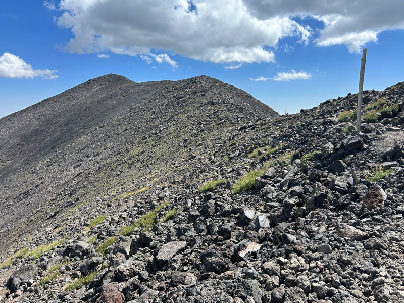
The trail here is not wide, but it is defined, and staying on it is crucial because hiking off trail in this fragile landscape carries a hefty $500 fine. Good luck walking straight down it, though. Even if you’ve never had a drop of alcohol in your life, you might be failing that test right now. For some, this is the area that they start to feel the effects of the high altitude. If you start to feel lightheaded or can’t catch your breath, stop and take a break. If it continues, turn around and get to a lower elevation. Altitude sickness is not to be messed with (visit Travel to High Altitudes on the CDC website to learn how to avoid and treat altitude sickness).
[Editor’s note: This is our trail mama, remember. She wants everyone to have a safe hike. Also, she’s really nice. In the interest of full disclosure, all the sassy comments are mine.]
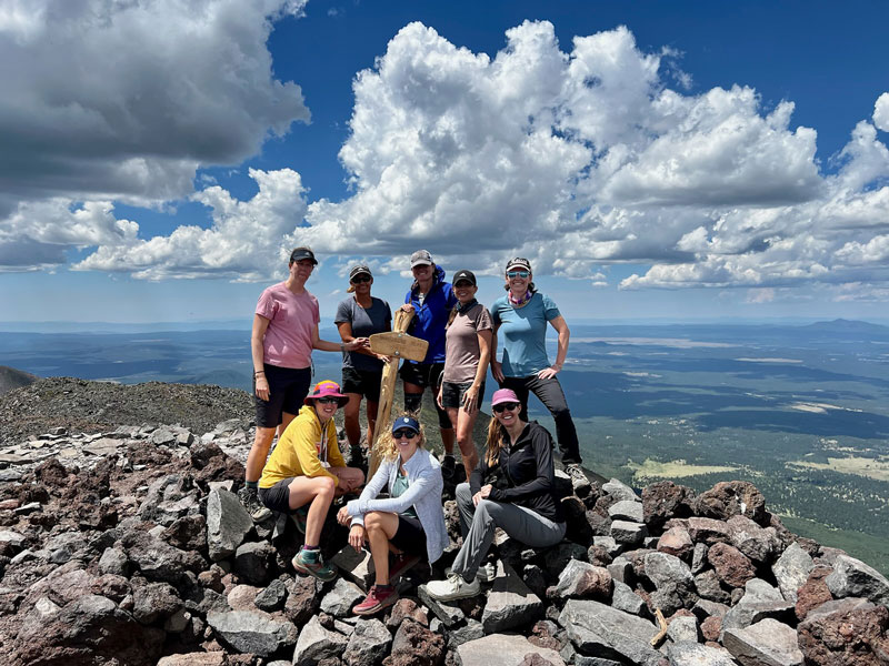
Summit
After the false summits, you can finally see the true summit ahead! It is wonderful! And so fetchin’ far away still. Those last few steps are going to take all you’ve got, but it’s so worth it!
It doesn’t really matter when you visit the summit. There will always be at least one of these three things making it less than ideal:
Wind On the summit, some awesome people built a little wall of rocks to help block the wind. Don’t be afraid to sit really close to a stranger because the wind can be really crazy up there. We’ve seen people crawl to the sign so they would not get blown over.
Bugs If there isn’t wind, there will definitely be annoying flying bugs. Like, tons of them, and they’re right on the summit where you’d like to be sitting and enjoying the view.
Snow If you’re hardcore enough to summit when there’s snow, well. . . you have snow. And you undoubtedly know why that’s on this list.
The Descent
The descent is in many ways more exquisite an experience than the ascent, and not just because you’re not going uphill anymore. With the peak behind you, there are ample opportunities for wide, sweeping views.
Be careful heading down below the tree line because those darn roots and rocks love to trip people. Or so I’ve heard. I never trip on anything.
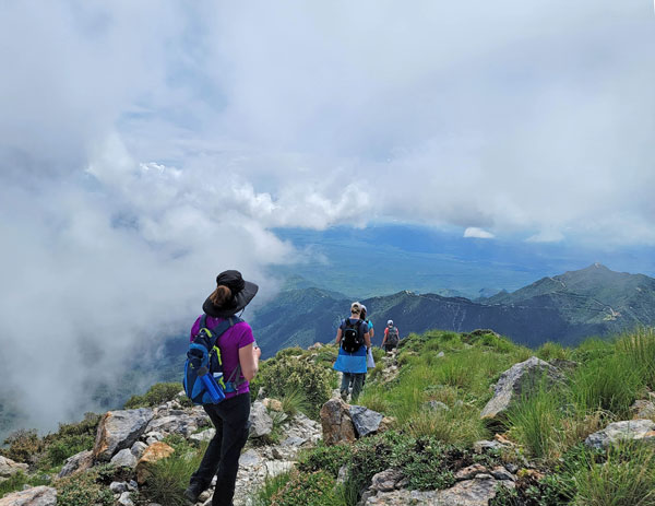
[Editor’s photo]
Trail Mama Tips
I love this trail, but it is a tough one.
- Don’t feel like you need to finish it
- Take your time and take breaks if you need them
- Pack plenty of water (no less than 3 liters) and good snacks
- Bring a jacket (even on a warm day) and something to cover your ears
- Use hiking poles
- Watch for signs of altitude sickness and go down if you need to
Be prepared. The jerk ranger at the bottom made clear he had no intention of rescuing me.
Weather Considerations
Snow
The trail for most of the year is covered in snow, so verify trail conditions before you go and make sure you are prepared with the right equipment and experience.
Temperatures
The weather can be unpredictable up here. We’ve been on the summit on warm, windless days, and we’ve been on days that felt warm at the base but were windy and cold near the top. Bring clothing to keep you warm in case of the latter.
Lightning
During the summer monsoon season, lightning storms often develop very quickly, especially in the afternoon, and you do not want to be anywhere near the summit during a storm. People have been killed by lightning up there. Don’t be one of them.
Always check the weather before you go and don’t hesitate to cancel if conditions aren’t right. The mountain will still be there for you next time.
Map & Directions
Location Humphreys Trail, Kachina Peaks Wilderness, Coconino National Forest, Flagstaff, Arizona
From Flagstaff, take Highway 180 (Fort Valley Road) north toward Snow Bowl. Turn right on Snow Bowl Road and follow it to a parking lot on the left for Humphrey’s Peak Trailhead, just before you enter the ski resort.
Fees/Passes None
Trailhead Facilities There are porta-potties by the trailhead
Preview this Hike
Recommendations for you
Ten Awesome Arizona Peaks that Aren’t Humphrey’s
Wilson Mountain | Sedona
Mount Wrightson | Santa Rita Mountains
Leave a Reply