Pedestal Arch
TRAIL STATS
Deep in the Goldfield Mountains, discover Pedestal Arch and the pedestal next to it that looks as if it had been punched out of the mountain. The Goldfield Mountains feature stunning desert scenery with a forest of saguaro cactuses twisted into wild and unusual shapes. Most of this route is on trail, but the last part leaves the trail and travels cross country up to the arch. Pants and long sleeves recommended.
Trail Description
When it comes to hiking trails, the Goldfield Mountains are often overshadowed by their more popular neighbor, the Superstition Mountains. However, the Goldfields are a worthy hiking destination in their own right with rocky peaks, colorful formations, plentiful saguaros, and hidden arches. Keep your eyes out while you hike because you never know what’s out there just waiting to be discovered. The only major downside to the Goldfields (for hikers, at least) is that it’s a popular OHV area. You may experience some dust and noise, but this route mostly follows a trail, and we didn’t notice any vehicles out there while we were there.
Willow Canyon Trailhead
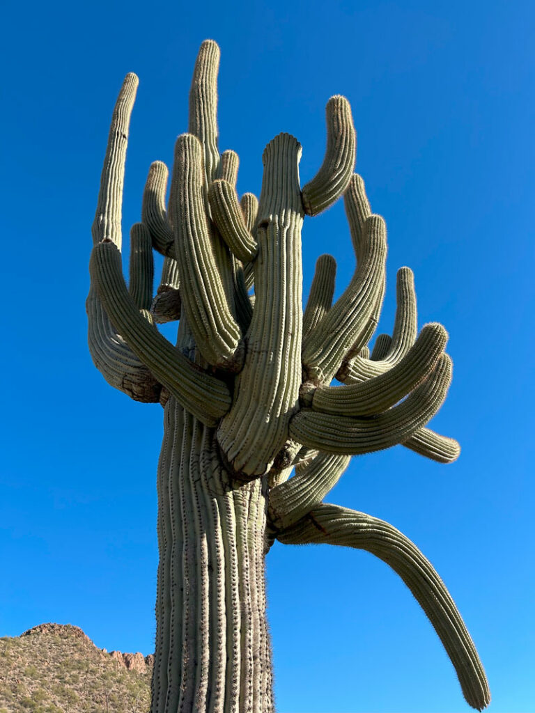
From the Willow Canyon Trailhead, start off on a wide dirt road. Just over half a mile in, you’ll branch off to the right onto a trail. For the first three and a half miles, there isn’t too much elevation gain as the trail gently rolls along a beautiful landscape of golden volcanic rock formations and saguaro cactuses. Okay, yeah, I’m in love with the saguaros!

The trail is pretty well-defined, but owing to the lack of marked trail junctions and the abundance of other trails in the area, it can be easy to get off track. Just keep an eye on that GPS or you might end up going on a long detour. Actually, more like probably. Almost guaranteed. Yeah, we’re guilty.
Just before you hit two miles, the trail will enter the Willow Springs Canyon wash. This is where the trail to Triple Arches goes straight across the wash, but you’ll want to fork left to follow the trail along the wash on the right side. The wash is sandy, so taking the time to find the trail can make this part a lot more pleasant.
After another almost quarter of a mile, you’ll bear right to continue northwest. I’ve said it before, but I’m gonna say it again. There are a lot of trails branching off, so check your map often or you’ll find yourself going the long way.
At almost three miles, you’ll enter another wash. This time we walked directly in the wash for about a tenth of a mile before it intersected with a second wash, which entered in from the left side. It’s important to find the trail leaving the first wash on the left side toward the west.
Continue on this trail as it roughly follows the second wash along a beautiful segment lined with the most impressive saguaro forest.
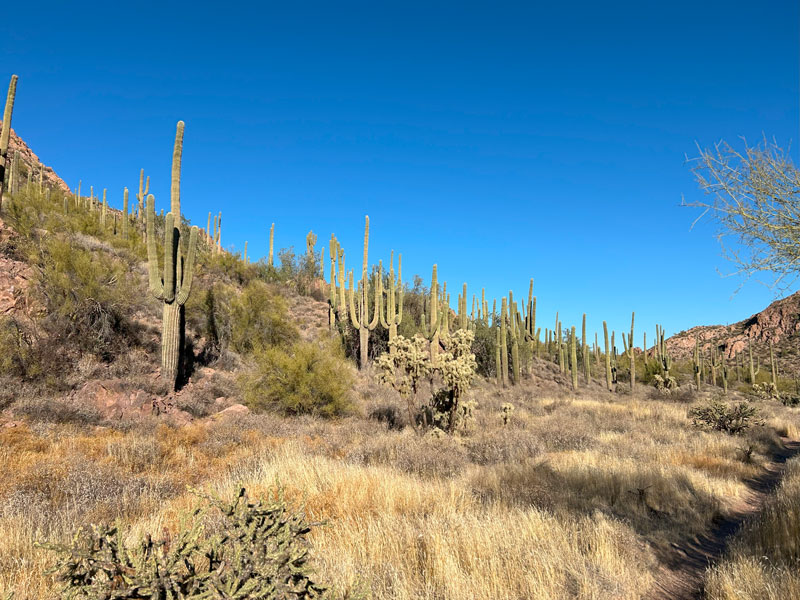
Allow extra time for gawking at these babies.
Once you’ve gone another 1.3 miles (or 4.3 from the start of the hike), you’ll get to the point where you need to leave the trail. If you’re not the off-trail type, go home now.
Off Trail Segment
We got a little impatient and tried to cut the corner here, so our GPS track crosses the wash and then goes up a hella steep hill. Yeah, the hill sucks, but once you get up on to flat part above, you can follow any number of game trails through a grassy area that isn’t too bushy. Would not recommend in snake season, although we went in January, and we saw a non-venomous snake sunning itself, so use caution at all times of the year.
For the patient, you can keep going a little way and find where a drainage comes in from the right. Find the path of least resistance, being sure to generally follow the direction of the drainage. The trail gets a lot steeper as you make your way toward Pedestal Arch.
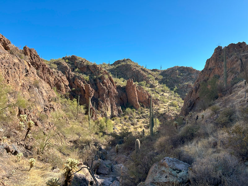
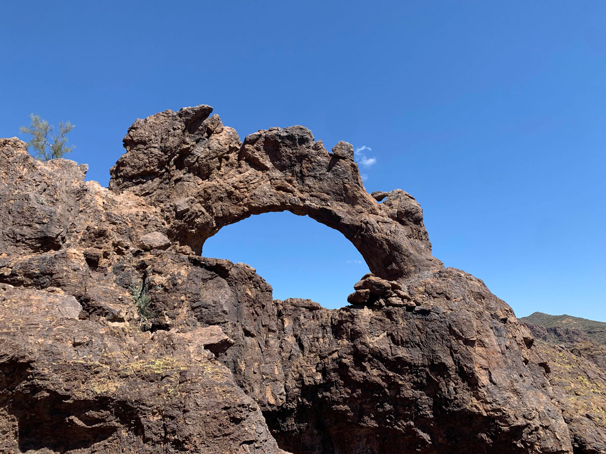
There are some striking rock formations here showing off their rugged beauty.
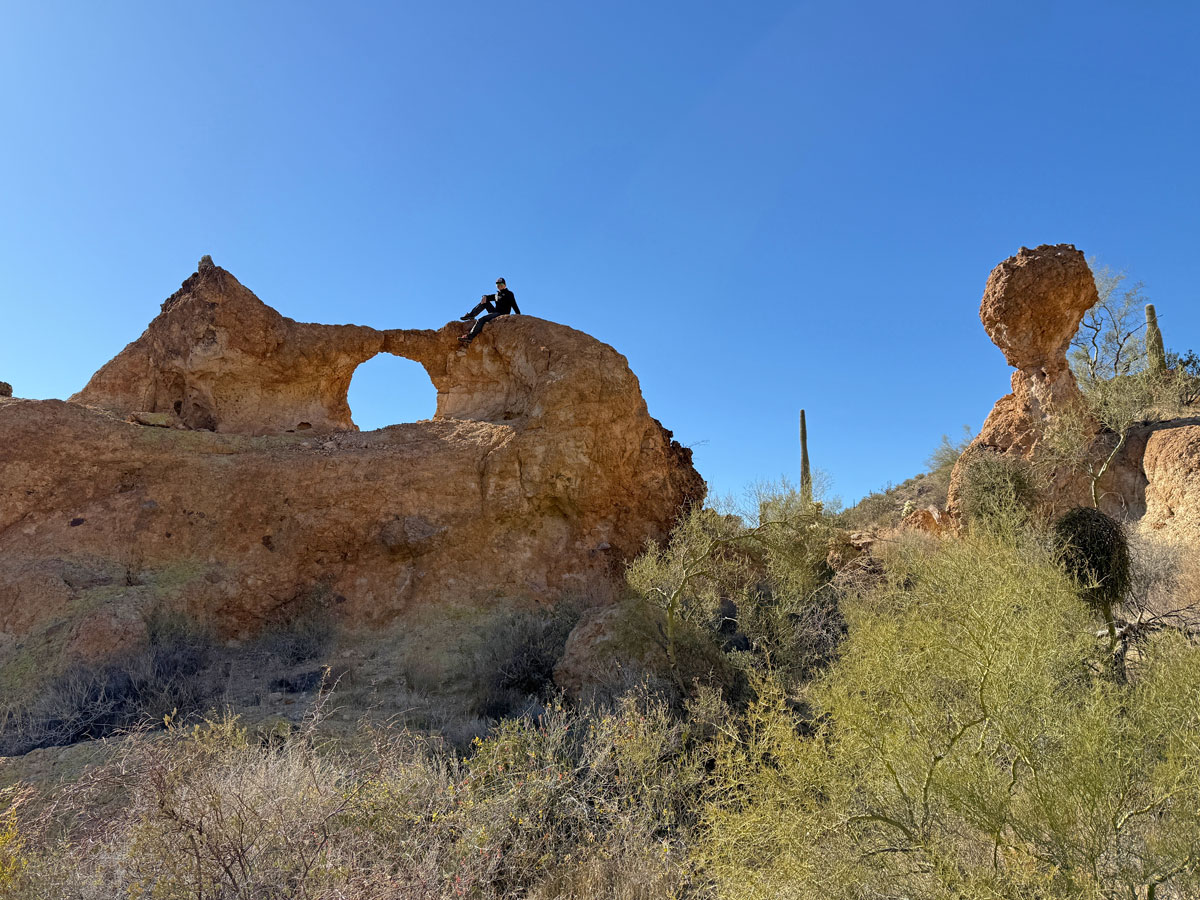
Pedestal Arch
The arch is located on the left side of this drainage as you’re going north. Keep your eye on the map for the point where you leave the drainage and go up the left side. It’s rugged terrain, but not too sketchy.
When you spot Pedestal Arch, you might find yourself letting out a little gasp. It’s located in a little rock fin that’s kind of on its own, just sitting pretty right out there in the desert. Go between the arch and the pedestal to easily get inside the arch.
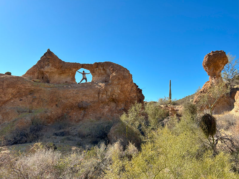
You can also climb up either side for some fun photos with this arch.
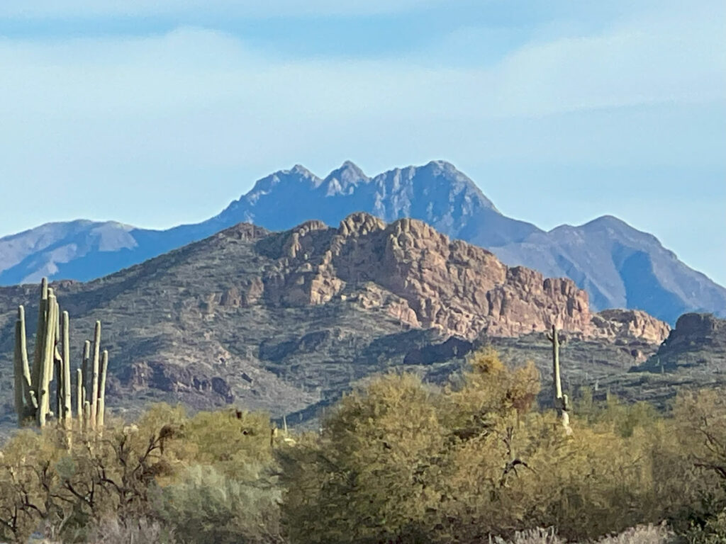
From this vantage point, you’ll have nice views of the Superstition Mountains, too, and you’ll likely be thinking you want to explore the Goldfields more. We’re right there with you. Enjoy!
Map & Directions
Location Goldfield Mountains, Tonto National Forest, Apache Junction, Arizona
Take the US60 to Idaho Road and go north. From Idaho Road, turn right onto State Route 88 toward Canyon Lake. Just past the sign for Weaver’s Needle Vista, look for the large Willow Canyon Trailhead parking area on the left.
Fees/Passes None
Trailhead Facilities None
Recommendations for you
Triple Arches | Goldfield Mountains
Little Four Peaks | Goldfield Mountains
Sunrise Arch | Goldfield Mountains
Leave a Reply