Peters Canyon
TRAIL STATS
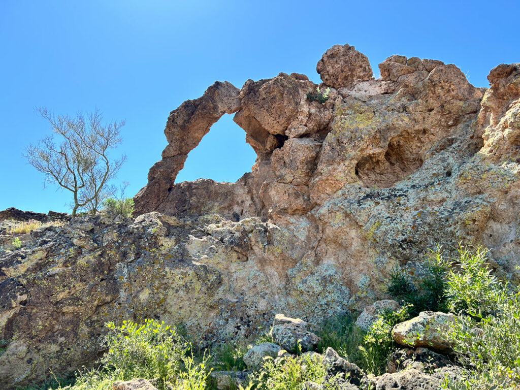
The rugged beauty of Peters Canyon in the Superstition Mountains features seasonal pools, greenery, dramatic cliffs, and a large cave. The scenery is well worth the effort, but you will have to do a lot of rock hopping and scrambling over and under giant boulders. There is no official trail, and much of the time you are just finding the best course upstream with an occasional cairn to guide you. Adventurous souls can explore beyond the cave.
Trail Description
The start of this hike is located right next to the tourist town of Tortilla Flat, which is usually hopping with visitors on any nice day in the winter. Despite its proximity to this popular spot, you will find relatively few people who venture out into Peters Canyon. We saw only a couple others the whole time, which meant there was a lot of peace and solitude out there.
For parking, go through the “town” of Tortilla Flat and turn right just after the little museum they have at the far end. This is a dirt parking lot that is shared with visitors to Tortilla Flat, but there was plenty of availability when we went. The upper portion of the lot is actually closer to the start of the trail, but be aware that overnight parking is not allowed.
Peters Canyon Trail
Since this is not an official trail, it doesn’t really have a name, and you won’t find it on a topographical map. I’m calling it Peters Canyon Trail for the purposes of this post.
The start of the trail is not obvious at all, but once you get on it, it’s easy to follow. . . for now. The trail climbs a little in elevation as it follows along the side of a hill with views down to Tortilla Creek.
Just over a quarter of a mile in, you will come to a junction. Fork left to head down toward Tortilla Creek. (Staying right would take you to Geronimo Head, which is another great hike.) I labeled this junction on the map below so that you won’t miss it.
Tortilla Creek
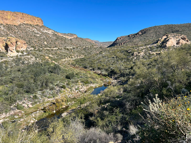
Once down at Tortilla Creek, turn right to head upstream. You can find some signs of a trail here and there, but the main goal is to follow the best path you can find to travel upstream. This will require some rock hopping as you cross the creek multiple times along the way. We had a moderate-low flow, and we never had to get our shoes wet.
Because of the wild, rugged nature of the route and the lack of a trail, don’t expect to follow my GPS track exactly. Sometimes I went a different way on the way up than I went on the way back, and that is reflected in my track. Just know that if you’re following the path of the creek, you’re going the right way.
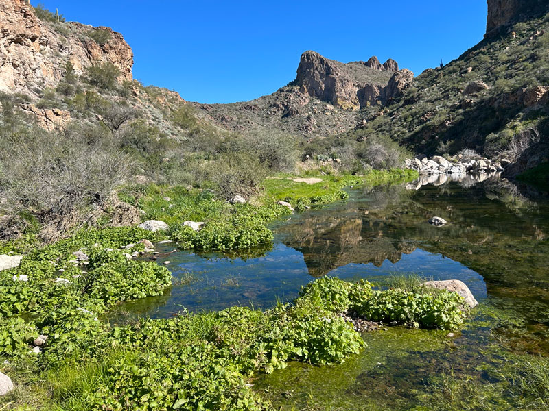
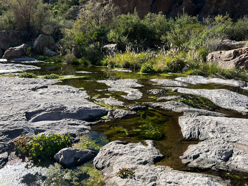
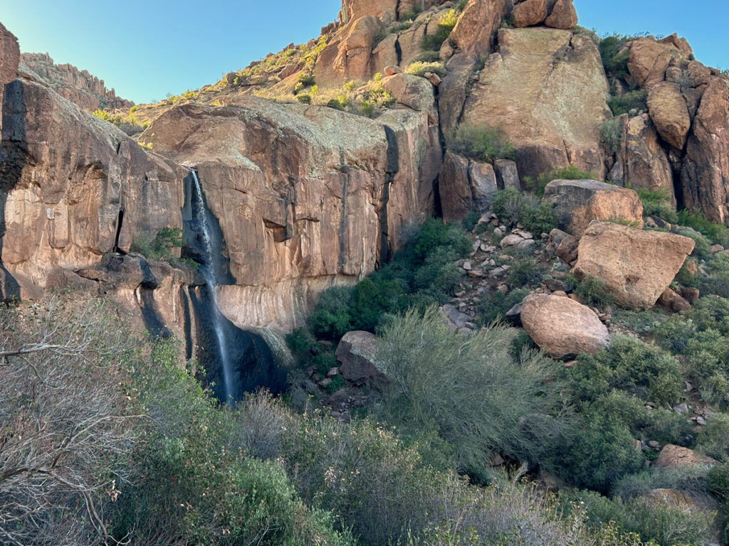
This area is extremely beautiful when water is present, offering the peaceful sound of flowing water and pools that reflect the towering cliffs above.
Oh yes, and I can’t forget the butterflies and wildflowers. It was January when we were there, but it already felt like spring.
After traveling up Tortilla Creek for half a mile, you’ll see an obvious fork in the creek. Tortilla Creek continues along the left fork while the right fork heads into Peters Canyon.
Peters Canyon
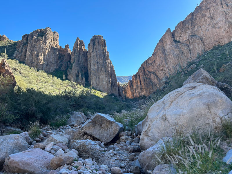
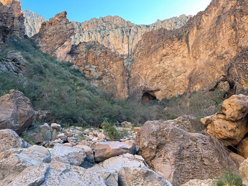
Soon after entering Peters Canyon, the creek bed will become clogged with gigantic boulders. Here, you’ll have to find the best way past the boulders, whether up and over or down through a tunnel. Occasionally, there are cairns to help guide you on the trickiest spots. If you find yourself at an impossible obstacle, simply look around to the left or right for an alternative route. Expect to hike at a fairly slow pace because of the constant obstacles.
There is noticeably less water in Peters Canyon than there was in Tortilla Creek, but we still found some flow. Once past the gigantic boulders, you’ll find an area of solid rock with pools that flow from one to the next (if there’s water).
It’s waaaaay better in person. Like, way way better.
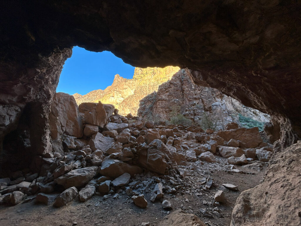
Peters Cave
Continue up Peters Canyon until it begins to narrow again. Here, you will see Peters Cave in the distance.
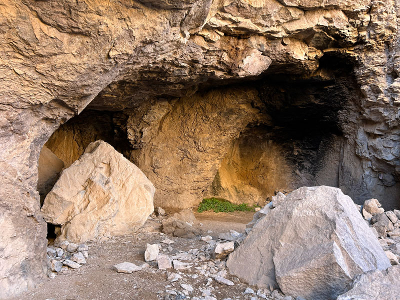
A little more rock hopping, and you’ll be at the cave opening. It’s a short, but steep, climb to get up to it. There are actually a couple of openings, with a smaller cave just to the right of the big cave.
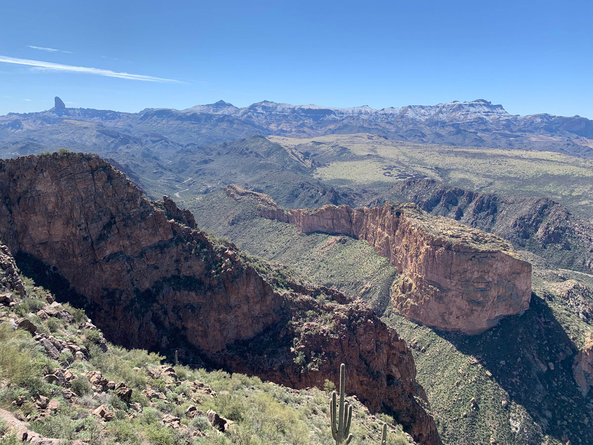
Looking farther up canyon, I really wished I had more time to explore. It was so enticing, but I had to save it for another day. Going back, I tried to hurry to make up some time and ended up stepping on an unstable rock that sent me crashing down into the boulders. Word to the wise: take your time, don’t trust the rocks you have to step on. . . and have fun!
Map & Directions
Location Superstition Wilderness, Tonto National Forest, Tortilla Flat, Arizona
From the US60, take the exit for Idaho Road. Go north on Idaho Road to State Route 88 and turn right. Follow that road to Tortilla Flat. Just past the town, but before you cross the creek, there is a dirt parking lot on the right.
Fees/Passes None
Trailhead Facilities None
Recommendations for you
Geronimo Head | Superstition Mountains
Hackberry Spring Loop | Superstition Mountains
Massacre Falls | Superstition Mountains
Leave a Reply