Spur Cross Full Loop
TRAIL STATS
See most of what the Spur Cross Conservation Area has to offer on this nearly 10-mile loop around the area. A peaceful riparian pond, the gentle flow of Cave Creek, sweeping views, desert springs, and gobs of saguaro cactuses are just some of the delights you’ll find here. Smaller loops can be made by taking alternative trails.
Trail Description
We really weren’t expecting much when we set out that sunny January morning. We’ve hiked in the Phoenix area a lot, we love the Superstition Mountains more than anywhere else, and we’ve seen all the desert views. Right? Yet Spur Cross Conservation Area had some special surprises for us that made our day there quite gratifying.
Our first pleasant surprise was that we happened to arrive on its 25th anniversary, which meant we got in free. What? We were feeling lucky. After a quick stop at the information booth to grab a map and get some advice, we decided we would attempt the full loop counterclockwise. If we ran short on time, we would cut through the middle of the loop on a different trail. Or so we told ourselves. We almost never cut it short.
From the information booth, we headed out on the Spur Cross Trail toward Metate Trail. You can take Spur Cross going northeast, but we were told Metate was prettier. It’s only a short 0.2 miles before the junction with Metate Trail.
Metate Trail
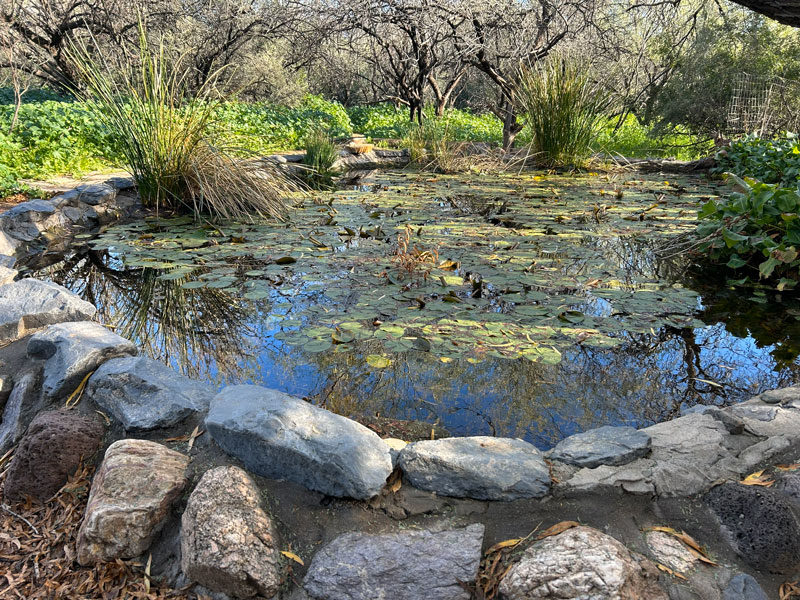
Turning onto the Metate Trail, you’ll soon come to a small pond filled with lily pads. No, that’s probably not a peacock behind the pond. Just a stick. I guess my hopes were getting too high already.
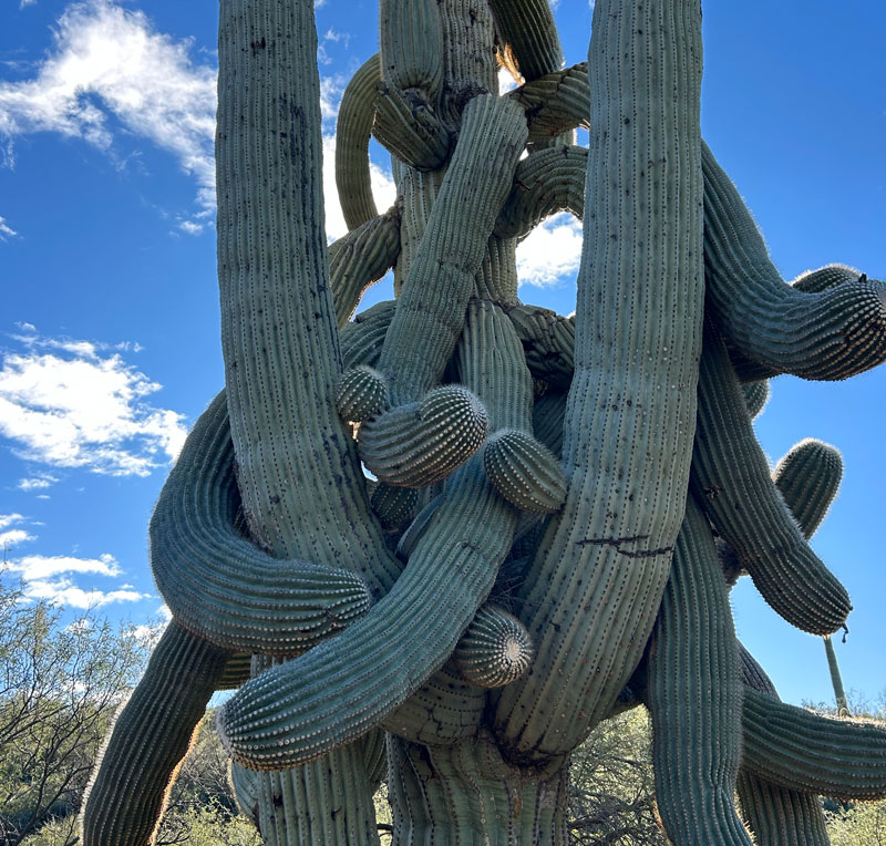
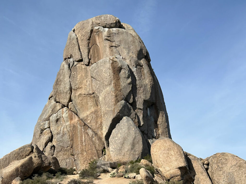
Continuing on the Metate Trail, you’ll come to some crazy looking saguaro cactuses. This one was particularly crazy. Yes, ALL those arms belong to the same cactus!
The Metate Trail is quite beautiful, and we passed a few other groups along the way. Little did we know we wouldn’t pass any other people on the other trails the rest of the day.
After 0.8 miles on the Metate Trail, you’ll turn left on the Spur Cross Trail and go a short distance before exiting the Spur Cross Conservation Area and continuing on the Maricopa Trail.
Maricopa Trail
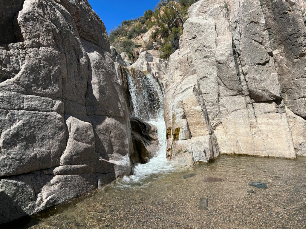
When you were in the Spur Cross Conservation Area, creek crossings were a cinch because there were log bridges to walk across on. You’re in the wild west of Tonto National Forest now, and the creek crossings are about to get more fun. To hear the lady who was coming the other way talk about it, we thought we were about to ford a raging river. But no.
The trail crosses the creek a couple times, and there were always rocks to use as stepping stones. Still, you need a bit of fancy footwork, and a hiking pole will be your best friend! Or, if you didn’t bring poles (oof!), then your friend who brought theirs and lends you one will be your best friend. Thanks, Hillary!
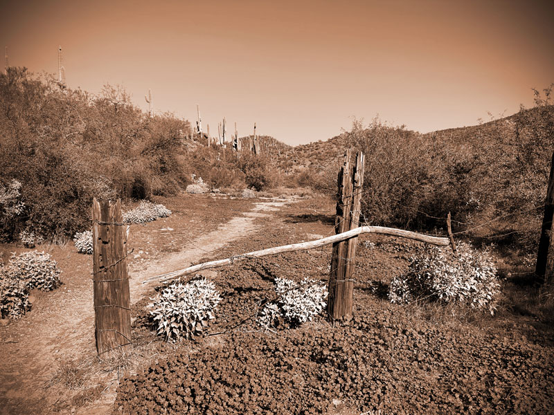
For the loop, you’ll want to turn left at the corral. Although the junction and the corral are in plain sight, they still aren’t super obvious. Either that, or we aren’t very observant. We just kept trucking across a couple more exciting creek crossings, complete with at least one wet shoe, until we arrived at the Skull Mesa Trailhead. OOPS!
There is a sign marking trail 252, but it’s pretty small, so keep an eye out for the trail breaking off to the left and the corral set back a little way from there.
Limestone Trail (#252)
There wasn’t much to the corral, but it did give off an antique vibe. Are you feeling it?
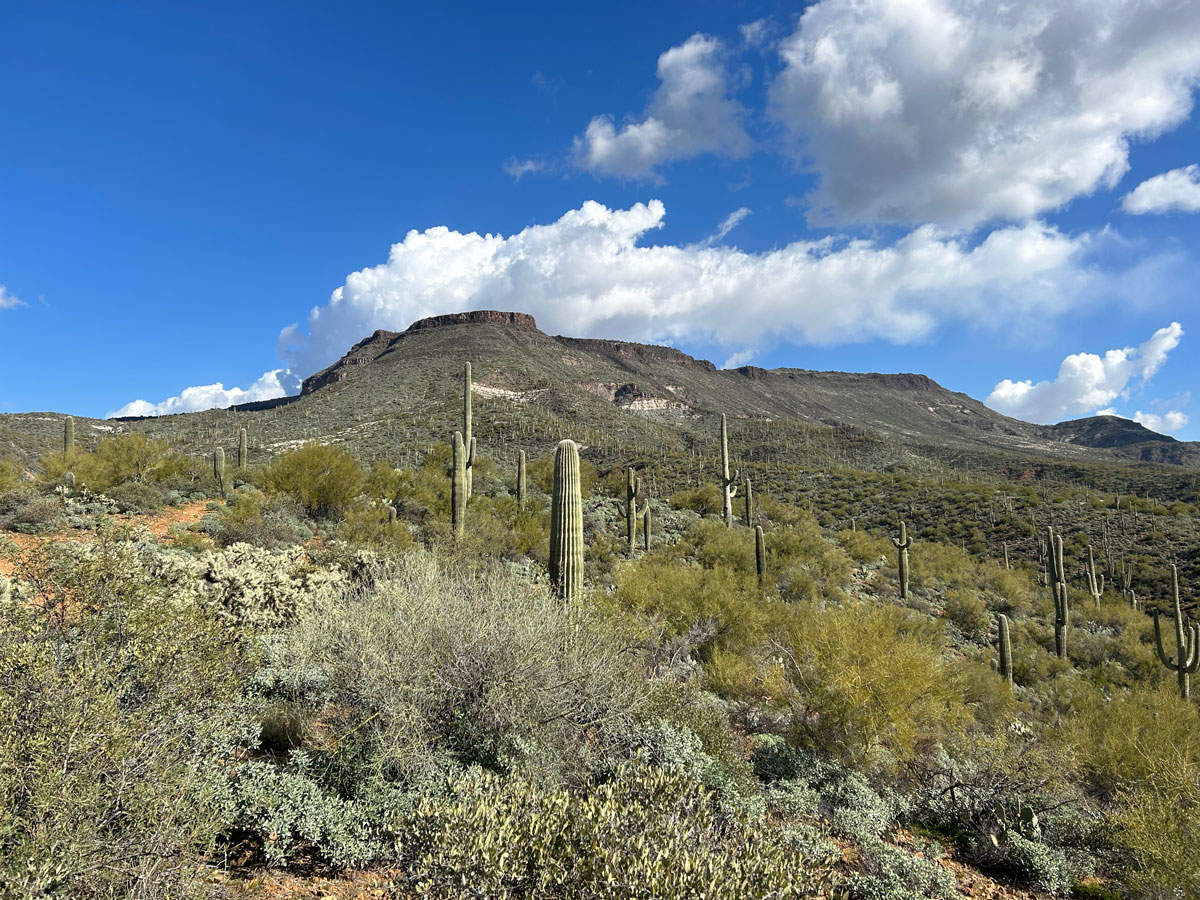
Right away you’ll notice that the Limestone Trail is much rougher than the trails you’ve been on up until this point. For the next 0.8 miles, you’ll gain about 500 feet in elevation on the way to Limestone Spring. The upside is that you’ll start to see a lot farther into the distance.
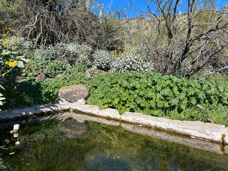
Limestone Spring
Limestone Spring is right next to the trail, so you can’t miss it. It’s also near the high point of this trail, so you might be able to finally get some cell signal just in case you can’t wait to post a pic. Guilty, okay? This kind of place is worth sharing!
After the spring, the trail gets less steep and rolls along gently past Page Spring.
Page Spring
Page Spring is located in a small ravine, off to the left of the trail at a hairpin turn in the trail.
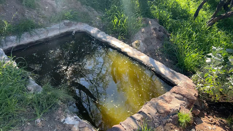
Not totally sure I’d want to drink from that.
Half a mile past Page Spring is your first opportunity to cut this trip short. You can see Elephant Mountain in the distance, and knowing you have to hike up over its saddle to do the full loop, you may be tempted. If you can, keep going. The most adorable spring is coming up, along with all those cactuses I talked about in the hike summary. Worth it!
The disheartening part is that you’ll soon realize you have to hike down into a canyon before you can even think about starting the climb up to Elephant Mountain’s saddle. Get a move on, you’re doing this thing!
Ringneck Spring
After crossing the low point, you’ll start the steady climb up toward the saddle. In this section, you’ll find the most adorable spring ever, Ringneck Spring. Or, on my Garmin’s topographical map, “Drinking Water.” Indeed, it’s much more appealing than Page Spring.
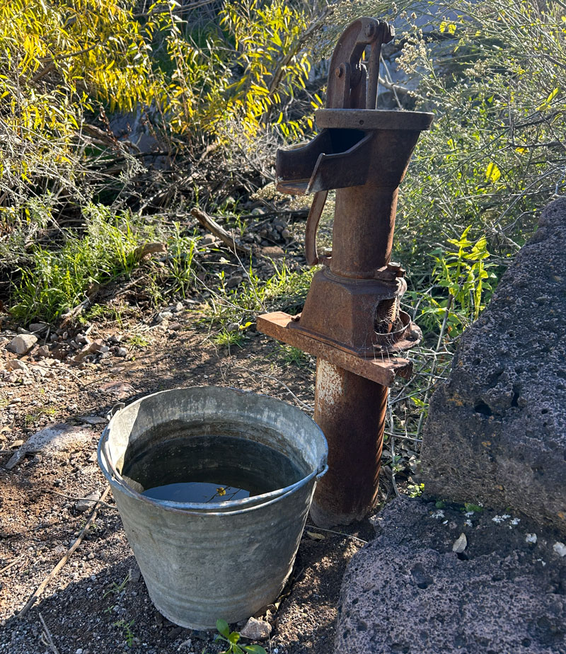
Man, I should have made this photo antique too. It just needs a few posies at the base for the perfect photo old-fashioned photo. If you need water, give it several pumps, but be patient. It takes a little effort to get it going!
At this point, you’ll have your second opportunity to bail on this hike early and take the Elephant Mountain Trail left instead of right to skip the saddle. Come on, though, you’ve come this far, and those magnificent saguaro cactuses are waiting.
Elephant Mountain
By this point, you’re almost to the saddle of Elephant Mountain. At the junction with the Elephant Mountain Trail, go right. Once atop the saddle, it looks like a fun hike up to the high point to your left, but alas, it’s closed to hiking.
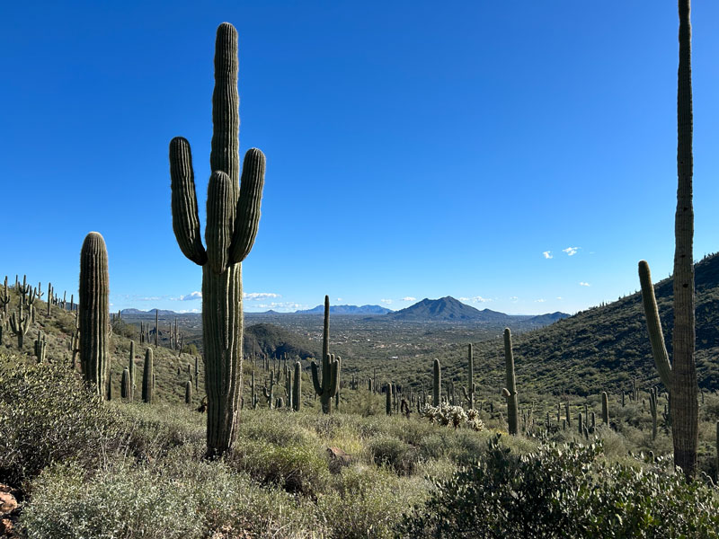
The views, though? Awesome! At this point, you cross back into Spur Cross Conservation Area, and the trails are noticeably nicer.
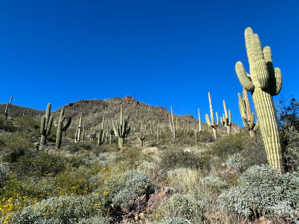
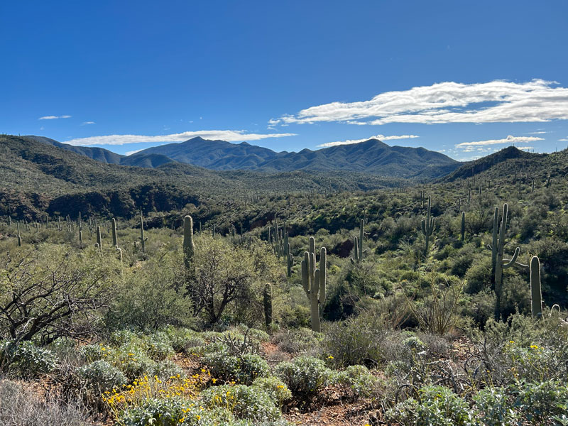
Heading down Elephant Mountain was probably my favorite part of an already great hike. There are many beautiful sights at Spur Cross Conservation Area, but none were more spectacular to me than the gazillions of saguaro cactuses that cover Elephant Mountain. I hike in the Arizona desert a lot, so saguaros are a common sight for me, but even I had to stop and marvel at just how many there were. And when I say marvel, I mean I was completely losing my mind over it. SO AMAZING!
Spur Cross Trail
After about three-quarters of a mile, you’ll reach the junction with Spur Cross Trail (which is also part of the Maricopa Trail). There’s a bench off to the right where you can sit and take in the view before descending the rest of the way.
The Spur Cross Trail meanders in and out more than you’d like. It’s been a long day, and you can see the parking area off to the right, but the trail just keeps taking you back toward the mountain. After an annoyingly long time, you’ll finally come to the junction with the Tortuga Trail. Head right to continue on the Spur Cross Trail back to your car.
Map & Directions
Location Spur Cross Ranch Conservation Area, Cave Creek, Arizona
From the 101, take Scottsdale Road north. Turn left on Cave Creek Road the then right on Spur Cross Road, which makes a little jog over to the right at Grapevine Road. Follow this to the parking area.
Fees/Passes There is a per person fee, or you can use your Maricopa County Parks Pass for a car load (4 people).
Trailhead Facilities Portable toilets available
Preview this Hike
Recommendations for you
Skull Mesa | Cave Creek
Camp Creek Falls | Cave Creek
Tom’s Thumb | Scottsdale
Leave a Reply