Salt River Overlook
TRAIL STATS
See the Salt River from a grand panoramic overlook on this rugged hike in the Superstition Mountains. On your way to the viewpoint, you’ll have the option to visit a large cave, hike up to a high point for a different perspective, and see wildflowers in season. The trail can be hard to follow, so be sure to bring navigation along.
Trail Description
To get to the trailhead, you’ll need to drive a short distance on Forest Road 80, which is a dirt road that is generally in good condition. Park just before the gate that leads down to the dam. There is room for 3-5 vehicles.
Black Cross Butte Trailhead
The route starts at the Black Cross Butte Trailhead, on the left side of the road (if you’re facing the gate). This part of the trail is actually fairly easy to follow, but it’s definitely rough.
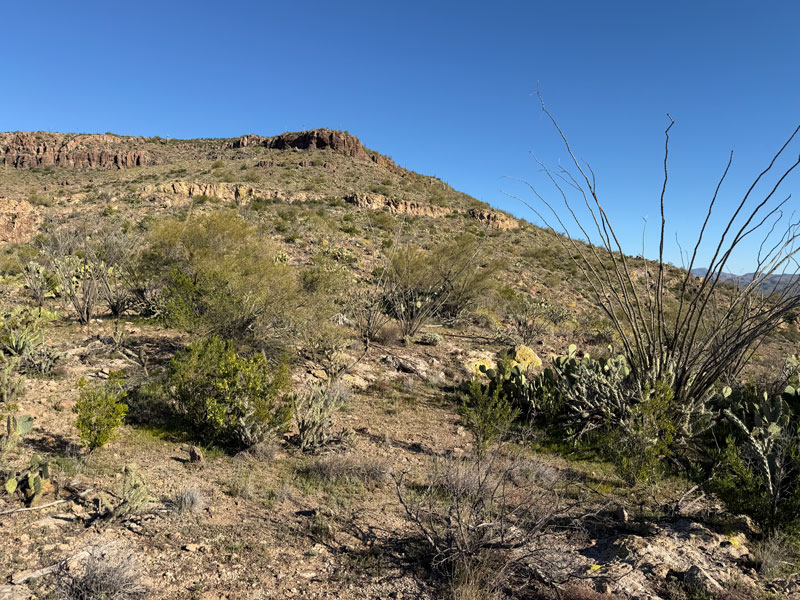
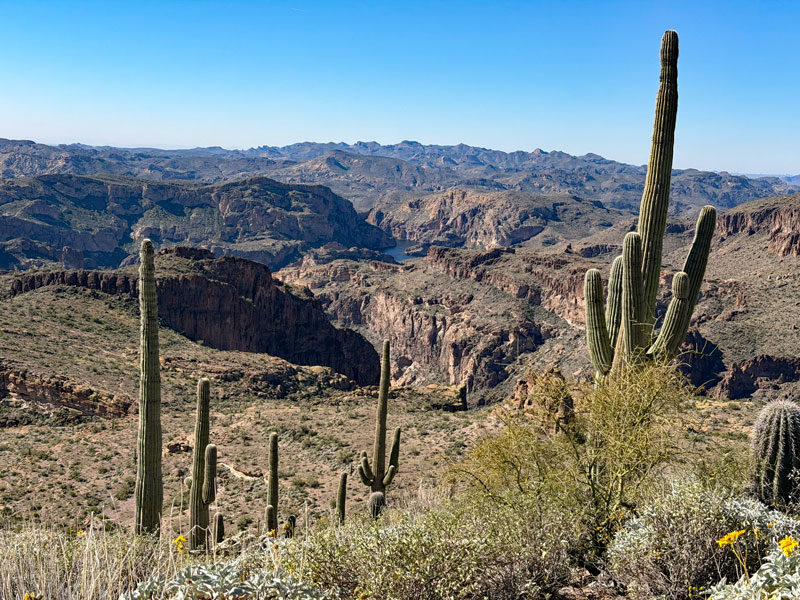
The trail heads northwest along the flank of Black Cross Butte (3340), not to be confused with the other Black Cross Butte (4774) just 6 miles to the southwest. I guess they were running out of creativity when they named these buttes. The trail gradually gains in elevation until you reach a saddle where you will easily see Black Cross Butte to your right. An obvious trail for the summit breaks off here, so ambitious hikers have the option to add it on.
Sure, it looks close now, but on the way back, it’ll look as far away as the moon. We all thought we would visit it on the way back, but we all thought wrong.
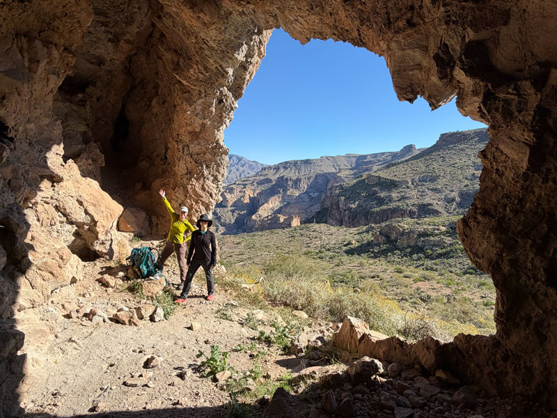
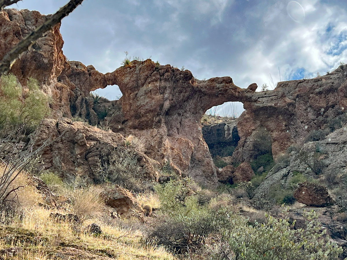
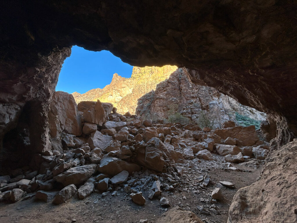
Black Cross Butte Cave
Looking opposite the butte, you can see the large cave a little way off. It’s just a short detour to visit the cave and worth a stop. If you decide to climb into the smaller crevices of the cave, just be aware that you will be getting up close and personal with a crap ton of rodent poop. We didn’t know that until we turned on the flashlight. You’re welcome.
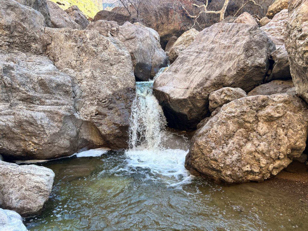
From here, the trail gradually descends as you continue toward the overlook. The views all around are rugged and dramatic, and you may be treated to wildflowers in season. The trail past the cave is a little harder to follow, so bring GPS to help you.
At 2.5 miles in, the trail will start heading over toward a tall butte.
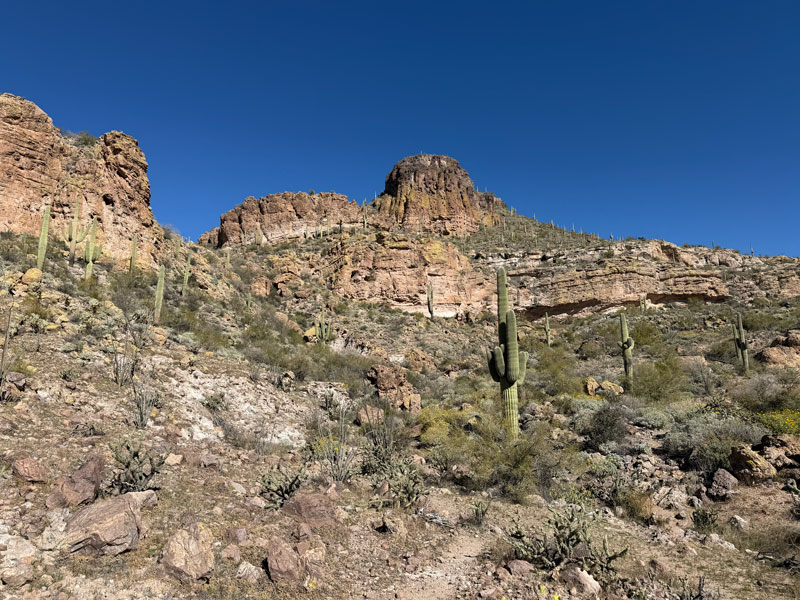
This butte is the biggest hiking joke I’ve seen in a while. Not only do you not have to climb up (and back down) this thing to visit the overlook, it also doesn’t even have the best view. So, unless you really want to get some more elevation in, you can skip it all together. There is no defined route to skip the butte, but it’s relatively easy to travel cross country and meet back up with the trail on the other side. I have included both routes on the map below.
If you do decide to continue up to the butte, make sure you do it on the way in and not on the way out. We thought the views up there were pretty nice until we got to the Salt River Overlook. It’s better for the views to get better as you go than worse. Do the butte first.
Butte
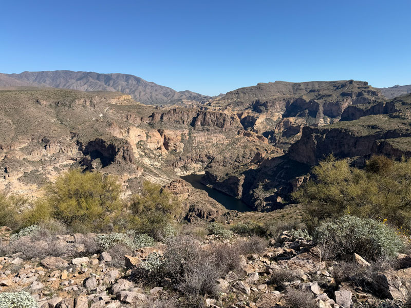
Heading up to the butte, it’s steep and a little slippery with loose gravel. At the top, you will get your first view of the Salt River in one direction and a distant view of Canyon Lake in the other. The views toward the far end of the butte are even better than at the top, so choose wisely where you decide to stop and eat lunch.
Or, I can save you some time and just show you the two views so you don’t even need to go up there.
As of this writing, my butt is still a little sore from biffing it on my way down this butte. It’s steep, loose, slippery, and you’ll want poles for stability.
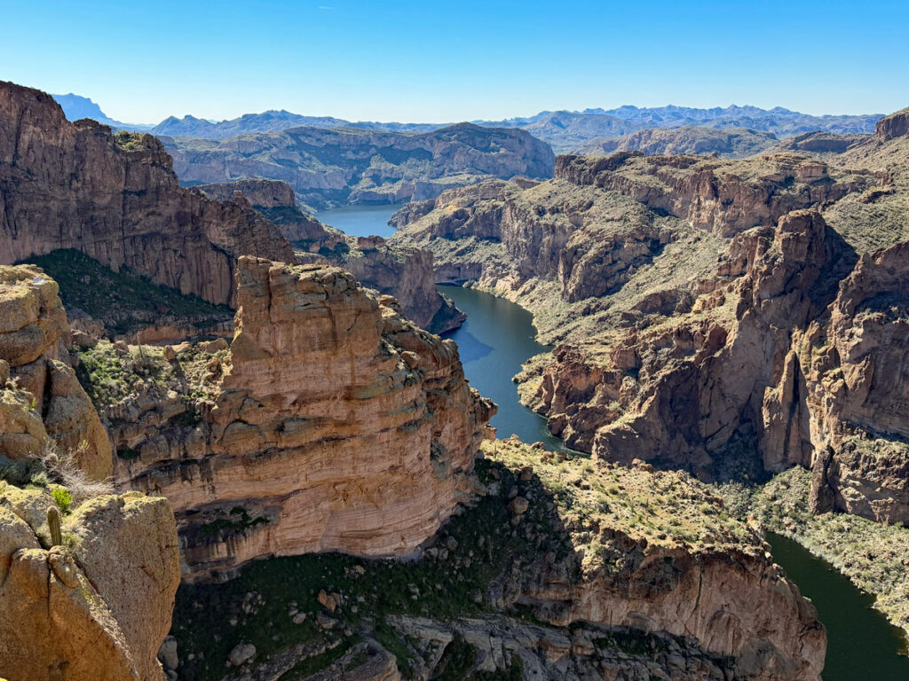
Salt River Overlook
Continuing on, you’ll soon approach the cliff edge of the Salt River Canyon, and the view there just might take your breath away. The cliffs are high with sheer drops and sweeping views down to the river below. You’ll likely see birds swooshing and people enjoying their day on a boat. It’s a grand sight to behold.
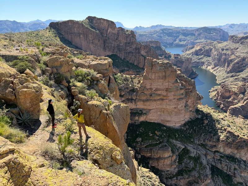
There’s no one specific overlook, so you’ll have to scout around for your favorite viewpoint. I marked a couple of mine on the map.
After experiencing that, you may be asking yourself, “Why the heck did I climb up that butte?” We chose to take a cross country route on the way back, and we did not regret it. The desert has enough openness there to make an off-trail route not too difficult.
Next time, I think I’ll just go cross country both ways.
Map & Directions
Location Location Tonto National Forest, Apache Junction, Arizona
Google Maps Black Cross Butte Trailhead
Fees/Passes None
Trailhead Facilities None
Recommendations for you
Crucifix Canyon | Superstition Mountains
Fish Creek | Superstition Mountains
Peters Canyon | Superstition Mountains
Leave a Reply