Crucifix Canyon
TRAIL STATS
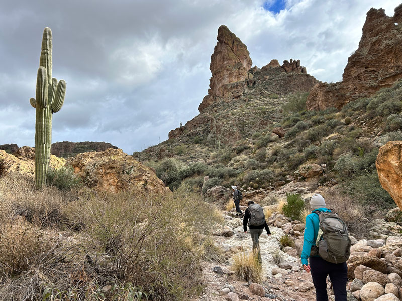
Just outside of the Superstition Wilderness, you can find Crucifix Canyon, one of the canyons that drains into Canyon Lake. The geological formations here are intriguing, with caves, hoodoos, and arches to ignite the imagination. Since you’re following the watercourse of a canyon, there is no official trail, so you’ll find yourself crawling over obstacles and making friends with the overgrown vegetation in spots. It’s a physically demanding route, but one that anyone with reasonable fitness and an appetite for an adventure can do.
Trail Description
When we did this hike, we parked a shuttle vehicle at the end of Crucifix Canyon on Forest Road 80 and then drove back to the point near Mesquite Flat to start the hike. You could do it either way, or do it as an out and back from Forest Road 80, but this seemed like a good arrangement because we enjoyed views of Canyon Lake and Crucifix Canyon ahead of us.
Forest Road 1827
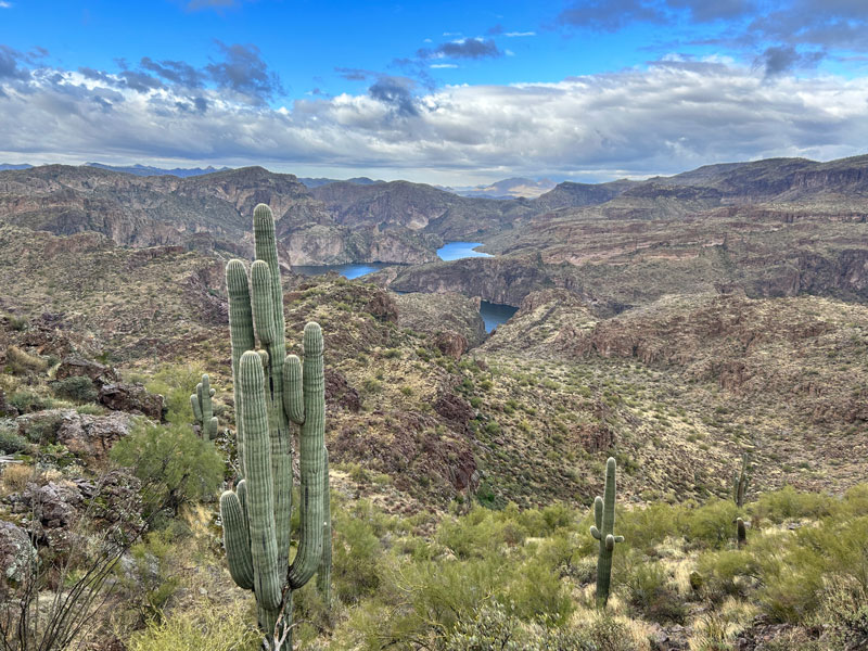
This is a dirt road that’s easy to follow as it toward Crucifix Canyon. You’ll be treated to magnificent views of Canyon Lake off to your left.
As you get closer to the canyon, you’ll come to a cliff band, and our friend, Justin, told us there is only one break in the cliff where you can hike down. I marked it on the map so you can be sure to get to the right spot.
Bat Guano Cave
Once down in the canyon, you’ll easily spot the mysterious Bat Guano Cave with an old, rickety ladder hanging out of it.
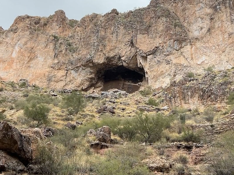
If you’re wondering where this canyon got its name, it’s from a crucifix that was embedded into a wall inside that cave. You can only get up inside the cave if you bring your own equipment and are willing to walk through piles upon piles of bat guano. Ew. The only reason I know about this is because I saw it on a show called “Legend of the Superstition Mountains.” It did not look appealing.
But, you can easily hike up to the base of the cave, although we did not because we were short on time.
Canyon Lake
If you go to the left for about a quarter mile down canyon, you can get to the end of the canyon where it becomes an arm of Canyon Lake.

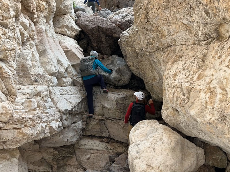
There are quite a few scrambles to get down piles of boulders in this section, so if you’re not feeling up to that many obstacles, you might want to skip this part.
At this point, you turn around and head back up canyon, passing the bat guano cave once again.
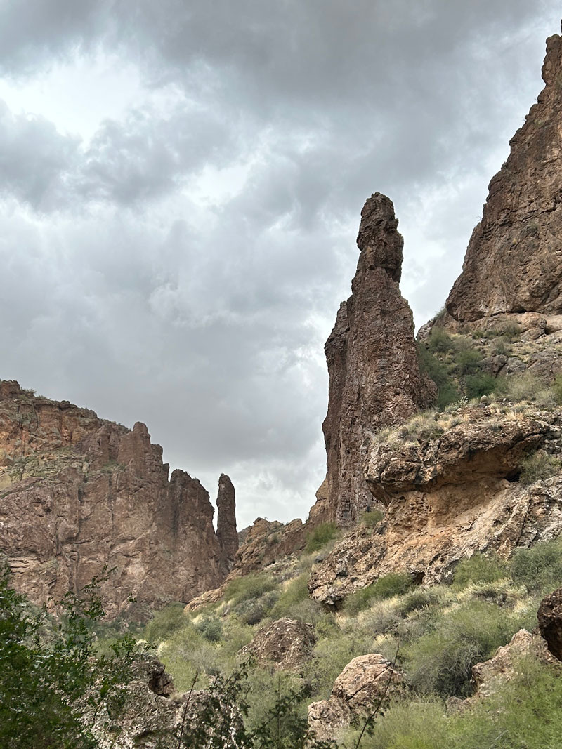
As you hike up canyon, keep your eyes out for caves, hoodoos, and arches on the canyon walls. Some of the formations Justin called “arches” were no more than a boulder sitting on another boulder to make a “roof.” I think calling them “arches” makes them sound cool.
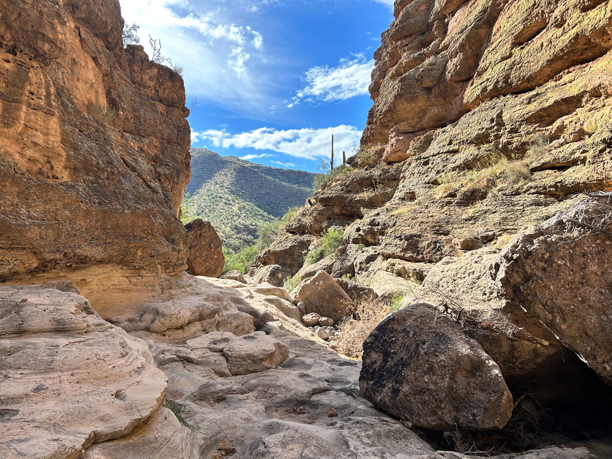
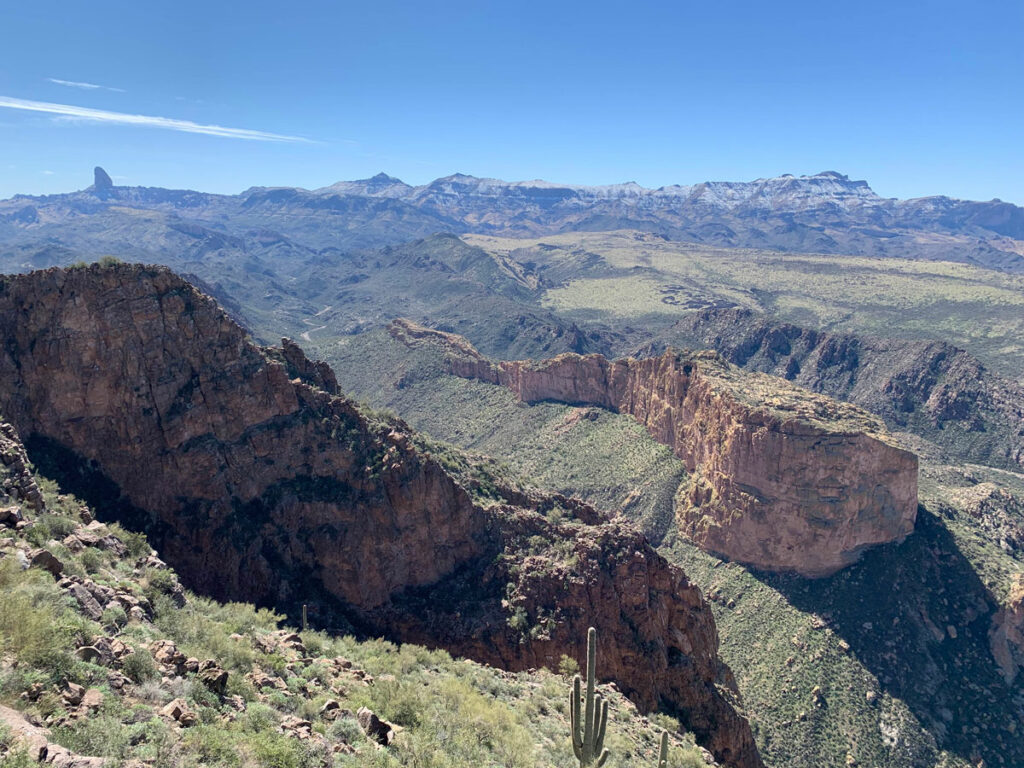
Also, it’s important to look back to get awesome views like this one.
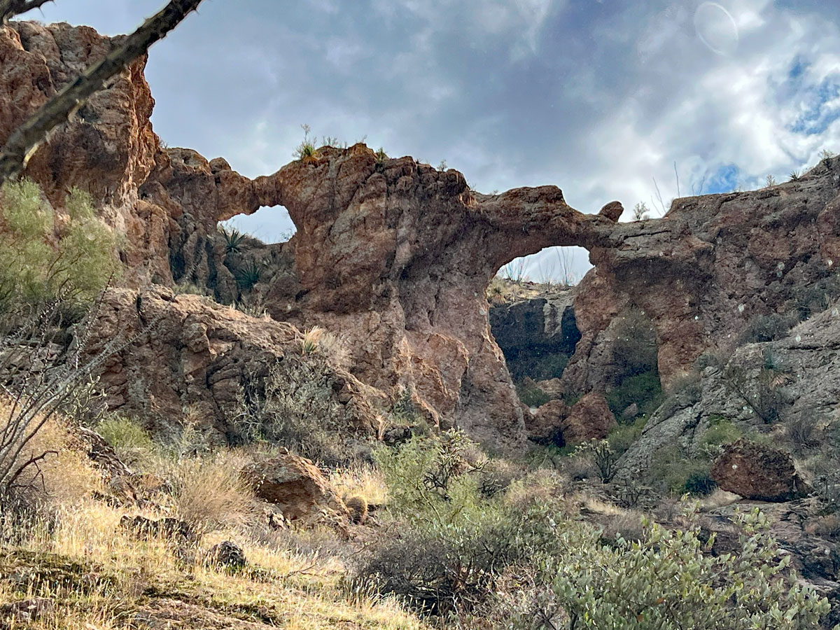
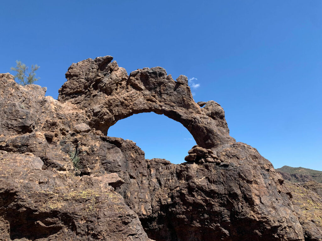
But none of those things will impress you like the magnificent double arches toward the end. They made up for all the lame, tiny arches he pointed out way on top of the cliffs.
Double Arches
As you go up canyon, you’ll see a huge rock tower on your right.
A faint use trail leads up and around to the arches.
We were just blown away. Where have these beauties been hiding all my life?
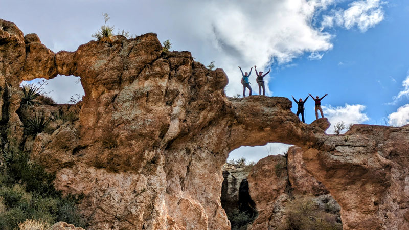
Climb up to them around the left side. Get your picture on the arches, and then go up behind them to continue the hike. Or, if you’d rather, return to the canyon floor and follow the canyon back to the road.
On the final stretch, we stopped at a few more small “arches” as we made our way to the car. On this section, we were not on any sort of trail. We could see our car, and Justin was basically sighting where we needed to be and then finding the path of least resistance to get there.
Some of those paths of “least resistance” were a tiny bit sketch, and at least one of us slid onto her butt (yep, it’s in the video). But hey, that’s the price of adventure. You, too, can experience the butt sliding by downloading our route. Good luck to you.
Map & Directions
Location Tonto National Forest, Apache Junction, Arizona
Google Maps Crucifix Canyon Parking
You can complete this canyon as an out and back from Forest Road 80, or set up a car shuttle to do a one way hike that starts or ends by walking down Forest Road 1827. We opted for the car shuttle. Car shuttle drop point is near Mesquite Flat.
Fees/Passes None
Trailhead Facilities None
Preview this Hike
Recommendations for you
Apache Trail Canyon | Superstition Wilderness
Geronimo Head | Superstition Wilderness
Triple Arches Loop |Goldfield Mountains
Leave a Reply