Apache Trail Canyon
TRAIL STATS
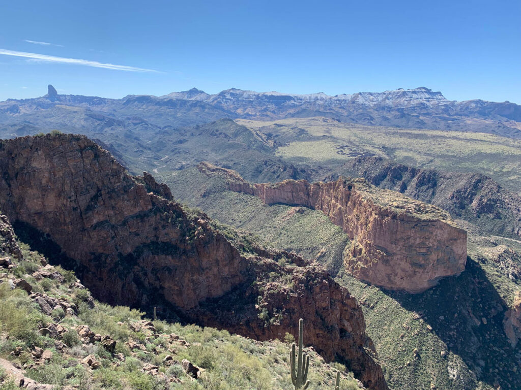
Apache Trail Canyon is a fun little adventure for those who enjoy downclimbing, navigating giant boulders, and a light dose of sketchy. Along the way, you’ll explore dark tunnels, climb through rabbit holes, and find the remains of cars and motorcycles that had a really bad day. Although some people have used rope and harness in this canyon, you can reasonably complete it with an adventurous spirit and maybe a good pair of gloves.
Trail Description
Did I already scare you? Any time I say the word “sketchy,” you’re all of the sudden on edge. Listen, if you always stick to well-marked trails that don’t require use of your hands, then yeah, this might be the wrong hike for you. But if you’re the type to squeeze through a narrow passage, climb into a cave you found while hiking, or climb up a mound of rocks to get a better view, you’ll love Apache Trail Canyon! You know which one you are.
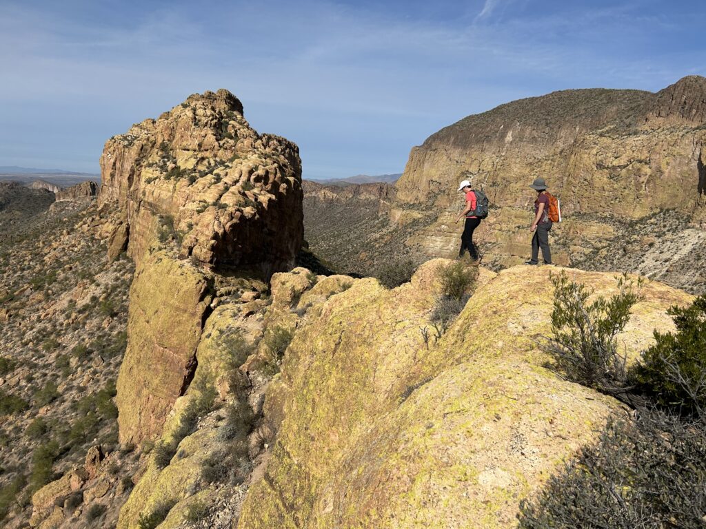
After parking along Highway 88, look for a use trail that will take you down toward the wash below. Or just find the best path you can. Toward the bottom, the terrain turns into more of a solid rock slope, and you’ll want to stay left of the rock, where you’ll find a well trodden path into the wash. Or be like Hillary and crab walk it (not recommended).
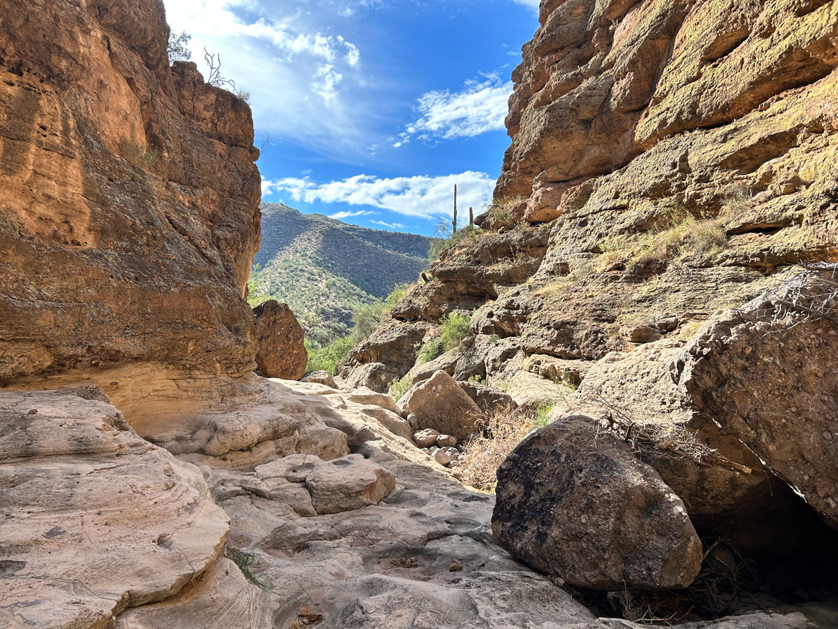
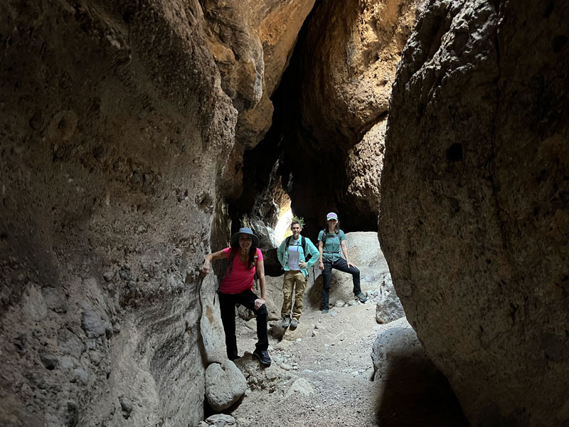
The Wash
Once in the wash, turn right to start making your way down. Almost immediately, it drops into some deep narrows that you won’t be able to get into unless you brought that rope and harness. Keep right and walk along the cliff until you’re almost to an obvious confluence joining the wash from the left. A bit before your cliff peters out, you’ll find this lovely little place where you can downclimb to the bottom.
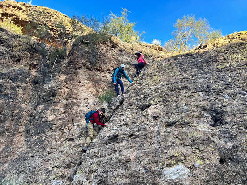
When I opened this image, I thought, “Oh my gosh, that looks a grade or two more sketchy than it felt.” Huh. Well, this obstacle is basically the gatekeeper for Apache Trail Canyon. If you can get down this, you can finish the whole canyon. It’s the crux of the route.
See, that wasn’t so bad.
Ahead, you’ll follow the wash through some pretty sections of narrows.
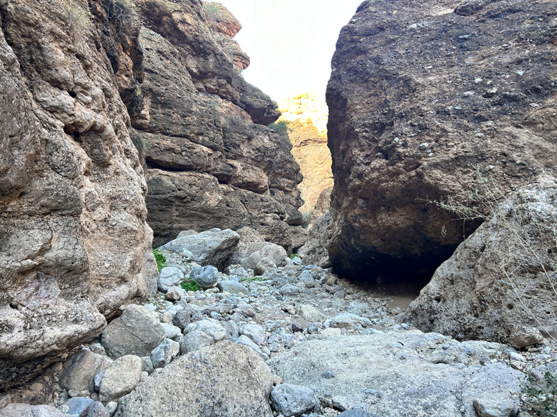
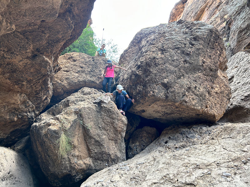
You’ll also find yourself needing to figure out how to get over, under, or around piles of enormous boulders.
If you go one way, and it ends in a drop that’s too high to jump, turn back and go around the other side. You’re sure to find a way past every obstacle. Although the flash floods change this canyon slightly every year, we have never had a problem getting through.
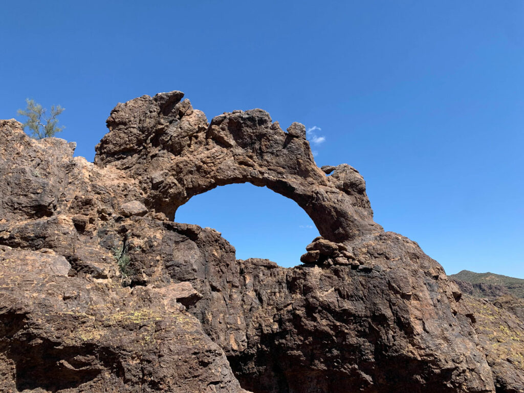
Tunnel
At a couple of spots along the way, you’ll be able to walk through a dark tunnel formed by the huge boulders, one of which is particularly long and awesome.
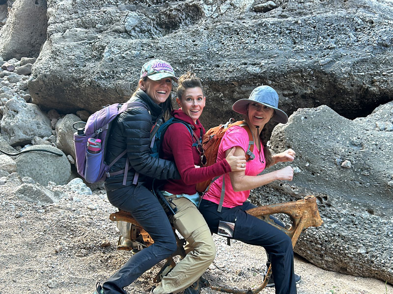
You’ll also find plenty of old vehicle pieces like trunk lids, tires, mufflers, and motorcycle frames. I don’t even want to think about how those got down there!
But, since they are, why not have a little fun?
Eventually, you’ll start seeing more sunlight, and the canyon walls will widen. From here, it’s just a matter of doing some tedious boulder hopping until the wash goes under Highway 88. You can either go under the road and then make a sharp right to climb up to the road or keep walking until an old forest road rejoins the highway.
Whatever you do, don’t think you’re just going to cut out early and climb up the side of the canyon and then go cross country to the highway. (I mean, unless you know the route that exits immediately after the canyon widens.) We found out the hard way that another deep ravine separates you and the road. And you know our motto. We try it so you don’t have to. You’re welcome.
Map & Directions
Location Apache Trail Scenic Byway, Tonto National Forest, Apache Junction, Arizona
From US60, go north on Idaho Road and then turn right onto Highway 88 toward Canyon Lake. Parking for this hike is about 2 miles past the old west tourist town of Tortilla Flat. It’s kind of fun to stop there for a minute to explore the little museum and take some kitschy photos. You can get freezer burned prickly pear ice cream at the store there afterward.
Fees/Passes None
Trailhead Facilities None
This map shows the regular exit (magenta) and the sneak exit (yellow).
Preview this Hike
Recommendations for you
Geronimo Head | Superstition Wilderness
Triple Arches Loop | Goldfield Mountains
Battleship Mountain | Superstition Wilderness
Leave a Reply