Black Top Mesa
TRAIL STATS
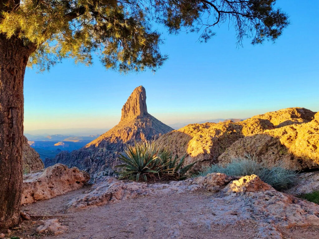
Even though Weaver’s Needle can be seen from miles around, few views of this magnificent spire can compare with the view from Black Top Mesa. Sure, it’s not the classic perspective that you get on Peralta Trail, but it’s a fantastic alternative that’s a lot less crowded. Plus, you’ll have the opportunity to view petroglyphs and take in a panoramic view of the Superstition Wilderness. An awesome campsite at the brink of the mesa with a perfect view of Weaver’s Needle makes this a great backpacking destination as well.
Trail Description
I made it sound so great, didn’t I? It is great, but it’s a whole lot longer than Peralta Trail, which is why you’re unlikely to share this vantage point with others. However, if you like all day hikes through the desert with wildlife, flowers, and stunning views, this hike is for you.
We made this into a loop by taking Dutchman’s Trail #104 on the way there and Black Mesa Trail #241 on the way back, but you can shorten it a little by taking Dutchman’s Trail both ways. It’s the more scenic trail anyway. However, since we did the loop, I will describe that route going in a counter-clockwise direction.
First Water Trailhead
First Water Trailhead is at the end of a dirt road that’s just north of Lost Dutchman State Park. The road is maintained and is usually suitable for a passenger vehicle when dry, but it can become rough during and after rain. If you’re going at a busy time, the lot can become full, but there is a horse lot half a mile back where you can park instead. Vault toilets are available, but no water.
Dutchman’s Trail #104
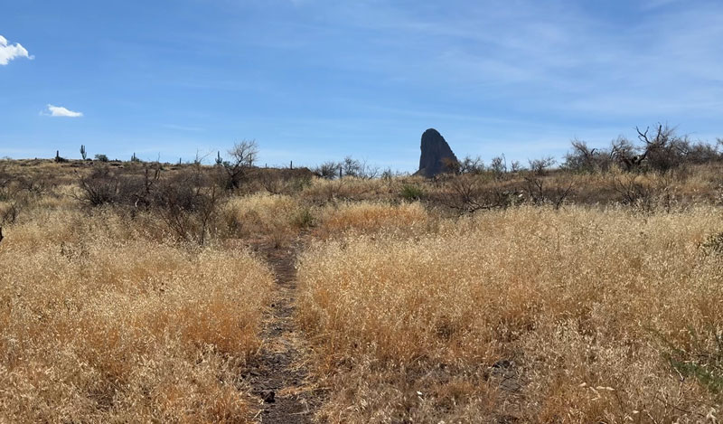
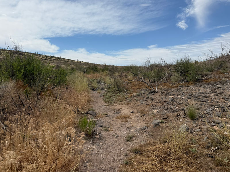
Heading out from the parking area, you’ll be on the Dutchman’s Trail. This trail is well traveled, so it’s easy to follow, but the trail is very uneven. After about a quarter mile, you’ll see the Second Water Trail #236 break off to the left. Lots of your fellow hikers will be heading that way for Hackberry Spring or Battleship at this point, but you’ll keep right to stay on Dutchman’s Trail. This is the shortest route to Black Top Mesa.
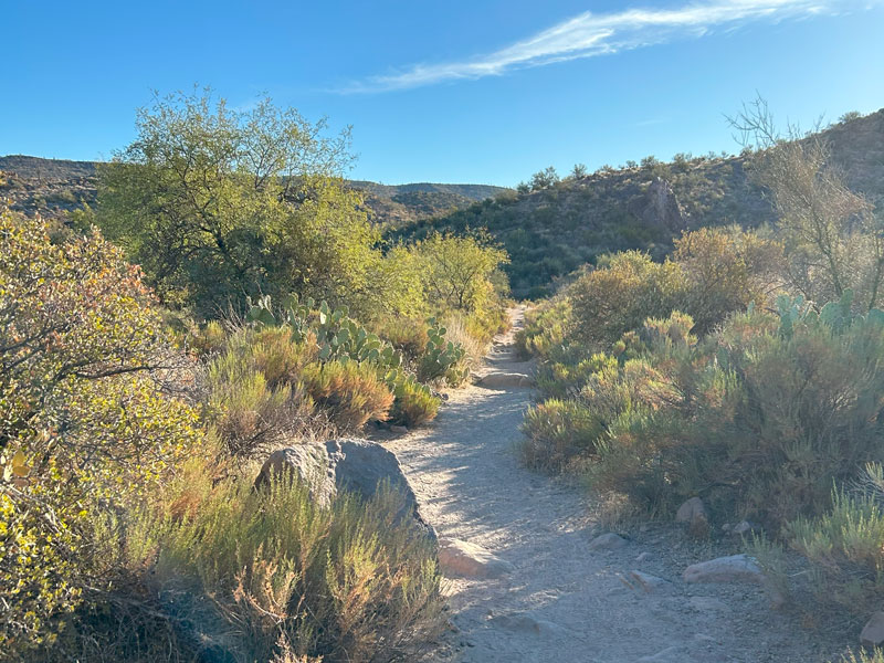
The Dutchman’s Trail has some ups and downs, but it doesn’t gain much elevation. As you progress, you’ll have some panoramic views of the mountains ahead and glimpses of Weavers Needle in the distance.
Beautiful Superstition Wilderness landscape
When you get close to the junction with the Black Mesa Trail #241, you’ll be able to see Palomino Mountain and Weavers Needle up ahead. Evidence of the 2024 is all around, but it’s nice to see the shrubbery coming back to life.
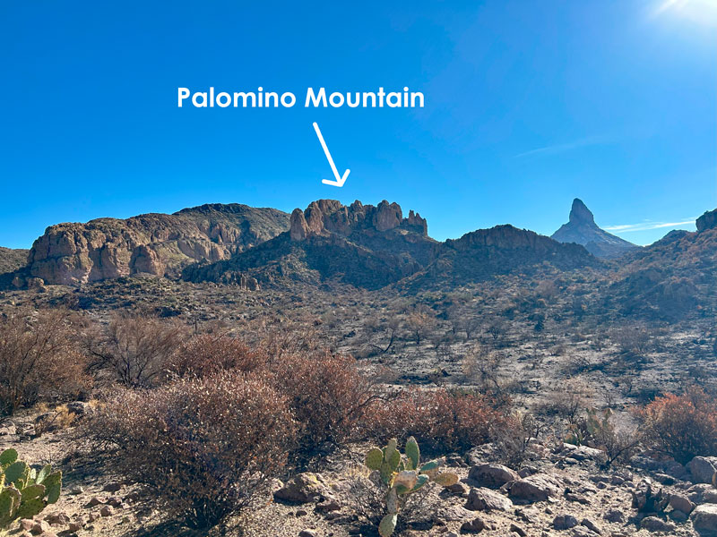
Black Mesa will be behind you at this point, so don’t confuse it with Black TOP Mesa ahead, which is where you’re going. Indeed, both of these mesas have black rocks on the top, but really? Where’s the creativity? There’s also a Yellow Peak and Red Hills nearby, so I guess someone was just tired of thinking up interesting names.
If you’re backpacking, you’ll find plenty of campsites in this valley. The downside is that this area is likely to be completely dry unless there has been a significant amount of rain recently. Honestly, it’s worth it to wait for the campsite on top of Black Top Mesa if you can, especially if you have to dry camp anyway.
Bull Pass Trail #129
Past Palomino Mountain, you’ll come to the signed junction with Bull Pass Trail where you will fork left. For the last 4.5 miles, you’ve been cruising along the desert floor, only gaining around 500 feet in elevation. Well, that’s about to change. As my friend noted, it starts going up, and it doesn’t stop until the top.
Black Top Mesa Trail
You’re only on the Bull Pass Trail for about half a mile before you’ll reach a saddle next to Black Top Mesa. The trail to the top is not an official trail, so there won’t be a fancy sign. But if you ever start going down, you probably missed the turn. Remember, it’s all uphill from here.
The trail has obviously seen a good amount of use, so it’s fairly easy to follow. However, don’t let that get your hopes up too high. There’s still catclaw. Geez, is there anywhere that plant won’t grow? Wear pants, but not your favorite ones. There’s lots of grass, too, but maybe a few desert mariposas in springtime to keep your spirits up.
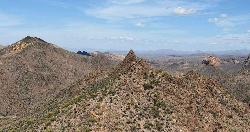
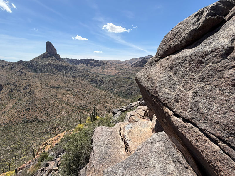
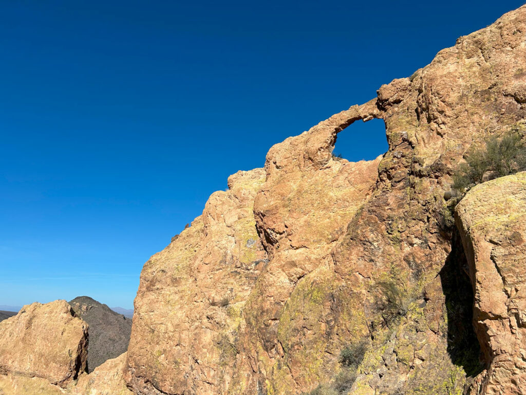
The trail gradually makes its way up the left flank of Black Top Mesa, providing expansive views to your left. Look back every so often to take in a grand view of the Superstition Wilderness, including Battleship Mountain.
As you progress, you’ll start to see the tip of Weavers Needle poking up in front of you. You’re almost there!
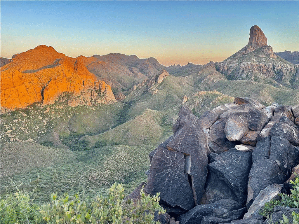
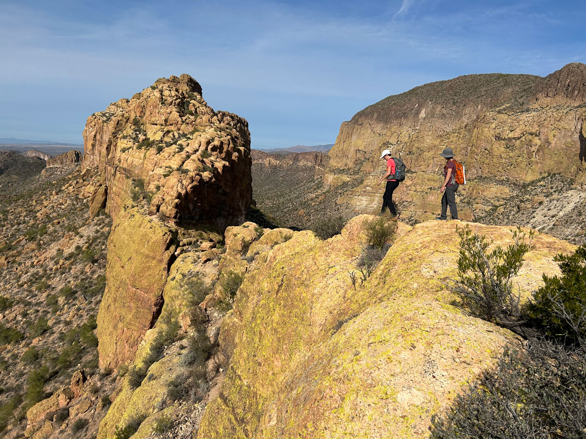
Black Top Mesa
The trail leads directly to a campsite with a spectacular view that might make you wish you brought your tent and sleeping bag. The cover photo for this post is from a previous backpacking trip, which just goes to show that the waning light makes the scene even better.
Black Top Mesa Petroglyphs
Continue on the trail around to the left to a rocky outcropping where you can see the petroglyphs.
There are a few interesting looking suns, and a lot of graffiti left by former visitors. Boo. Apparently there is some question as to whether these petroglyphs were left by the Spanish or Native people. I have no idea, but if you do, let me know in the comments!
Out and Back Option
Mileage Saved 0.3
Elevation Gain Saved 258
On the way back, you can go back the way you came on the Dutchmans Trail for the shortest return to the trailhead. This will save you just 0.3 miles and 258 feet of elevation gain, so it’s not much difference.
Black Top Mesa Trail #241
If you’d like a little more variety, you can take Black Mesa Trail #241 on the way back. Honestly, though, you’re not missing much.
It feels sort of barren, and the gently sloping terrain often obscures any view you might have had. In fact, if I were to do the loop again, I would probably start with this trail and go in the opposite direction. The view as you are approaching Weaver’s Needle is far more interesting.
To add to the disappointment, you don’t really go up on Black Mesa at all. You’ll just have to settle for a distant view of its black topped summit, taunting you with its lovely crown of saguaros that are so far out of reach. Don’t worry, there will be more saguaros up ahead.
After what seems like a endless walk through a desert wasteland, the trail begins descending toward Second Water Trail, and you’ll finally have some views!
Second Water Trail #236
At the signed junction for Second Water Trail #236, take a left to head back toward the First Water Trailhead. You’ll be on this trail for about 1.5 miles before you get back to the junction with the Dutchman’s Trail that you took earlier. Keep right to continue onto Dutchman’s Trail just a little more than a quarter mile back to your vehicle.
Map & Directions
Location Superstition Wilderness, Apache Junction, Arizona
From the US60 take the exit for Idaho Road. Go north on Idaho Road to state route 88 and turn right. Follow this road past the Lost Dutchman State Park to the turn for First Water Trailhead. Turn right and follow the dirt road to the end to the parking lot. There is an overflow lot about a quarter mile back if the main lot is full. The road is a bit rough, but usually passable in a passenger vehicle.
Fees/Passes None
Trailhead Facilities Vault toilets
Recommendations for you
Battleship Mountain | Superstition Wilderness
Peralta to Lone Pine | Superstition Wilderness
Palomino Mountain | Superstition Wilderness
Leave a Reply