Chopper Drop Canyon
TRAIL STATS
With easy starts, epic rappels, cool geological formations, and jaw-dropping views, Chopper Drop Canyon is easily one of the best canyoneering routes in the region. Take a side trip to the famous Sedona Subway, stop for a snack in a cave arch, walk along the “Cougar Ledge,” and explore unexpected discoveries to round out a day of adventure.
🪢 This is a technical canyon with four rappels up to 190 feet. You will need one 200-foot rope, one 200-foot pull cord, plus all the required safety equipment for rappelling and knowledge how to use it. This guide is not intended to provide instruction on how to descend a technical canyon safely.
Trail Description
Owing to the popularity of the Subway Cave, the parking for the Boynton Canyon Trailhead is very competitive. Even if you get there early on a weekday, chances are good you’ll be parking on the street, so allow extra time.
Deadman’s Pass Trail
From the trailhead, you’ll start on the Deadman’s Pass trail for a short distance until a well-marked junction with Boynton Canyon Trail.
Boynton Canyon Trail
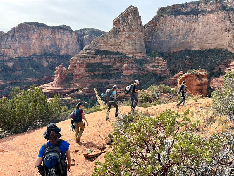
The Boynton Canyon Trail starts out skirting the outside of the Enchantment Resort as it passes popular attractions like the Kachina Woman and the Boynton Canyon Vortex. The trail is generally flat and easy, but watch for rocks sticking up along this trail, as they have been known to trip people and bust kneecaps (don’t ask how we know).
Juniper Tree Junction
Now here’s the key to finding the Subway. You must look for a large juniper tree that marks the junction where you’ll turn off to the right to get to the Subway Cave. The trail is obvious, owing to the number of visitors using it, but if you’re not paying attention, you could still miss it. Follow this trail to the Subway Cave entrance.
Subway Cave
Scramble up the rocky chute if you want to visit Subway Cave for an iconic photo op, or continue the Chopper Drop Canyon route by veering to the right of the cave entrance.
The next part of the route is a little bit tricky, and you’ll want to keep a close eye on your GPS as you make your way up. The tendency is to follow the drainage because there is a legit trail going that way, but as you know if you’ve been canyoneering a while, we don’t always follow the “obvious” trail. The trick is to stay farther left than feels natural on a less worn trail. But not too far. If you find yourself stemming, just remember there was an easier way, and you missed it (bail on your crazy homie – it’s not too late to go around).
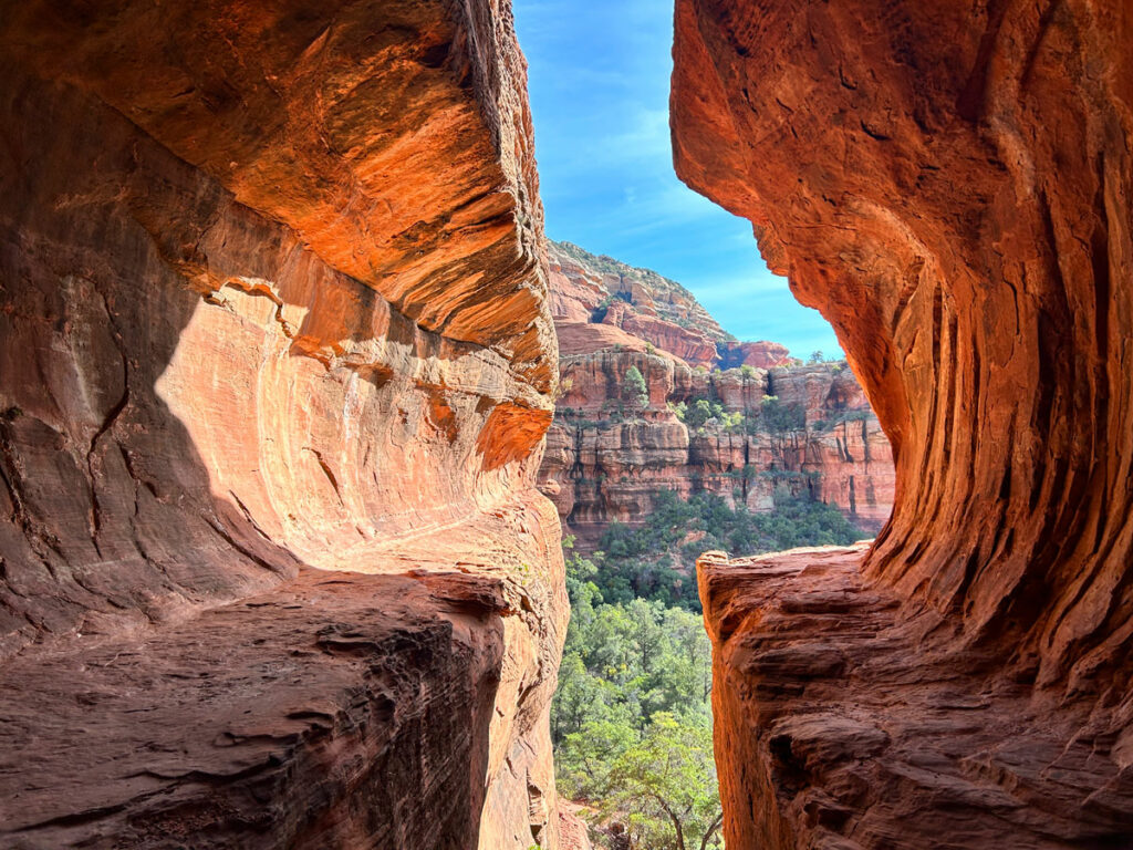
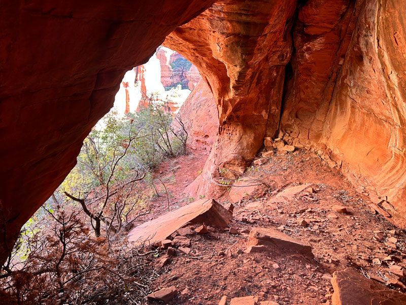
Cave Arch
If you’re on track, you’ll eventually come to a small cave, which reveals itself to be an arch upon closer inspection. This one you’re likely to have all to yourself.
That is, unless “Two Snakes” is there. If you see him, you’ll know.
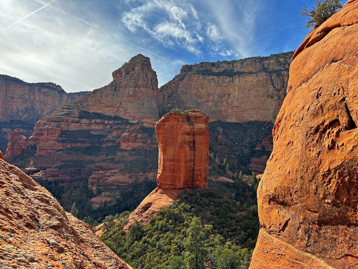
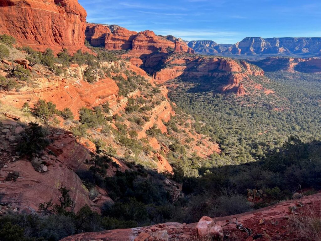
Hike through the arch and continue hugging the canyon wall until you make it up to a saddle where you’ll be treated to a stunning panorama. You’ll see Boynton Island in the distance on your left and perhaps a helicopter tour flying through. Or, if you’re lucky, that chopper will wait until you’re dropping on rappel to fly by (wink, wink).
Once on the saddle, make your way to the right, trying to stay up high without too much bushwhacking. Getting on the solid rock is the ticket here.
Soon, the short and easy rappel 1 will be on your left. Game on.
Rappel 1
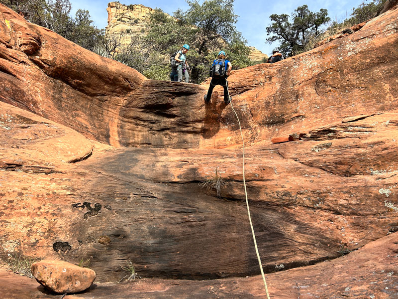
Length 20 feet
Anchor tree
Easy two-tier rappel can possibly be downclimbed RDC if you like slightly freaky stuff.
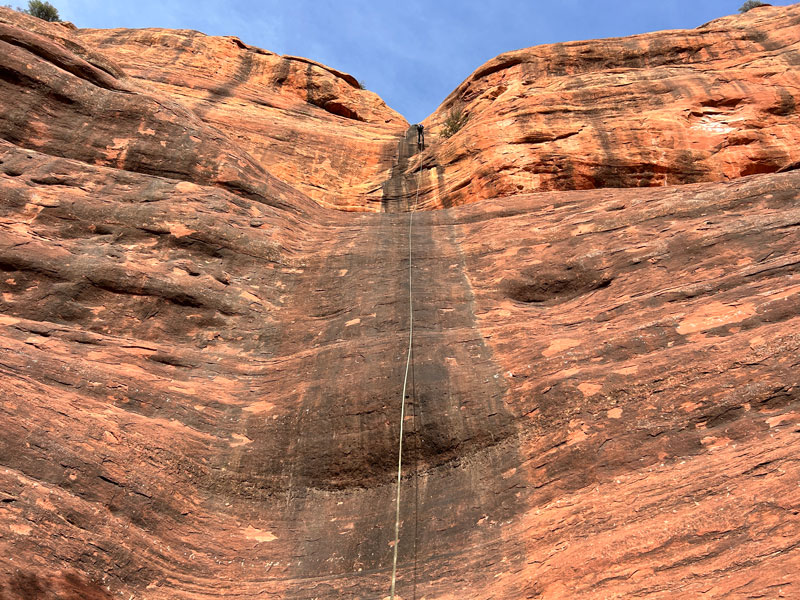
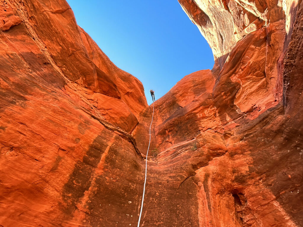
Rappel 2
Length 195 feet
Anchor boulder
The view from the start of this rappel is incredible, so plan to get a picture of everyone when they get on rope. From there, it’s two big drops straight down with a short shelf between.
After rappel 2, look behind you at the cliff wall (to the right side of the rappel). Enjoy but definitely respect the area like the rad canyoneer that you are.
Rappel 3
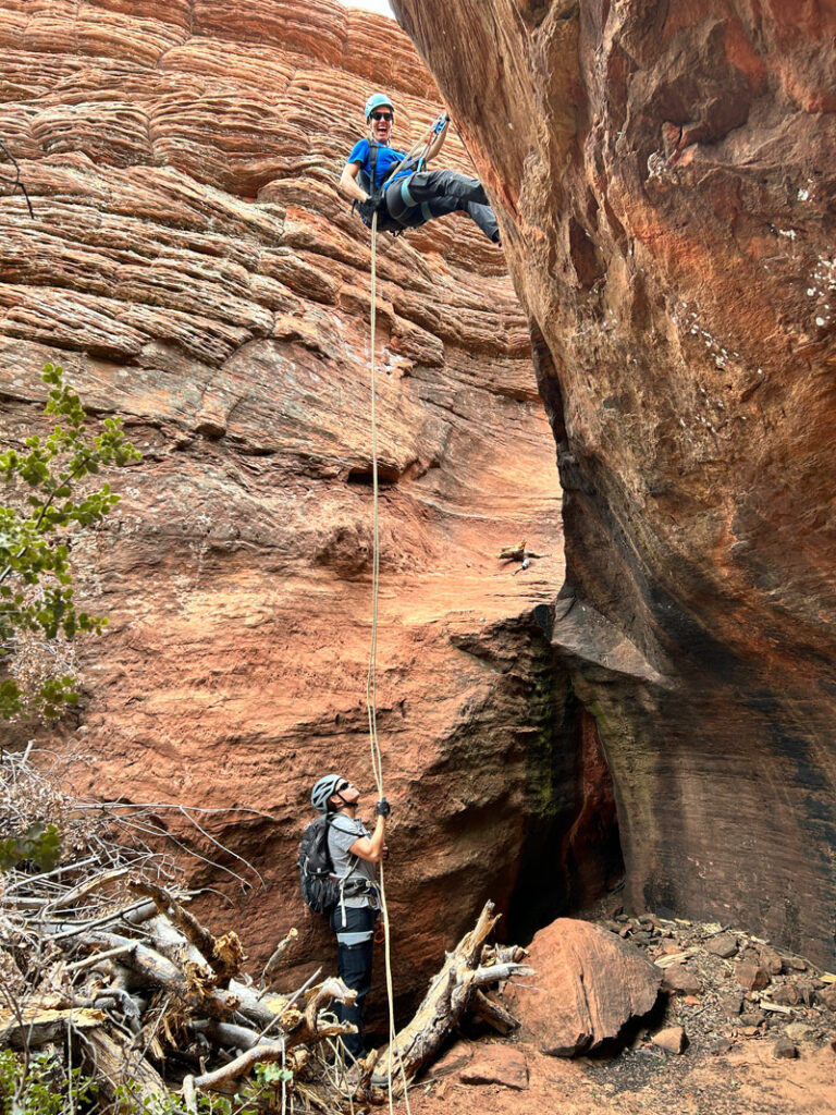
Length 40 feet
Anchor bolt
Evidently, this rap sometimes has a small waterfall. You’ll rap down into a small, sandy, cove, and the last bit is freehanging.
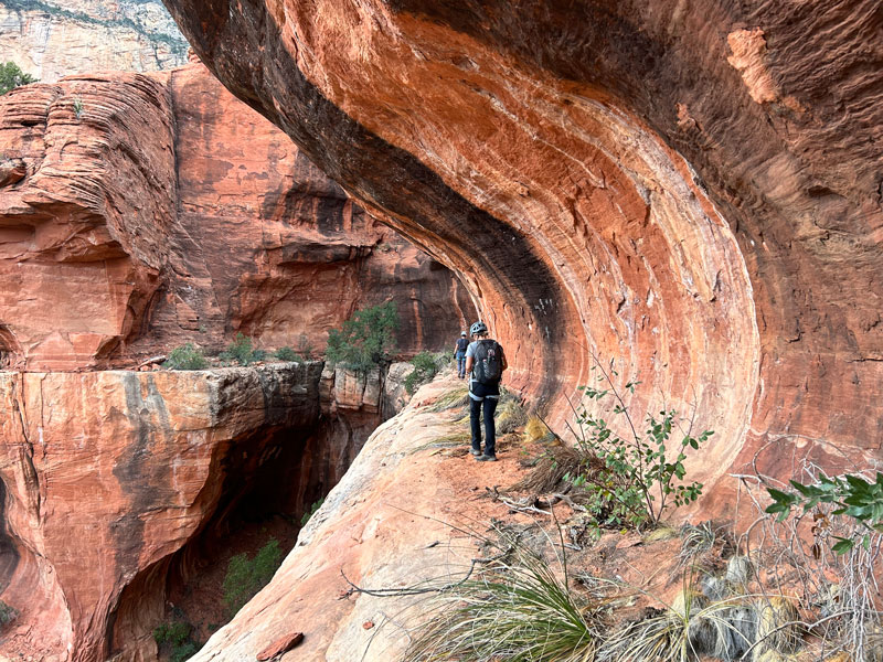
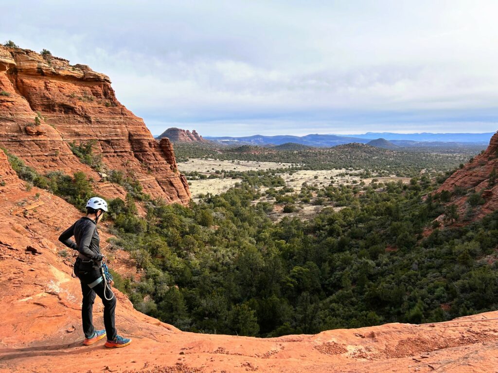
Cougar Ledge
When you arrive at rappel 4, take a walk out to the right along the ledge. Follow it around for a sweet view and epic photo op.
Rappel 4
Length 170 feet
Anchor tree
Most of this rappel is straight down a cliff face, but stow all your loose gear inside your pack in case you want to get that badass upside down shot at the end.
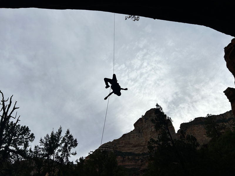
Also, if you feel a sharp tug on the rope just before you start rappel 4, it’s because it’s haunted. Or maybe the rope just fell down to the next level. You decide.
The Exit
After you gear down, you can basically follow a drainage for a while until it turns left (east) and begins to parallel the Boynton Canyon Trail, where you can get on the trail and follow it out to your car. Or, keep rock hopping in the wash like a moron when there’s a nice, flat, groomed trail like 20 feet away (no, not us. . . why are you looking at me like that?)
Map & Directions
Location Red Rock Secret Mountain Wilderness, Sedona, Arizona
From Highway 89A, go north on Dry Creek Road in West Sedona. That will turn into Boynton Pass Road. Keep left at the fork. Turn right onto Boynton Canyon Road. The Boynton Canyon Trailhead will be on your right. This is a very popular hike, so go early enough to find parking or allow extra time to park on the street.
Fees/Passes Red Rocks Pass or America the Beautiful Pass required. Pay kiosk at the trailhead.
Trailhead Facilities Pit toilets
Preview this Hike
Recommendations for you
Boynton Island East | Sedona
Dillinger Canyon | Sedona
Bobcats Canyon | Sedona
Leave a Reply