Hangover Trail
TRAIL STATS
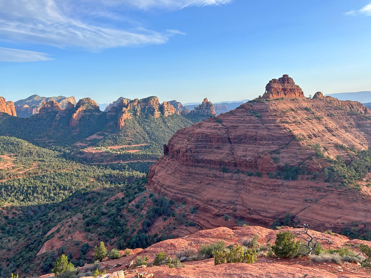
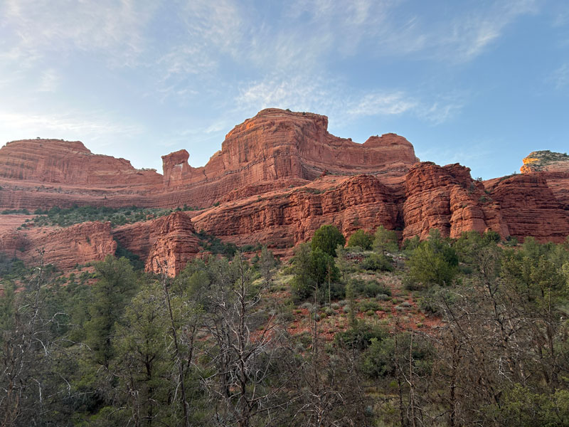
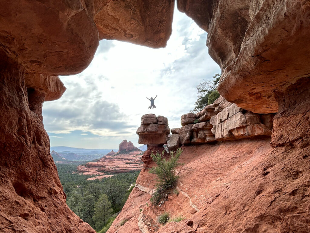
Just when you think every cool trail in Sedona is overrun by crowds, you find Hangover Trail. Sometimes called Cow Pie Loop, this trail starts on the Cow Pie Trail in Bear Wallow Canyon and goes up over a saddle for massive views into the neighboring canyon. The trail stays high, so your views just keep going and going as you hug the edge of the canyon wall. See interesting formations like Teapot Rock and Queen Victoria along the way. Steep drop-offs may make this unsuitable for those with a fear of heights.
Trail Description
Sometimes it’s hard to get excited about Sedona because you know you’re going to face a lot of crowds and fight for parking. Luckily, there are still a few hidden gems where you can escape the masses and still see the best that Sedona has to offer.
Hangover Trail is one of those trails.
There are a couple ways to get to this trail, but the most important thing is that you hike it from east to west. You really want to be looking at the grand views ahead of you as you hike rather than facing up canyon. So that means you need to get yourself to the Cow Pies Trailhead, and how you get there will depend on the type of vehicle you have.
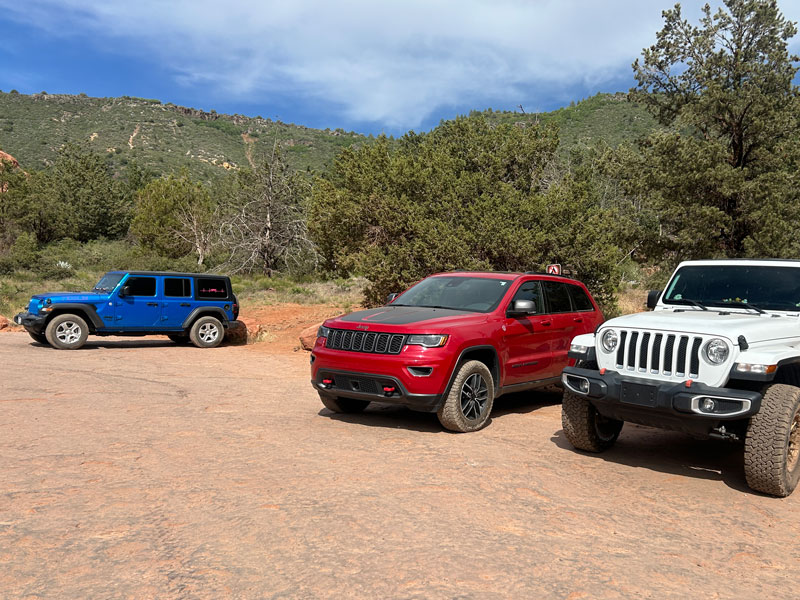
Cow Pies Trailhead (4WD)
High clearance 4WD vehicles can drive 2.7 miles up Schnebly Hill Road to the Cow Pies parking lot. The road starts off very rough, so that will be the gatekeeper for this option. If you make it past the first 100 yards, you’re golden. Just know it’s rocky the WHOLE way.
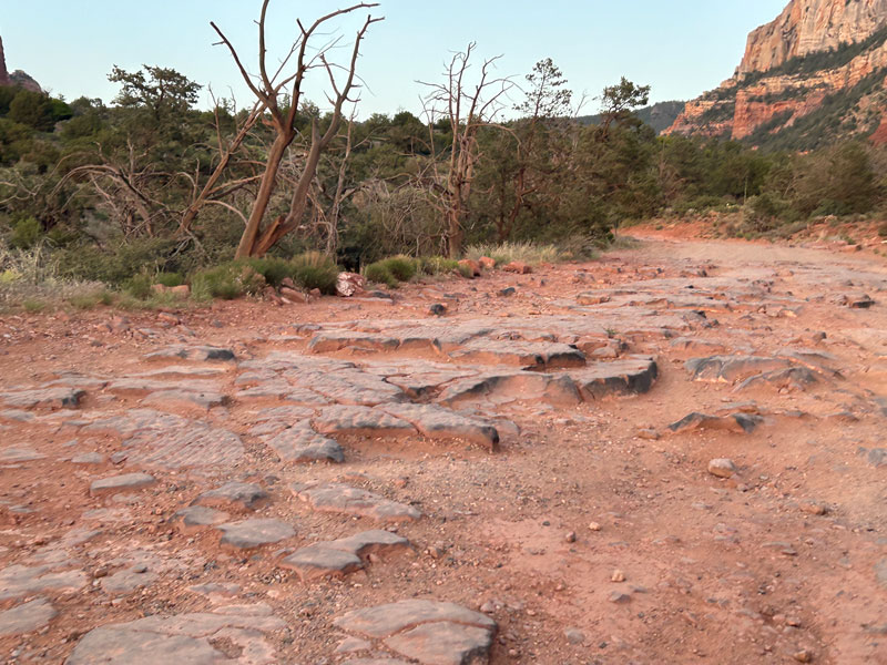
The Cow Pies Trailhead is not marked on every map, but you’ll know it because it’s a platform of solid rock. And it will probably have some Jeeps on it. Mine felt right at home there.
Huckaby Trailhead (2WD)
Additional mileage 3.4 miles
Additional elevation gain 863 feet
Passenger vehicles should park at the Huckaby Trailhead right before the road turns into dirt. This adds 3.4 miles to the total and 863 feet of elevation gain. Follow the Munds Wagon Trail to the Cow Pies Trailhead. You will need a Red Rocks Pass or America the Beautiful Pass to park at that trailhead. There is a pay kiosk at the parking lot.
Princess Option
I guess there’s technically a third option where you convince someone to drop you off at the Cow Pies Trailhead and pick you up at the end of the Hangover Trail. I’m guilty, but in my defense, I did hike to Merry Go Round Rock first, and my companion did not want to hike Hangover Trail, so it was on the way.
Cow Pies Trail
From the Cow Pies Trailhead, take the Cow Pies Trail toward the mountain. This section does not have much elevation change and passes over large platforms of solid rock. Keep an eye out for painted white markings to keep you on track. Or was that lichen? Or a bird turd? Sometimes it’s hard to tell.
When you get close to the mountain, you’ll see a sign marking the Hangover Trail.
Hangover Trail
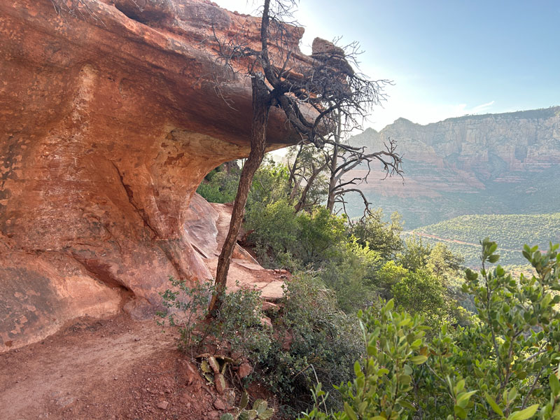
Incredibly, this is also a mountain bike trail that’s rated as double black diamond. After hiking it and seeing some spots that felt slightly sketchy on foot, I can safely say I won’t be riding a bike on this trail ever.
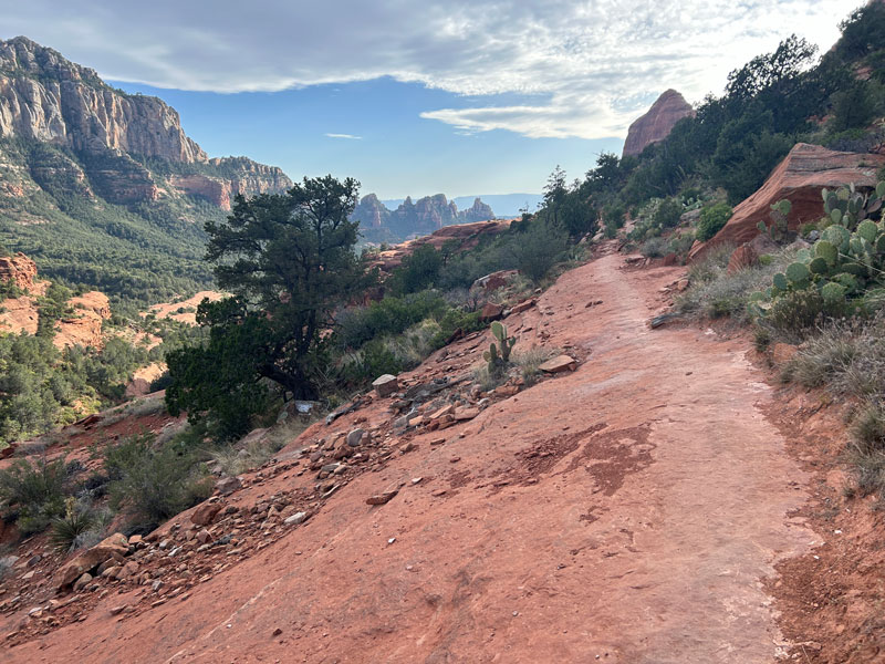
The trail starts to hug the side of the canyon and generally drops off to your left. When I saw this, I knew it was going to be a great hike for me. I love being up high where I can look down into valleys below while hiking.
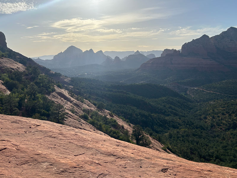
The trail eventually hits some switchbacks and takes you up over a saddle where you can get epic views into the next canyon.
Now the trail turns west and hugs the left side of this canyon, with drops-offs to your right.
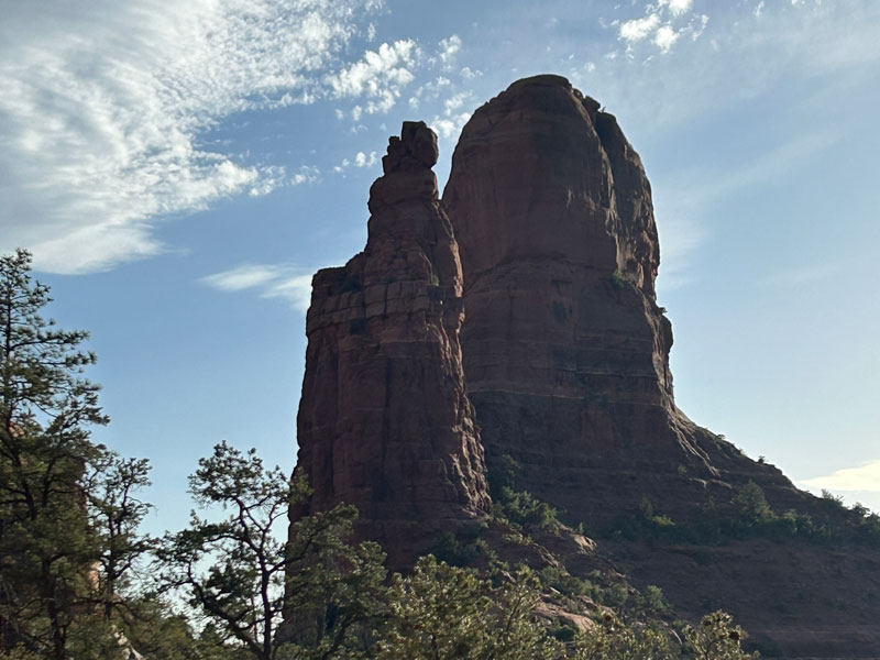
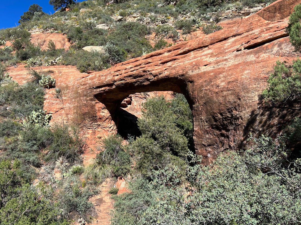
Teacup Rock and Queen Victoria are just some of the rock formations you’ll see along the way.
Once you get past the Queen Victoria formation, the trail will approach another saddle where you’ll start to go down. And this is where you’ll really think the mountain bikers are crazy. I hope they walk their bikes down this.
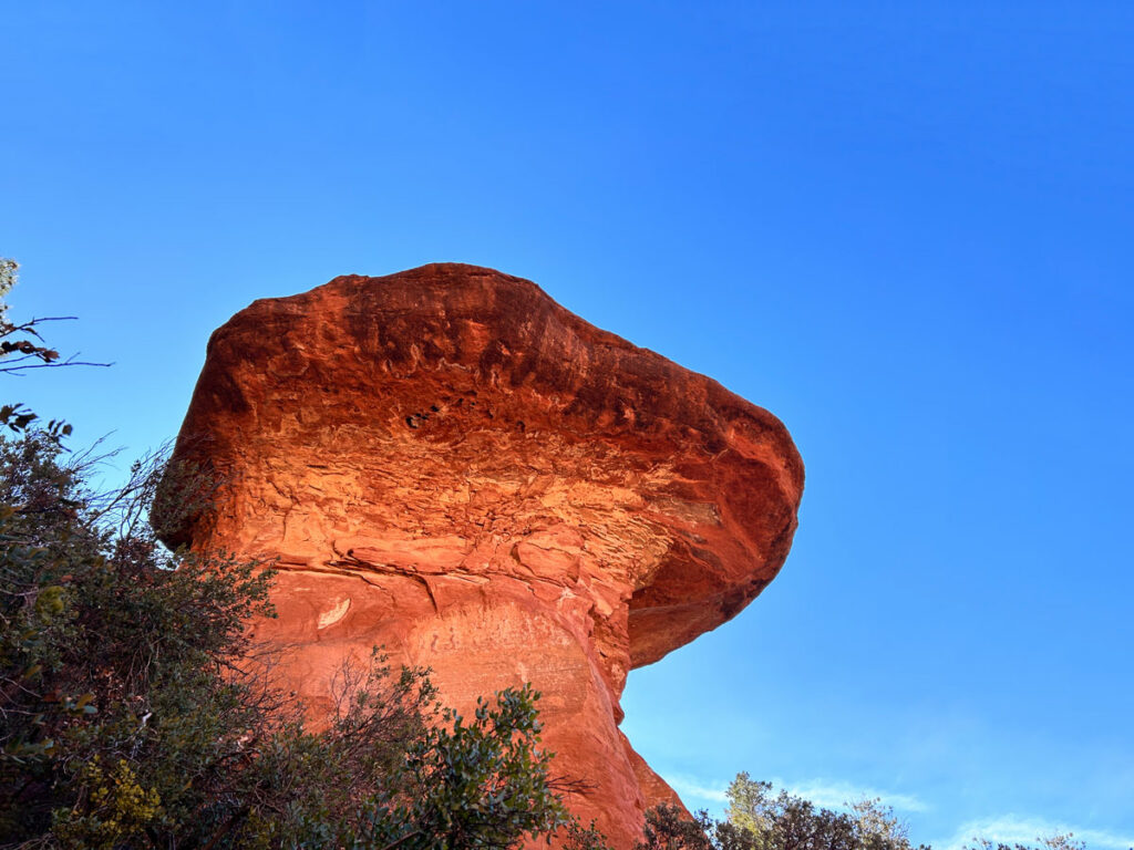
After rounding the corner, you’ll cross the saddle and start heading back down into Bear Wallow Canyon. From down there, you can really get a good look at Teapot Rock.
After a few switchbacks, you’ll be back on fairly even ground as you make your way back to Munds Wagon Trail. As I mentioned before, I took the princess option, so when I got to the end of the Hangover Trail, I just took a short use trail up to the road to catch my ride. So if you’re hiking Munds Wagon Trail back to your car, you’re on your own.
Map & Directions
Location Coconino National Forest, Sedona, Arizona
Google Maps Cow Pies Trailhead or Huckaby Trailhead
For whatever reason, the Cow Pies Trailhead is marked at the Huckaby Trailhead on Google Maps. So, if you search for it, your map will end where the dirt road begins. I marked the actual trailhead on the map below.
Fees/Passes If you park at the Huckaby Trailhead, a Red Rocks Pass or America the Beautiful Pass is required. Pay kiosk at the trailhead.
Trailhead Facilities None
Recommendations for you
Vultee Arch | Sedona
Mushroom Rock | Sedona
Merry Go Round Rock | Sedona
Leave a Reply