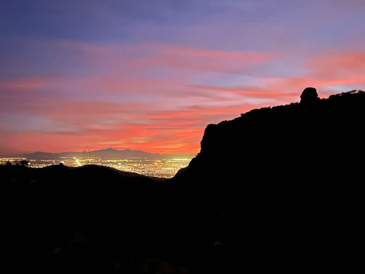
Thimble Peak
TRAIL STATS
Perched high on a mountain overlooking Tucson, Thimble Peak is an iconic destination for hikers and climbers alike. Visit the Shreve Saddle and Sycamore Reservoir along the way, and enjoy incredible views of Tucson and Sabino Canyon from the top. Getting to the top of the true summit requires a short technical climb, but the lower summit can be reached by scrambling to the top. Those who would rather stay grounded will still have great views from the saddle.
🪢 Thimble Peak is comprised of two summits divided by a gulley. The northern summit can be accessed by scrambling up, but it is the lower of the two. The southern summit, which is the true summit with the best views, can be accessed by a short technical climb protected by a single bolt and options for cam placement. Rock climbing skills are a must for the southern summit. This guide is not intended to teach you how to climb this peak safely.
Trail Description
The shortest way to hike to Thimble Peak is using the Sycamore Reservoir Trail, but you can also hike up the Bear Canyon Trail. This will add seven miles to your distance and a lot more elevation, but I don’t know you, and maybe you’re a glutton for punishment.
Not me, though. No. On this particular trip, we decided to climb both Thimble Peak and Finger Rock and backpack our way between them. Four days, 28 miles, and 10,000 feet of elevation gain with all our backpacking gear and climbing equipment. Plus, since it was a dry December, we were carrying 6 liters of water each after leaving Hutch’s Pool. I know nothing about punishing myself.
But I digress.
Gordon Hirabayashi Campground
So, we’ve established that the sane people will be parking at the Gordon Hirabayashi Campground and starting at the Sycamore Reservoir Trailhead (no offense to the hardcore folks who start at Bear Canyon—we’re impressed). If you drive all the way to the end of the campground, there’s a loop with parking spaces for hikers. We could not find any signs prohibiting overnight parking, so we left our car there for the four day backpacking trip, and all was well when we returned.
The campground is near an old prison camp that was used to house prisoners who helped build the Catalina Highway. One of the prisoners was the campground’s namesake, Gordon Hirabayashi, who objected to the internment of Japanese Americans during WWII and turned himself into the FBI rather than report for internment. All that remains of the prison camp is concrete foundations.
Sycamore Reservoir Trail #39
From the trailhead, fork right onto the Sycamore Reservoir Trail, which is also part of the Arizona Trail (AZT).
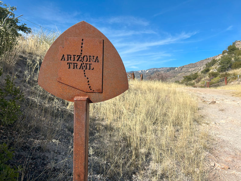
After a short distance, you’ll come to a junction with the Soldier Pass Trail, and you’ll want to keep right again to stay on Sycamore Reservoir Trail. Most of the official trails we saw had signs at the junctions.
Shreve Saddle
After a little over a mile and 200 feet of elevation gain, you’ll be at the Shreve Saddle, where there’s a nice view and a bench to rest.
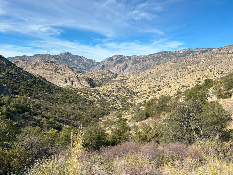
That is, unless a whole family and their dog beat you to it, which kind of sucks if you have 30 pounds on your back. There was a flat concrete block just a short way down the trail, so we rested there instead.
From here, the trail descends steadily for about a mile toward Sycamore Reservoir. Watch for a very short spur trail that will take you over to see the reservoir.
Sycamore Reservoir
According to the National Forest Service, Sycamore Reservoir was built to provide water to the prison camp that once stood near the campground where you started.
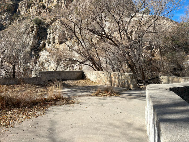
You’ll first come to a concrete terrace above the reservoir, but you can get a better view if you go down below the terrace.
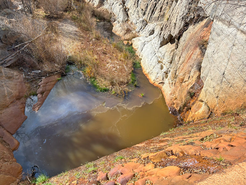
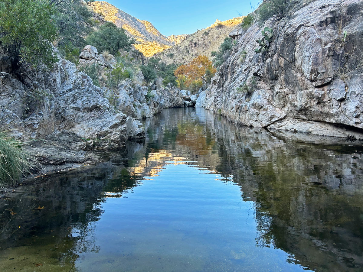
There was still water in Sycamore Reservoir when we went during a very dry time, but we did not see an easy way to access the water safely. Still, you’ll enjoy a nice riparian area with large trees and some good places to camp (marked on the map).
Sycamore Basin Link Trail #29A
From here, you’ll continue on the Sycamore Reservoir Trail until you turn left at the junction with the Sycamore Basin Link Trail #29A. There wasn’t a sign marking this junction, but there was a large cairn. If you get to the Sycamore Saddle, you’ve gone too far, but that’s okay because you can go left on the Bear Canyon Trail #29, which will get you there, too.
Bear Canyon Trail #29
The Sycamore Basin Link Trail ends at the junction with Bear Canyon Trail, where you’ll go left. Make a mental note of where this junction is so you can find it on the way back. Follow the Bear Canyon Trail until just before it begins dropping into the canyon. Look for an unofficial spur trail breaking off to the right near a small wash. This area is relatively flat, and you can find a nice place to camp if you want, although we didn’t see any well established sites.
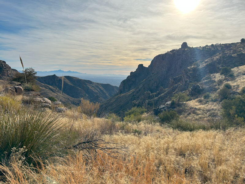
Thimble Peak will be visible at this point, and it even looks like it’s not that far away now. Well, that would be true except that when you get over the next hill, you’ll realize there’s a huge ravine between you and the peak. I call it Heartbreak Ravine for obvious reasons. Thankfully, you won’t lose too much elevation as you curve around the contours of the ravine, but the trail is not well maintained, and there are loose, gravelly spots. The real heartbreak is trudging up the the last hill that never seems to end.
After just over a mile, you’ll find yourself at the base of Thimble Peak.
Thimble Peak
Once at the base of the peak, you can scramble up the closest (northern) peak, climb the tallest (southern) peak, or just find a nice spot next to the peak to take in the view. We opted to climb the tallest peak since we had hauled all our rock climbing gear up there.
Rock Climbing the Southern Peak
If climbing, continue to the right (west) side of Thimble Peak to find a large gulley separating the two peaks. Scramble up this as far as you can go.
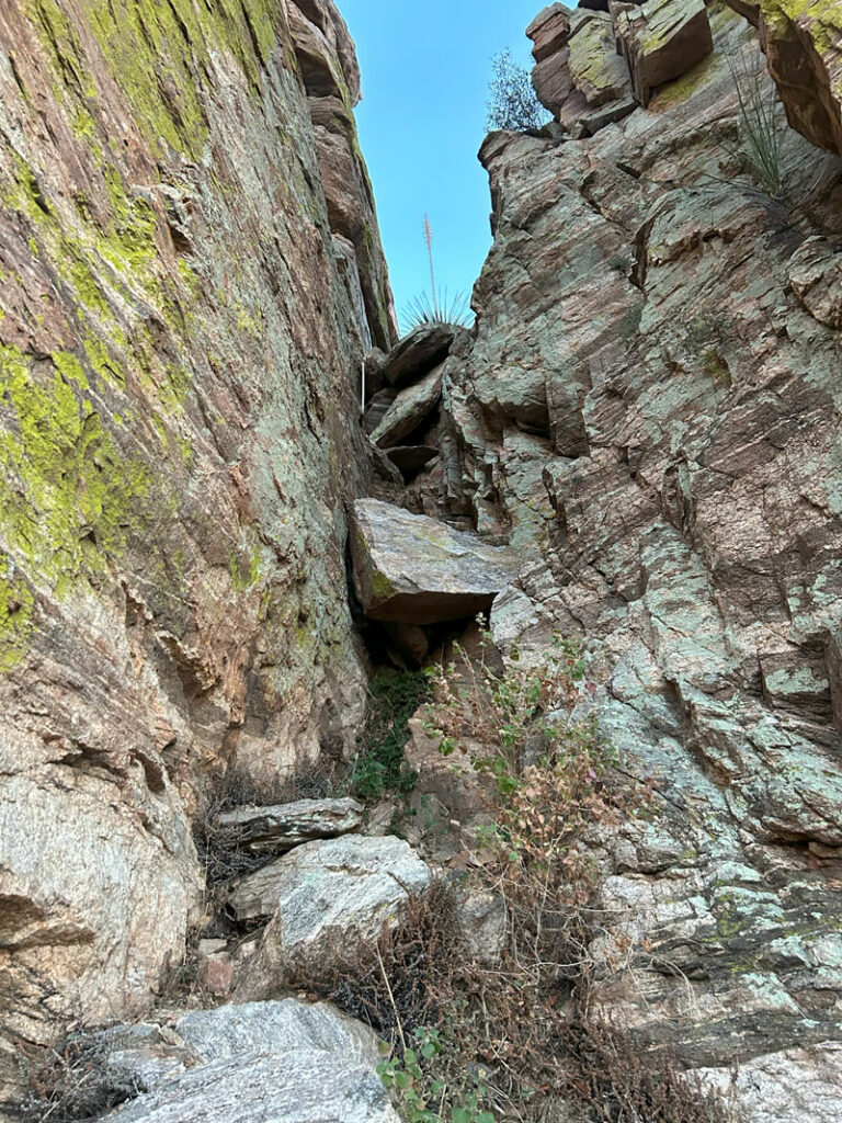
Once you have scrambled as far as you can, you’ll find yourself at a 10-foot wall with a single bolt in the face. The guide on HikeArizona said you could either climb straight up this face or make your way to the right to climb up an arête. The exposure to the right is extreme, so we opted to climb the face.
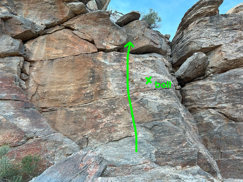
The bolt doesn’t do much, except to keep you on the mountain since it’s only about 6 feet off the ground. You could probably get a cam in the crack above it, but we didn’t end up needing it (good thing, too, since we left all our cams with our packs at our campsite). Once you get above this section, you’ll find one bolt and quick link for belaying and rappelling.
We’ve heard this one move rated a 5.8 YDS, but we think that’s debatable. In any case, even a novice should be able to manage to get up there and enjoy the view.
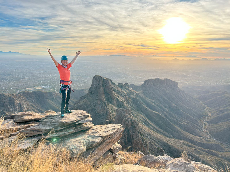
It’s a sweet feeling to be standing on top, and you’ll have an epic view of Bear Canyon, Sabino Canyon, and Blackett’s Ridge.
We had a 60m rope, which was plenty to allow us to rappel all the way down to where we started up the gulley. Some reviews said 100 feet of rope is all that is needed.
Scrambling Up the Northern Peak
With waning daylight, we did not have time to explore the northern peak, but we could see from the gulley that it would have been impossible to get up there from that side. Looking at reviews, we couldn’t find a specific route, but we found a description of scrambling up a gulley with some difficult 4th class moves. It seems most hikers opt to stay on the ground, but if you do scramble up the shorter peak, please comment below and let us know how it went!
Map & Directions
Location Pusch Ridge Wilderness, Tucson, Arizona
Google Maps Gordon Hirabayashi Campground
Fees/Passes No, unless you are camping at the Gordon Hirabayashi Campground at the trailhead, which charges a nightly fee.
Trailhead Facilities Pit toilets in the Gordon Hirabayashi Campground

Leave a Reply