Pusch Peak
TRAIL STATS
It may not be the longest hike in the Tucson area, but Pusch Peak is quite possibly the steepest. Ascending over 2600 feet in just two miles, most of that gain comes in the latter half of this hike, making it a nonstop thigh burner to the top. You will definitely be earning the superb views of the Pusch Ridge Wilderness and the city of Tucson at the summit. The best time to do this hike is in the months of November and December when it’s cool out and before the area is closed for bighorn sheep lambing season January 1 – April 30.
Trail Description
The trail to Pusch Peak is not a part of the official Forest Service trail system, so you cannot hike to the peak between January 1 and April 30 because it is closed for bighorn sheep lambing season. During that time period, hiking is limited to official, numbered trails here. Please protect the bighorn sheep and be respectful of this closure.
Linda Vista Trail
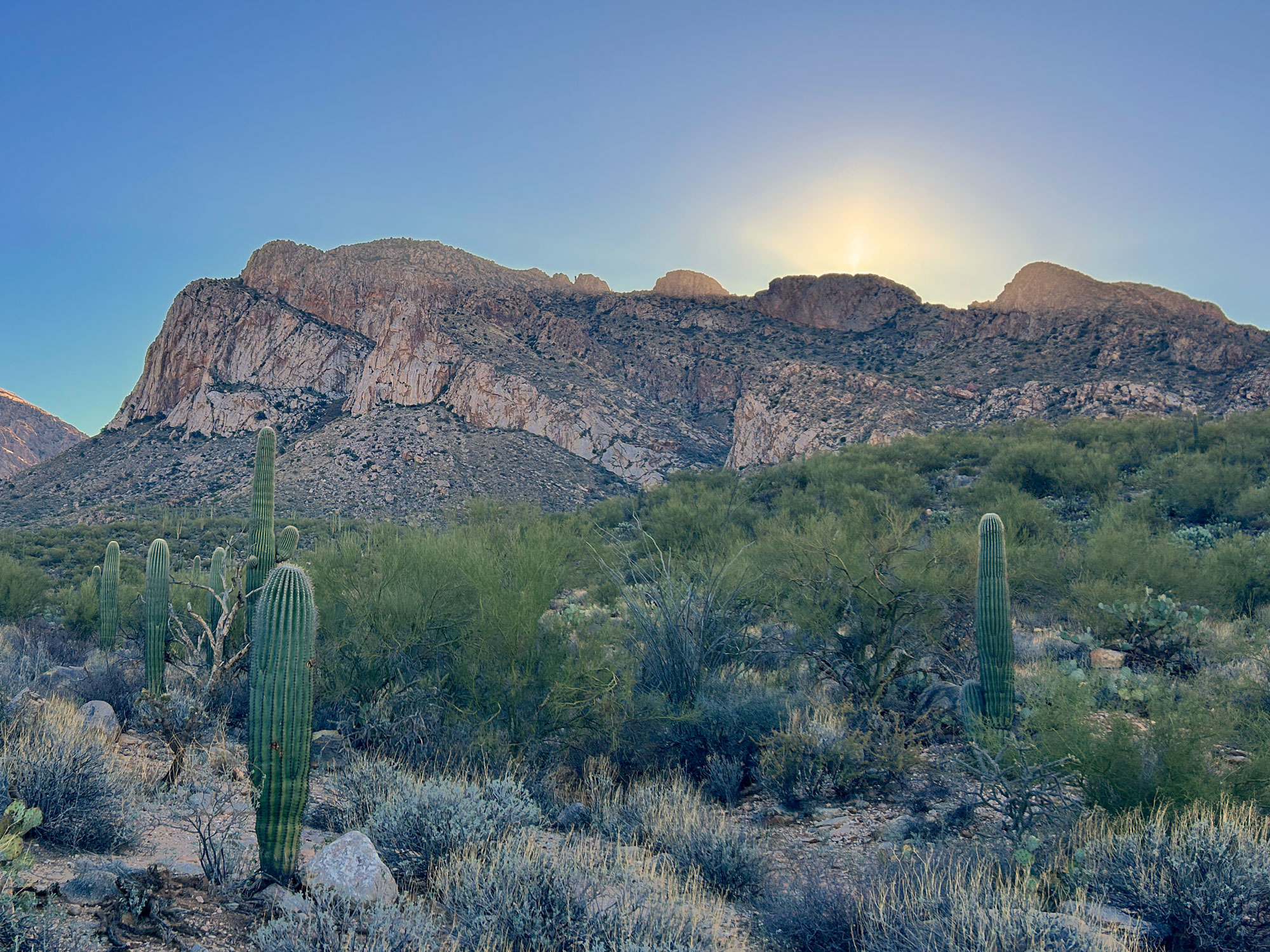
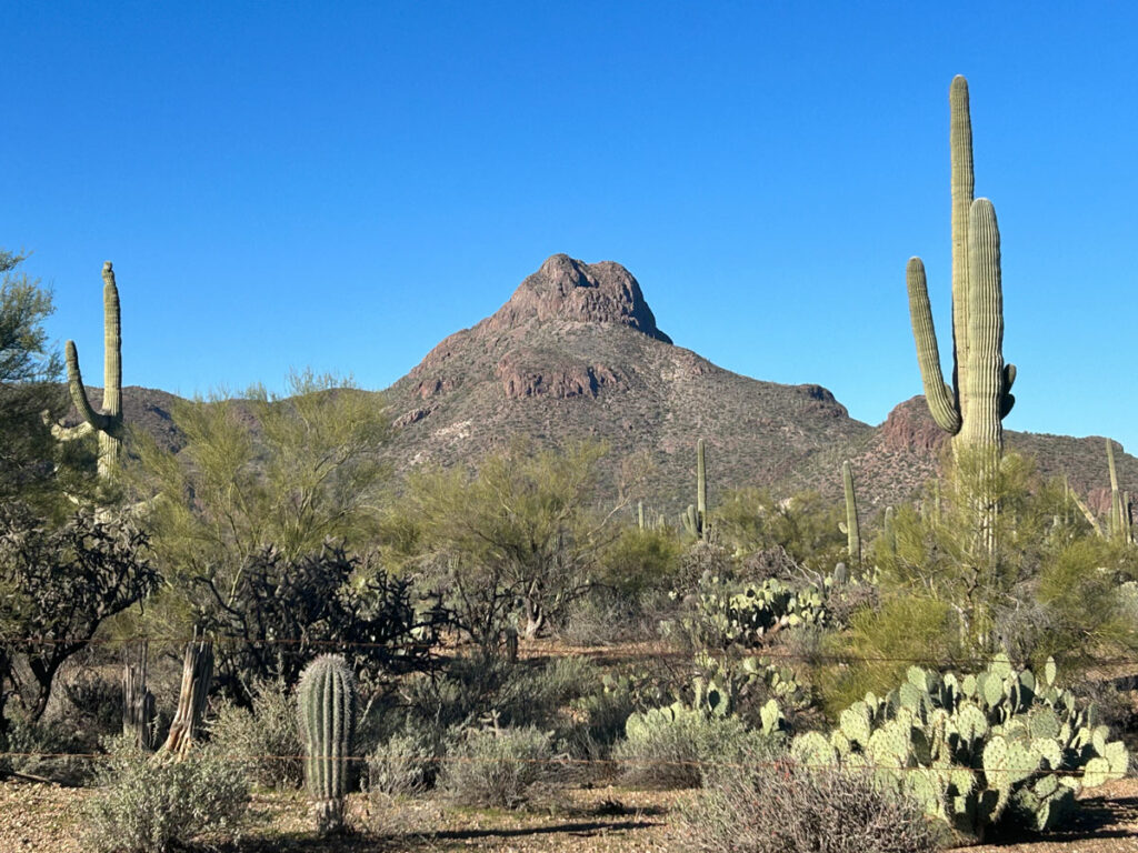
The trail starts out at a very gradual incline as it wends its way toward the imposing mountain ahead. If you’re doing this in the morning, you’ll probably have shade for a good chunk of the hike, which is nice since you’ll soon be sweating. Very likely, you’ll be thinking about that 2600 feet of elevation gain and how steep it must get in the remaining mileage.
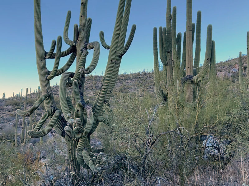
Are you a little afraid? We were, too. That’s okay, you can distract yourself with the massive saguaro cactuses that decorate this trail. By the way, before you tell me the plural form is “cacti,” like my friends did, just know Merriam Webster told me it was okay.
Pusch Peak Trail
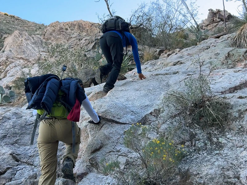
When you get to the sign marking the bighorn sheep closure area, that’s your turn. From here on out, it’s gonna straight up kick your butt. At one point, there’s a rock slab that you might almost have to crawl up. Fun or torture? You decide.
The trail goes up the right side of the drainage. You might’ve wondered if that high ridge to your left was the peak, but no. Pusch Peak is actually about 1000 feet higher and out of your view at this point, so you just gotta keep on sloggin’ onward and (mostly) upward.
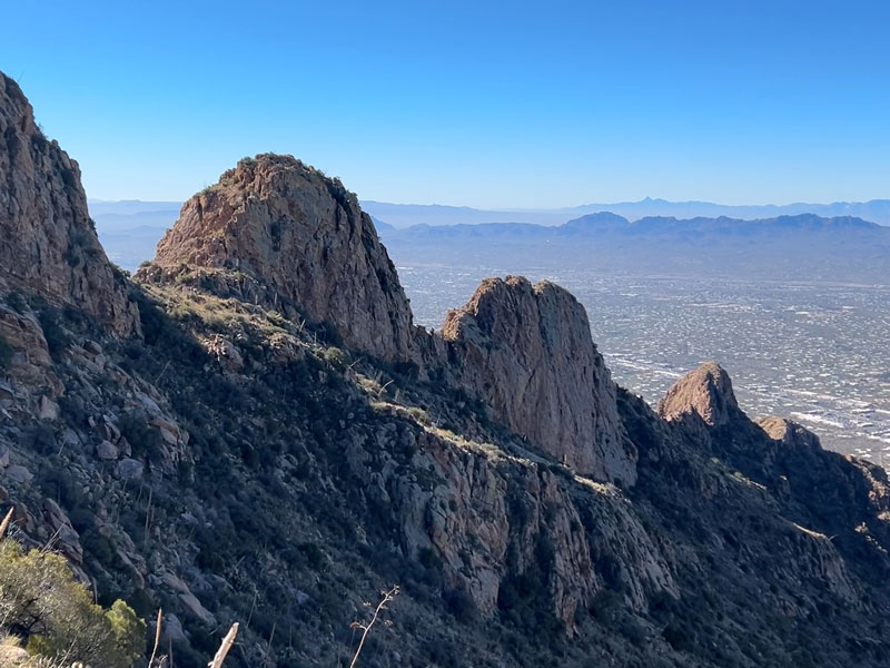
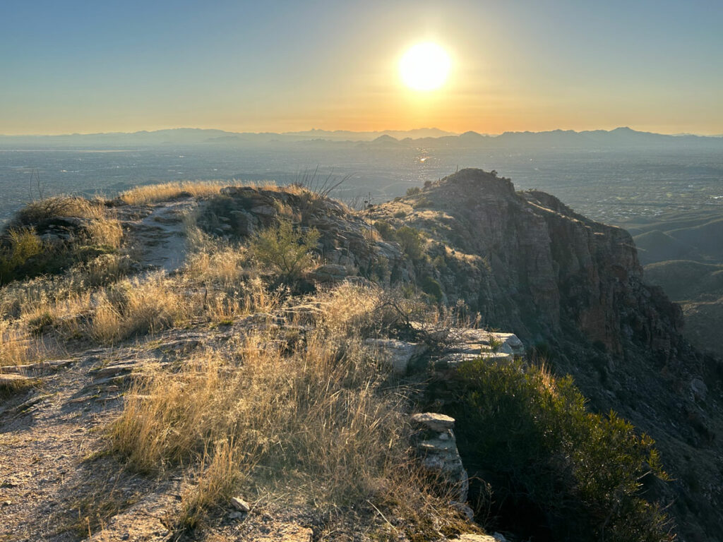
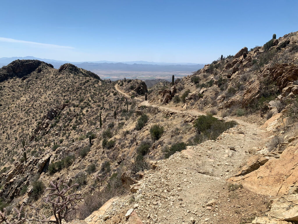
Be sure to take the time to turn around every so often and enjoy views of the valley below. Look how far you’ve come! As you get higher, you’ll see a very cool ridgeline descending into the valley below.
We heard tales of bighorn sheep sightings the day we were there, so keep your eye out.
Though the trail sees a lot of traffic and is well-defined, the person who started it has never heard of a switchback. So it’s a lot of steep upward hiking that has some loose spots. We didn’t have poles, but they’d probably be helpful at times.
Pusch Peak Summit
After relentlessly chugging uphill for what seems like an eternity, you might start to wonder if this is some sick version of hell where you have to climb an infinity peak forever. Or was that just me? The top seems like it’s not too much farther, but then magically some more uphill climbing keeps coming into view.
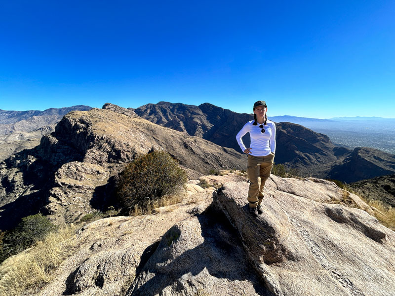
But, if you continue to persist, the trail will eventually make a turn to the right, and you will, in fact, top out. Wow, the view is superb!
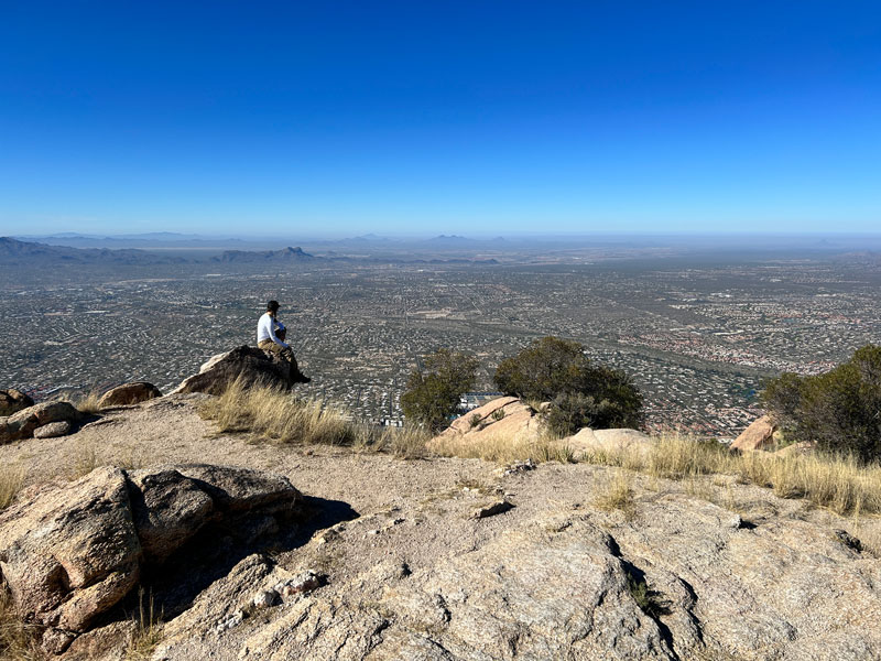
You also have a great view of the Pusch Ridge Wilderness on the other side.
I know, you thought you were going to get up here faster, and now you’re wondering how you’ll get down in time to make it to El Charro for enchiladas. Going down is not much faster if you’re unwilling to roll an ankle, so plan accordingly.
Map & Directions
Location Pusch Ridge Wilderness, Tucson, Arizona
From Tucson, head north on SR 77 (Oracle Road). Turn right on Linda Vista and head east until you see the trailhead parking area. Overflow parking is on the left just before that.
Fees/Passes None
Trailhead Facilities None
Preview this Hike
Recommendations for you
Sombrero Peak | Tucson
Blackett’s Ridge | Tucson
Wasson Peak | Tucson
Leave a Reply