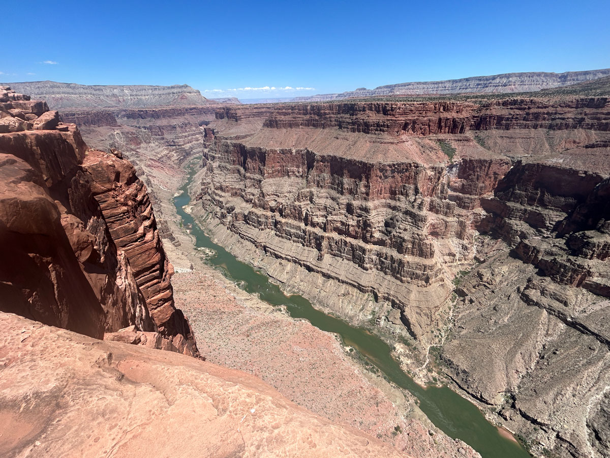
Toroweap Overlook
TRAIL STATS
Toroweap Overlook is a unique viewpoint in Grand Canyon National Park where the Colorado River can be seen vertically below you, endlessly carving its masterpiece. With a sheer drop of 3,000 feet, you’ll enjoy dramatic views of the river and get the chance to watch rafts tackle the largest rapids in the canyon: Lava Rapids. There’s not much hiking involved, but you will have to drive at least 120 miles on dirt roads to get to this remote spot.
Trail Description
Toroweap Overlook offers a view of the Grand Canyon like no other. From many viewpoints at South Rim and North Rim, you can see the splendor of the Colorado River’s handiwork, but it’s a special treat when you can actually see the artist at work. At Toroweap Overlook, you’ll have expansive views up and down the river 3,000 feet below.
But it’s far away. Like really far. To get to this remote location, you’ll have to drive 120 miles round trip on dirt road.
There are a few different ways to get there, depending on where you are starting from. We started from North Rim, so the map below shows that route, which starts just west of Fredonia, Arizona. For more information on the other access roads, visit the Tuweep page of the National Park Service website.
County Road 109
The drive starts out on County Road 109, which is two lanes, well-graded, and good enough of a road that we saw a big semi truck on it. The speed limit is 35, and most cars should be able to travel that fast.
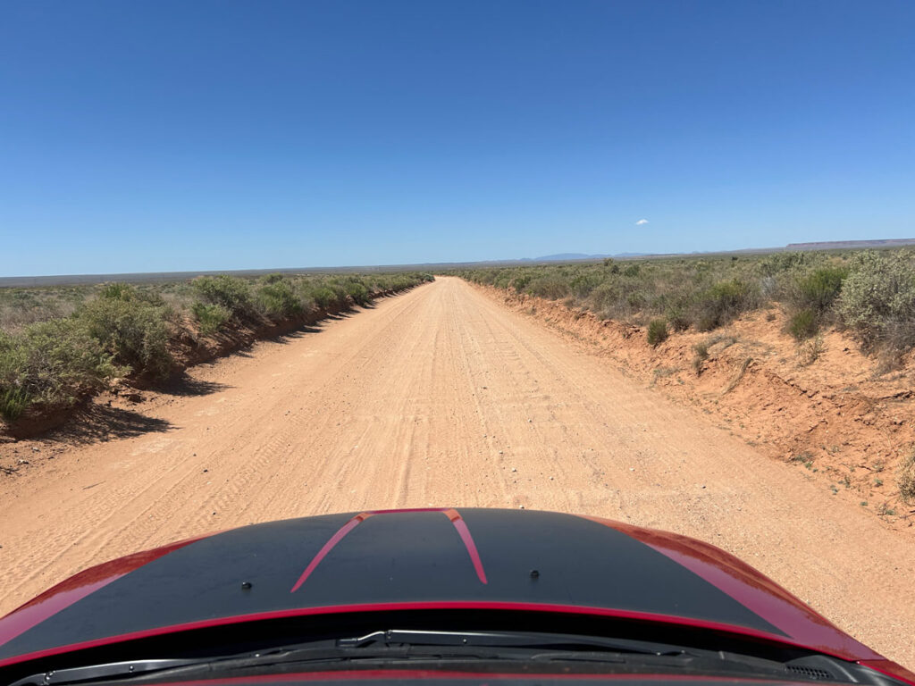
There are some intersections along the way, but every intersection has signs, so it would be hard to get lost. Keep following the signs for Toroweap.
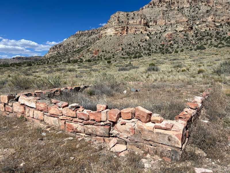
After 38.4 miles, County Road 5 comes in from the right. Continue straight onto County Road 5. This road passes the historic Tuweep area, and you can see the foundation of a church on your left. It’s marked on Google Maps.
At 46.5 miles, you’ll see a turn off for Mount Trumbull. Fork left here to go onto County Road 115. The road gets a bit worse after this point, but it’s still good enough for a low clearance vehicle to make it. It’s also considerably more narrow, so watch for vehicles coming the other direction because you may have to pull aside to let them pass.
Toroweap Ranger Station
A short distance after you pass the sign for Grand Canyon National Park, you’ll come to a ranger station, and a friendly ranger will likely come out to meet you. Be prepared to show your day ticket or backcountry permit AND your Grand Canyon National Park pass or America the Beautiful Pass. Have your ID ready as well just in case.
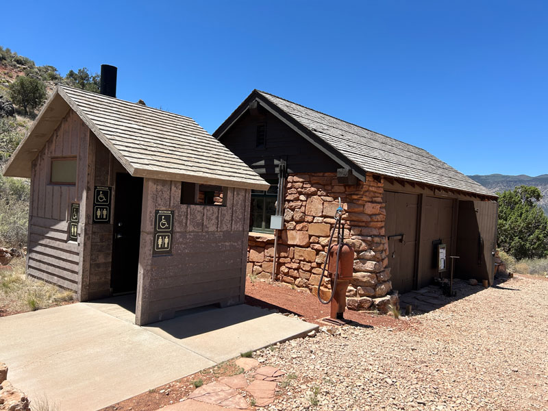
There are bathrooms here, in case you need them after that long, bumpy road.
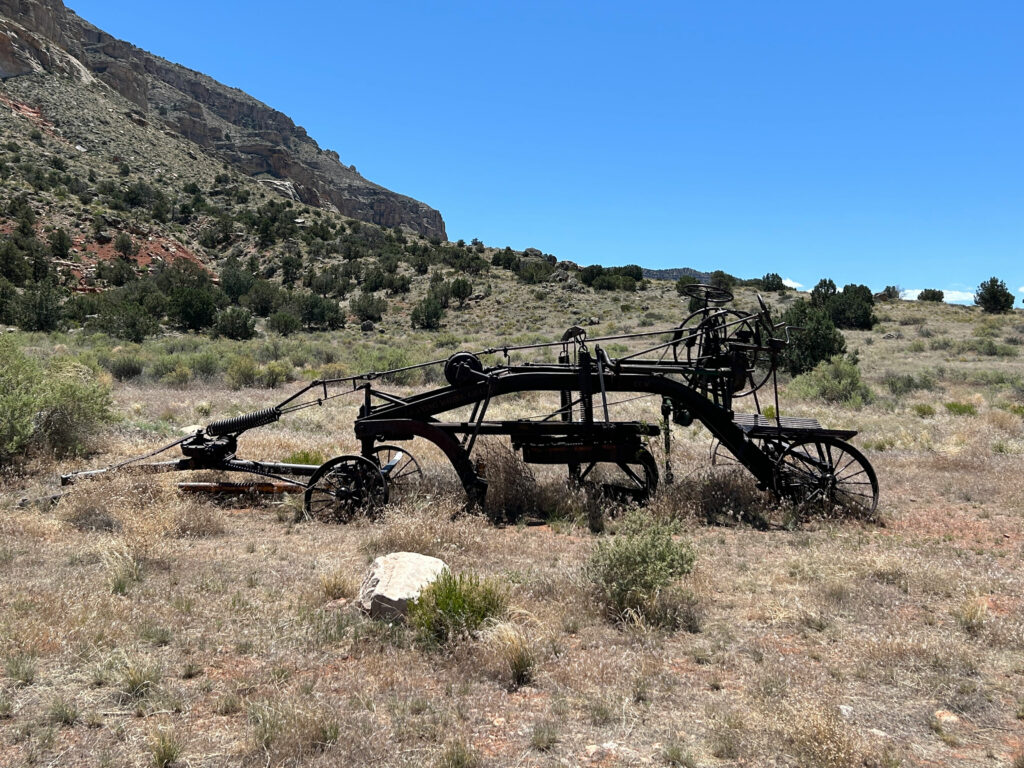
You’ll also notice an old gas pump, and some old farm machinery just after the ranger station. These are just a few of the items that showcase the history of the Tuweep area.
At 57.3 miles, or 3.3 miles after the ranger station, you’ll see a sign that says only high clearance vehicles can go beyond this point. They are not kidding, so if you have any doubts about your vehicle’s capabilities, you’re parking there and hiking another 2.7 miles along the road to the overlook.
Here is an example of the typical terrain you will encounter.
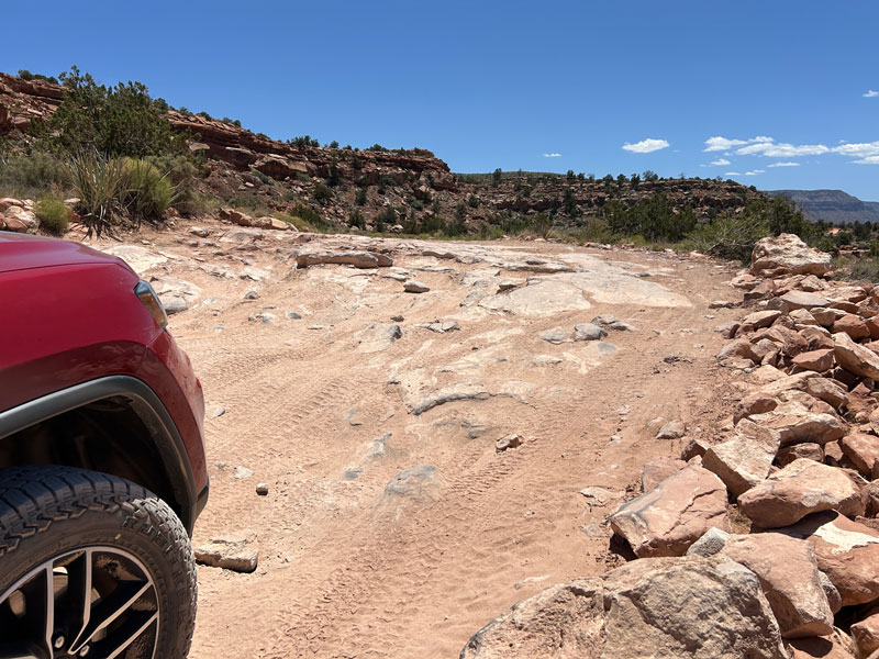
It’s just really, really rocky.
On this last stretch, you’ll pass the Toroweap Campground and the bathrooms at the overlook. There are several places to park after the bathrooms, and we chose not to drive all the way down to the picnic tables because the rocks showed a lot of evidence of people bottoming out, and we figured we were plenty close to walk. But many other vehicles drove down there, so it’s your choice.
You’ll find a couple of picnic tables, which make a good spot for lunch, but they are not close enough to the edge to see the views. Such a tease!
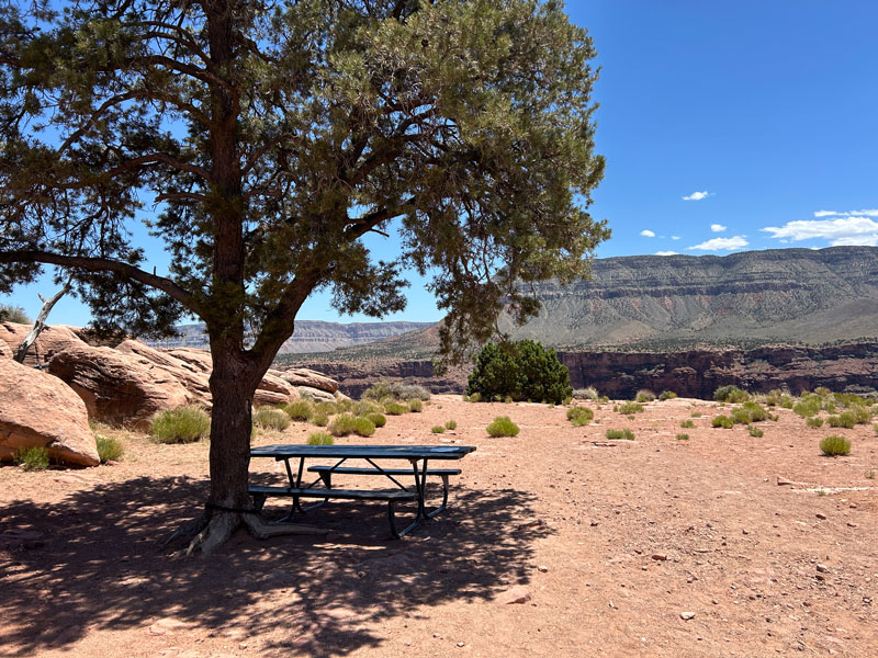
From here, it’s just a short walk to the edge for those jaw-dropping views!
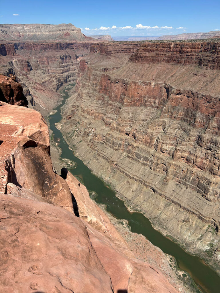
WOWZA!
Continue to the west for a short way to get a view of Laval Rapids, the biggest rapids in the Grand Canyon. If you’re lucky, you’ll be able to watch a raft go over. As you explore this awesome area, try to stay on hard surfaces and trails others have made as much as possible to preserve the fragile desert vegetation and soil.
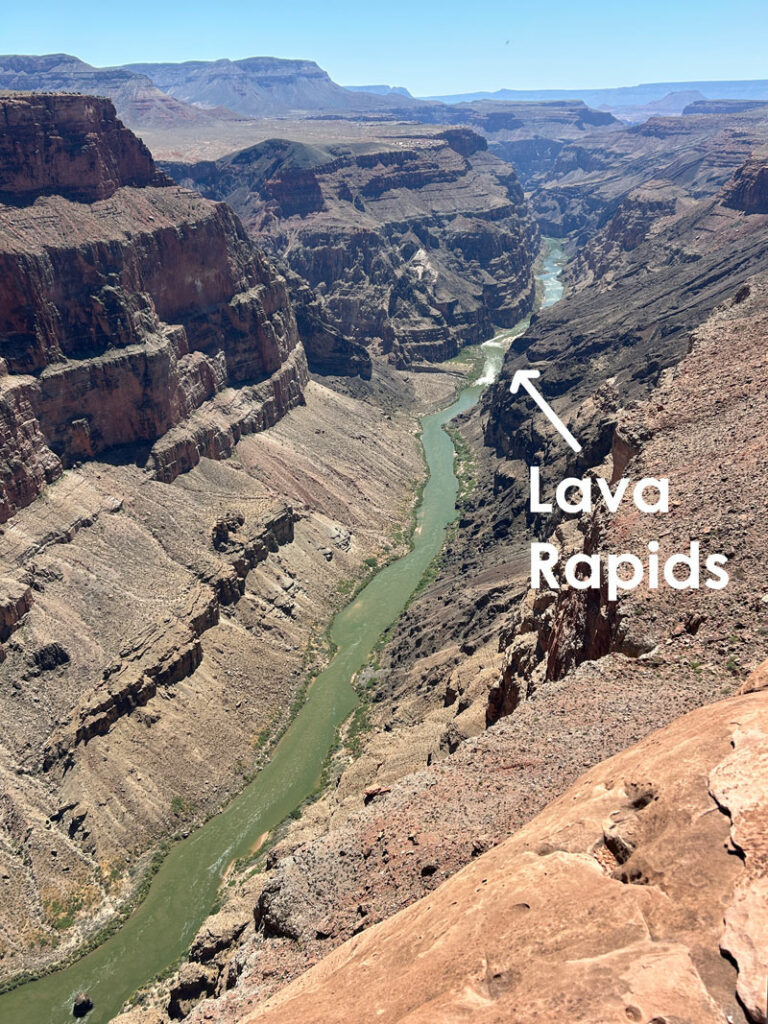
At this point, you’ll be wishing you brought binoculars or a telescope to get a closer look at the rapids. Hopefully you did or there’s some kind soul out there willing to share. Shout out to the family from Utah who let us peek through their scope.
There are many freaky ledges out there to test your fear of heights and give you various views of the river. Take your time, look out into the vast empty space, and let yourself feel like you’re flying. It’s a long drive back, so soak up the moment.
Warning
The Tuweep area of Grand Canyon National Park is remote, and there are no services. No food, no water, no gas, no lodging, no cell service. Come prepared to self rescue and stay longer than planned if something happens.
Visit the Tuweep page on the National Park Service website for all the rules and regulations, plus tips on weather and preparedness.
Map & Directions
Location Tuweep Area, Grand Canyon National Park, Fredonia, Arizona
Google Maps Toroweap Overlook
Fees/Passes For day trips, you will need a day use ticket for the Tuweep area from Recreation.gov. To camp at the campground, you will need a backcountry permit for Grand Canyon National Park from Recreation.gov. Select “Above Rim Areas – North Rim” and then “Tuweep Campground.”
For either option, you will also need a Grand Canyon National Park pass or an America the Beautiful pass. None of these options can be purchased at the Tuweep ranger station, so plan ahead and buy your permits/tickets/passes before you leave. Also, there is no cell phone service back there, so take a screen shot of your permits. There was a ranger on duty when we went who was checking permits.
Trailhead Facilities Pit toilets

Leave a Reply