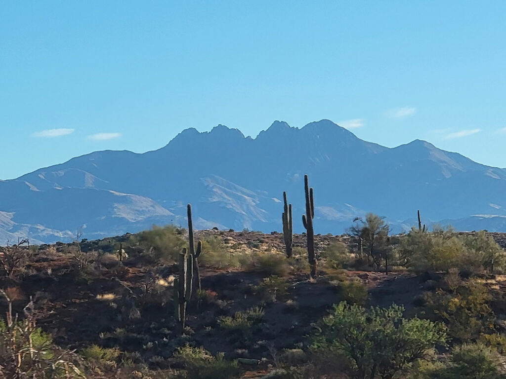
Mazatzal Peak
TRAIL STATS
As one of the highest peaks in central Arizona, Mazatzal Peak boasts incredible panoramic views from the summit. However, those views don’t come cheap because of the dense thickets of manzanita guarding the path to the top. Only experienced hikers with a healthy tolerance for the suffering that you’ll experience on the way up will want to attempt this. The 5-star view at the summit will only be worth it to the hardcore off-trail hikers among us, and even then you’ll most definitely be questioning your life choices at some point.
Trail Description
So, you didn’t click away? What’s wrong with you? Probably the same thing that’s wrong with me. It defies logic. Even though five hours of continuous bushwhacking, route finding, scrambling, and getting stabbed by agave sucked, we also laughed our heads off and relished in the memories we took home in our hearts. It’s not for everyone, but the few weirdoes like us out there may find it rewarding.
Barnhardt Trailhead
You do have to drive on a dirt road out to the trailhead, but in dry conditions, this should not pose a problem for most vehicles. We saw a sedan out there when we went. The road is pretty rocky, though, so a high clearance vehicle is your best bet.
Barnhardt or Y Bar?
You can approach Mazatzal Peak from either Barnhardt or Y Bar Trail, and some people make it into a loop. I didn’t know much about either route, so I picked Y Bar because it’s the shorter route. If my friend hadn’t lost her phone somewhere in the sea of manzanita on the way up, you could have easily convinced me to take Barnhardt on the way down. It’s gotta be better than what we just went through, right? Well, I don’t know. Surely, it can’t be worse.
Barnhardt Trail
Almost immediately after you start on the Barnhardt Trail, you’ll reach the junction with the Y Bar Trail. Take a left onto Y Bar Trail to go the way we did.
Y Bar Trail
You’re so excited and unsuspecting right now, aren’t you? You looked at the mileage for this hike and thought, “No way that’ll take us 10 hours.” Sure, you’ll probably blow through the first 4.5 miles in 2-3 hours, but after that? Good luck.
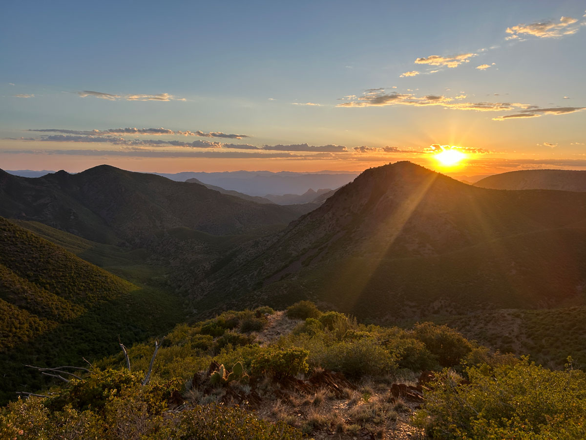
Y Bar Trail is very rocky, and poles helped us with balance on such uneven terrain. The trail headed steadily uphill through a pretty forested area. It’s not long before you’ll be high enough to enjoy some really nice views, although they’ll mostly be behind you. Don’t forget to stop and take them in now and then, especially since it might be dark by the time you are coming down this beast of a hike.
Around 1.5 miles in, the trail begins to moderate as it heads southwest around the mountain. Here the trail curves in and out along the contours of the mountain, going both up and down along the way.
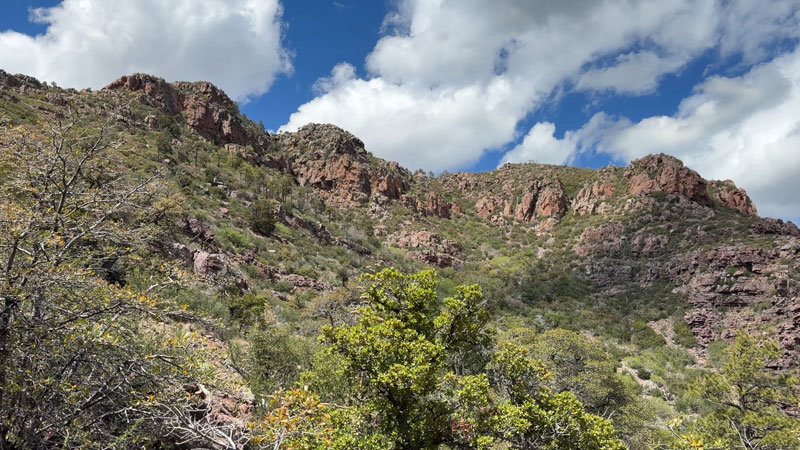
As you approach the saddle up ahead, the ponderosa pines will begin to close in around you, and these are some surprisingly tall trees! This serene forest scene is the calm before the storm, so enjoy the birdsongs and wildflowers while you can. It’s about to get a lot more ugly from here.
Mazatzal Peak Turnoff
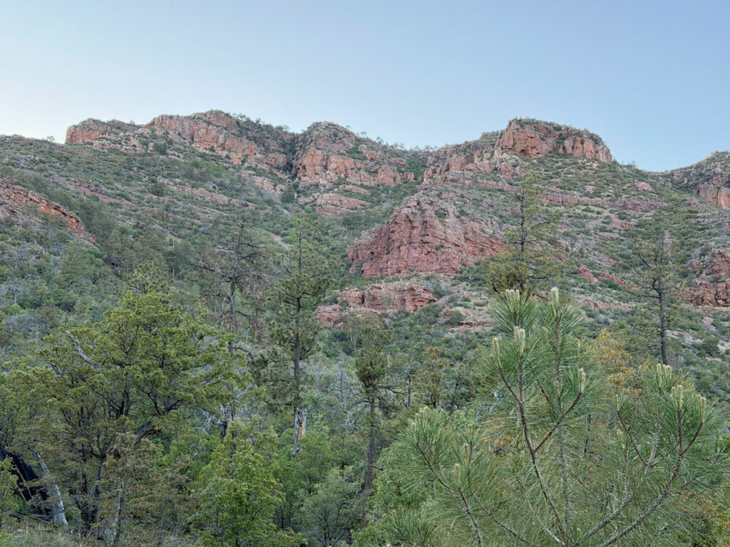
There’s a really nice campsite at the point where most people turn off to head toward Mazatzal Peak. This is the last nice part of this route before the summit. Do not look for a trail or cairns or any sort of sign that you’re in the right place. There aren’t any! In fact, if it looks like pure hell up ahead, you’re probably in the right place. The imposing profile of Mazatzal Peak towers above you as if to say, “I dare you.”
Those plants may look small from here, but soon you’ll be in the fight of a lifetime to get past them. If there’s any good news here, it’s that they don’t have thorns. Oh, but the cactus and agave plants will make sure you get stabbed anyway.
We downloaded five different tracks, hoping that would give us more data points to help pick out the best path. I can say pretty definitively now that there is no good path, just variations on the bad path.
Manzanita Galore
Almost immediately after you leave the Y Bar Trail, the manzanita fight begins. It’s sort of like a maze as you try to stay on the most clear path while continuing to head in the direction of the peak. No matter which way you go, though, it seems you’ll always end up at a dead end where your only choice is to bust through the bushes. Make sure your phones are secure because my friend’s phone slipped out of her pocket in this area, and it’s hard to find anything in this dense thicket with no trail.
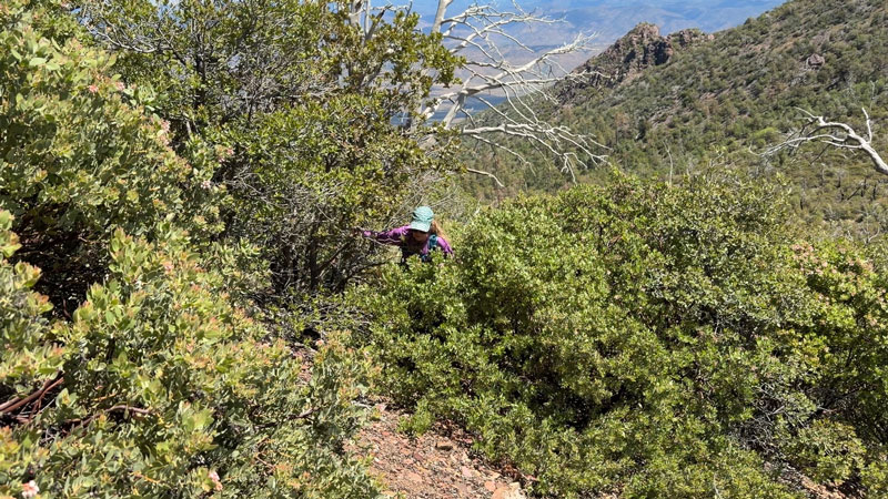
Covering distance is a painfully slow process here. With all the effort you’re expending, a few choice words might escape your mouth when you check your progress. However, once you get past the first section of manzanita, you’ll actually get some reprieve as it opens up a little.
Don’t bother with a sigh of relief. You’re not even to the bad part yet.
Rocky Cliffs Ahead
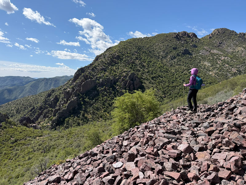
As you continue toward the peak, you’ll see cliffs ahead. You want to make your way toward the right so you can get up on the top of the cliffs and then swing left to continue up. It was at this point that we found our first cairn to let us know some other fool had gone this way before. We never saw enough cairns to follow reliably, but the ones we did see made us feel like there probably wasn’t a better way we were missing.
As you look up at Mazatzal Peak now, it finally seems to be getting closer. On a normal trail, you’d be up there in no time! If only it were that simple.
From here, you’ll follow along a rocky ridge toward the summit, which means there’s some scrambling in your future. So here’s the deal. You either stay on the rocky ridge as much as possible, climbing up rock walls when necessary to maintain course. Or, you try to go up the gully through the most hellish, unforgiving, “just leave me here to die” bushwhack of your life. Odds are, no matter which way you go, you’ll get a little of both.
We tried to hug the left side of the cliff and go up the manzanita-choked gully, but the manzanita wasn’t having it. After losing some hair, we ended up climbing a frickin’ tree trunk to get up onto the cliff. On the way back, we tried to stay on the cliff more, but then ended up on a sketchy downclimb. It’s a cruel game of “Would You Rather” where everyone loses.
But, come hell or high water, we’re going to the summit because we already invested too much by that point. Both our up and down routes will be depicted in the map below, including a special waypoint for that sketchy downclimb.
When the trail finally begins to flatten a bit near the top, it actually becomes a nice little jaunt through the woods. It’s just a couple tenths of a mile over to the summit from there.
Mazatzal Peak Summit
After all that pain and suffering, you’ll feel really triumphant as you finally reach the peak. Woohoo! You are a manzanita warrior!
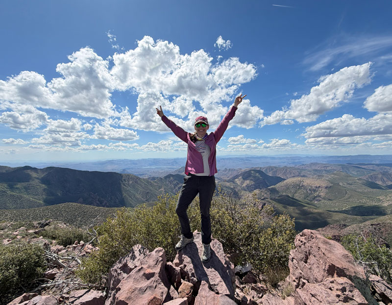
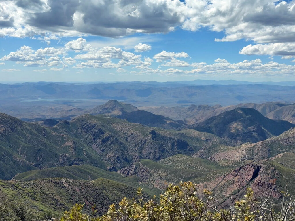
As the highest peak in central Arizona, you’ll have a commanding view of almost everything around you, including Horseshoe Reservoir out to the west. And, of course, you’ll have to share the summit with a few bushes to remind you of what you had to conquer to get here.
Wipe that smile off your face, though. You still gotta get back down.
Map & Directions
Location Mazatzal Wilderness, Payson, Arizona
Google Maps Barnhardt Trail
Fees/Passes None
Trailhead Facilities None
Recommendations for you
Barnhardt Y Bar Loop | Mazatzal Wilderness
Barnhardt Waterfall | Mazatzal Wilderness
Browns Peak (Four Peaks) | Four Peaks Wilderness
Leave a Reply