Barnhardt Y Bar Loop
TRAIL STATS
The Mazatzal Wilderness is home to a quiet, unassuming mountain range in the heart of Arizona, and the Barnhardt Y Bar Loop is the perfect way to experience a little slice of it. Along this trail, you’ll find a seasonal waterfall, plentiful wildflowers, plunging verdant valleys, and imposing rocky peaks. A highlight of the trip is the short section of the Arizona Trail that snakes along the contours of the mountain with magnificent views into the distant valleys to the west. If you catch it at sunset, all the better.
Trail Description
I have to admit I didn’t have high hopes for this backpacking trip. After hearing lackluster reviews of Mount Ord, I figured it was just another sunny, bushy, nondescript desert hike on an ordinary mountain. I can admit when I’m wrong. Sometimes.
Our plan was to hike up to Barnhardt Waterfall, take a canyoneering route down Big Kahuna Canyon, and then hike back up to the waterfall and continue the loop as a backpacking trip. Amazing day, right?
Barnhardt Trail
From the Barnhardt Trailhead, you’ll almost immediately come to the junction with Y Bar Trail. We did this route counter-clockwise, so we forked right to stay on Barnhardt Trail.
The trail follows the canyon up toward the Mazatzal Divide, hugging the left side and staying high above the drainage. As you wind back and forth along the contours of the canyon, you’ll begin to hear water running below (if it’s in season), and you can get a glimpse of it at various points along the trail. But the water is not the only star of the show here. Interesting zigzagging geological formations adorn the opposite side of the canyon.
Pro tip if you go walk into the campsite I marked as “Barnhardt Y Bar Camp 1” on the map, you can walk out onto a precipice with a pretty rad view.
Due to the location of the trail on the side of a slope, the terrain drops steeply to your right and rises steeply to your left and is covered in dense vegetation. This leaves little room for you to skirt around any snakes you might encounter, and you might have to wait a while for the snake to mosey along. Yep. That happened.
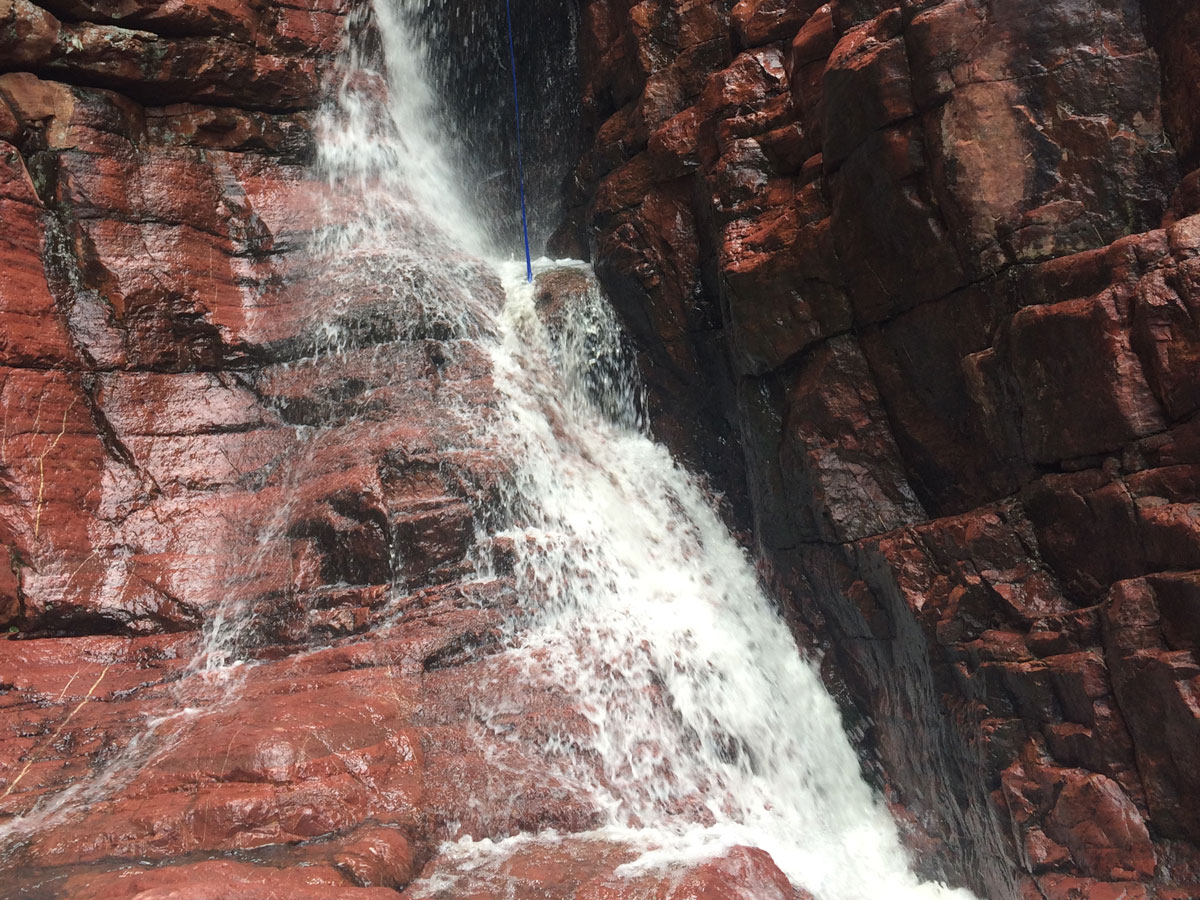
Barnhardt Waterfall
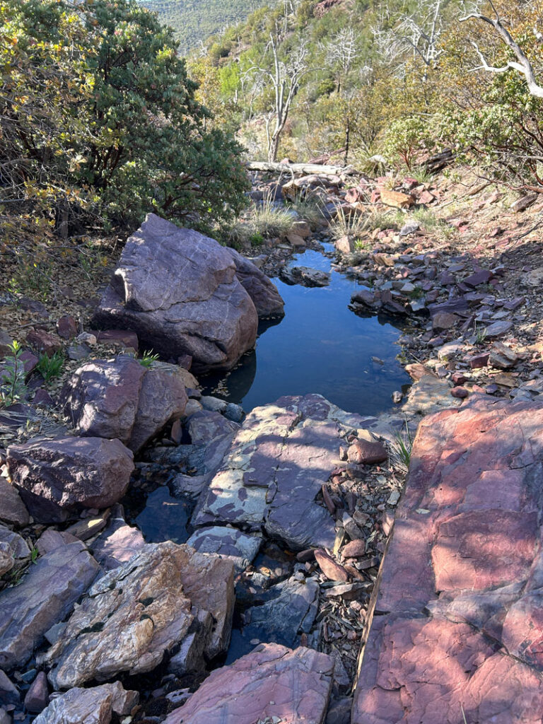
If Barnhardt Waterfall is running, you should definitely plan to make a stop. Not only can you refill all your water, but the water is incredibly clear and delicious. I almost wanted to throw out the water I had brought from home to make room for more. But, you know, I’m too practical for that.
The waterfall is not directly on the trail, and you’ll need to be on the lookout for a turn in the trail that crosses over a drainage with large boulders. There are a couple spots that might trick you into thinking you’re there (ahem, Heather), but you’ll know it by the pool of water close to the trail and the narrow rock corridor to your left. Oh, and hopefully the sound of rushing water.
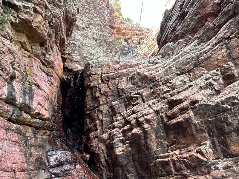
It’s a great, shady spot to eat your lunch, and carefully climbing up into the waterfall for a cold shower isn’t a bad idea, either.
Continuing up the trail, you’ll enter a thick forest of manzanita with occasional sweeping views as you look back down canyon. This was the least interesting part of the entire trail, as it seemed like you just kept coming around another corner to the exact same view you had before. “Oh, more hills covered in manzanita. Are we going in circles?”
But if you just keep chugging along, eventually you’ll hit the Arizona Trail (AZT) passage 23 – the Mazatzal Divide. If you need more water at this point, Chilson Spring is about half a mile in the wrong direction, but since I told you to fill up at the waterfall, you’re good, right?
Arizona Trail Passage 23 Mazatzal Divide
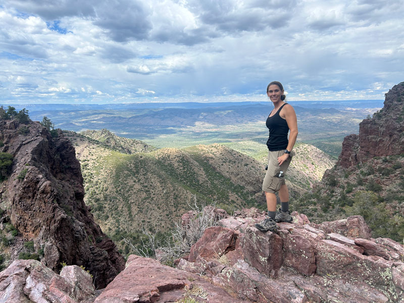
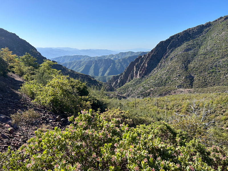
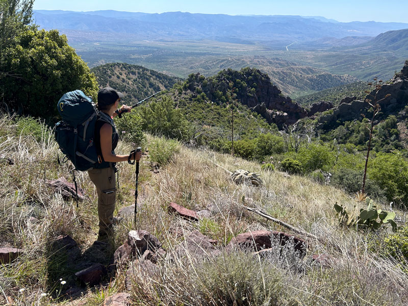
If you love being up high where you feel like you can see forever, this part of the trail is going to wow you. Head south (left) on the trail, and continue through a thick forest of manzanita, juniper, and scrub oak. Every now and then, you might come across some ponderosas, but for the most part, it’s the shorter stuff.
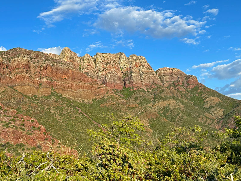
But there’s a good side to that. Up ahead, you’ll begin to see Mazatzal Peak rising majestically in all its rugged glory.
After 3/4 of a mile, you’ll come to the first good place to camp. If you’re about ready to call it a day, learn from our mistakes and stop here. We hoped to go another mile, but ended up being forced to go another three miles because there was nowhere else to camp in this very slanted terrain. Check our map for the location of good campsites along the trail. Other options may be slim to nonexistent.
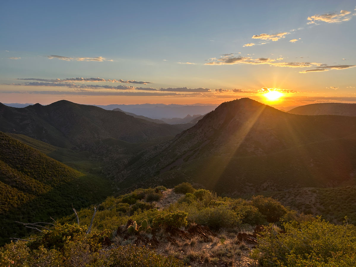
Even though we unknowingly committed to three additional miles before we could rest, we also were about to enter the most stunning part of the journey. And time being what it was, we were doing it at one of the most magical moments of the day: sunset.
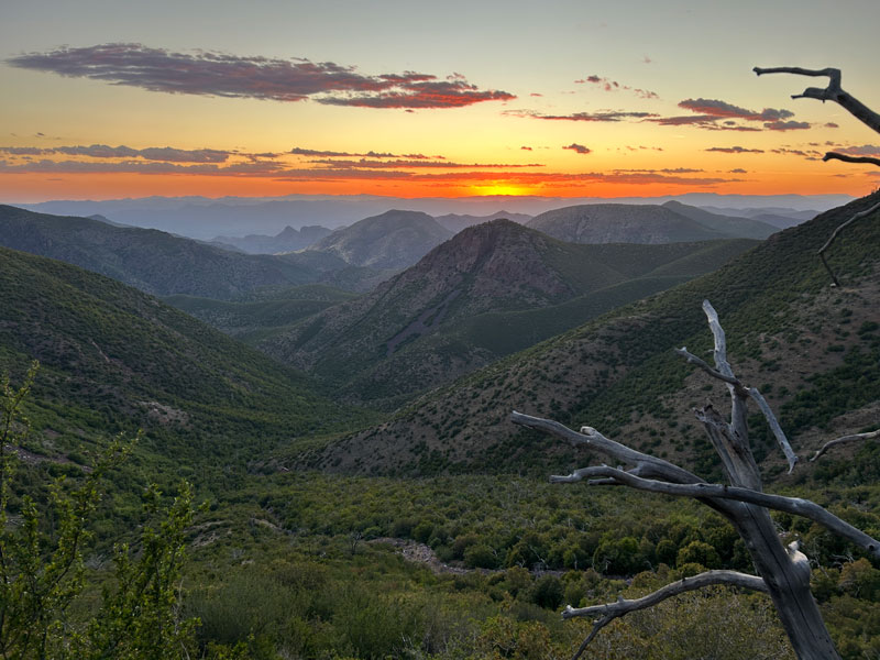
The trail snakes along the contours of the mountain, dropping into wide, deep valleys covered in green, then rising again to lofty saddles along the flanks of the imposing Mazatzal Peak. From those heights, let your eyes trace the layers of peaks and valleys as they rise and fall into the distance. Eventually, your eyes will rest upon the placid waters of Horseshoe Reservoir. If it sounds idyllic, it’s because it is.
Go.
If you’re still looking for a campsite, there are several sites available near the junction with Y Bar Trail. I honestly couldn’t mark them all. We found a nice one with three logs for seating, which we called our sectional sofa. It felt that luxurious after a long day, and I was happy to be sleeping under the watch of Mazatzal Peak towering above.
Y Bar Trail
After reading many reviews of the Y Bar Trail, I figured I had already seen all the good stuff this loop had to offer. So it’s hard to explain why I loved this part, too. Maybe it’s not as memorable if you’re hiking up this trail, or maybe I was still on a high from the previous day. Who knows?
The most important note about coming down the Y Bar trail is that it doesn’t follow the trail marked on the topographical map. We tried so hard to follow the map, and we ended up bushwhacking and cursing the cartographer, fellow hikers, and anyone else we could think of to blame.
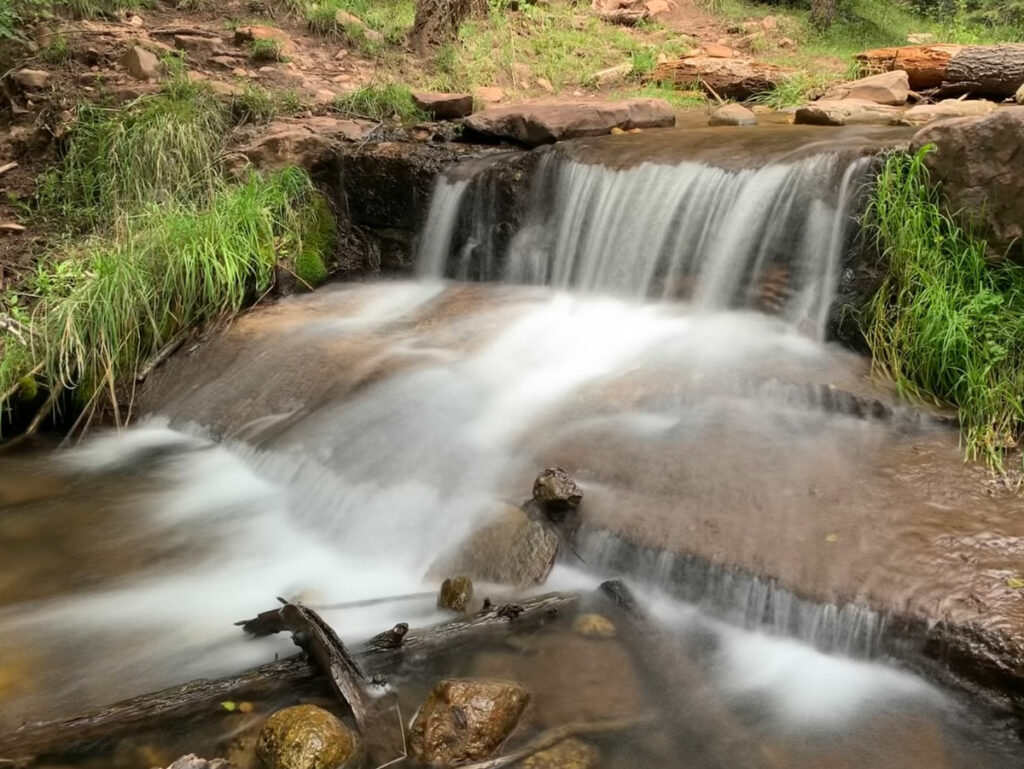
So here’s the trick. Well, other than following the GPS map below. You’ll get to a small clearing where the trail might seem to disappear. Currently, there’s a large cairn there saying, “Turn here, dummy.” But if you’re trying to follow the official trail, you’ll naturally start to follow a small drainage through rocky, bushy terrain. This is not it, although you might find seasonal pools here where you can collect water.
Go back to that nice cairn, apologize for not following it, and make an unnatural left turn uphill. There was a log laying across the correct trail, so we cleared that in hopes that the people behind us wouldn’t have such a “fun” time.
If you made it onto the correct trail, you’ll stay high instead of dropping low and continue along the left side of this canyon toward the valley that opens in the distance.
We knew the original trail must have dropped into the valley to our right. We were very glad it had been rerouted so we wouldn’t have to hike down only to hike back up to get over the next saddle.
Along this section of the trail, you’ll be treated to a magical forest of ponderosas that sort of feels out of place after all the shorter trees you’ve been seeing. It felt so special that I had to mark it on the map. I mean, just in case you’re hiking up this trail, which is apparently isn’t as pleasant, and you need some motivation to keep going.
After you go over the saddle, you’ll have even more expansive views into the valley and the town of Rye in the distance.
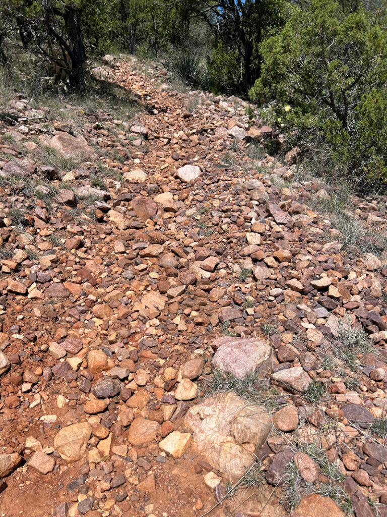
When the trail starts to descend with real intent, it gets kind of annoyingly rocky in places. Okay, there you go. Something negative. See, I try to keep it real.
But the good news is, you’re almost back to your car, and the Country Store Bar & Grill in Rye is calling your name.

It’s pretty much the only choice in Rye, so good thing it was delicious! Or maybe I was STILL on that high from the day before. Who knows?
Map & Directions
Location Mazatzal Wilderness, Payson, Arizona
Google Maps Barnhardt Trail
Fees/Passes None
Trailhead Facilities None
Preview this Hike
Recommendations for you
Barnhardt Waterfall | Payson
Cabin Loop | Mogollon Rim
Horton Creek and Springs | Payson
Leave a Reply