Hanging Gardens and White Box
TRAIL STATS
One of the most beautiful places on West Clear Creek, Hanging Gardens is an oasis with waterfalls, lush greenery, and a cave you can swim into. As a bonus, you’ll pass through the beautiful White Box narrows. However, to get to this gem requires an hour drive on horrible forest roads and a rugged hike with wades, swims, and slippery boulders. Not a great choice for beginners or families, but well worth the effort for experienced adventurers. There’s an optional canyoneering route with five rappels called Jacob’s Ladder that you can use to get to Hanging Gardens (details at the end of the post).
Trail Description
So, you want to go to Hanging Gardens? Of course you do. It’s an incredible place, but the cost of admission is horrible forest roads and a very rugged, physically demanding hike down the creek. I hope you have a good high clearance vehicle and possibly 4-wheel-drive, depending on road conditions. Plan to spend at least one hour driving really rocky forest roads where your maximum speed will probably be 7 mph, and sometimes only 3.
There are actually a couple different routes you can take to the trailhead.
- Forest Road 142-142A-142J – This is the route most often listed on other hiking websites. It will definitely get you there, but the reviews we read said it is a rougher road. We have never driven this route, so comment below and let us know how it is if you do!
- Forest Road 9241-power line road-142J – This 5.6 mile route is an alternative that many people have said is less rough than the normal route. The problem is that most maps don’t show the road that is under the power lines, so we included the drive on our GPS map.
Neither road is great, so expect slow driving and lots of bumps. It’s not technical, just really, really rocky. We took an Expedition several years ago and bottomed out five times before parking it and jumping in with our friends in a Jeep. Fawn described it as “potato salad road.”
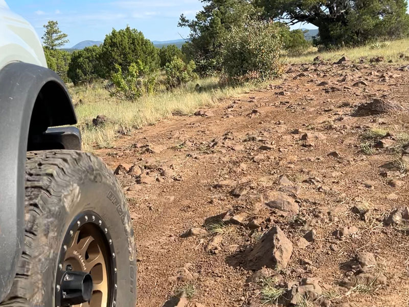
Bring a jack, a spare, and maybe an inflator if you want to air down. We didn’t air down, and we didn’t get a flat (which was lucky since we realized we didn’t have a big enough jack for our lifted vehicle), but better to be prepared. We didn’t see another soul or another vehicle the entire time (on a weekday), so help might not be readily available. However, we did have cell service for much of the drive.
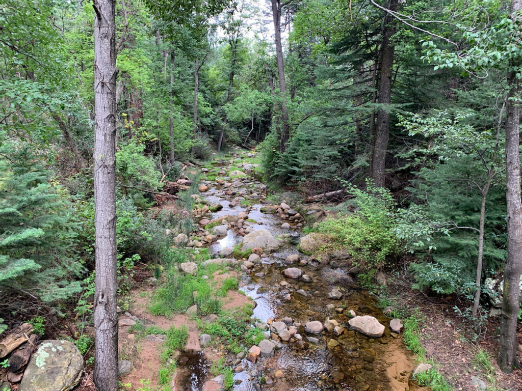
Trail into West Clear Creek
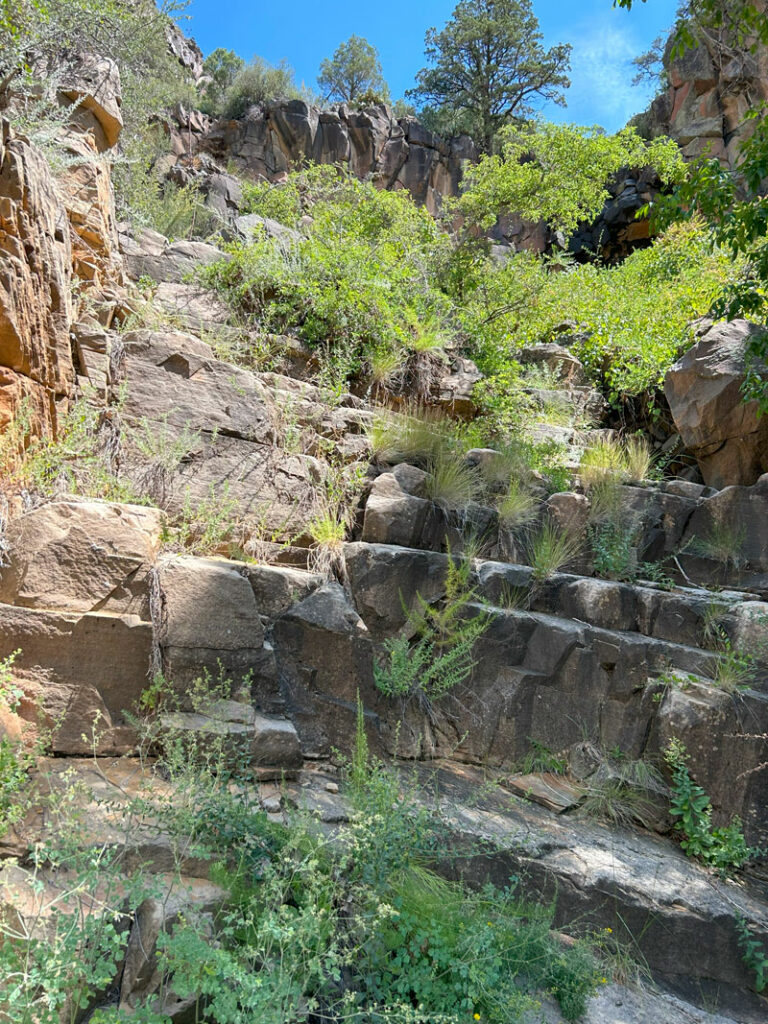
The trail from the parking area is not an official trail, but it’s clearly been used a lot and shouldn’t be that hard to follow. To find the start, look for a fire ring near a tree, and then follow an obvious path that leads from the fire ring to the canyon.
The trail is steep and a bit loose in places, but honestly, I’ve had worse. We lost the trail once, and we should’ve just gone back and found it, but apparently we would rather scramble up a sketchy cliff and do a little bushwhacking. Don’t be like us. Go back and find it.
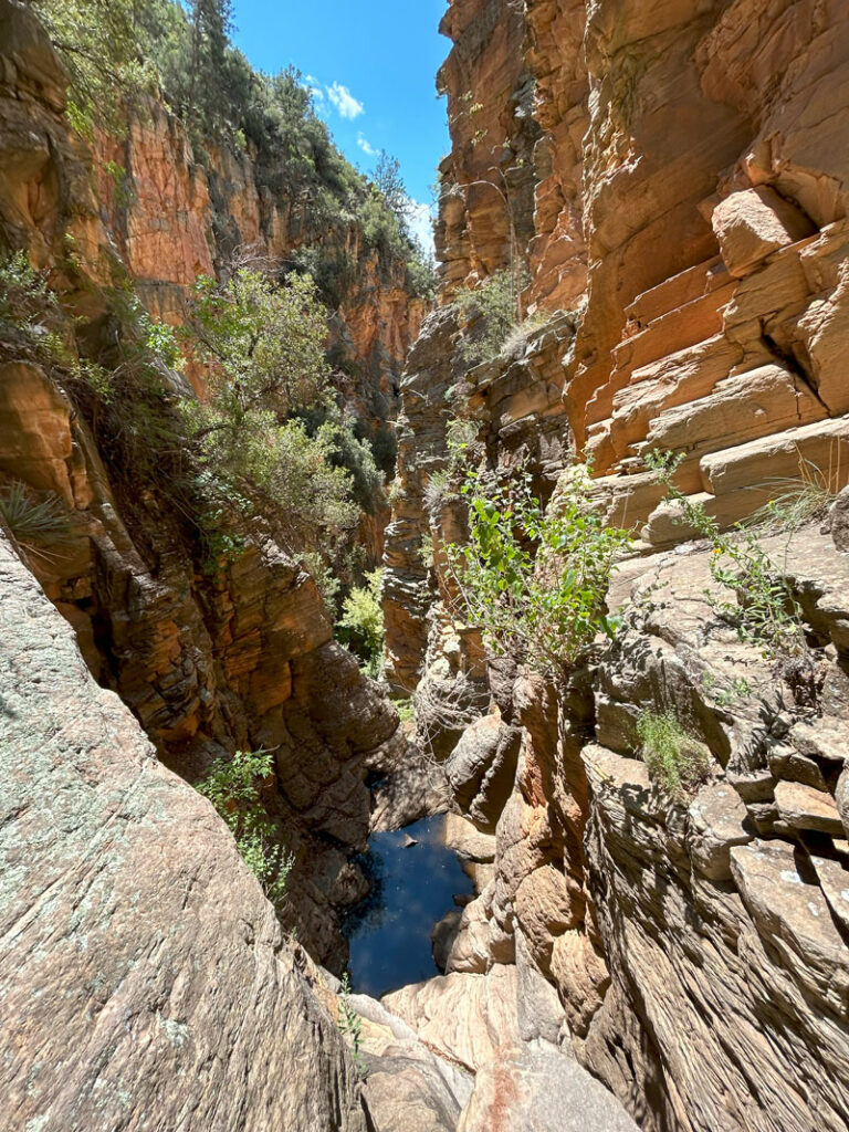
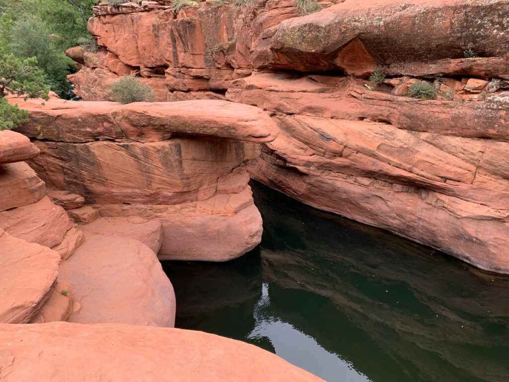
At the bottom of the trail, you’ll hit a particularly beautiful part of West Clear Creek, which is at the beginning of the White Box. Look around and memorize this spot because you don’t want to miss the exit trail on your way out. Turn left to head toward Hanging Gardens.
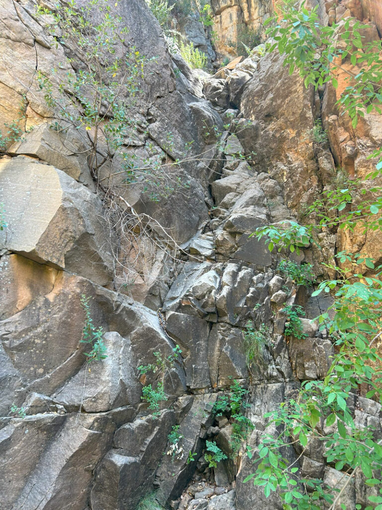
White Box
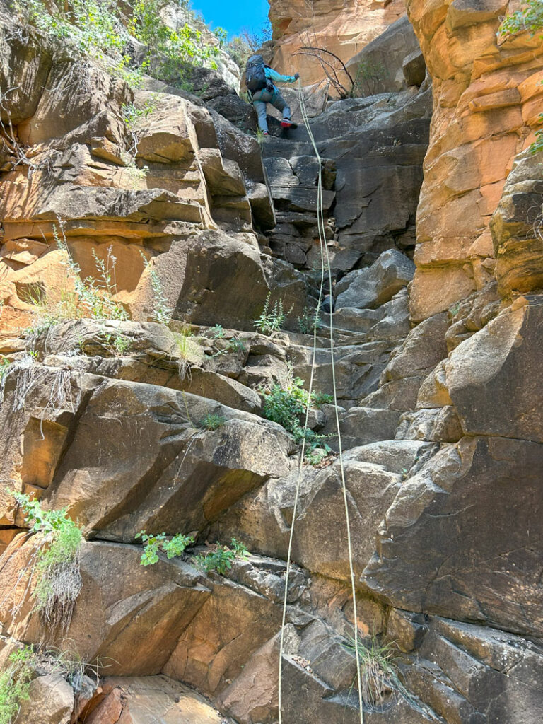
This part of the trail starts out in a narrow part of the canyon with plenty of boulders to negotiate. The wet rocks are super slick, and you’ll occasionally need to use your hands to climb around the obstacles.
But, oh my gosh, this is gorgeous!
Eventually you will come to a swimmer. This is when a pool noodle or other floatie can come in handy, but please remember to pack out EVERY SINGLE THING you bring in with you.
The swim through White Box is pretty long, and hiking clothes and shoes are really heavy when wet (and hard to swim in), so don’t skimp on the floatie. Even if you’re a good swimmer, you’ll be expending a lot of energy on this hike, and you’ll appreciate being able to float these beautiful narrows at a leisurely pace. Even a dry bag with air inside will be better than nothing.
Eventually, the canyon widens out a bit, but that doesn’t mean it’s the end of the swimmers. We counted a total of six required swims each way.
Between the swimmers, you’ll have to find the path of least resistance. There’s rarely any kind of trail to follow. Wading, slipping on algae, climbing over boulders, and going through bushes are all part of the adventure. You wanted this, right? Thankfully, we didn’t run into any thorny plants, so your floaties stand a chance of survival. Some people say to bring duct tape just in case.
If I’ve sounded a bit too negative so far, let me say that West Clear Creek is absolutely gorgeous. Even before you get to Hanging Gardens, your jaw will drop at the high canyon walls, dramatic narrows, rushing creek, and plentiful foliage. You could stop just about anywhere and feel satisfied. But keep going! It’ll be worth it!
The distance between the point where you hit West Clear Creek and the Hanging Gardens is only 1.2 miles, but plan about 2 hours for this section. It’s very physical and aerobic.
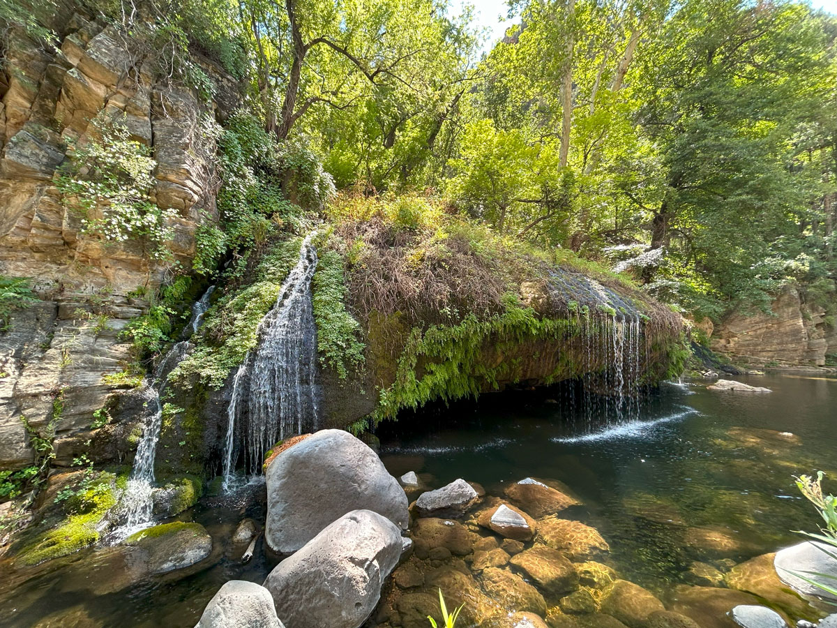
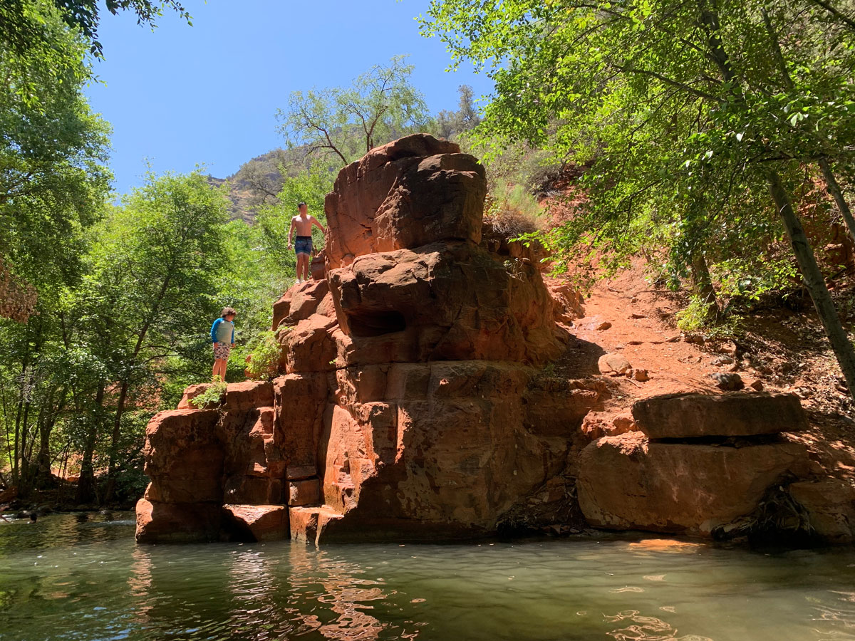
Hanging Gardens
When you first lay eyes on this little oasis, your heart will be set aflutter. It has all the beauty of Hawaii without the long flight. Okay, yeah, it does have the crappy road in. But still.
And it’s cold in winter. But still.
Hopefully you left early enough to enjoy more than a half hour lunch break here. You worked hard to get here, and you deserve it! The cave behind the falls is big enough for multiple people to float inside, where you can get a view of some water rushing in from behind. It looks absolutely refreshing.
Sometimes, if you’re lucky, you might find a rope swing a little farther down on the shore. There’s a tree that makes a perfect spot for one, but we have only seen one there once out of the three times we’ve been.
When you’ve had your fill of fun, you’ll simply retrace your steps back to your vehicle. Once you’ve gone back through the White Box, watch for the high cliff on your right to give way to gently sloping terrain. This is where you will want to be looking for your exit. When we were there, we saw multiple cairns, one of which had a fishing rod sticking out of it. Keep an eye out because you won’t have time left for a detour.
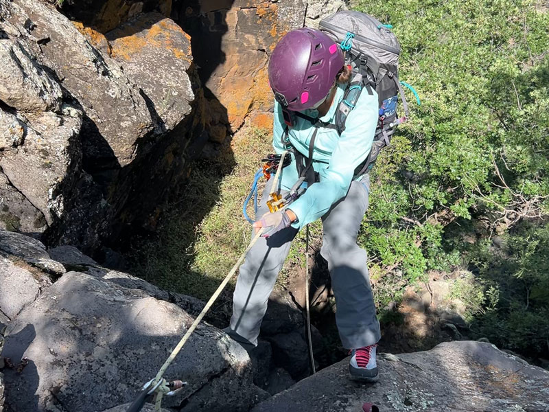
Jacob’s Ladder Canyoneering Route (Optional)
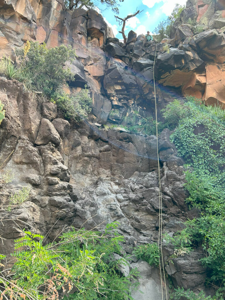
Those who are up for a little bit more adventure can take the more direct canyoneering route down Jacob’s Ladder to get to Hanging Garden. This route will not go through the White Box, but you can go through it on the hike back. Some people have found a return route that goes up and to the right of Hanging Gardens, but we did not elect to do that route because we wanted to visit White Box and use the more established trail.
🪢 This is a technical canyon with five rappels up to 100 feet. You will need one 200-foot rope, plus all the required safety equipment for rappelling and knowledge how to use it. This guide is not intended to provide instruction on how to descend a technical canyon safely.
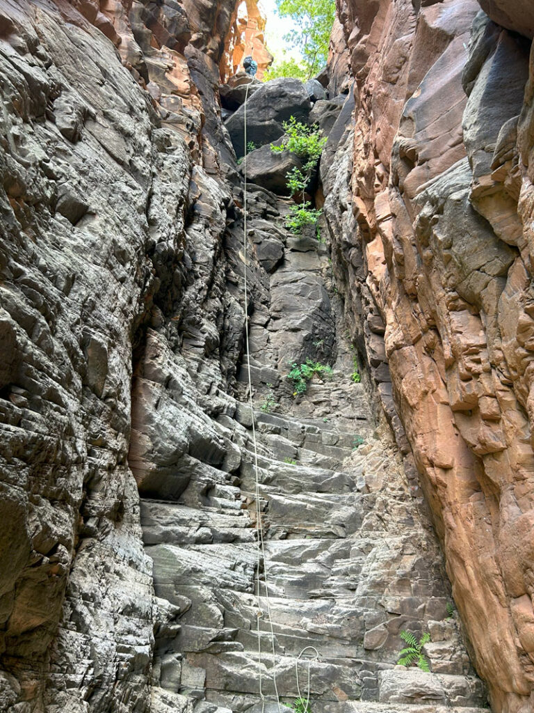
To do this route, you’ll park in the same place as the hiking route. Open up your GPS map and walk about half a mile cross country to the drop in point. There is a rocky outcropping there, and you’ll want to downclimb this first part on the left side and keep veering left until you come to a side drainage with a dryfall. This is rappel 1.
Rappel 1
Anchor Boulder
Height 60 feet
You’ll know it when you see it because it is a rocky drop-off, not the sketchy slope we tried to go down first.
Rappel 2
Anchor Dead man (legit, though)
Height 60 feet
Oh, rappel 2, the most memorable of the trip. This does have a dead man anchor currently, but in the past it has had other types of anchors. If you have enough webbing, you could probably find another placement if the dead man isn’t working for you, but it seems pretty bomber the way it is built now.
Pull Problems
We found the pull on this one to be weirdly hard. We put both our weight on it, and it would not budge. I thought maybe the carabiner block was getting caught, so I tried to upclimb a bit to see if I could fling it loose. No dice. So then I ended up climbing all the way back up. The climb wasn’t very difficult, but I knew the rope had not budged, and so I just tied in and tightened the rope as I climbed. There was no obvious reason for the difficult pull. I removed the carabiner block and rappelled down on two strands to try again. You would not believe this, but it still wouldn’t budge!
Now I had to climb it again. This time, I made sure the rope was not twisted at all, and we did a test pull before I came down. Bingo. I’m not sure if one strand would have been easier to pull than the other, so I kept track of which strand was coming out the top of the quicklink and which out the bottom. As I went down, I made sure the rope followed the most direct route possible and was on the most featureless parts of the rock. At the bottom, we pulled on the top strand and got it down without much trouble.
All I’m saying is, be aware.
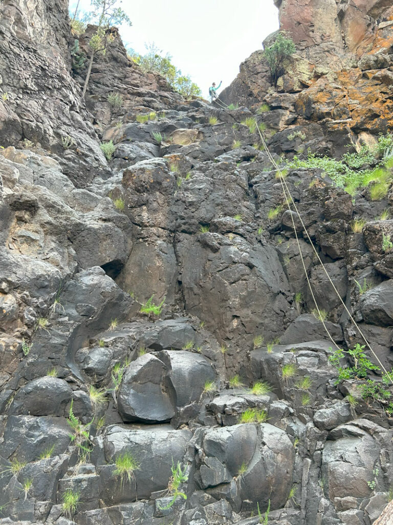
Rappel 3
Anchor Rock pinch
Height 60 feet
This rappel is so unmemorable, I barely remember doing it.
Downclimbs
After rappel 3, you can put your rope away because you’ll have to go down canyon a while before the next rappel. There are a few downclimbs in this section. The first one was easy, but the second one looked kind of crazy at first. As we got closer and started down, we realized it wasn’t as bad as it looked. The third one looked the most difficult, though not too bad going backward and carefully watching foot placement. Someone had placed an anchor on a boulder there, so we just used that.
Rappel 4
Anchor Tree
Height 100 feet
Soak it in because this is one of the prettiest spots in the canyon. On this two-tier drop, you’ll first drop down to a small pool which can be easily avoided. Once you get over the second lip, you still won’t be able to see the bottom, but we had a 200-foot rope and easily made it all the way down on a double strand. There are some ledges near the bottom that you can land on if needed.
Rappel 5
Anchor Tree
Height 85 feet
The view from the top of this rappel is pretty sweet, too. Nice, straightforward rappel. The top has a slightly awkward move to get past the big boulder, but nothing big.
After rappel five, keep following the drainage until you hit West Clear Creek. Water!!! Turn left and walk about 15 minutes to Hanging Gardens. Return to your vehicle by taking the hiking route described at the beginning of this post. The only bad news once you get to your car is that you still have to drive those crappy roads back.
Map & Directions
Location West Clear Creek Wilderness, Pine or Camp Verde, Arizona
From Camp Verde, take 260 east, and turn north (left) onto the road shown in the GPS map below.
From Pine, take 87 north to 260 west. Turn right (north) onto the road shown in the GPS map below.
Fees/Passes None
Trailhead Facilities None
Preview this Hike
Recommendations for you
Bull Pen Swimming Hole | Camp Verde
The Crack | Camp Verde
Pine Canyon | Payson
Leave a Reply