
Mount Bigelow Butterfly Loop
TRAIL STATS
When it’s scorching hot in the Tucson valley, hiking the Mount Bigelow Butterfly Loop on Mount Lemmon is a great way to escape the heat. Beginning at an elevation around 8,000 feet, you’ll hike through a ponderosa forest with plenty of leafy greenery and a dripping spring while enjoying expansive views into the valley below. Along the way, you’ll pass through a tunnel and see abandoned structures before hiking over the summit of Mount Bigelow for even more magnificent views.
Trail Description
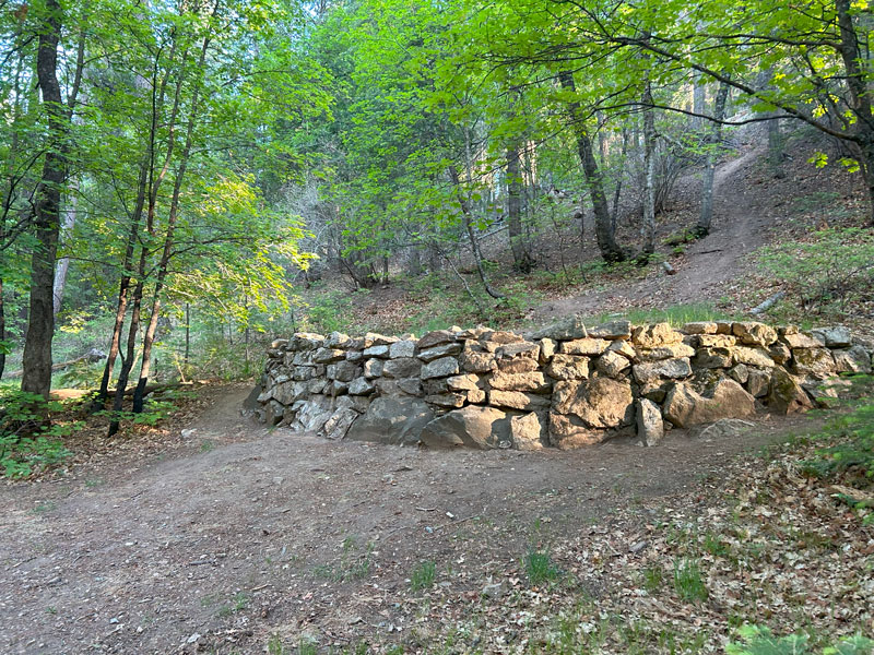
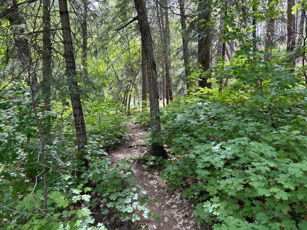
On a day when the temperatures in the valley were set to exceed 100 degrees, we looked for a hike in the higher elevations of the Santa Catalinas and came up with this loop. We weren’t sure what to expect since it looked like part of the route would be dirt road, but it ended up being very enjoyable. Not only were the views spectacular throughout, but the trail was easy to follow, and it passed through some surprisingly beautiful, verdant forest that was alive with happy birdsongs. The green maple leaves surrounding us hinted that this would be a beautiful place to visit in the fall, especially in the section that passes the abandoned structures. (I couldn’t find any information about what these were, but if you know, please drop a comment!)
Although we did this hike as a loop, if you had two cars or were willing to hitchhike, you could certainly do this as a one way hike between Bigelow Trailhead and Butterfly Trailhead. By doing this, you would miss the summit of Mount Bigelow, although it’s just a 0.2 mile diversion if you had a mind to do it anyway.
Bigelow Trail
We started from the Bigelow Trailhead, near milepost 21 on the Catalina Highway. This is the bottom of the “stick” for the lollipop loop, but I realized in hindsight that we could have started at the Butterfly Trailhead (near milepost 23) and cut off the “stick” completely. This would have saved around a mile total, but we were happy to enjoy the whole thing.
From the Bigelow Trailhead, the trail starts up a moderate incline for half a mile. When you arrive at a saddle, you’ll be at the start of the loop. Continue straight onto the Butterfly Trail to do the loop in a counter-clockwise direction like we did, or head left toward the summit of Mount Bigelow to go clockwise. I would recommend counter-clockwise to hit the best parts of the trail at the beginning and save the dirt road bit for last.
Butterfly Trail #16
About this time, you’ll realize you have to start going downhill, and looking at the valley below from your lofty height, you might be wondering just how far down. It’s about 1500 feet, and it never really drops below the forested elevations, so it’s a beautiful, pleasant hike.
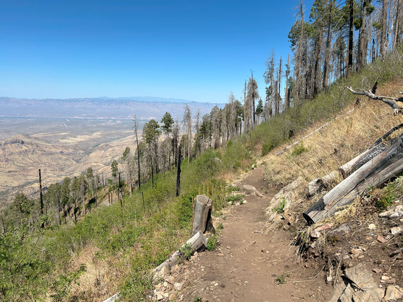
There is burn damage in this area, but there are still plenty of trees to offer shade along the way, and there’s also a lot of greenery from the regrowth. The birds were out in full force that day, and we enjoyed endless birdsongs as we made our way.
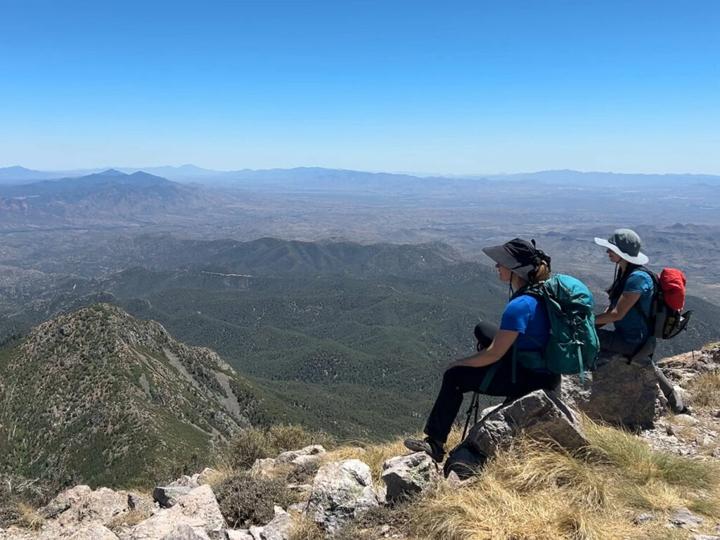
As you drop in elevation while hiking along the side of the mountain, you’ll be treated to views of the valley below and the rest of the Santa Catalina mountain range in the distance. At the junction with Davis Spring Trail, fork left to continue on Butterfly Trail.
Novio Spring
Eventually, you’ll find yourself at a spring surrounded by tall trees and dense foliage. It’s beautiful, peaceful, and it’s the lowest point in your journey. That means it’s all uphill from here!
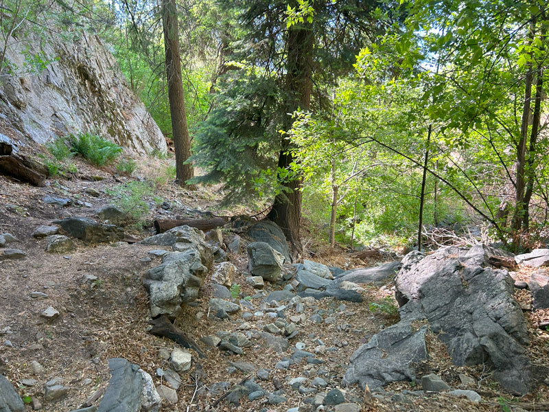
I should add that the spring wasn’t really flowing when we went, but more like wet rocks with ferns growing nearby. I wouldn’t count on being able to actually get any water here.
From here, your heart is bound to start pounding as the trail heads back up to higher elevations. Give it a rest at “Pride Rock” for a sweet photo op.
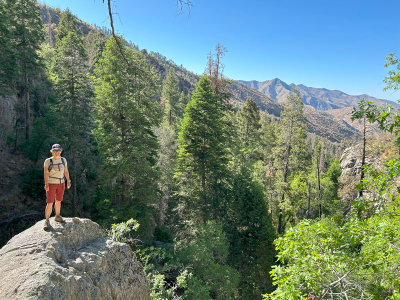
Oh my gosh, my legs were filthy. Not sure if shorts were the right choice that day.
Keep cranking at that uphill climb, enjoying more forest and views as you approach 8000 feet. If you’re from the valley like I am, you’ll be feeling that elevation, too.
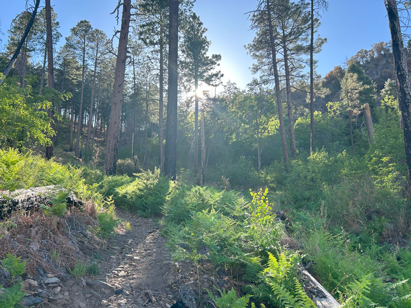
When you arrive at the junction with the Crystal Springs Trail, fork left to continue on the Butterfly Trail.
Butterfly Trailhead
If you keep going up long enough, you’ll find yourself at the Butterfly Trailhead near milepost 23 on the Catalina Highway. Breathe a sigh of relief, but don’t get too complacent. Your uphill climb isn’t over, but it does flatten out a little bit on this section.
To avoid walking on the Catalina Highway to get back, cross the highway and walk up a couple hundred feet to your right to the Sunset Trailhead. Here, you’ll head to your left down a trail that wasn’t on the forest map, but it was on the topographical map. It turned out to be a great trail that passed by a rather stagnant but pretty little pool of water.
The trail parallels the highway for a while, and you’ll have ever present reminders that you’re close to civilization again. Still, the path is quite lovely, and there are plenty of maples leaves that make me want to come back this fall.
As the highway curves right, the trail passes underneath it through a tunnel.
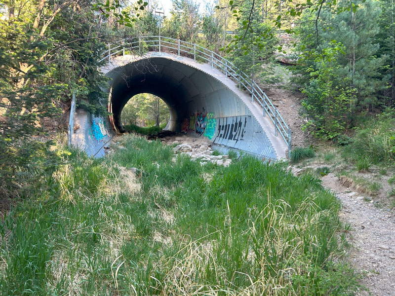
Human made or not, I always love walking through tunnels for some reason. Once on the other side, you’ll pass by the ruins of some structures. I’m not sure what they are, as the signs have nothing on them now.
I did some research and found that there used to be a prison camp near Mount Bigelow where the prison workers stayed while building the highway. Not sure if that’s what these were from, but if anyone knows for sure, please leave a comment!
As you continue, the trail gets farther from the highway, giving you blessed relief from the sound of cars.
Mount Bigelow Road
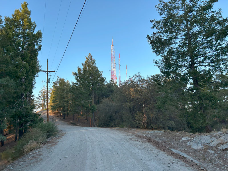
The next part of the trail goes up rather steeply until it ends at Mount Bigelow Road. On the one hand, it’s nice to get some relief from the steep uphill. On the other hand, it’s a road. But it gets you through the next mile or so very quickly. There are tons of car campsites in this area that would make a great home base if you’re doing this on an overnight trip.
Mount Bigelow Summit
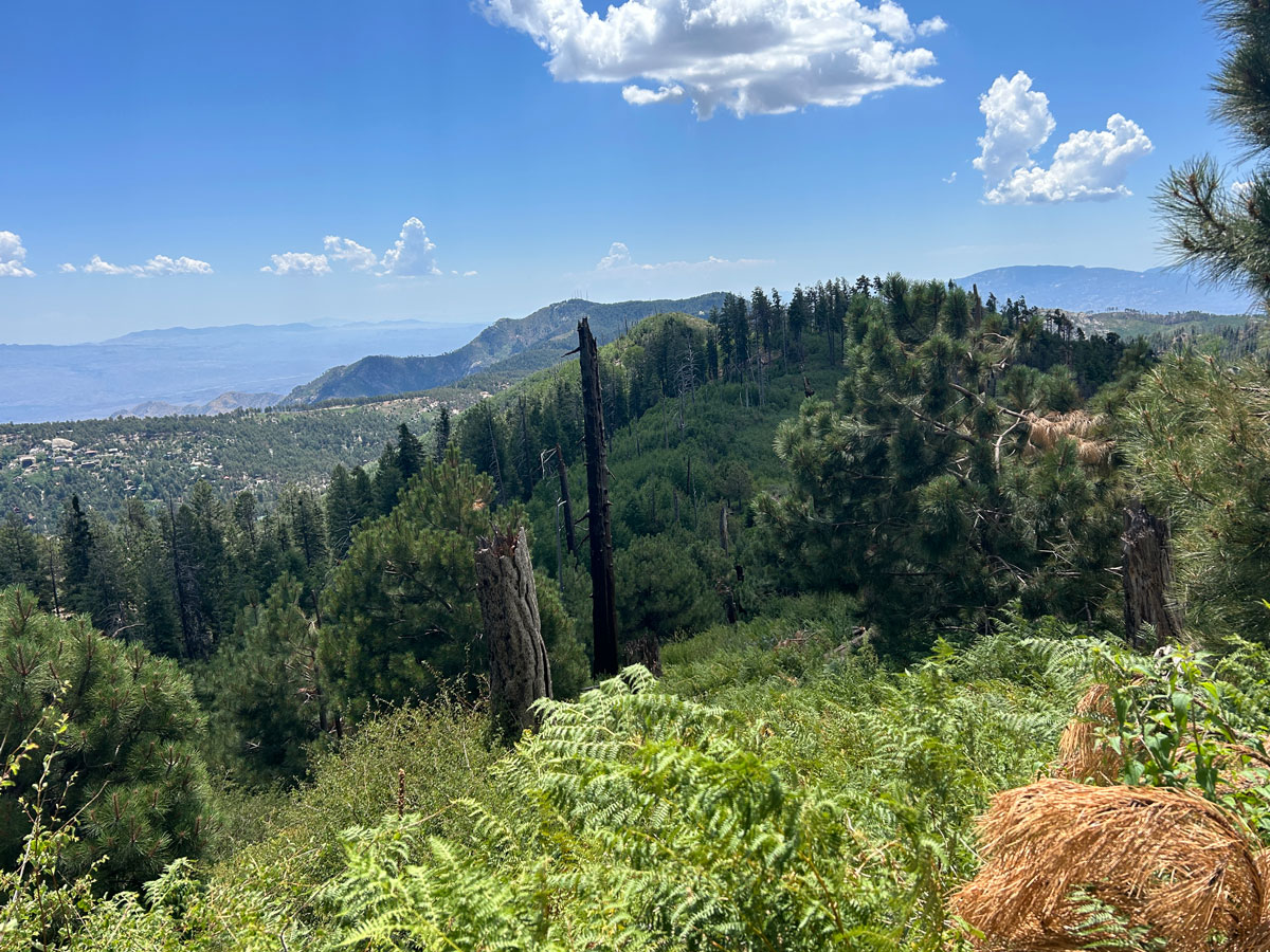
As one might guess, Mount Bigelow Road takes you up and over the summit of Mount Bigelow, where you’ll get fantastic, sweeping views of the surrounding area. Yep, that’s the pretty cover photo on this post.
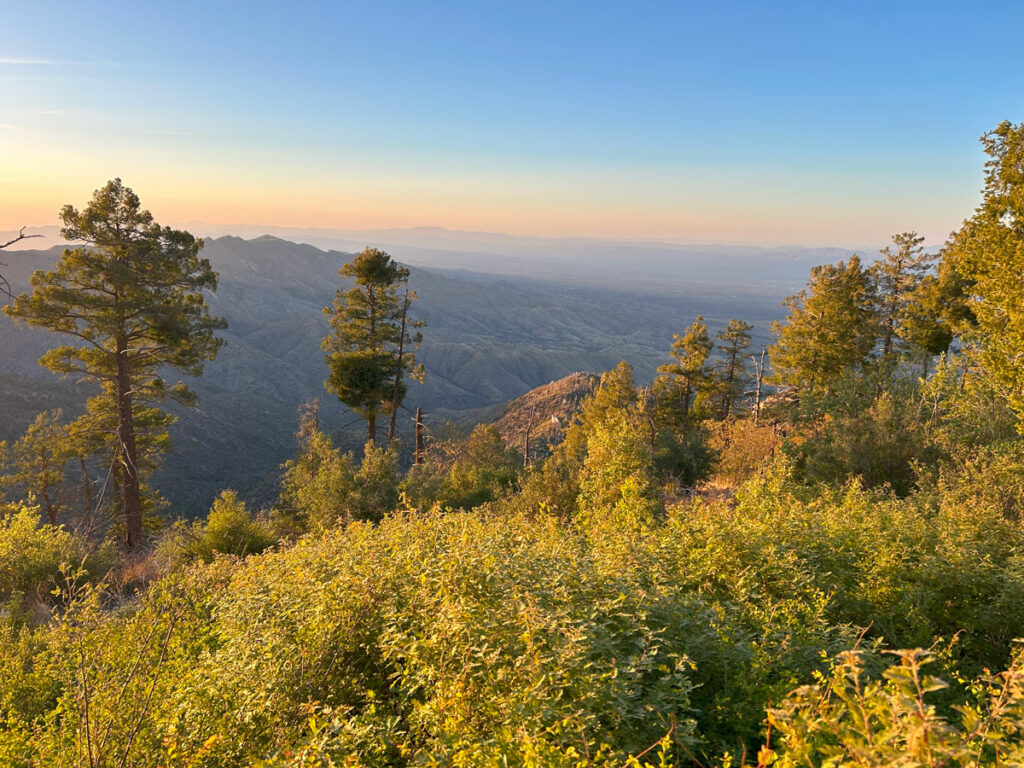
Thankfully, you’re done with the dirt road part of this route. We did not visit the actual summit because we were satisfied with the views from where we were (and human made objects kind of ruin the scenery anyway). Simply continue on the road if you’d like to reach the summit. Otherwise, look for a trail breaking off to the left.
Bigelow Trail #54
From here, it’s just a short 0.2 miles back to the junction at the saddle where you were earlier this morning. Make a right at the junction and continue 0.5 miles back to your car.
Camping
Although this doesn’t make an ideal backpacking route due to its relatively short length and proximity to the highway, I did notice a few spots along the trail that had established campsites with shade and room for at least one tent. I marked those on the map.
My favorite was the one marked as Mount Bigelow camp 2. For car camping, there are plenty of spots along Mount Bigelow Road.
Map & Directions
Location Mount Lemmon, Santa Catalina Mountains, Coronado National Forest, Tucson
Google Maps Bigelow Trail Trailhead
Fees/Passes None
Trailhead Facilities Vault toilets, water spigot
Recommendations for you
Lemmon Loop | Mount Lemmon
Marshall Gulch Aspen Loop | Mount Lemmon
Mount Wrightson | Santa Rita Mountains
Leave a Reply