Mount Wrightson
TRAIL STATS
A mountain south of Tucson is probably not the first to come to mind when you think of Arizona high country, but Mount Wrightson delivers a beautiful forested hike up to an elevation of 9456 feet in the Santa Rita Mountains. There is usually wildlife, streams, and magnificent views to be had, though you will definitely have to work for it.
Trail Description
While Mount Wrightson is breathtaking and well worth your time any day, we happened to catch it on possibly the most magical day ever. There were pockets of rainstorms scattered around southern Arizona, and it even rained pretty hard on us as we drove to Tucson, which sent us rushing to CVS to buy ponchos. As we started the hike, we saw a couple coming down who were drenched, and we assumed that would be our fate as well, but we pressed on anyway.
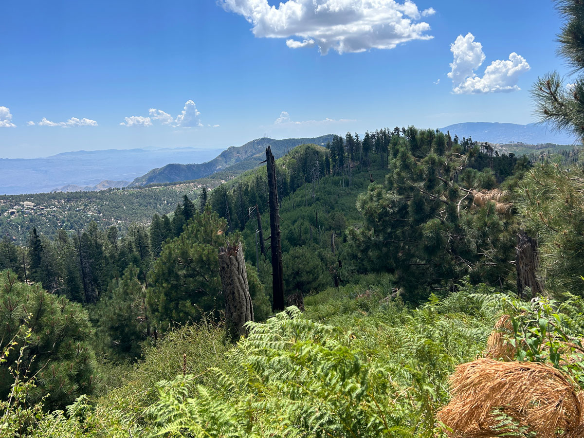
Right away, the trail weaves its way through a forested area as it begins to head up canyon. The trail is well-defined and easy to follow as you enjoy alternating views of the forest and the valley gradually getting farther and farther below you. It’s a steady climb that never really gets much more or less steep on the way to the summit.
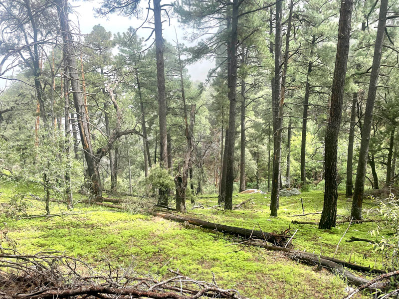
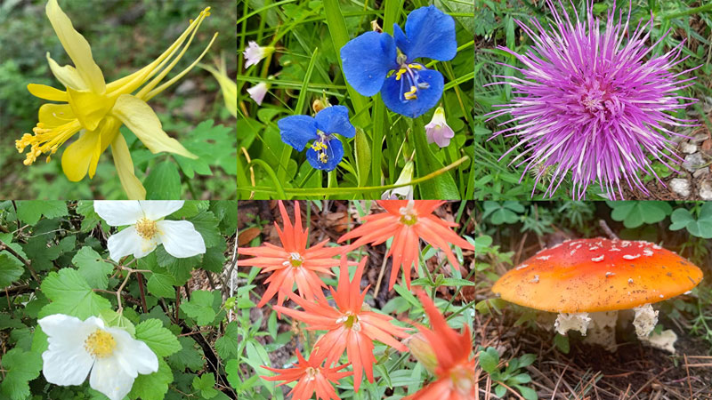
Since we went on the most magical day ever and were in the middle of one of the wettest summers Arizona had had in a long time, there were wildflowers galore in every shade, and the cutest poisonous mushroom I ever did see! April spent a lot of time with it, wishing she could set up a Polly Pocket scene.
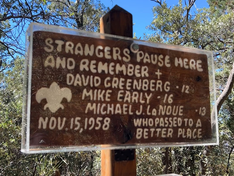
Josephine Saddle
At about 2.5 miles, you’ll come to a saddle with a memorial sign for three Boy Scouts who died there in 1958 when they were caught in an unexpected blizzard.
This saddle is a crossroads for several trails, so be sure you stay on the Old Baldy Trail, which forks off to your left. There is another fork soon after where the Old Baldy Trail and Super Trail split. Both will take you to Baldy Saddle since they form a loop around Mount Wrightson, but the Old Baldy Trail is shorter.
Bellows Spring
If you stayed on the Old Baldy Trail, you’ll continue through beautiful, lush forest and begin to get views of the peak above you. Eventually you’ll come to Bellows Spring, which comes in from the right and flows over the trail down to your left. This spring is seasonal, and we have seen it flowing 2 out of 3 times we have gone, so don’t depend on getting water there unless you’re reasonably sure it will have water.
Old Baldy Saddle
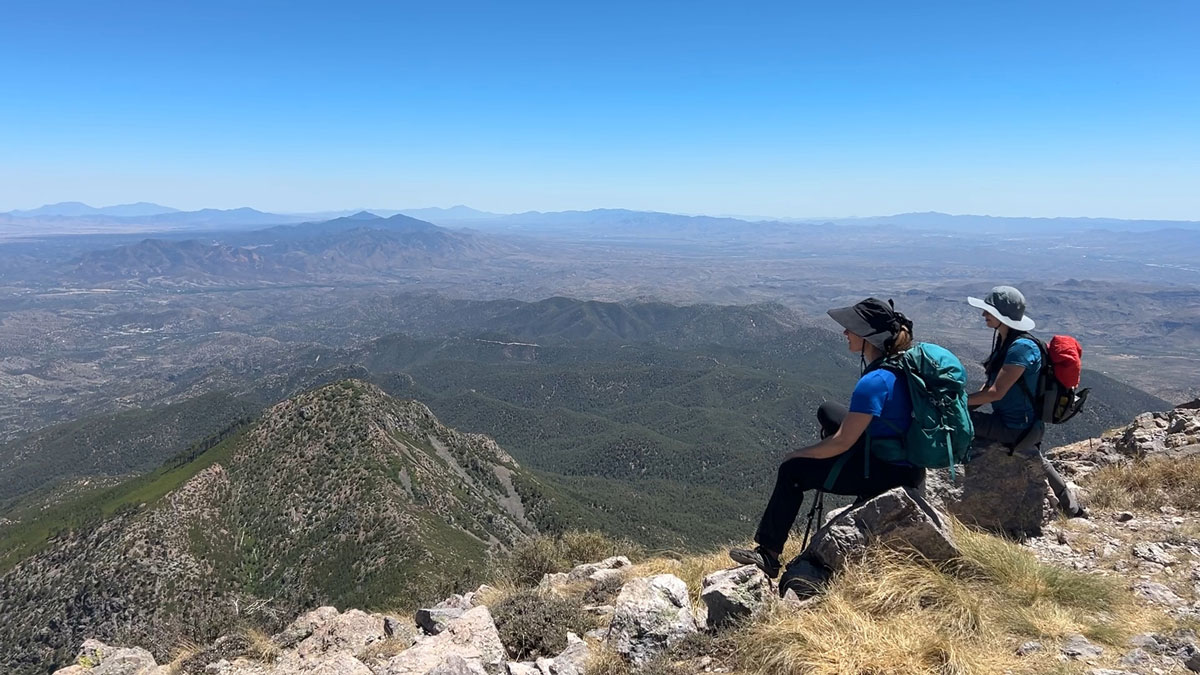
At 3.5 miles, a series of switchbacks led us up to the Old Baldy saddle, where we could finally see to the other side and get a taste of the spectacular view that awaited us at the summit. It was clear a fire had come through the area at some point because most of the trees were dead or downed, and that was a little sad, but it also guaranteed an unobstructed view. I know, right? Are you packing your backpack yet?
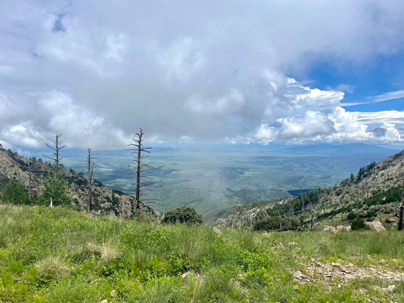
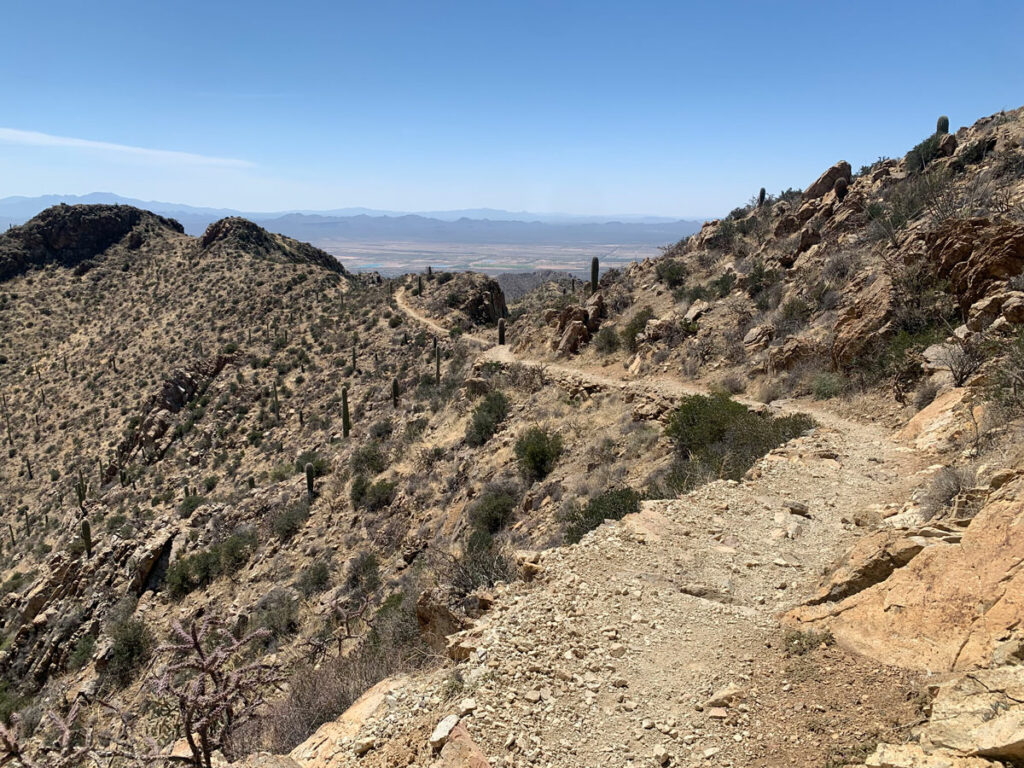
From there, the peak was to our right and the trail became more rock and less dirt, but the views never stopped.
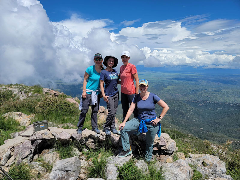
The Summit
As we were about to reach the summit, another couple was coming down and told us we would have it all to ourselves. Imagine that! A beautiful peak in Arizona all to ourselves on the most magical day ever.
There have been a lot of flying bugs at the summit every time we have gone, and they can get pretty annoying. Except the ladybugs. And when I say ladybugs, I mean like zillions and zillions of them! April was in heaven, and instead of enjoying the view, she spent her time making friends with them and putting them all over her face.
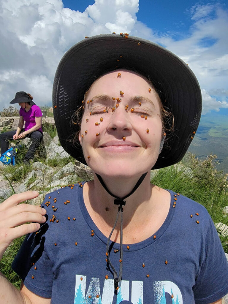
So weird. We know.
For the shortest round trip hike, you’ll want to follow the Old Baldy Trail to and from the summit. However, if you’re looking for longer mileage variations, you can use the Super Trail, which forms a figure 8 with the Old Baldy Trail, and they cross at Josephine Saddle. According to the Forest Service website, the Old Baldy Trail is steeper but more shaded due to its location on the mountain, while the Super Trail is a bit more gradual but has less shade.
We used the Super Trail to make a loop around the peak, which we describe below, but then we rejoined the Old Baldy Trail back to the trailhead. We have never taken the Super Trail between Josephine Saddle and the trailhead, but if you have done that segment, please leave us a comment and tell us how it was!
Optional Loop
Additional mileage 2.3
Additional elevation gain 137
When you get back to the Old Baldy Saddle, you can make a loop around the peak by turning right onto the Super Trail. This doesn’t add anything particularly interesting, but it’s a nice enough trail and will give you more mileage.
Josephine Peak
Additional mileage 1.3
Additional elevation gain 638
If you opted for the Super Trail and you’re a true glutton for punishment, you can also add on a side trip to Josephine Peak. Prior to 2005, there was an official trail to this peak, which is still shown on the map at the trailhead. However, after a wildfire burned through the area, the Forest Service stopped maintaining it, and the trail is so faint at this point that it can hardly be called a trail. Additionally, the terrain is loose, overgrown, and generally unpleasant, so I would not recommend this unless you’re a seasoned off-trail hiker who enjoys a little pain.
Consider yourself warned.
Map & Directions
Location Santa Rita Mountains, Coronado National Forest, Sahuarita, Arizona
Take I-19 to exit 63 for Continental Road and go east. Turn right onto Madera Canyon Road and follow it to where it ends at the Old Baldy trailhead.
Fees/Passes You will need a Coronado Pass or an America the Beautiful Pass to park.
Trailhead Facilities There are pit toilets available. No water.
Preview this Hike
(Note: this video was from a subsequent trip that was NOT the most magical day ever.)
Recommendations for you
Ten Awesome Arizona Peaks that Aren’t Humphrey’s
Mount Lemmon Loop | Tucson
Wasson Peak | Saguaro National Park
Leave a Reply