Picketpost Loop
TRAIL STATS
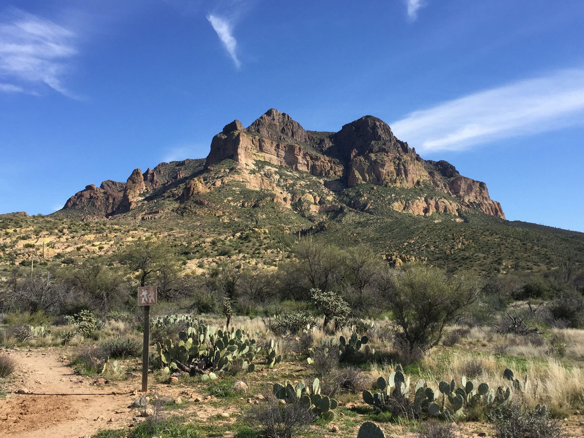
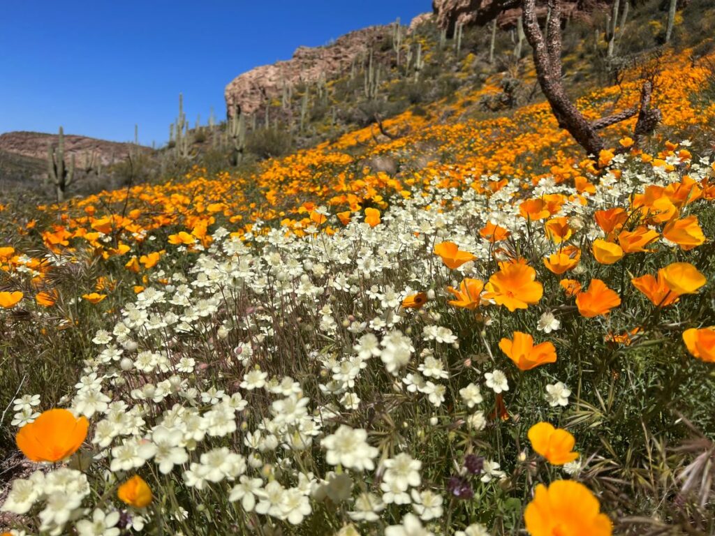
Picketpost Mountain is one of the prettiest mountains you’ll find anywhere in Arizona, and a loop around its perimeter offers scenic views, striking rock formations, a seasonal creek, and wildflowers in spring. Plus, we saw plenty of wildlife along the way, including two desert tortoises! We can’t promise you’ll be that lucky, but we can promise an enjoyable hike featuring large trees and idyllic vistas that are rare on a desert hike like this. The trail gets a little hard to follow on the back side, so bring GPS.
Trail Description
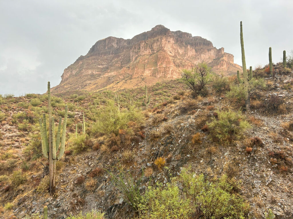
While many people head to Picketpost for a challenging hike to the summit, there’s a less obvious but still compelling reason to hike here—it’s so beautiful! Picketpost Mountain (sometimes spelled Picket Post Mountain) rises above the surrounding desert so magnificently that I often describe it as a castle. On the Picketpost Loop, you’ll get to enjoy it from every angle and be treated to the desert oasis formed by the creeks that run around its base. Even if the creeks are not flowing, the tall trees provide shade and greenery that lend to the fairytale setting.
Am I getting too dramatic? Maybe. We did visit on a rainy day in September that made it feel all the more magical (until the lightning started—more on that later).
Picketpost Trailhead
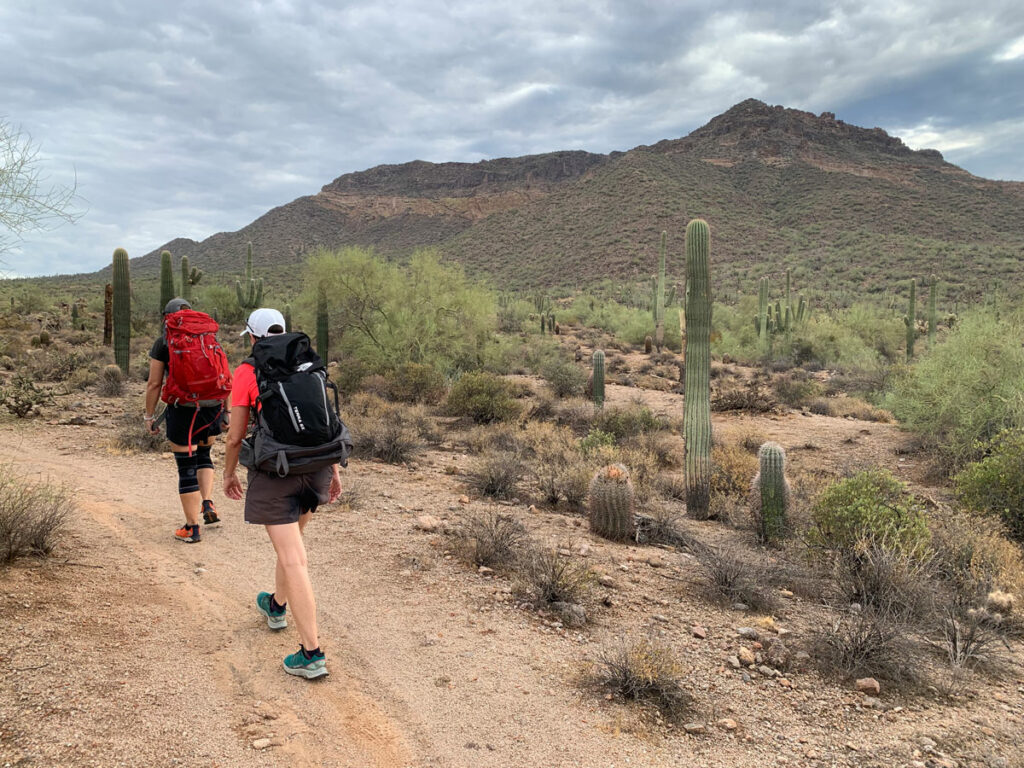
The Picketpost Trailhead is located in an area that is popular for camping, horseback riding, and other forms of outdoor recreation. You’ll usually have company there, and you may even run into someone hiking the Arizona Trail, which passes through here. In fact, the western side of Picketpost Loop is on the AZT.
From the trailhead, you’ll start near the Arizona Trail sign and immediately cross what is hopefully just a wash. A sign indicates that you should not cross it when flooded. I have never seen any water in that wash, but just be aware.
LOST Trail
Very soon you’ll come to one of the most confusing trail forks I’ve ever seen. I think we mess this up about 50% of the time, and this time was no different. The lesson we learned that day is that if you want to go around the loop counter-clockwise, fork right to continue on the Arizona Trail. I mean, it does seem obvious, but we weren’t sure we were at the right junction because of past mix-ups and confusing signage. So we went left onto the LOST Trail (ironic name, right?), quickly discovered our error, and ended up on the clockwise route. No worries, it was just fine going that direction, and the rest of this guide will describe a clockwise loop.
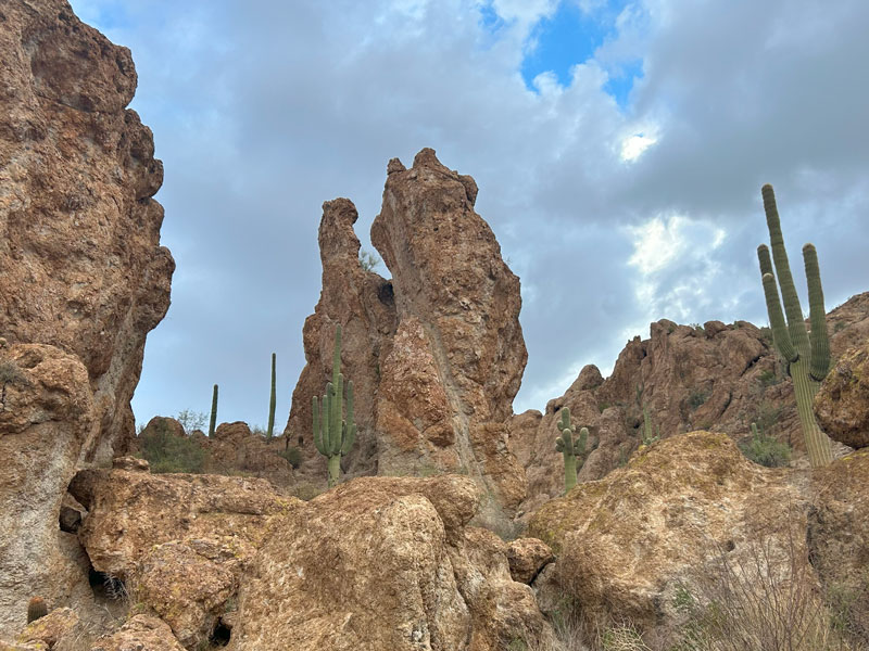
You’ll immediately gain some elevation only to lose it again just as quickly as you descend toward Arnett Creek. The geological formations in this area will have you in awe.
Arnett Creek
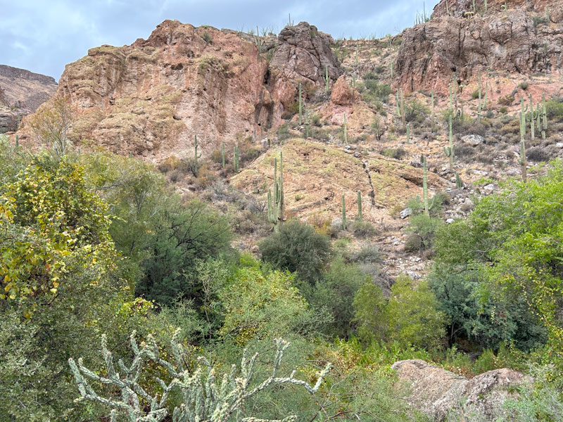
Soon the trail begins following Arnett Creek, and you’ll find yourself in a little desert oasis with towering trees, massive rock formations to either side of you, and hopefully a trickling stream. If you come in the spring, you may even be treated to gobs of wildflowers.
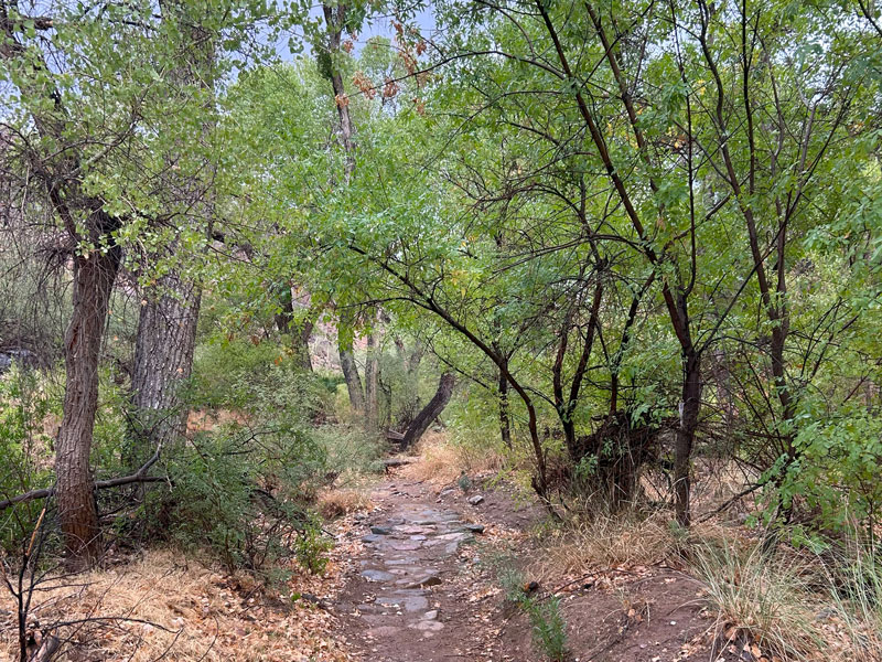
You’ll also share this peaceful haven with the resident cows that will probably be eyeing you suspiciously. Watch your step—there are cowpies everywhere.
Telegraph Canyon Trail
After following Arnett Creek for around two miles, you’ll come to a signed junction for Telegraph Canyon Trail. At first, it can seem depressing to leave Arnett Creek, but I promise there is more to come!
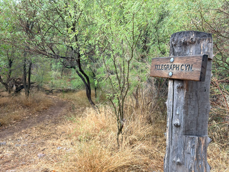
This trail generally stays low in the canyon as it travels southwest toward Telegraph Canyon Road. It’s definitely less traveled, but still not too difficult to stay on course. You brought GPS just in case right?
Majestic mountains, cactuses, and plentiful trees—how pretty!
Telegraph Canyon Road
After about a mile, you’ll come to the junction with the unpaved Telegraph Canyon Road.
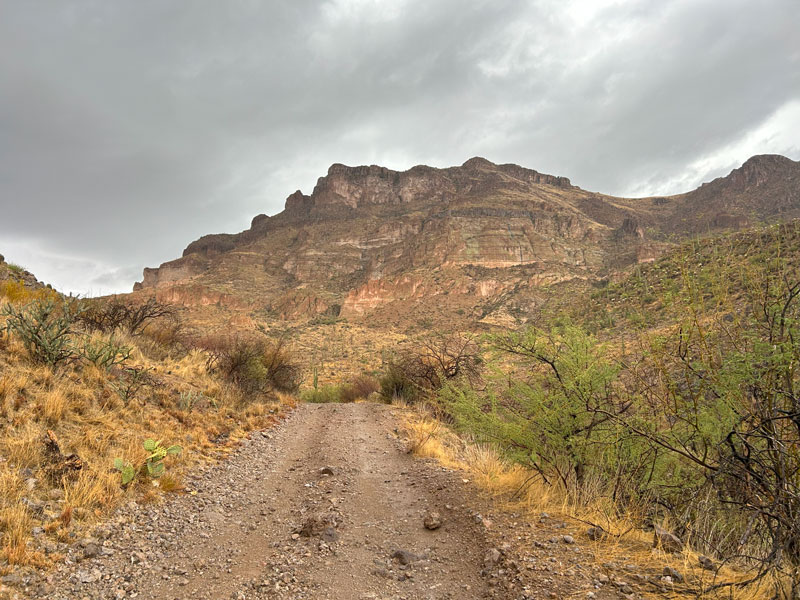
What did I tell you? Picketpost Mountain is just as pretty from behind. Don’t get too comfortable on this nice, easy-to-follow road. You’re only on it for about half a mile before the canyon splits. The road goes left to continue along Telegraph Canyon while you’ll go right through an unnamed wash toward the Arizona Trail.
Note that I’m calling these washes because they were all dry when we went, but your experience may vary.
Unnamed Wash
As far as I can tell, there is no official trail through this section, and it seemed like there were social trails everywhere. It can be a little confusing, so my best advice is to pick a beaten path that heads in the right direction and try to follow it for as long as you can. When it runs out, find another one you like, and repeat. This lasts for just over half a mile before you’ll connect with the Arizona Trail, which will feel pretty fancy by then. Maintained, well-traveled trail? YES!
Arizona Trail
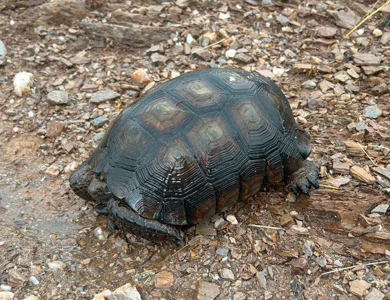
You’ll stay on the Arizona Trail for the rest of the hike, as it travels up and down over the rolling foothills of Picketpost Mountain. Along this section, we ran into two desert tortoises, which is an extremely rare sight! I hike hundreds of miles every year, and these were two of only four I’ve ever seen in my lifetime!
I wish I could describe the last mile of this trail, but the lightning bolts started threatening, and this trail continued to go up onto exposed hills. Great for views, bad for lightning storms! So we dropped into Alamo Wash and followed it back to our car, but I am confident this trail will treat you well with continuing views of Picketpost Mountain.
Soon you’ll be back at the junction that started the loop, and you’ll go left back to your car.
Map & Directions
Location Tonto National Forest, Superior, Arizona
Take US60 to the turn off for Picketpost Mountain. Follow this dirt road to the T, make a left, and then follow that road to the trailhead. This road should be fine for all passenger vehicles.
Fees/Passes None
Trailhead Facilities Vault toilets
Recommendations for you
Picketpost Mountain | Superior
Arnett Canyon | Superior
Pass Mountain Loop | Usery Mountain Park
Leave a Reply