Coffee Flat Loop with Herman’s Cave
TRAIL STATS
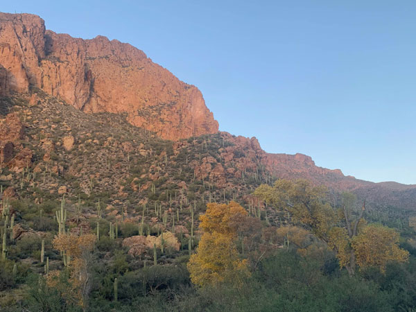
This long loop in the Superstition Wilderness takes in Whiskey Springs, Herman’s Cave, Upper La Barge Canyon, Coffee Flat, and Miner’s Needle as it circumnavigates Coffee Flat Mountain. It can be done as a long day hike, but most people will prefer to backpack it when there is a lot of water running in the Superstition Wilderness. Great campsites exist at Whiskey Spring, La Barge Creek, and Coffee Flat.
Trail Description
If you have a friend who talks you into a 20-mile day hike with no specific destination other than wandering around in the desert, then you’re one lucky person. [Pause.] Wait, my legs still hurt. Maybe I’m not quite ready to say that yet, but the pictures keep bringing a smile to my face, so it must’ve been good.
Dutchman’s Trail #106
From the Peralta Trailhead, take the Dutchman’s Trail at a well-marked junction just after you leave the trailhead. This trail has some ups and downs as it traverses the rolling hills of the desert over to Miner’s Needle. If there’s been recent rain, you’ll rock hop over a couple streams along the way.
When you get just below Miner’s Needle, you’ll see a well-marked junction with Coffee Flat. This is the start of the big loop, so you have two options:
- Clockwise Bear left to stay on Dutchman’s Trail and go up canyon toward Miner’s Needle saddle to do the loop in a clockwise direction.
- Counter-clockwise Bear right toward Coffee Flat to do the loop in a counter-clockwise direction.
We opted to go left, so the rest of this guide will describe the clockwise loop.
Whiskey Spring Trail #238
Once at Miner’s Needle saddle, you’ll see another well-marked junction for Whiskey Springs. This is your turn. The Whiskey Spring Trail takes you into the heart of the Superstition Wilderness.
When you find yourself in a shady thicket of trees, look down to your right to find a pleasant stream and Whiskey Spring. A small concrete trough and two pipes that hopefully have water flowing out let you know you’re at the right spot. There’s a great campsite on the other side of the stream that you might want to snag if you’re backpacking.
Continuing from here, you’ll go mostly downhill as you make your way down into La Barge Canyon where you’ll find La Barge Creek. Hopefully it’s flowing, but as with most places in the Superstitions, it can be bone dry if it hasn’t rained in a long time.
Red Tanks Trail #107
Once you cross La Barge Creek, you’ll intersect with Red Tanks Trail and take a right. This portion of the hike passes through the always stunning upper La Barge Canyon. It could be the most beautiful section of the entire route.
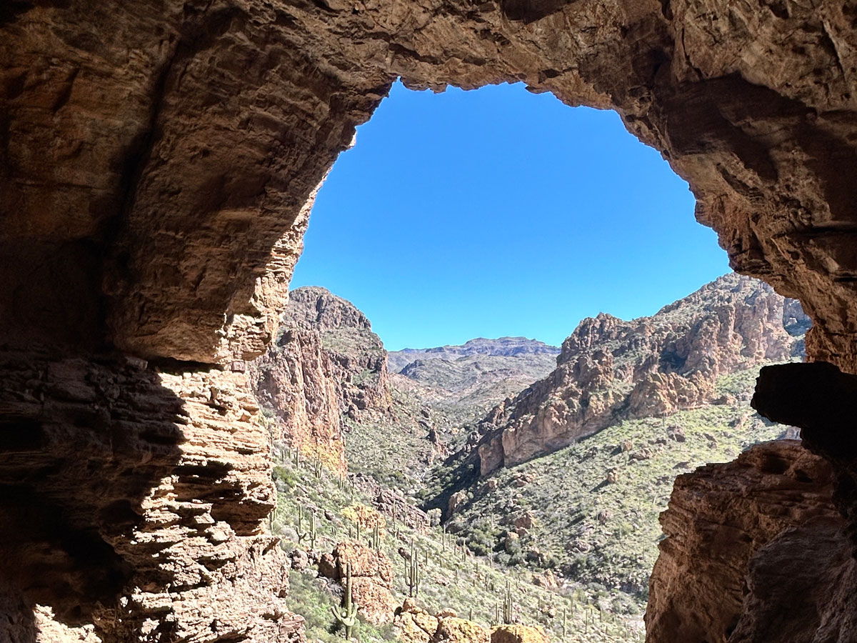
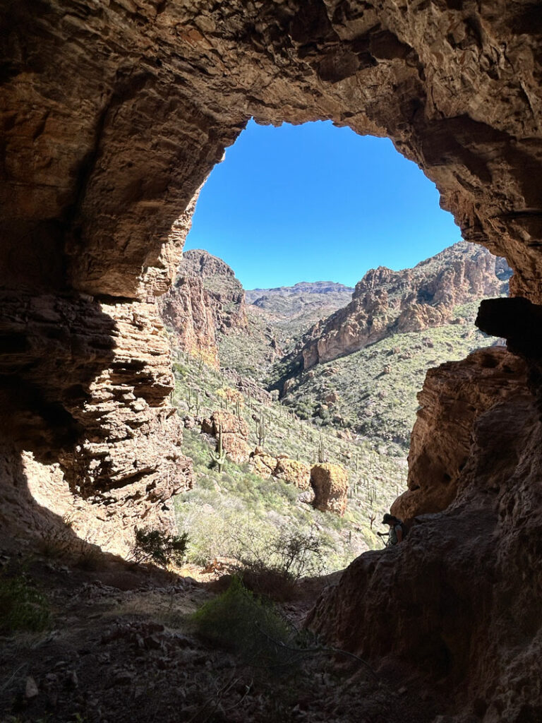
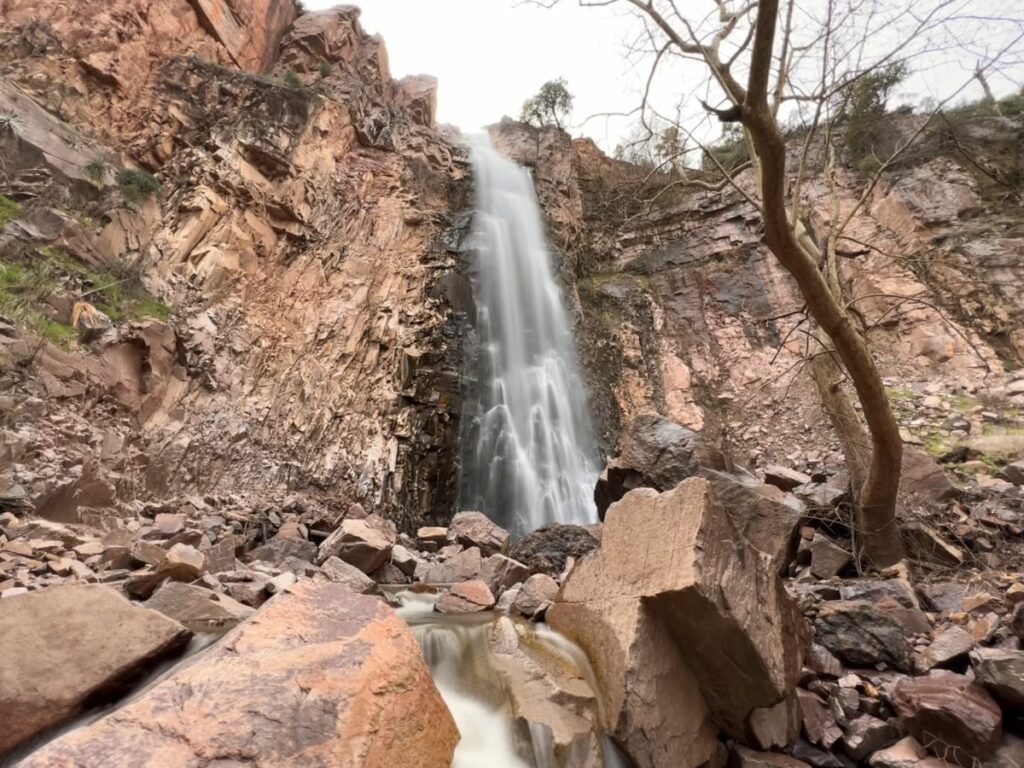
Herman’s Cave
Keep your eye out for Herman’s cave up in the cliffs above you to your left. It’s a short but steep scramble up to the cave if you’d like to explore it. Lots of interesting smells and animal droppings, but a nice, shady spot and great views of the canyon ahead.
And no, you are not halfway there.
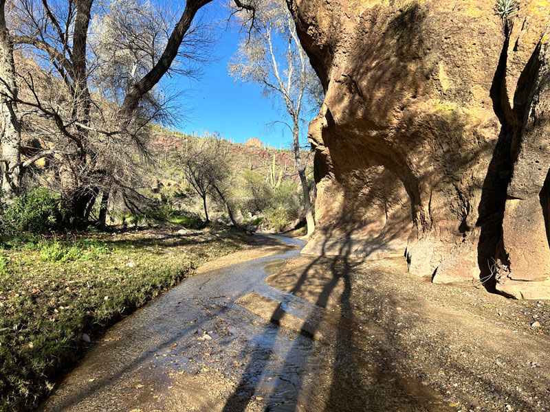
Further down the Red Tanks Trail, the trail gets hard to follow in spots. It seems like every time we hit the creek bed, we lost the trail. There are cairns every now and then, but plan time for a little bit of route finding.
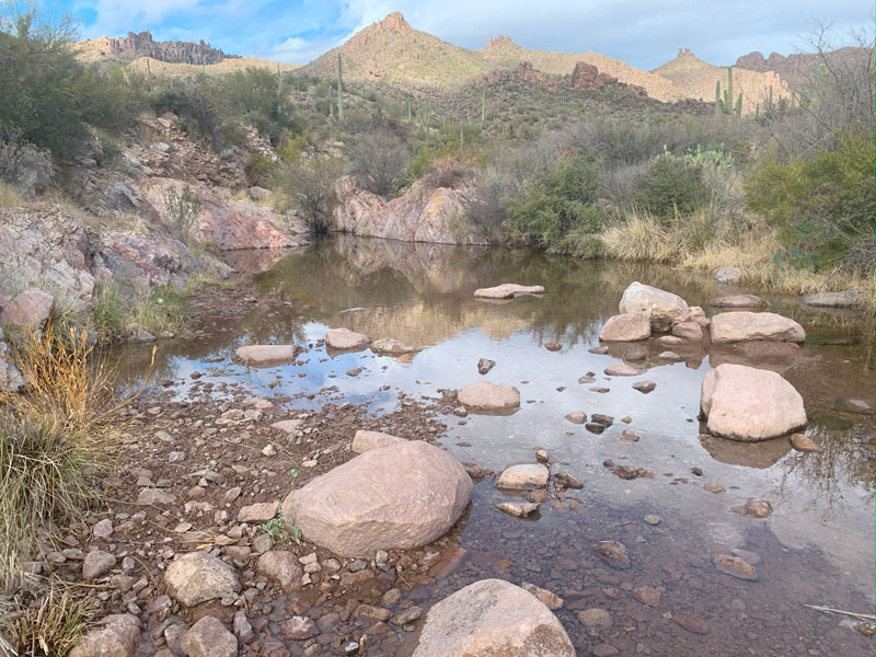
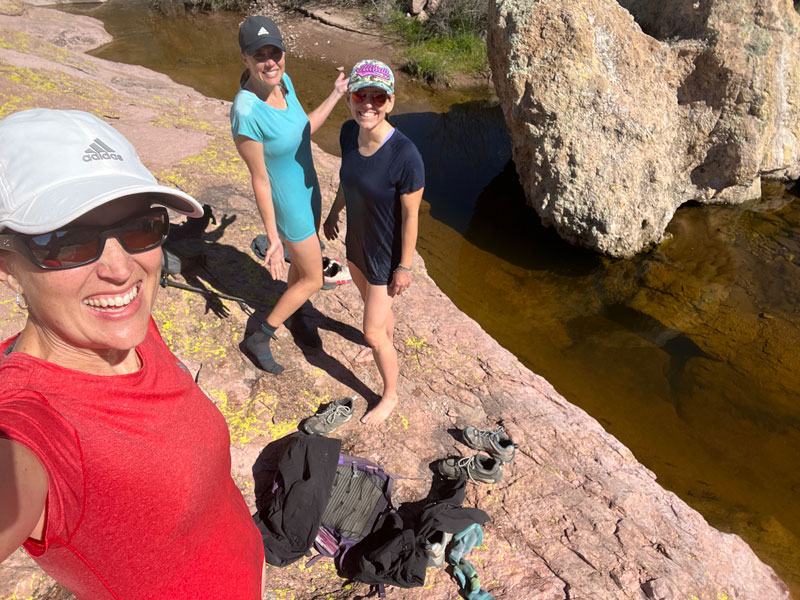
But if there’s a decent amount of water in the creek, you’ll find pleasant places to camp and maybe even a pool deep enough to take a dip. Yes, we did! In February!
As the trail leaves the creek, you get to the least scenic portion of the trip: the legendary catclaw forest of doom. It’s ugly, you’re tired, and you might even want it to be over.
Also, you’re going uphill. The pain is suddenly coming back to my memory now, and I’m once again questioning my friendship with Heather.
But alas, you’ll eventually get over the high point and start trending down. As you get close to the junction with Coffee Flat Trail, something magical happens. The trail flattens out a lot, large trees appear, and you’ll experience a bit of magic at Red Tanks Canyon. It might make you want to cry, and not just because you have so far left to go.
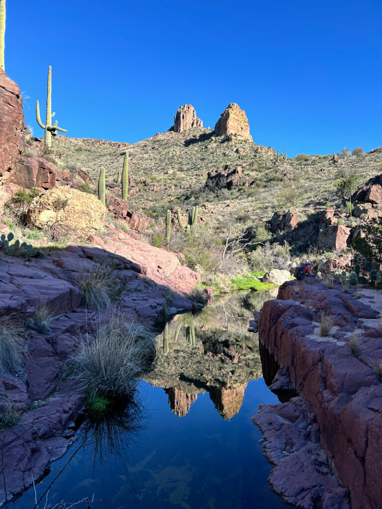
In wet conditions, the water flows through a bed of red rock, creating pools, small cascades, and stunning reflections. Love, love, love!
Coffee Flat Trail #108
The beauty continues as you hit the junction with Coffee Flat. We didn’t notice a sign or a junction, but evidently we navigated it perfectly anyway. This whole area is blessed with large shade trees, a tranquil creek, and plenty of flat places to pitch a tent. You just might wish you had a tent so you could stay forever.
The Coffee Flat Trail leaves the wilderness boundary for a while, so you’ll have to travel through a couple of gates. Outside of the wilderness boundary is an interesting spot with an old windmill and a trough.
Now, if you’re on a day trip, it gets a little disheartening here. No, Heather, that is not Miner’s Needle behind us. It’s Buzzard Roost. Miner’s Needle is visible up ahead in the far off distance, so far away that it looks a bit hazy at this point. Hey, you were the one who came up with this crazy plan. Let’s get it, ladies!
So basically from here, you just walk. And walk. And walk. Then walk some more. There’s not a whole lot of elevation change, so the going isn’t too bad, and the trail is obviously used often by horses, so it’s pretty clear and easy to follow most of the time.
Chances are good that by the time you reach Miner’s Needle, the sun will be setting, and you’ll be treated to the most glorious sunset that will make you feel like it was all worth it. Keep heading into the sunset. You just have that little bit of Dutchman’s Trail left to take you back to the trailhead.
After your food, shower, and a good night’s sleep, you can think fondly on that friend who convinced you to do this big loop. A cave, a wilderness swim, cascades, pools, giant trees, and the rugged beauty of the Superstition Mountains. That’s the good stuff in life.
Backpacking Campsites
There are a lot of potential spots to camp along this route, but your best bets are next to Whiskey Spring, along La Barge Creek, or on the Coffee Flat Trail. I marked one potential site that has no trees, but features a large pool and a nice sandy beach next to the creek.
Map & Directions
Location Superstition Wilderness, Apache Junction, Arizona
From Phoenix, take the US60 east to Peralta Road, and turn left. Follow this normally well maintained trail to the end, keeping left at the fork. A passenger vehicle can make it unless there has been a lot of rain recently.
Fees/Passes None
Trailhead Facilities Pit toilets available
Preview this Hike
Recommendations for you
Charlebois Spring Loop | Superstition Wilderness
Reavis Ranch | Superstition Wilderness
Reavis Falls | Superstition Wilderness
Leave a Reply