
Drew Trail
TRAIL STATS
The Drew Trail extends from the Highline Trail below the Mogollon Rim up to a campground on the rim, giving you beautiful views and a nice workout. You can start your adventure from Fs 9350 Campground or from See Canyon, a lesser known alternative to Horton Creek that’s every bit as beautiful. For the extra ambitious, make it a loop!
Trail Description
Arizona gifted us a cloudy, cool-ish day in June, so we knew we had to make the most of it and head out for an adventure. Since we were doing this as a day hike coming from the valley, we chose to start our hike at the See Canyon Trailhead. However, if you happen to be out camping on the Mogollon Rim, you can start this hike from the Fr 9350 Campground. Yeah, creative name, right?
See Canyon Trailhead
If the trailhead seems a bit crowded, never fear. The parking area is near a pretty little creek, and most people are just there to play. When we pulled up, the parking was full, but we had the trail to ourselves. The dirt road to get there was easily manageable in our sedan, so just about any car can make it when dry. Pit toilets available.
Highline Trail
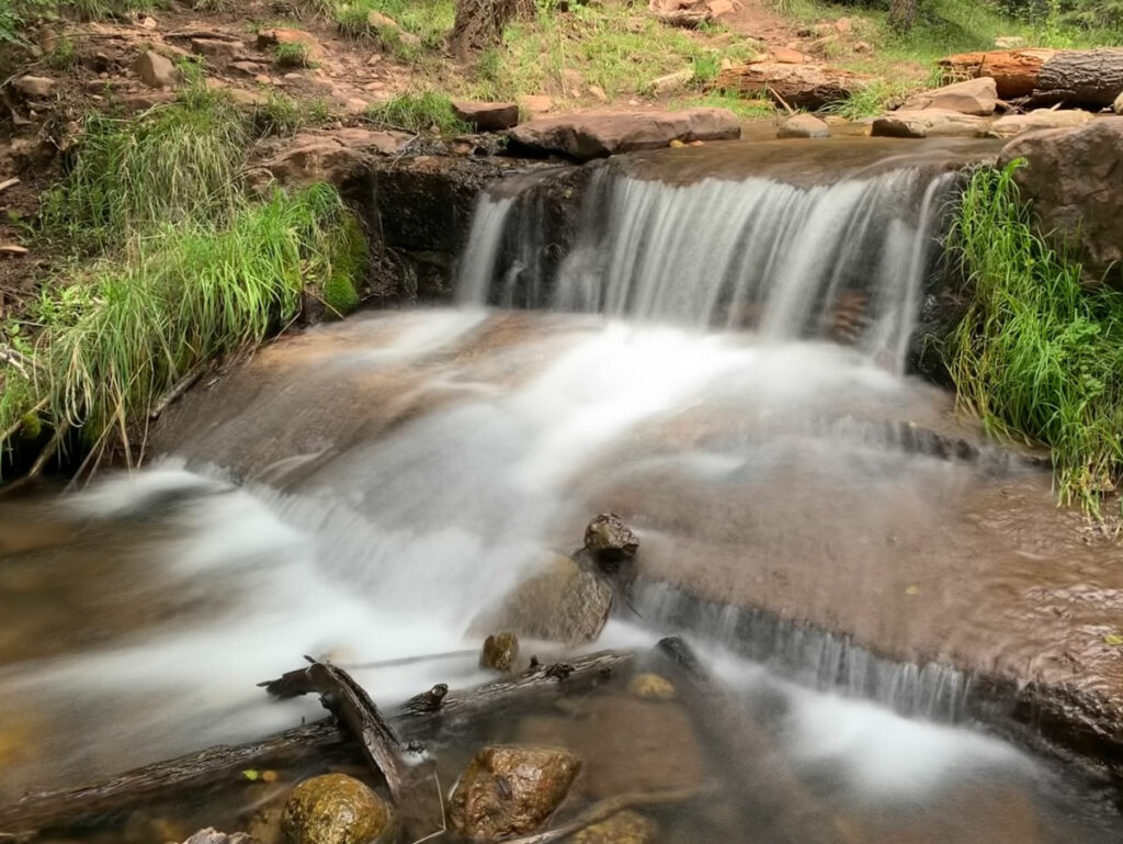
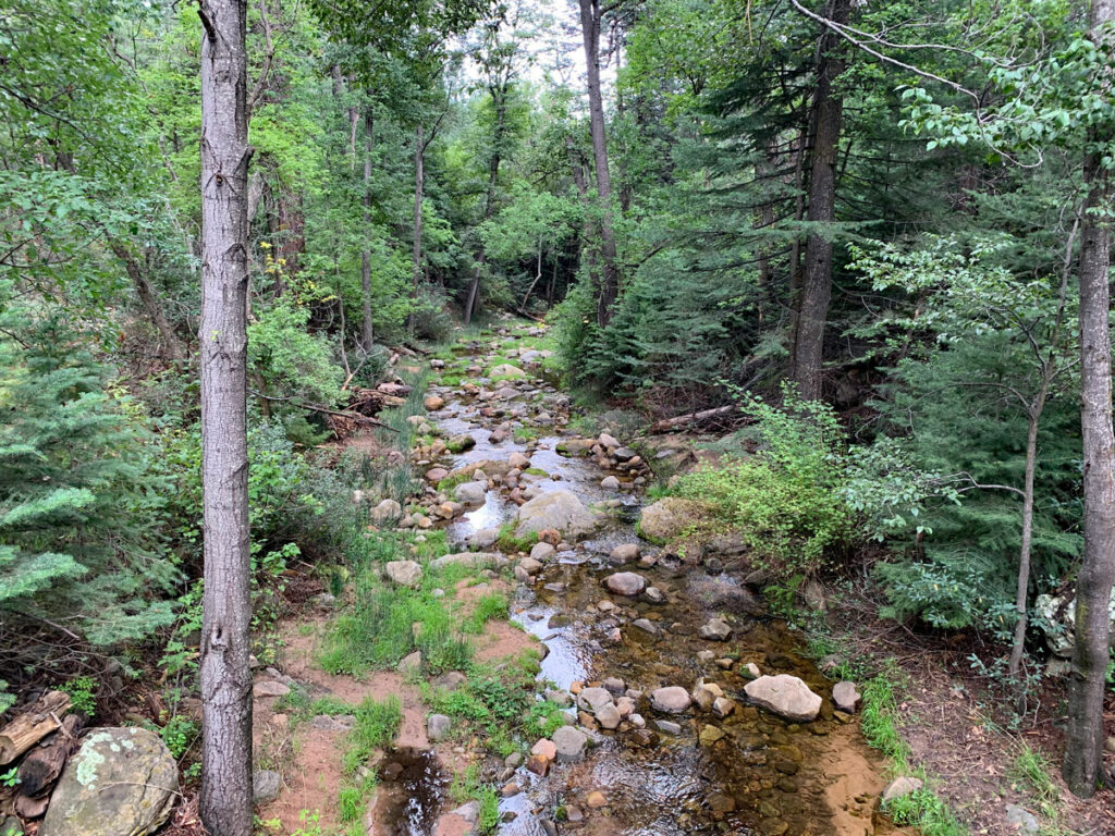
You’ll start out on a section of the Highline Trail, a 60-ish mile trail that runs along the base of the rim from the town of Pine to the Two Sixty Trailhead. This part of the trail is shared with the See Canyon Trail, and you’ll get the opportunity to see the pretty little creek that most of the people came for.
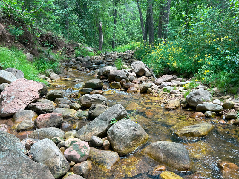
This creek flows from a couple of springs up canyon, including See Spring, which also makes a nice hike and is incredibly gorgeous in the fall.
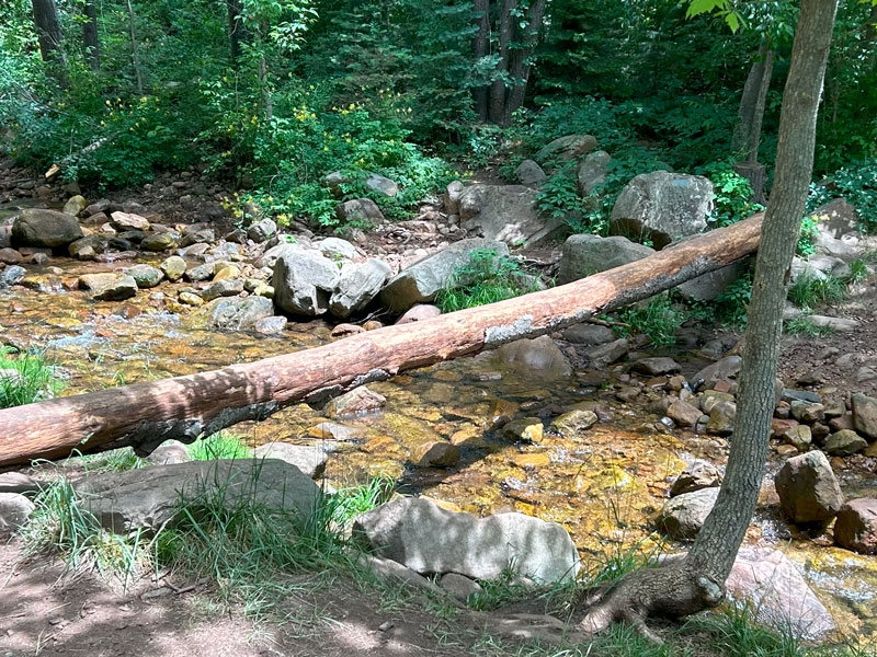
Just before you’ve gone a quarter mile, you’ll see a well-signed trail split. Fork right to stay on Highline Trail and cross over the creek. There was a log at this crossing when we went, so If you want to be tricky or just show off, you can give it a go. One person in our party did it successfully, but you better believe I had my camera rolling because I had serious doubts.
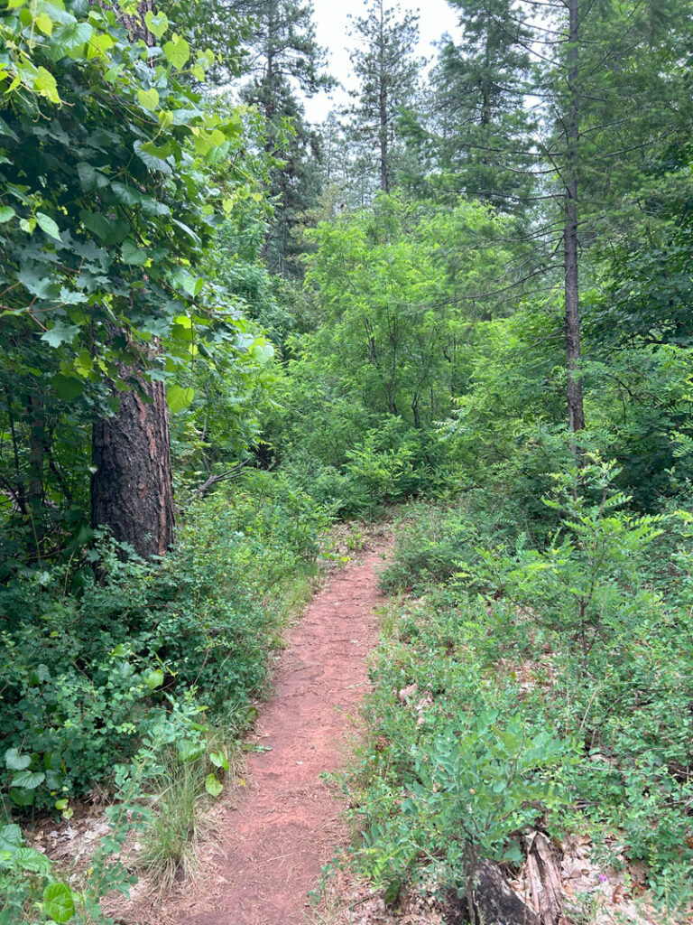
There’s not much elevation change for the first mile after the crossing, but don’t get too comfortable. You know it’s coming.
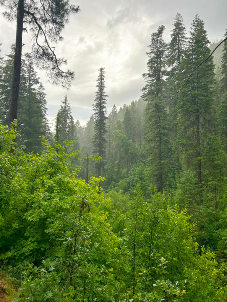
Owing to the thick greenery and the cloudy, humid, cool-ish—okay, okay, it was more like warmish—day, it felt a little like we could be in a rainforest.
With all the maple leaves I saw along the way, I resolved to come back and backpack the entire Highline Trail in the fall. It was incredibly beautiful, and this section of the trail really deserves four stars.
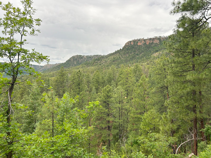
Eventually, the trail begins to ascend, and you’ll enter an area that has Sedona vibes. It also has some nice views of the rim out to toward the east. Find yourself the perfect spot to plop down for a break and take it all in.
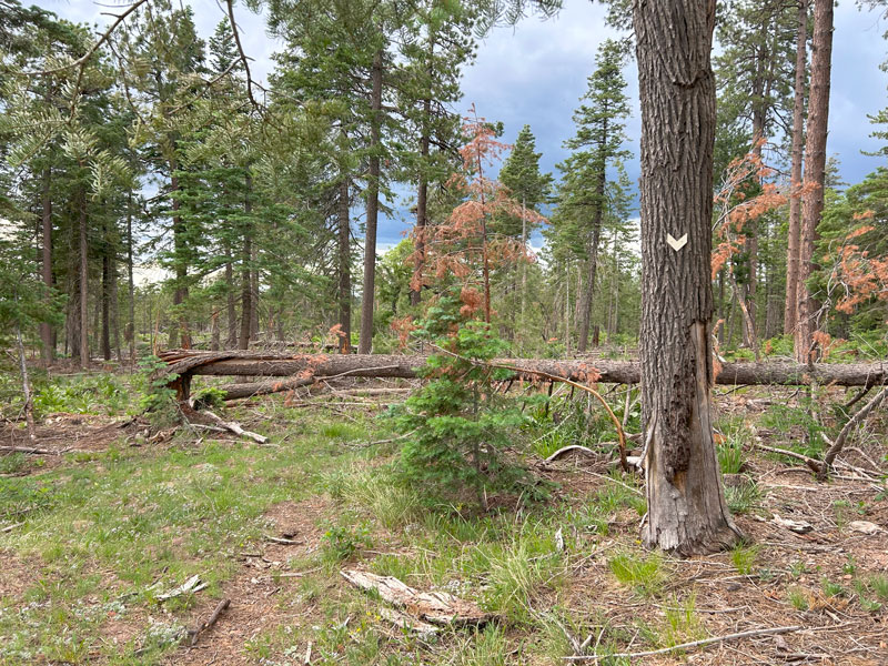
When you get to a fence, you’ll see another nice sign for Drew Trail. Buckle up, kids, this is where the trail really starts to climb.
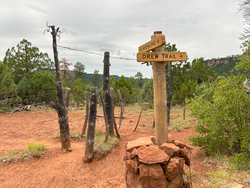
Drew Trail ascends steeply up the side of the rim through a lovely ponderosa forest. Whenever there’s a break in the trees, you can stop to catch a view of the valley below (and secretly catch your breath, too—I mean, if you crossed that log successfully, you can’t be showing weakness now.)
Mogollon Rim
Now the bad part. When you get up onto the rim, there isn’t really a great view from up there, and you’re smack dab in the middle of a busy campground. You came all this way, so what to do? Well, if you’re like us, you’ll borrow some great views from the adjacent campsites (marked on the map). Note that any viewpoints you choose to walk to will add a little bit of mileage to the stats given at the top.
Nobody seemed to mind, and we were quite jealous of the awesome hammock setup these two guys had.
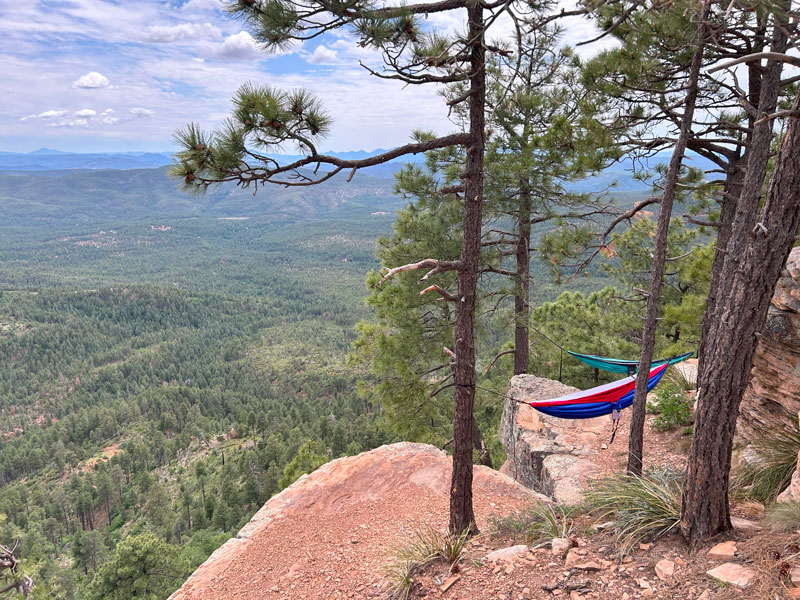
(Note to self: go back and snag campsite #26 someday. Bring hammocks.)
If you’re ready to call it good, simply retrace your steps back to the parking lot. However, if you need more miles like we did, you can follow the rim northwest back over to the See Canyon Trail to make a loop.
See Canyon Loop Option
Additional mileage 4.4
Additional elevation gain 947
So, upfront I have to say that this route is a mishmash of trails and roads that range from obvious to very faint. If you don’t have GPS, turn around and go back to the trailhead. Then vow to have GPS on every hike from now on because why not?
At the point where the Drew Trail intersects with the campground road, it actually continues on to the north. But since we had walked quite a way along the campground road to take in the views, we weren’t really keen on backtracking. So, we chose to continue along the road to where it intersects with the General Crook Trail.
Yes, you’ll have to deal with cars and underage drivers cruising past in off-road vehicles. Keep the faith, hiker. Soon the road is blocked off and you’ll blissfully continue on a closed road toward the trail junction.
General Crook Trail
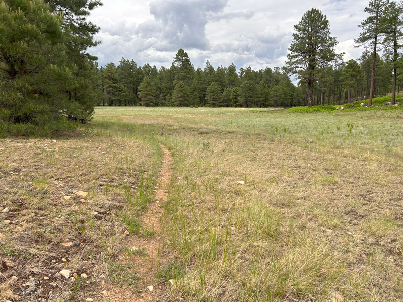
General Crook Trail is apparently supposed to run along the top of the rim, much like the Highline Trail runs along the base. I don’t know what the deal is with it, though. Sometimes it’s kind of there, sometimes it’s maybe rerouted, and sometimes it disappears into the ether.
When you first get on the trail from the intersection with the road, it’s actually somewhat defined as it passes through a serene meadow.
The trouble comes after it reconnects with the dirt road. We followed the road for a bit, but then noticed a sign that indicated the trail forked off to the right. That coincided with the topographical map on our GPS device, so we tried to take it.
Just no. Save yourself some frustration and keep following the closed dirt road. I know it’s no fun, but neither is the alternative.
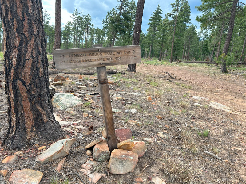
As long as you’re on the road, which is also the Carr Lake Trail #412, the navigation is pretty easy. Make sure to turn left onto the General Crook Trail at this sign.
The trail continues to be easy to follow here, but it gets tricky again when it intersects with Forest Road 300. Because ain’t no way you’re gonna hike on Forest Road 300—AKA the Mogollon Rim superhighway.
Just south of the road, there’s a trail that runs roughly parallel to it. I know what you’ll be thinking when you get there. I’m a liar and a thief just like General Crook. (Okay, I have nothing personal against the guy except that the trail named after him kind of sucks sometimes). When we were there, a big downed tree obscured the trail, but be persistent, and you’ll find a faint path. Look for white markers on the trees that also mark the path.
It occurs to me at this point in my story that I may not have any readers left. Most of you all probably bailed three paragraphs ago, but if you’re still with me, give me some knuckles. We are kindred hardcore adventurers who aren’t afraid of a little pain and frustration, right? Do me a favor and drop me a comment if I’m talking to you right now – I need to know where my peeps are. Of if I have any.
Okay, back to business. The trail continues to be pretty faint as it parallels Rim Road for about a quarter mile. Keep watching for those white trail markers because they continue all the way to the junction with See Canyon Trail.
Hallelujah, people, you made it! I mean, you made it to the next, less confusing section.
See Canyon Trail
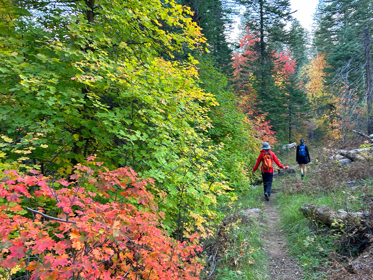
When you get to junction with the See Canyon Trail, make a left and start heading down canyon. The views from this trail on the way down are absolutely the best of the entire journey, so pat yourself on the back for a job well done. You earned these!
At this point in our adventure, the rain clouds started gathering and soon we found ourselves wet and a little bit chilly. It went from feeling like a rainforest to feeling like somewhere in the Pacific Northwest. But did I care? No, because this kind of beauty is rare in my home state of Arizona. I soaked up every drop of it. Get it? Mostly because I had a puffy on and not a rain jacket.
The trail can be a bit rocky and steep toward the top of this trail, but as you get closer to the trailhead, it evens out and becomes more dirt than rock. Thankfully, it’s pretty well defined, so you shouldn’t have much trouble with navigation.
Like at the beginning of the trail, this section features tall trees and dense foliage. We were here in October once, and it was better than any other fall color I’ve seen in Arizona, including the popular aspen forests in Flagstaff.
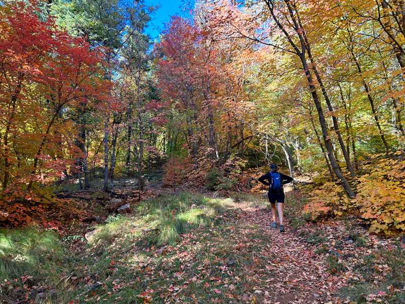
I’m a sucker for the red and orange of the maple leaves, okay? In three months’ time, I’ll be back. See you then?
Map & Directions
Location See Canyon, Tonto National Forest, Payson, Arizona
From Payson, take Highway 260 east toward Heber and Show Low for about 20 miles. Turn left on Christopher Creek Loop and then left again on Forest Road 284 (which is dirt). Follow that to the parking area.
Fees/Passes None
Trailhead Facilities Pit toilets
Recommendations for you
See Canyon | Payson
Horton Creek | Payson
Pine Canyon | Payson
Leave a Reply