Gibbon Mountain
TRAIL STATS
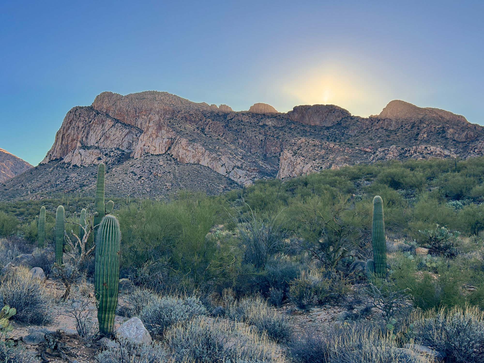
On a hike up to Gibbon Mountain, you’ll experience sweeping views of Tucson, Mount Lemmon, and the Pusch Ridge Wilderness as you follow the southeastern ridge of Bear Canyon. The trail becomes faint and difficult to follow for the last mile up to the peak, so you’ll need good navigation skills and a little bit of grit to obtain the summit. However, the views are outstanding.
Trail Description
Convenient to Tucson, Gibbon Mountain provides a strenuous alternative to neighboring hikes like Pusch Peak and Mount Kimball that are closed during bighorn lambing season. This hike is open year round and offers a great cardio boost and almost constant views into Bear Canyon. Even if you don’t have time or inclination to go all the way to the peak, you can enjoy the beautiful scenery this hike has to offer all along the way.
From the parking area, walk through the opening in the fence and head up the mountain. This part of the trail has obviously seen a lot of traffic, so it’s very easy to follow. As you make your way up onto the ridge, you’ll start to see those great views I promised.
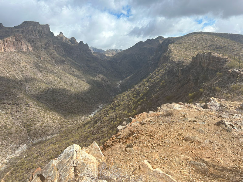
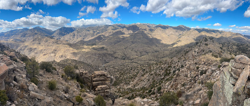
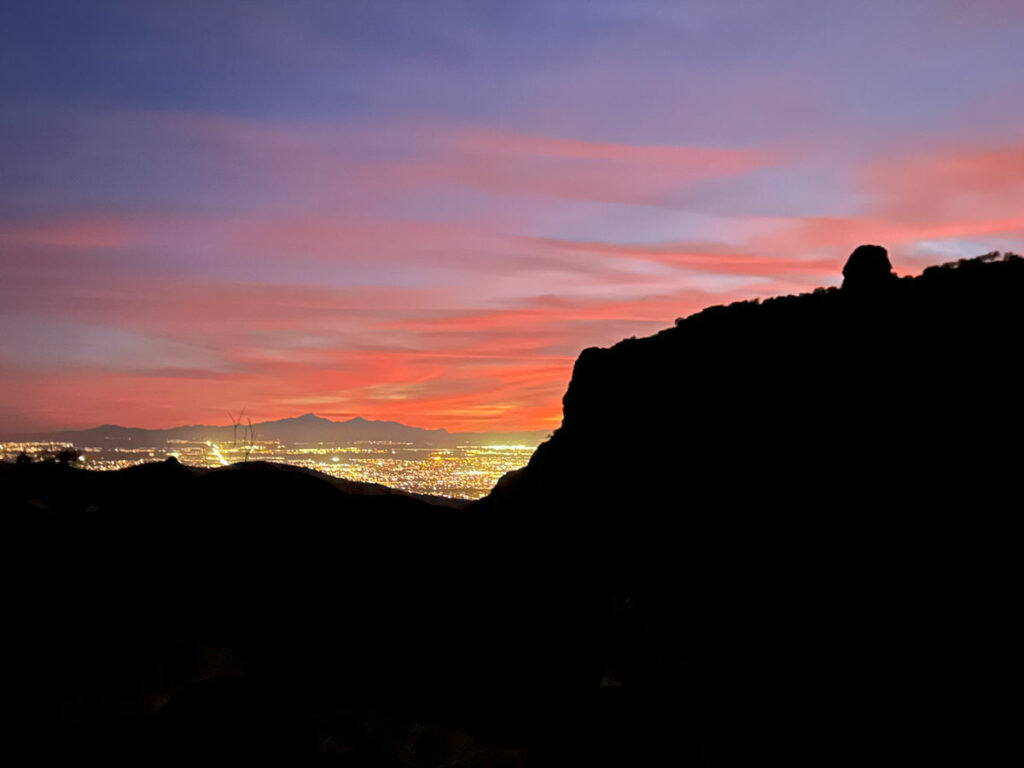
You’ll have a commanding view of Bear Canyon with Blackett’s Ridge across the canyon and Thimble Peak in the distance. Behind you are views of Tucson, which are nice, but would you just look at the mountain? Gorgeous!
The trail steadily gains elevation as it rolls up and down over the hills, and you’ll have plenty of viewpoints off to the side where you can enjoy your progress.
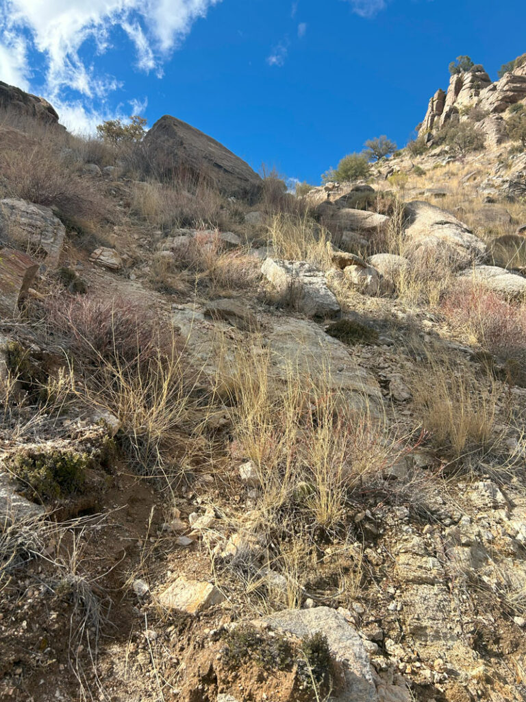
Despite the steady climb, this is the easy part, folks. After about two miles, the trail becomes less traveled and less obvious, but we still found it pretty easy to follow for another mile or so.
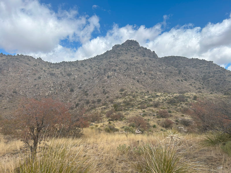
As you approach three miles, you’ll start to see your destination off to the left. Sort of. The true peak is hidden about a half mile or so behind this lower peak.
I figured it’s probably better just to dash your hopes now than to wait until you’re already on the mountain.
Time to Get Real
The trail eventually veers left straight toward the false summit, and I marked the approximate spot as “time to get real” on the map. For starters, the trail becomes extremely faint at this point, and you’re pretty much guaranteed to get off of it occasionally, even while watching your GPS unit constantly.
Which brings me to my disclaimer. I just want you to know I followed that trail as best I could and tried to clean up any mistakes, but it probably isn’t perfect. As you can see, there were times when I went on one path on the way up and another on the way down, and I just left both options because they’ll both get you there. We saw occasional cairns, and we even built a couple, but a lot of this is about following the most likely route while trying to stay on the paths other people have made. If you’re a bit off the GPS track, but it looks like you’re still on a social trail, stick with it. You’ll likely be back on track soon.
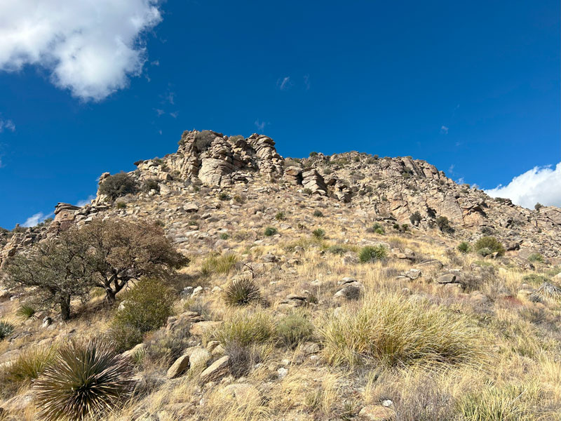
Once the trail veers left, you’ll go down into a low saddle and then begin your ascent up toward the false summit. First, you’ll come to a prominent rocky high point.
Two trails diverge
Here, the AllTrails map is almost useless. At first, we followed a faint trail with cairns as it went up and then curved around the right side of this rocky high point. Our GPS showed that we were off the AllTrails route, but it was a path with cairns. Instead of trusting our instincts, we tried to get back on the AllTrails route, and ended up on the “dumb way.”
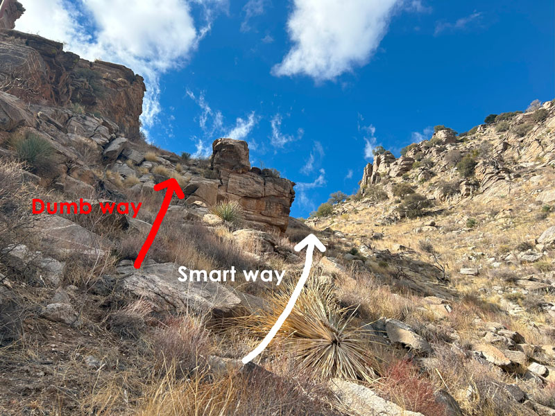
I’m not saying it won’t get you there, but it’s a lot more sketchy than the “smart way.” While trying to figure this part out, we noticed a guy up on the rocks above us asking if we knew how to get to Gibbon Mountain. When we said it was our first time, he said he was turning around because the AllTrails map was so hard to follow. So, go to the smart way, but don’t give up because it gets easier (mostly) after this part. I marked where the AllTrails map and my map split as “two trails diverge.”
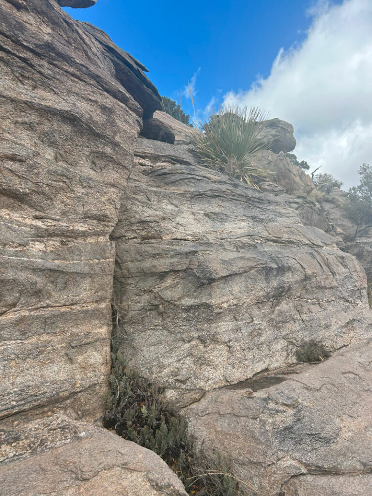
Once you have curved around the right side of the rocky outcropping (shown between the dumb way and the smart way), you’ll have a steep climb up to the saddle.
Let me tell you, this feels a lot more steep on the way down, and you’ll probably want poles to give you some stability.
Rocky Terrace
At the saddle, you’ll go right toward the next rocky high point, marked as “rocky terrace” on my map. When you get close to the top, you might wonder how you’re getting up there. The AllTrails route takes you on a pretty direct route, and we took that route on our way down.
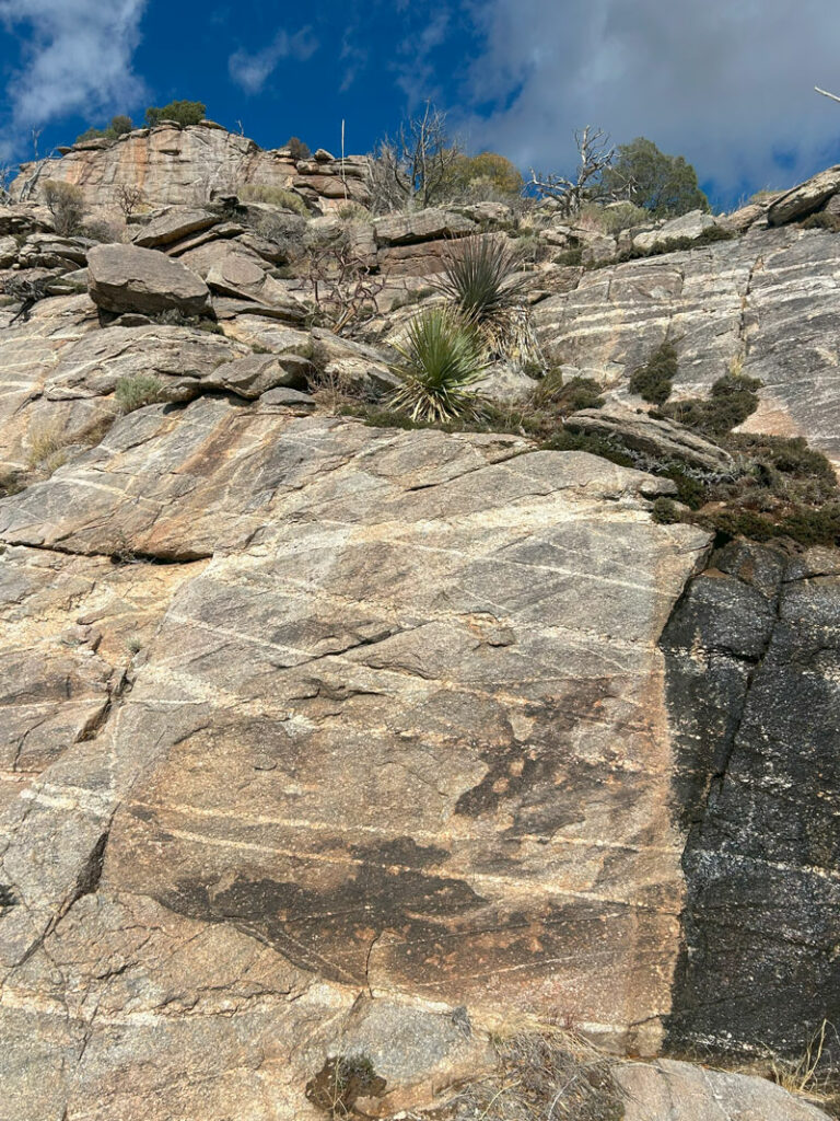
If that seems a bit too sketchy for you, try the route I took on the way up by swinging wide to go around the right side until you find a chute you can go up. There’s a tree at the top to let you know you’re on the right path. If you choose this way, you will have an easy scramble up this slab.
This way did not feel too sketchy, but be careful with your hand placement since I grabbed onto a flake of rock that broke off.
And that’s it! Once you gain the top of this rocky terrace, you’re past all the tricky spots.
There was a ginormous cairn at the top of the false summit, and you can stop there if you’ve had enough. But the peak is so close!! And the rest of the hike is pretty easy. Come on, now… you gotta!
The Summit
It’s mostly flat as you continue another half mile to the true peak of Gibbon Mountain. The trail is faint, but you can stay on it most of the time. If you get off trail, just continue in the direction of the summit, and you’ll connect back up with it again. Don’t sweat getting this part exactly right.
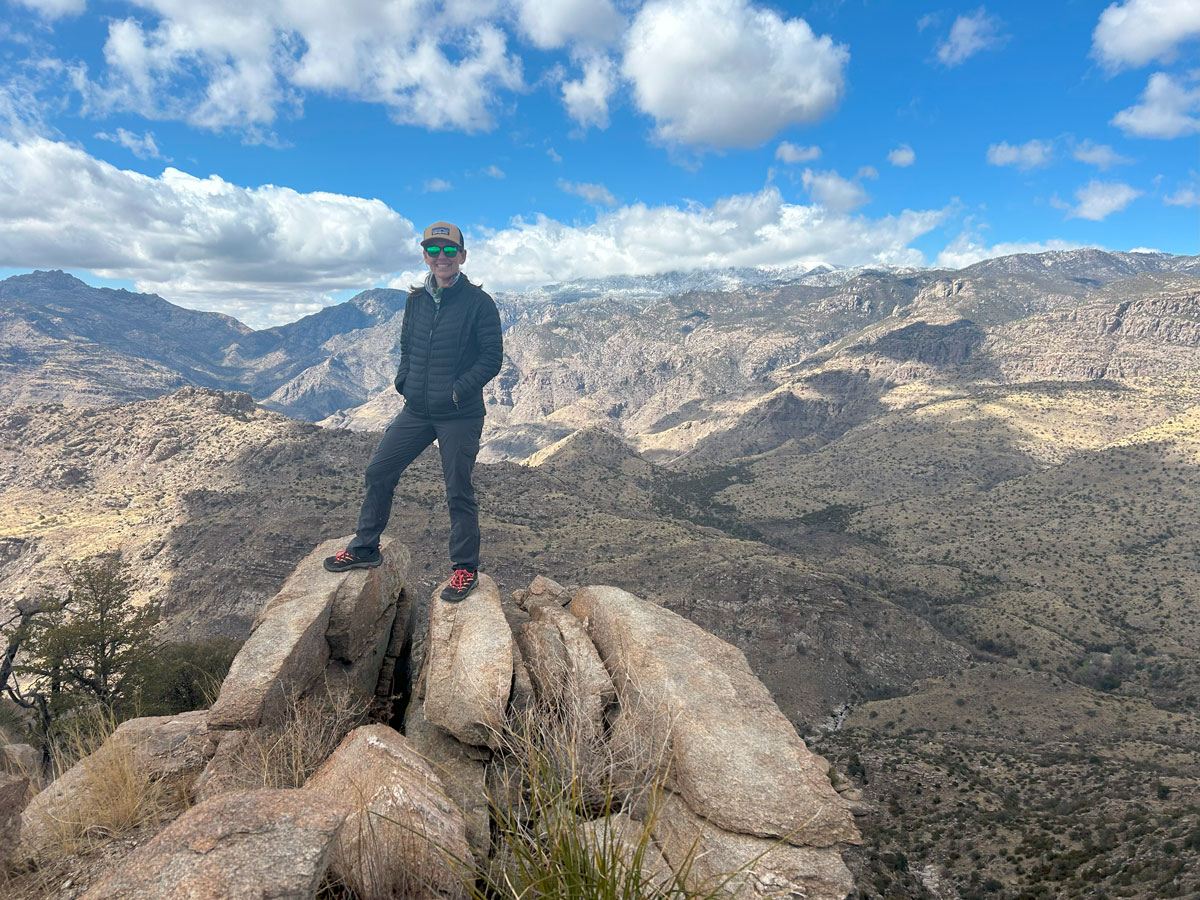
Now for the best part. The top!
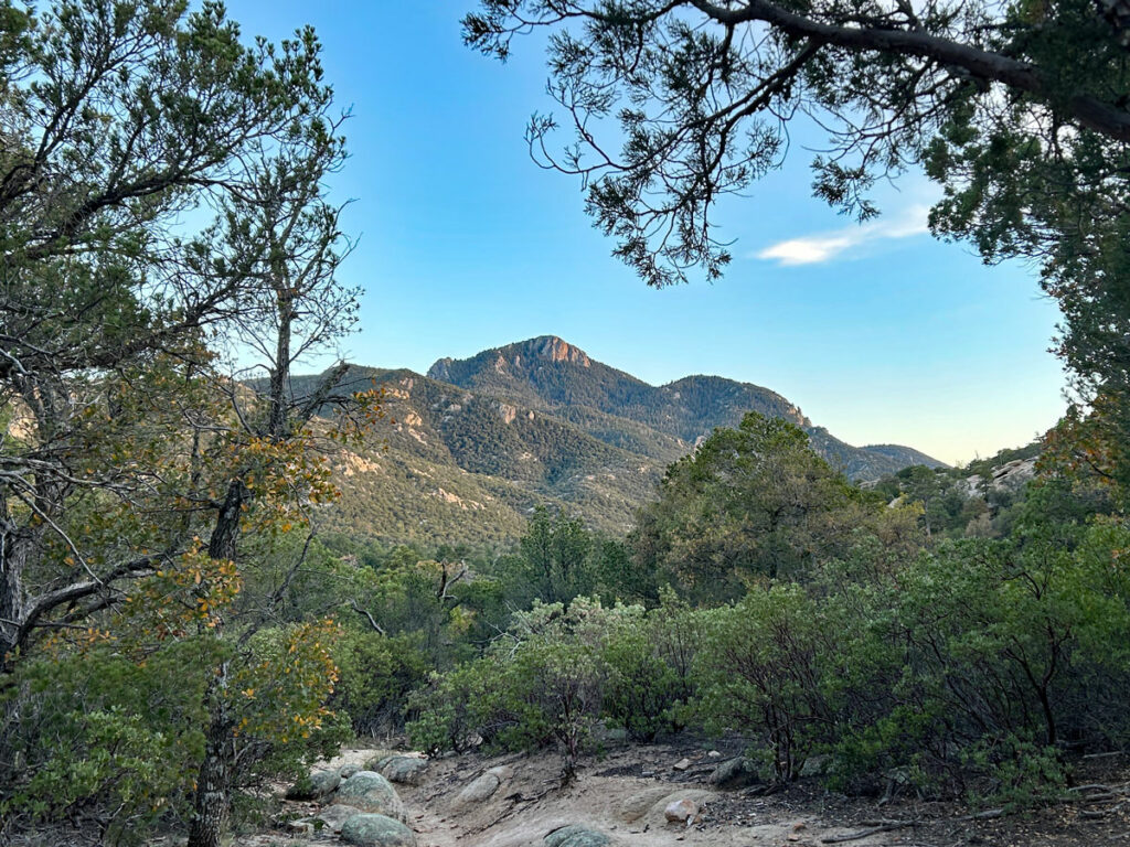
The views were absolutely amazing. You have Mount Lemmon in the distance, a great panoramic view of the Pusch Ridge Wilderness, and even views all the way to the RIncon and Santa Rita mountains. Maybe some of Tucson, too, but who cares about that?
Alternate Route
There is apparently a route to Gibbon Mountain from the Gordon Hirabayashi Campground that is much shorter and has a lot less elevation gain. We have not tried this route yet, but if you do, please comment and let us know how it went!
Map & Directions
Location Pusch Ridge Wilderness, Tucson, Arizona
Google Maps Bowes Road Trailhead
The trailhead is very small and can only fit about 3 cars on a dirt pullout.
Fees/Passes None
Trailhead Facilities None
Recommendations for you
Pusch Peak | Tucson
Thimble Peak | Tucson
Rincon Peak | Saguaro National Park
Leave a Reply