Rincon Peak
TRAIL STATS
Rincon Peak rises to an elevation of over 8400 feet, providing a welcome reprieve from the heat of the desert below. Although it is located in Saguaro National Park, you won’t see any saguaros here. Instead, you’ll find towering ponderosa pines, ancient juniper trees, pleasant creeks, and incredible views at the top. All this comes at a price, though, since you’ll be ascending over 4500 feet to the summit, with the last mile being particularly steep.
Trail Description
To get to the trailhead, you’ll drive north on Mescal Road, which is well-graded dirt. The only tricky part is there are several creek crossings along the way, some of which are kind of soft on the bottom. We were happy to be in our high clearance 4×4, but there was a Honda Civic at the trailhead (props, guys!).

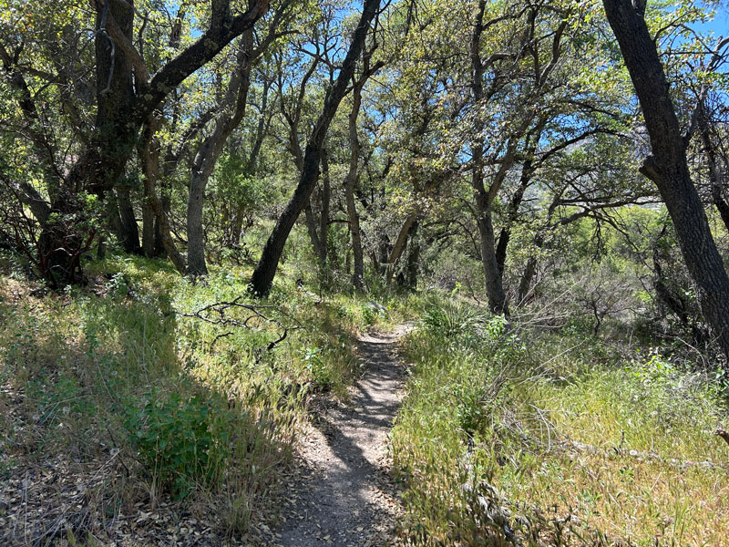
Miller Creek Trail
From the trailhead, you’ll enter a gate (close and latch it behind you!) and pass by some cows giving you dirty looks. The first mile and a half is mostly flat as it follows a lovely creek, shaded by large trees.
Don’t let the beauty and serenity of this area lull you into a false sense of security. That elevation gain has to come from somewhere, and all the flat spots are just making the rest more steep. Don’t let me ruin it for you, though. Enjoy.
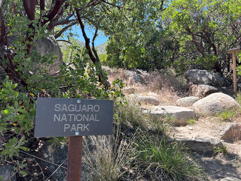
When you come to the gate marking the entrance to Saguaro National Park, you’ll know your walk in the park is over. It’s time to start going up.
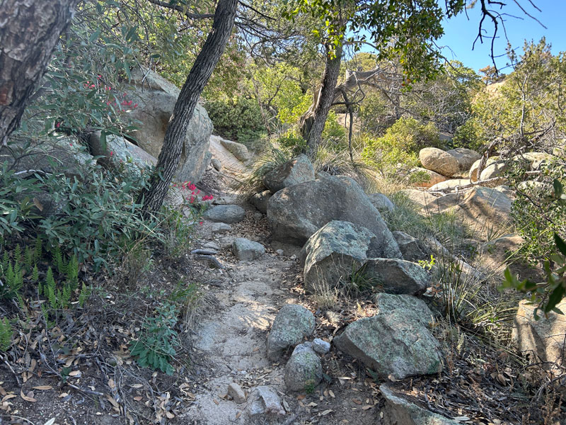
This next section consists of solid rock and gravelly terrain with large boulders. There’s a lot of stepping up required (which means a lot of stepping down on the way back). Any time the trail disappears onto rock, look for cairns to guide the way. Though this part is more exposed to the sun, there are still enough small trees that you can find shade easily.
If there is water along this trail, which is only available seasonally, you’ll find a couple places where you might be able to collect some. I marked some of the water crossings I saw on the map. If you find water there, you will likely be able to find more water at the top by the campground, too. If you don’t. Well, I hope you brought a lot.
When the switchbacks become relentless, take heart. The trail will soon make a big turn to the left where you’ll find yourself hiking up the final shady canyon to the saddle.
If you happened to consult Google Maps for directions to the Happy Valley Campground, you can just throw that information in the trash bin and keep going. You’re not there yet.
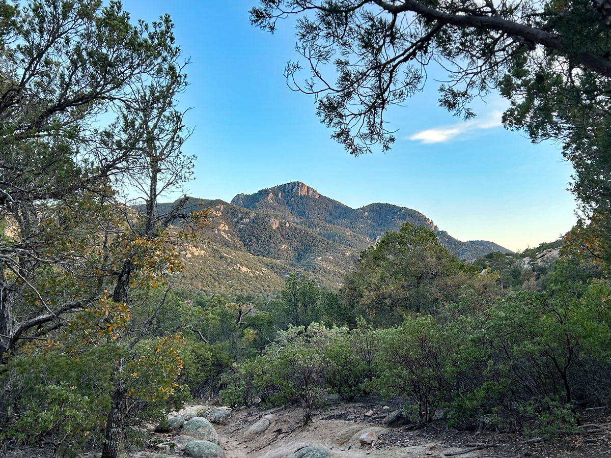
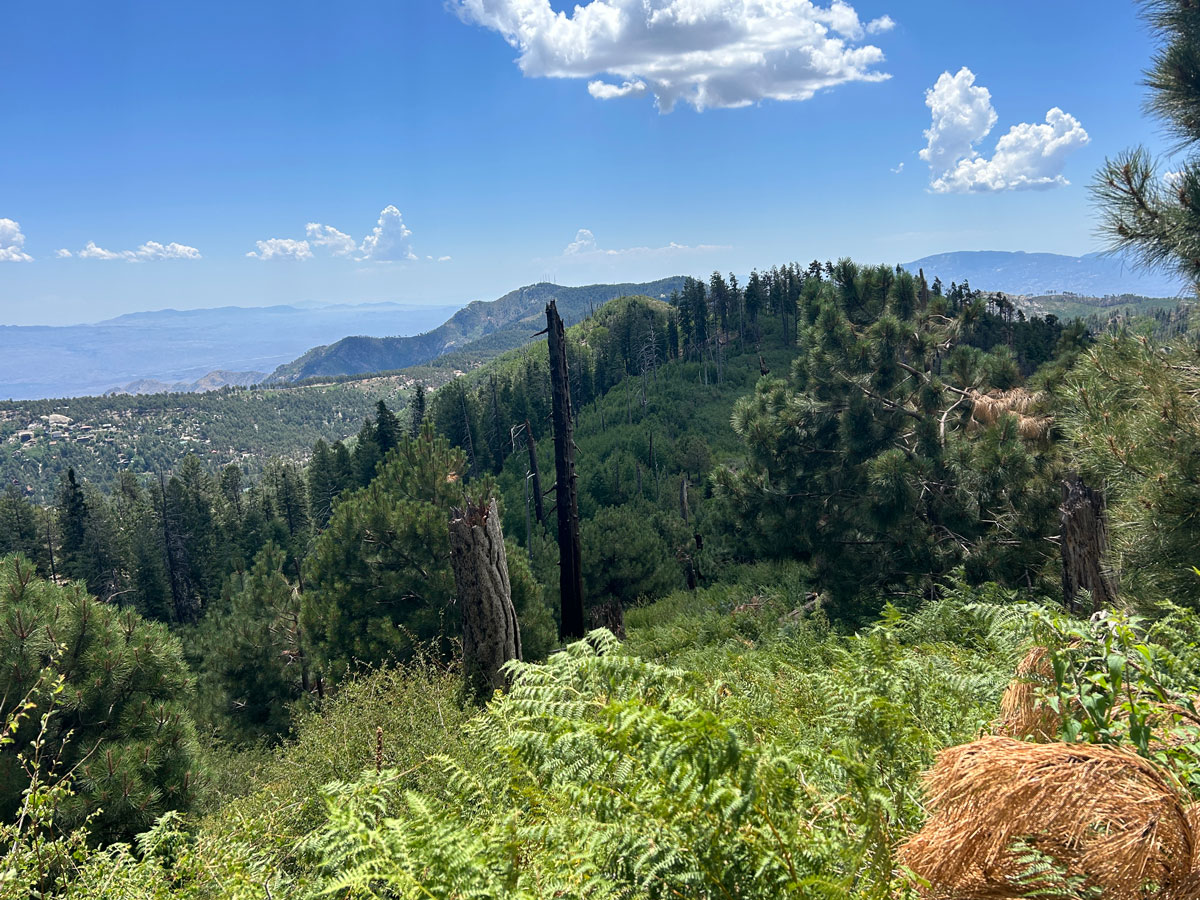
When you arrive atop the saddle, you’ll be able to get a glimpse of Rincon Peak in the distance (the cover photo). The trees get markedly larger here, and the trail flattens out. It’s a nice break.
Rincon Creek Trail
Ahead is a trail junction, and you’ll take Rincon Creek Trail to the left. In less than a quarter mile from there, you’ll arrive at Happy Valley Campground (more details about camping at the end of the post).
So pretty, right?
This trail follows a creek bed, and it may appear dry when you were expecting water. According to the Park Service, the creek runs underground in this area, so just keep following it until it gets to a rocky spot where the water comes to the surface. When we went, the pools were pretty mossy, but I found a spot where the water was tumbling down a rock that would be a decent place to collect it.
Enjoy this area. Drink deeply from the fountain of life. Things are about to get real.
Rincon Peak Trail
Watch for another marked junction where you will turn onto Rincon Peak Trail. From here, the trail starts getting steeper, but don’t make the mistake of saying, “I think we found the steep part.” I mean, yes it’s steeper, but you’re not yet at “the steep part.”
The good news is you’ve only got three miles left. The bad news is the trail is a bit less maintained here, and you’ll be climbing over some major logs.
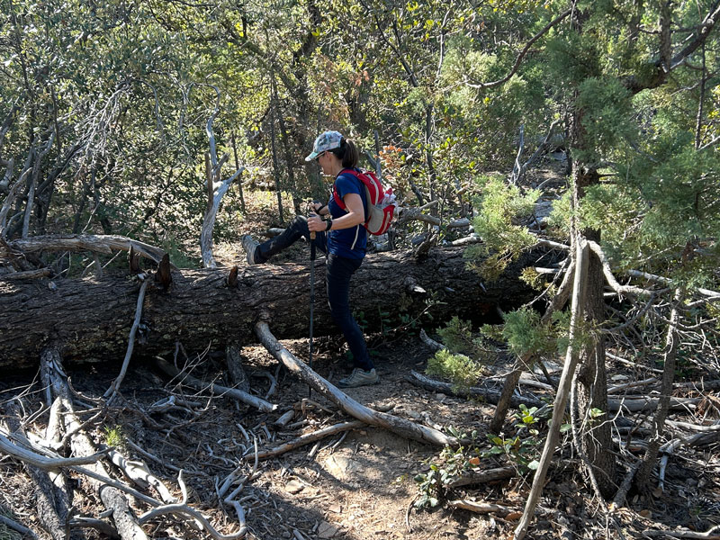
It’s not too bad, and it’s definitely not bad enough to make you wish you never came. I mean, “the steep part” is still ahead, so there are other things out there to make you wish you never came.
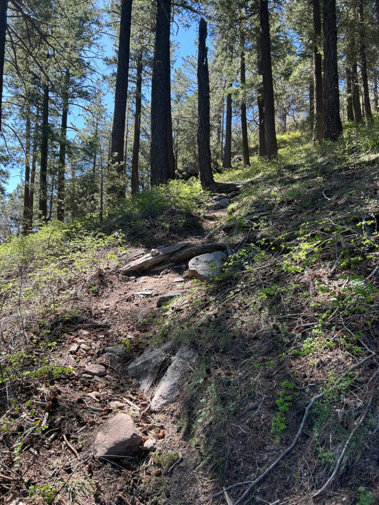
“The Steep Part”
Now I don’t know why, but it’s near impossible to capture a photograph that really shows just how steep it gets toward the end. But I took my best shot.
If you’ve come this far, you have to suck it up and finish. Unless it’s winter and icy—then I’ll cut you some slack. There are trail markers on the trees for when there is snow on the ground, but I can’t imagine how sketchy this would be in wintry conditions. Props to those who attempt it!
Eventually it will start to look like you’re going to run out of things to climb up. For some reason, though, this trail really drags out the final push to the summit. “We’re there! Oh wait, no.” Repeat.
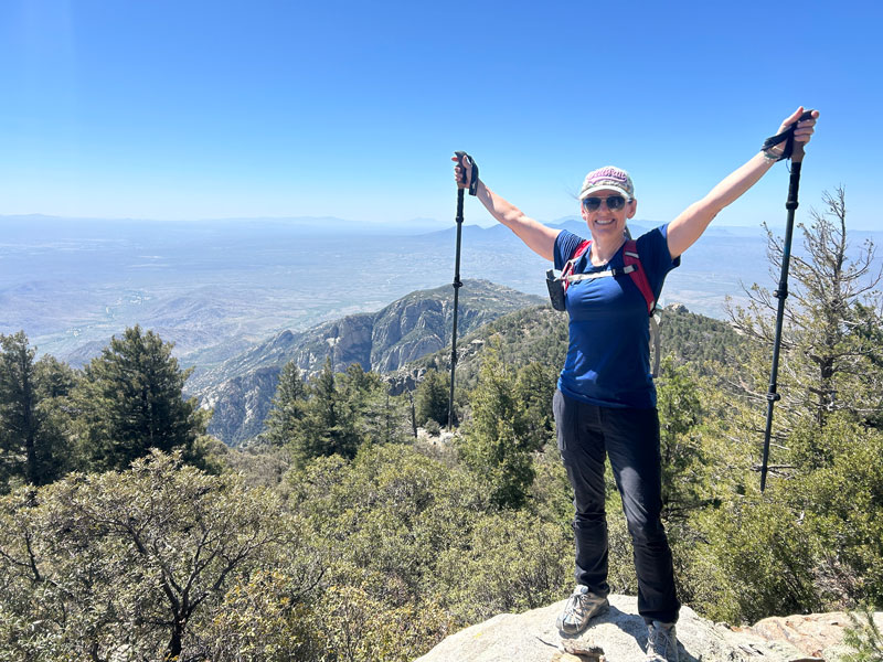
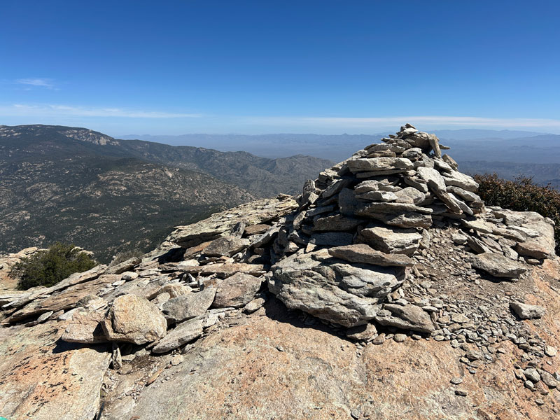
You are not there until you see this ridiculously huge cairn. Even if it’s been knocked over, there will be a load of loose rocks there to let you know you’re there.
The views from up there are grand, but it was windy, so I was happy I brought my puffy.
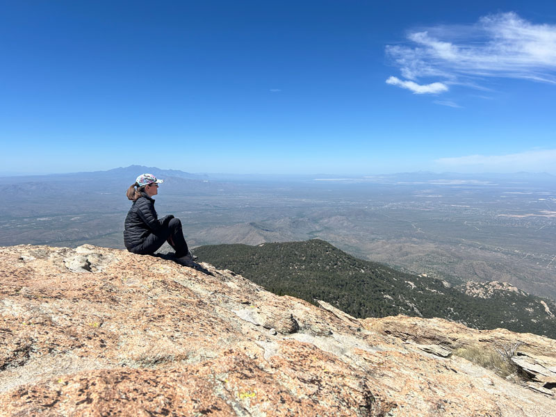
The peak area is rather large, so I recommend taking some time to explore the different viewpoints. I spend at least 15 minutes observing the large birds circling the peak, hoping they weren’t vultures who knew something I didn’t. (I really need bird identification lessons because I feel like I’m destined to be a bird nerd one day.)
All right, that was really cool, but you’re only halfway there. The descent is long, and you’ll swear that more boulder steps were somehow added while you were gone. Poles really helped, especially going down “the steep part.”
Overnight Camping
Although strong hikers can do this as a day hike, you can also do it as a backpacking trip. Since it’s within Saguaro National Park, you will need a permit to camp anywhere within the park boundaries, and camping is only allowed at designated campgrounds.
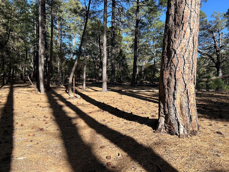
Happy Valley Campground
The campground is actually surprisingly beautiful with the tall ponderosa pines. There is a toilet, which I did not check out, and three campsites, each marked with a sign.
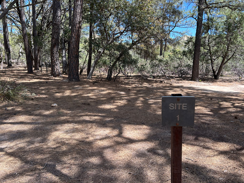
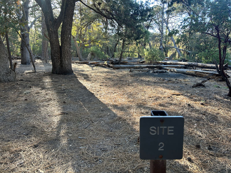
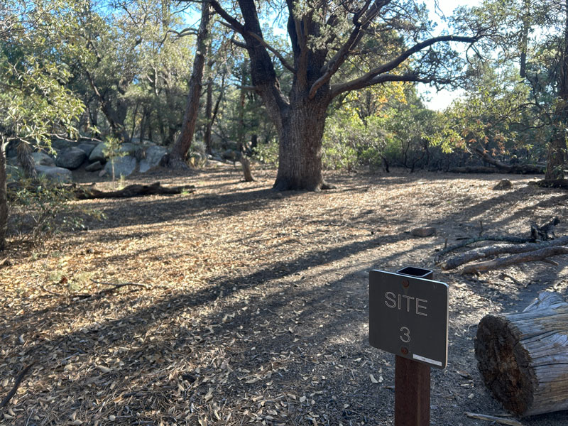
We stayed at campsite 2 because it was the only one left, which means we had to beg for space in the bear box from our neighbor (she was nice). We quickly realized that site 3 is the one to snag if you can. It’s the most secluded, prettiest, and has a bear box.
Go to Recreation.gov to buy your permit.
Map & Directions
Location Saguaro National Park, Tucson, Arizona
Google Maps Miller Creek Trailhead
Fees/Passes There is no fee at the Miller Creek Trailhead, but most of this hike is within Saguaro National Park, which requires a fee or an America the Beautiful Pass to enter by foot. The trailhead does not have a pay station. In addition, if you are backpacking, you need a permit from Recreation.gov to camp.
Trailhead Facilities None
Recommendations for you
Lemmon Loop | Mount Lemmon
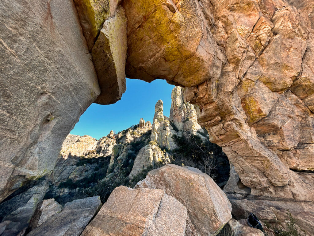
The Window | Tucson
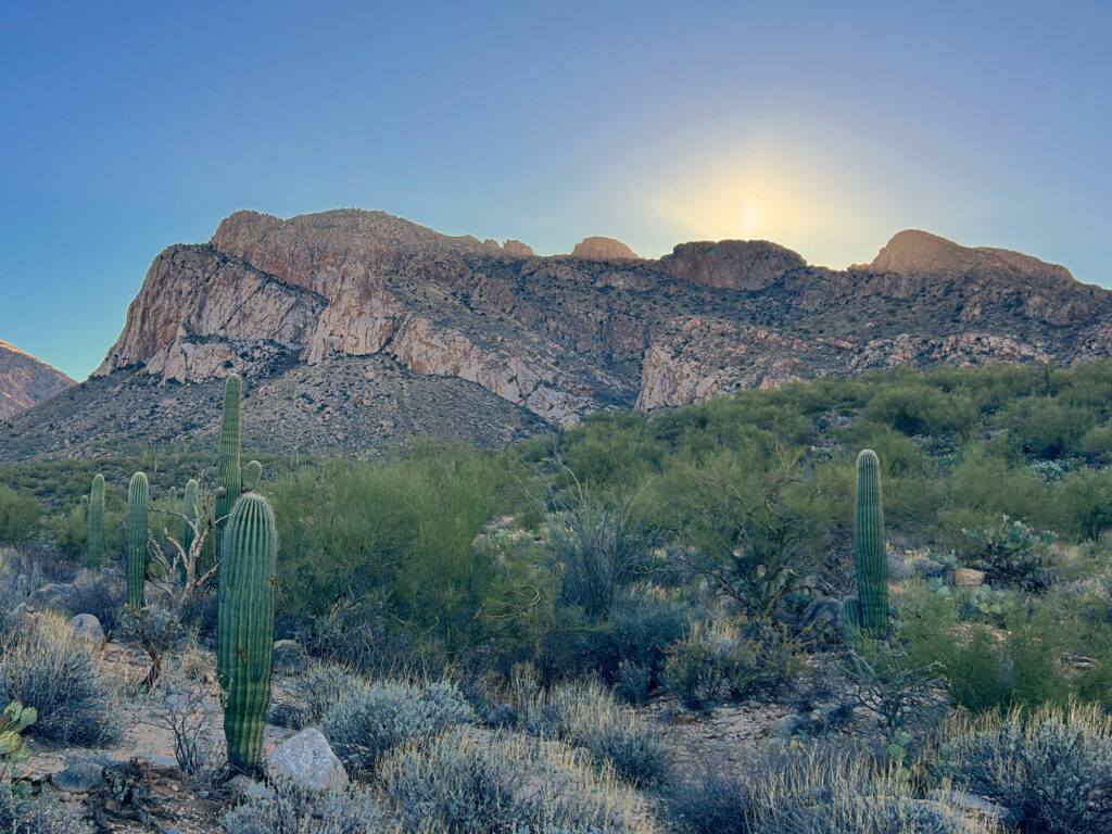
Pusch Peak | Tucson
Leave a Reply