Governors Peak
TRAIL STATS
From atop Governors Peak, you’ll enjoy panoramic views of the Hells Canyon Wilderness and Lake Pleasant. This hike gets steep toward the end as you approach the peak, but the abundant saguaro cactuses and wildflowers in spring make for a pleasant journey.
Trail Description
The road out to Castle Creek Trailhead is maintained and passable in any car. There is room for about two cars just after the guard rail, but those with high clearance can get just a bit closer by taking the first left and following it to a small clearing. If you miss the first left and take the second left, you will end up driving in the creek bed instead. Don’t ask how I know.
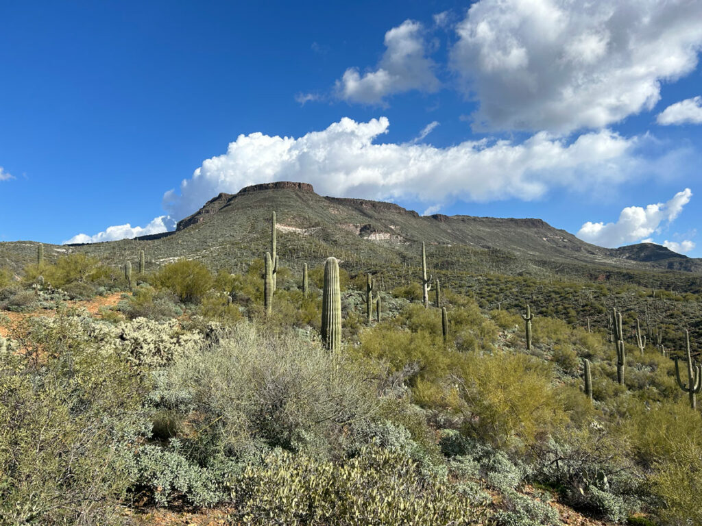
Governors Peak Trail
From the parking area, cross the wash and pick up the trail on the other side. You’ll see a trail register if you’re in the right place. From here, the trail can be quite confusing at times, but keep an eye out for the enormous cairns that mark the way.
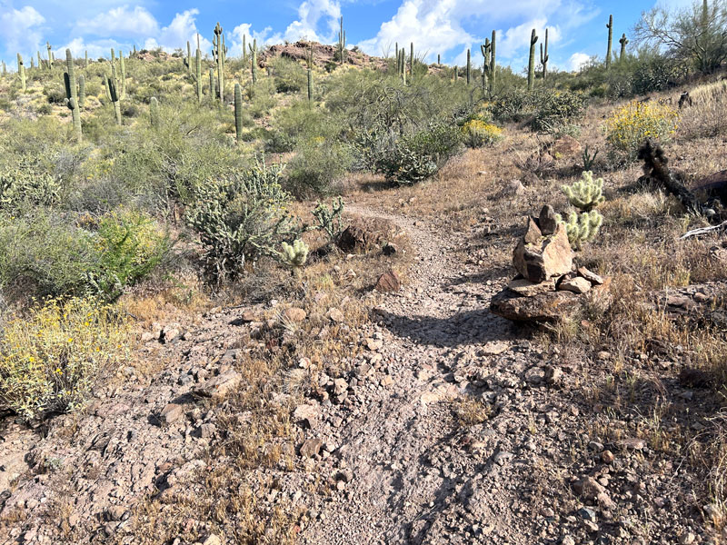
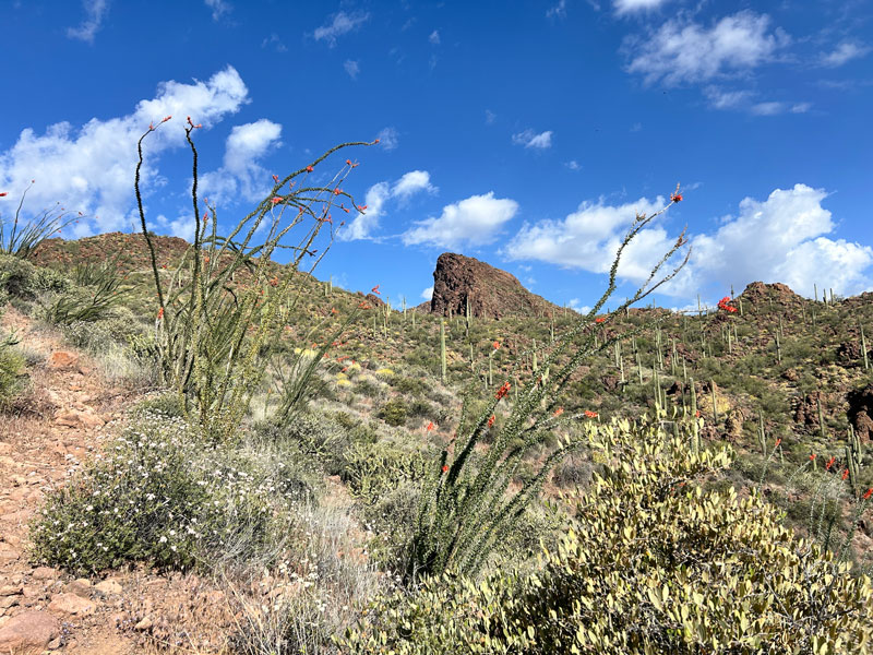
The trail starts out with a gentle incline, wandering through pretty desert with lots of saguaro cactuses and ocotillo plants. At the one major fork where both ways are marked with those enormous cairns, go right.
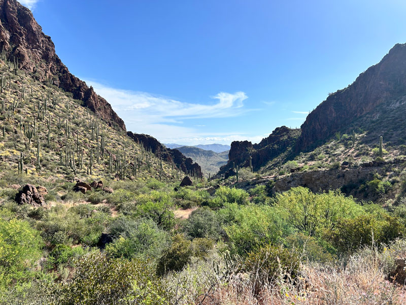
After going over a small saddle, you’ll go down for a short distance while enjoying beautiful views down the canyon. We found a little desert tortoise there, so keep an eye out!
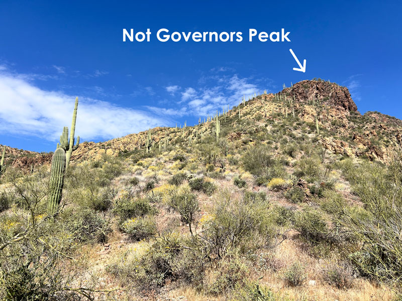
Beyond this point, the trail becomes steeper, and you’ll be huffing and puffing the rest of the way to the peak. Up ahead, you’ll see an obvious peak that you would have been hoping is Governors Peak. That is, if I hadn’t dashed your hopes right here and now. Governors Peak lies just a short ways beyond it, though, so don’t lose hope completely.
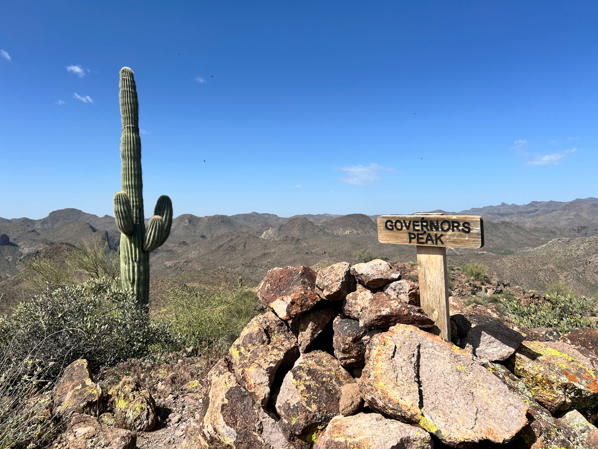
Governors Peak Summit
You’ll pass by the left side of the false summit and then do a few little switchbacks as you make your way up to the rocky peak. The trail was not obvious toward the very end, so we ended up going up one way and down a different way, but either way works.
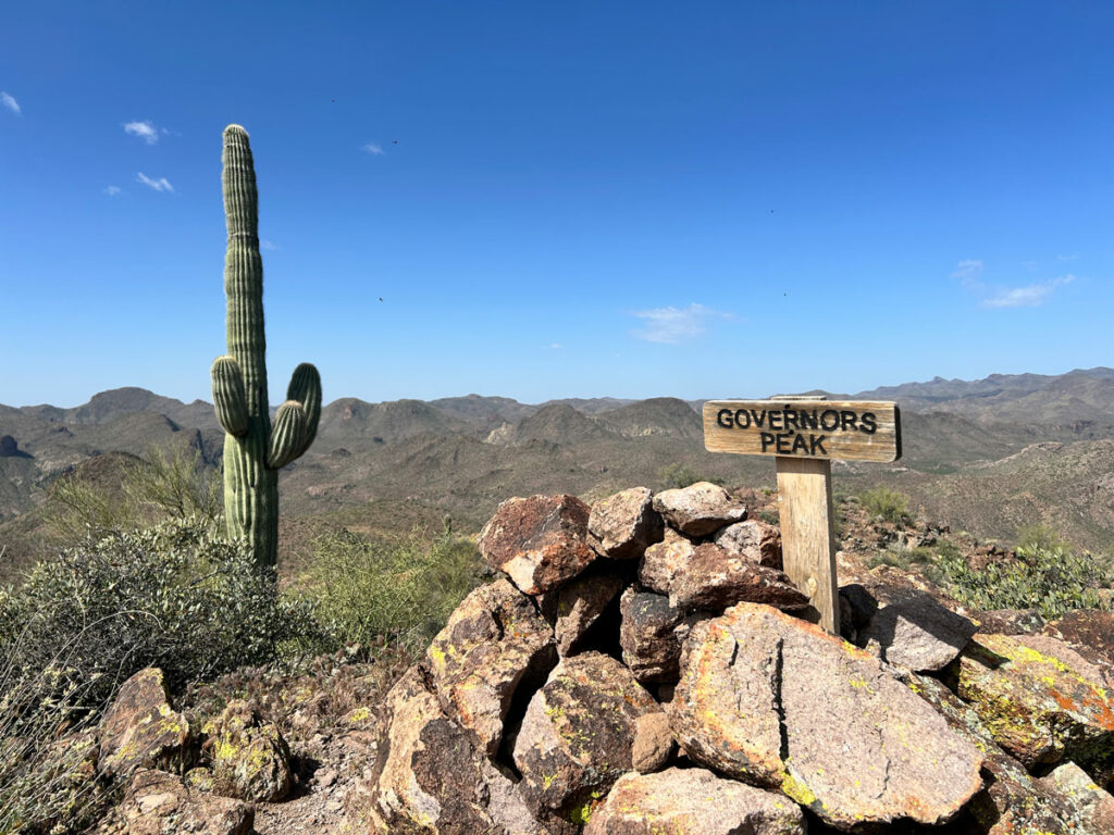
There’s a little wooden sign at the top to let you know you’ve made it!
The piece of rusty metal up there might look like garbage, but if you lift it up, you’ll find a scrappy little trail register in a jar underneath.
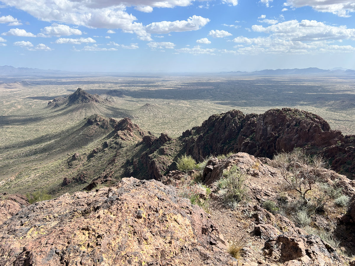
From the summit, you can see the Castle Hot Springs resort, a little bit of Lake Pleasant, and the Hells Canyon Wilderness to the southwest.
Map & Directions
Location Hells Canyon Wilderness, Wickenburg, Arizona
Castle Creek Trailhead on Google Maps.
Fees/Passes None
Trailhead Facilities None
Recommendations for you
Vulture Peak | Wickenburg
Granite Mountain Hotshots | Wickenburg
Skull Mesa | Cave Creek
Leave a Reply