Granite Mountain Hotshots
TRAIL STATS
On June 30, 2013, the Granite Mountain Hotshots answered the call to fight the Yarnell Hill Fire that was threatening the surrounding communities. When changing winds advanced the fire unexpectedly toward their position, 19 courageous firefighters lost their lives that day. This trail features memorials for each of the Hotshots, an observation area overlooking the site of the fire, a tribute wall, and a memorial at the fatality site. The trail is well-maintained and thoughtfully designed, providing a solemn experience you won’t soon forget.
Trail Description
The Granite Mountain Hotshots Memorial Park is right off of the highway and features memorial plaques for each Hotshot and a bronze statue, so it’s worth a stop even for those not looking to hike. A ranger should be on site to answer any questions, and (clean) portable toilets are available. Grab a paper map before heading down the trail so you can see where each memorial is and track your progress along the way.
Hotshots Trail
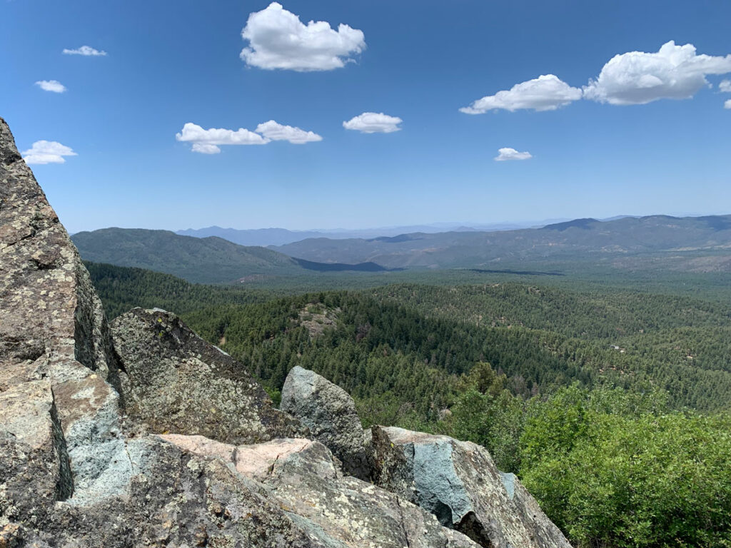
From the parking area, you’ll head up a flight of stairs to begin the trail. It’s a well-maintained, moderate trail with plenty of switchbacks as you make your way up the mountain. Every 600 feet or so, there’s a plaque memorializing one of the Hotshots.

We stopped to read each one and look at the mementos left behind, so even though you’re going uphill, there are plenty of stops and switchbacks to break it up.
We asked the ranger if there was any shade along the way, and he told us there wasn’t, but in reality there are five resting places with benches and shade.
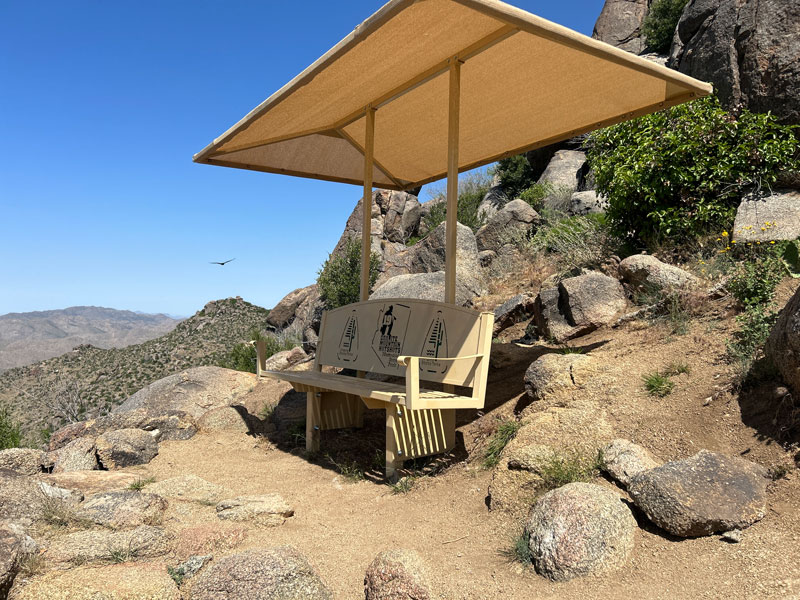
Each provides a decent view.

After about two miles, the trail begins to flatten out as it passes the last of the memorial plaques and heads over to the observation area.
Observation Deck and Tribute Wall
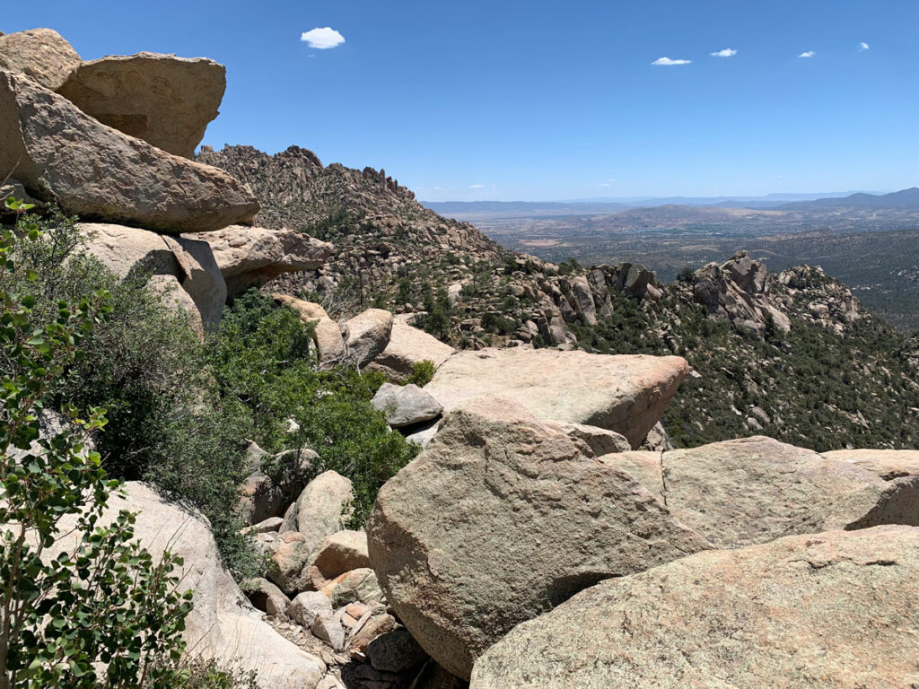
The Hotshots Trail ends at an observation deck with signs describing the Yarnell Hill Fire events leading up to the tragedy. From there, you can see the fatality site 400 feet below you and the town of Yarnell to the east.
Firefighters come from all over the world to pay tribute to the Granite Mountain Hotshots and leave mementos on the tribute wall.

Some less respectful people also added unrelated stickers, but we felt it was inappropriate to leave anything that was not a tribute to the fallen Hotshots.
Journey Trail
From here, you have the option to hike down the Journey Trail to the fatality site. This route roughly follows the final journey the Granite Mountain Hotshots took before losing their lives in the fire. It’s definitely a somber experience and well worth your effort.
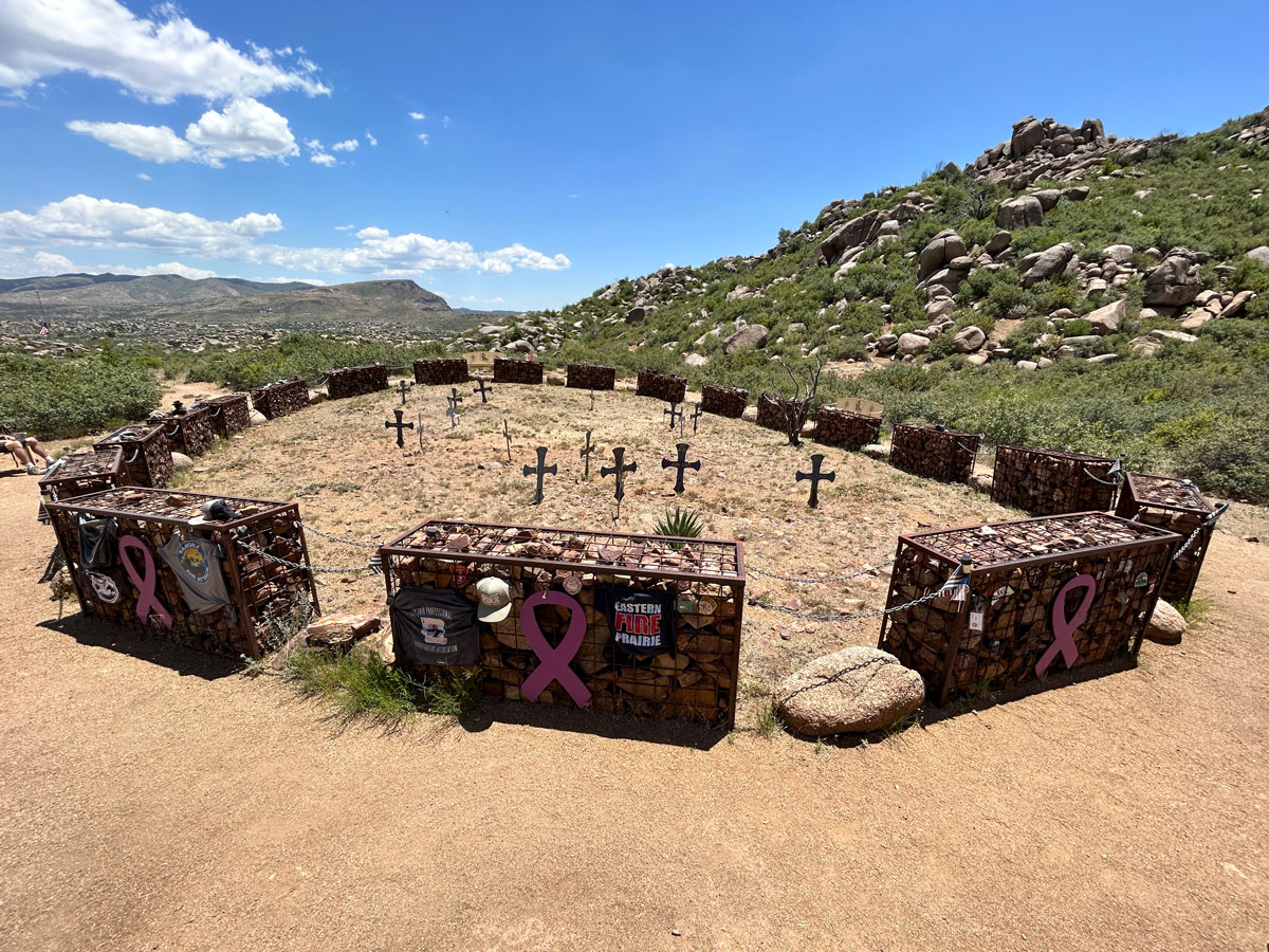
Fatality Site
The Journey Trail leads to a memorial that consists of 19 gabions, one for each Hotshot, connected together with chains. The place where each Hotshot fell is marked with a cross bearing his name. This is hallowed ground, and as such, you should remain outside the circle and keep your activities respectful.

A little bit farther off, you can visit a flag that remains at half mast.
Gone, but Not Forgotten
The whole experience on this trail is very moving, and you can tell a lot of effort has been put into maintaining this site and making it into a worthy memorial for these 19 men.

I left with great appreciation for the sacrifices made by the Granite Mountain Hotshots and those made by other first responders and their families every day.
Thank you!
Map & Directions
Location Granite Mountain Hotshots Memorial State Park, Yarnell, Arizona
From Wickenburg, Take Highway 60 west to Highway 89 north. On highway 89, there will be a sign marking the left turn for the Granite Mountain Hotshots Memorial. This short connector road takes you to the southbound lanes where you will re-enter the highway and follow it to the memorial parking area on the right. There are signs all along the way, so you won’t miss it. Be aware parking is limited.
Fees/Passes None
Trailhead Facilities Portable toilets
Preview this Hike
Recommendations for you
Granite Mountain | Prescott
Spruce Mountain | Prescott
Loy Canyon | Sedona
Leave a Reply