Maiden Falls
TRAIL STATS
One of the many gems in West Clear Creek, Maiden Falls cannot be adequately described in words or photographs. A tranquil pool above feeds the falls, flowing along a twisting watercourse before tumbling down a wall painted in a kaleidoscope of colors. To get here, you’ll have to brave the rough road, the boulder hopping, the swims, and the strenuous exit hike. It ain’t no joke hiking out of here. Allow as much daylight as you can, or consider backpacking it to make the most of your time. Backpackers can experience the splendor in the golden hour where fading light sets the red rock canyon aglow.
Trail Description
Reading reviews of Maiden Falls (aka Indian Maiden Falls) made me think the trail must be treacherous, hard to follow, and basically a piece of junk. Happily, I thought the trail from the rim down into West Clear Creek was surprisingly good! Sure, it was steep and loose at times, but it’s actually an official Forest Service trail most of the way down, and it’s clear some maintenance has been done. That is to say, I’ve had worse. Much worse (I’m looking at you, Frog Tanks Trail).
As with most things, it depends on your experience. It’s not “easy.” It can be hot, and that fact will be all too apparent when you are climbing out at the end. If you don’t hike much, you could definitely find it quite challenging and maybe even unpleasant. The trail register at the trailhead was filled with comments like, “We almost died,” and “NOOOO!” Hiker beware. It’s not a good trail for beginners, and it only gets more physically demanding when you get to the creek and have to scramble, leap, duck, and swim your way to Maiden Falls.
The mileage can also be deceiving. Technically, it’s about 7 miles round trip, but with all the obstacles, creek crossings, and route finding, it’s easy for the extra distance to add up. Plus, the section along the creek is VERY slow going, like less than a mile an hour. Five hours each way is a good starting estimate, plus time at the falls.
Forest Road 214A
Now, a little about the road in. Almost any vehicle can make it to within a mile of the trailhead. Once you turn on 214A, it’s a different story. You’ll want high clearance for sure and possibly 4WD. We had both of those, but elected to walk most of the last mile just to avoid unnecessary wear and tear on the vehicle (yes, my Bronco-driving friend did not let me hear the end of it). The road has a lot of large boulders, and you’ll be crawling along at hiking speed a lot of the time anyway, so it won’t save you much time. But for my off-road fans out there, have fun with it! It’s definitely doable with the right vehicle.
West Clear Creek Trail #17
The trail starts out mostly flat as it takes you toward the edge of the canyon. Once you arrive at the rim, it’s down, down, down. There are a lot of loose rocks, so poles can be useful. You’ll be slipping and sliding with things like “oooh,” “ahh,” “eee,” and maybe even a curse word coming out of your mouth. We’ll just let you guess which one.
This first part takes you down toward a subdrainage, trending slowly toward the creek to your right. This part is not too bad. That is, until you have to start going up for a while. It seems counterproductive, but save your proverbial brakes for when the downhill resumes ahead.
Soon you’ll find yourself with sweeping views as you travel high along the side of the canyon. From here, the creek still looks SO far away. Remember this for the hike back. Things seem even farther away when you’re going uphill. Hotter. Steeper. Sunnier. Just all the bad things. Do not hike down anything you’re not willing (and able) to hike up.
Right before you get to West Clear Creek, there’s a fork in the trail. The fork to the right continues along West Clear Creek to Bull Pen, but you’ll be going left. A little farther down, the trail turns left to go around a drainage, but there’s also a trail going straight down into it. Our GPS showed the left route, so we followed it even though it had a lot of rocks blocking the path. “What do they know?” we thought. Well, turns out they know a lot. We followed the trail left, and when it turned back toward the creek, it quickly disappeared into a sketchy, washed out, treacherous cliff that looked ready to break our necks. So, we went back and apologized to the person who put those rocks across the trail. “You were right.”
“But I also hate you right now because this is steep and sketchy.” At least it’s short. We marked the spot where you’ll go down into the drainage on the map.
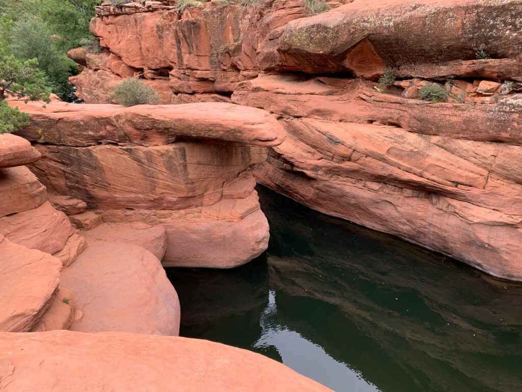
West Clear Creek
Soon, you’ll find yourself on the banks of beautiful West Clear Creek on a huge rock bench with some shade nearby.
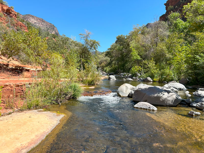
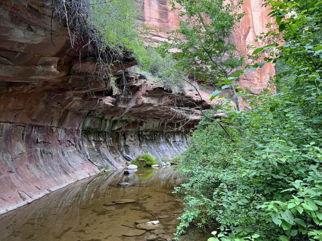
From here, the trail is mostly non-existent. It’s your standard creek hiking fare. Follow one side of the creek as far as you can, pushing through bushes, ducking under fallen logs, and climbing over log jams along the way. Then when that side gets too miserable or becomes a sheer cliff face, find a great spot to hop across boulders to the other side. Poles are useful to keep you steady, especially in the water.
Most of the time, you’ll be walking along the shore. Occasionally, you’ll be crossing. There’s no “right” path to do this, but I can say we were able to keep our feet dry all the way up until the first required swim (marked on the map), which is about a quarter mile from Maiden Falls. With big packs on. Yeah, we’re talented like that.
Now, you know you’ll have to swim eventually, so you could just give in right away and trudge through water instead of balancing on boulders. It might save a little time looking for the best place to cross.
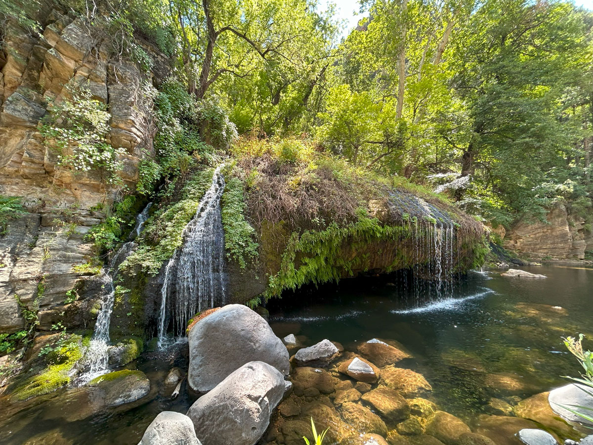
With all the fancy footwork you’ll be required to do, you can sometimes miss the beautiful things of this place while watching your step. Be sure to stop and take it all in. Maiden Falls or not, West Clear Creek is absolutely gorgeous.
Swimming Section
Just a quarter mile before Maiden Falls, you’ll come to the first swimmer. The canyon’s beauty is about to be multiplied from this point forward.
A note for backpackers At this point, we had a choice to make. Swim our packs to camp at the falls, which would necessitate another swim in the morning, or drop them here and return to make camp. We weighed the pros and cons, but in the end decided to keep our packs dry and avoid a morning swim. Your preference may vary, but we didn’t see any stellar campsites at the falls, and we were perfectly happy with our choice in the end (except for the spiders…).
You’ll be swimming upstream as you go, and at the end of the swimmer, you’ll come to some cascading falls. Find the best spot to climb up the boulder field to continue beyond.
There are a couple more swimmers after that, but none as long as the first. When you see a boulder tunnel, get excited! Maiden Falls is about to come into view on the other side!
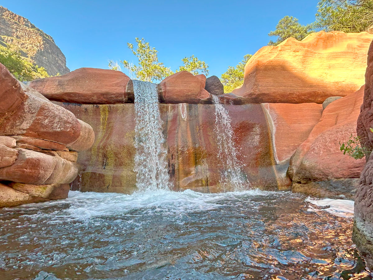
Maiden Falls
No, it’s not AI. No, your eyes aren’t deceiving you. They are real, and they are better than any picture can capture.
I mean, I tried my best. From the pictures I’ve seen on the internet, I thought they were a lot smaller and unimpressive. Wrong. A giant pool below Maiden Falls gives you a great opportunity to get up close and personal to the power.
You brought your floatie, right? (AND you’re hiking it out, right?!?!) As you float up closer, it’s gonna take all your toe strength to grab onto the wall and keep your tube anywhere near the waterfalls.
You can climb up and around to get a topside view of the falls (highly recommended). From up there, you can see the path the water takes from the pool above down to the waterfall.
On your way back, you’ll see all the beauty again from a new perspective. Backpackers might be lucky enough to catch the golden sunlight setting the canyon walls aglow.
Camping
We didn’t see any stellar campsites at the falls, although it’s certainly possible we just missed them. We saw one possibility on a flat rock a little farther down, but nothing that we thought would be worth having to get wet the next morning.
There aren’t a ton of campsites along the creek, but we found a few decent ones and marked them on the map. Our favorite was the one we named “Big Boulder.” We stayed at “Spiderhaven,” and it turned out to be pretty good. It was within a 10 minute walk of the first swim, had soft sand for our tent, a nice fire pit, and easy access to water.
Spiders (this needed its own heading)
Thousands upon thousands of daddy long leg spiders crawled all over absolutely everything at our campsite during the night. Not only did we have to do a continuous spider dance to keep them from crawling on us, but we also had to fling them off our tent and jump inside at super speed. No way in hell we were coming back out for anything. Have an empty bottle on hand just in case. Just sayin’.
Hiking Out
Yes, technically you just need to retrace your steps back to your vehicle. It’s not that simple with this one, though. The creek hiking seemed to go by fast on the way back, although we missed a few of the crossings and had to backtrack a bit.
It’s the climb once you leave the creek that’s the killer. If you’re day hiking it, it’ll likely be late in the day, and you’ll probably have some reprieve from direct sunlight. If you’re hiking it before noon like us, there is very little shade to be had, and it can get quite warm. The trail just seemed to go up and up and up forever. It’s a long, steep climb out of there, especially with packs. Be sure to have tons of water and take frequent breaks. Once on the rim, you’re not done yet. I didn’t even remember how long it was from the day before, and it seemed like they must’ve extended the trail while we were gone. Allow at least two hours just for the climb out.
This is all to say, this hike is hard. Don’t attempt as a day hike unless you’re in good physical condition and an experienced hiker. Do not do this hike in excessive heat. We went on a day that had highs in the 80s, and it was perfect. Bring lots of water and a water filter. Be careful, be safe, and enjoy the falls!
Map & Directions
Location West Clear Creek Wilderness, Camp Verde, Arizona
From Camp Verde, go east on Highway 260. Turn left on Forest Road 618. Then turn right on Forest Road 214. Turn right onto Forest Road 214A (rough) and follow it to the trailhead. If you have a low clearance 2WD vehicle, you can park at the turnoff for 214A and walk an extra mile to the trailhead.
Fees/Passes None
Trailhead Facilities None
Preview this Hike
Recommendations for you
Hanging Gardens | Payson
West Fork | Sedona
The Crack | Camp Verde
Leave a Reply