McCleary Peak
TRAIL STATS
On a hike up to McCleary Peak, you’ll leave the desert valley behind and ascend up into the cool forest air along a trail that climbs steadily upward from Florida Canyon. Located along the ridgeline of the Santa Rita Mountains, the summit of McCleary Peak offers panoramic views that take in Mount Hopkins, Mount Wrightson (Old Baldy), and extend into the valley below. There are enough trees to provide intermittent shade most of the way, and a couple seasonal springs may provide water. Most of the trail is in good shape, but be prepared for a rocky scramble to the summit. The good news? You’ll probably have it to yourself.
Trail Description
If you’re looking to escape the heat of the valley, a hike up to McCleary Peak might be just the thing you need. It’s not the highest peak in the Santa Rita Mountains. That honor belongs to Mount Wrightson (also known as Old Baldy), and if you’ve never done that one, I’d recommend you do that one instead. However, if you have done it and are looking for a new adventure, McCleary Peak is a great choice.
Florida Canyon Trailhead
The road out to the trailhead is dirt for about the last three miles, but it’s a well-graded road that should be passable to any vehicle. We took a sedan. Parking is on the left just before the gate.
Florida Canyon Trail #145
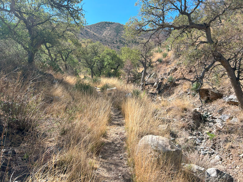
As the trail leaves the parking lot, it starts out pretty flat and travels through an area with lots of trees. This is a popular birding area, and you’re likely to see people with binoculars and cameras who will likely think you’re a little crazy when you tell them where you’re headed. The lady we spoke to said, “Oh to be young and foolish again.” We took it as a compliment.
We actually thought about those birders a lot during the hike because it’s true that there are a lot of birds in this area, and we were lucky enough to spot some very pretty ones.
Before long, you’ll enter the Mount Wrightson wilderness and leave the easy trail behind. From here, it’s a pretty steady climb all the way to the top. Because of that, you won’t have to go far before you’ll start to see evidence that you’re making progress.
A little over a mile in, you’ll get a reprieve from the sunshine and enjoy a little slice of heaven when you hike through a tree-filled gulley.
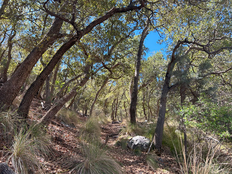
It’s a nice break, but it won’t last, and you’ll be back in the sun all too soon. Luckily, even in the sunny sections, there are trees every so often that are big enough to provide shade.
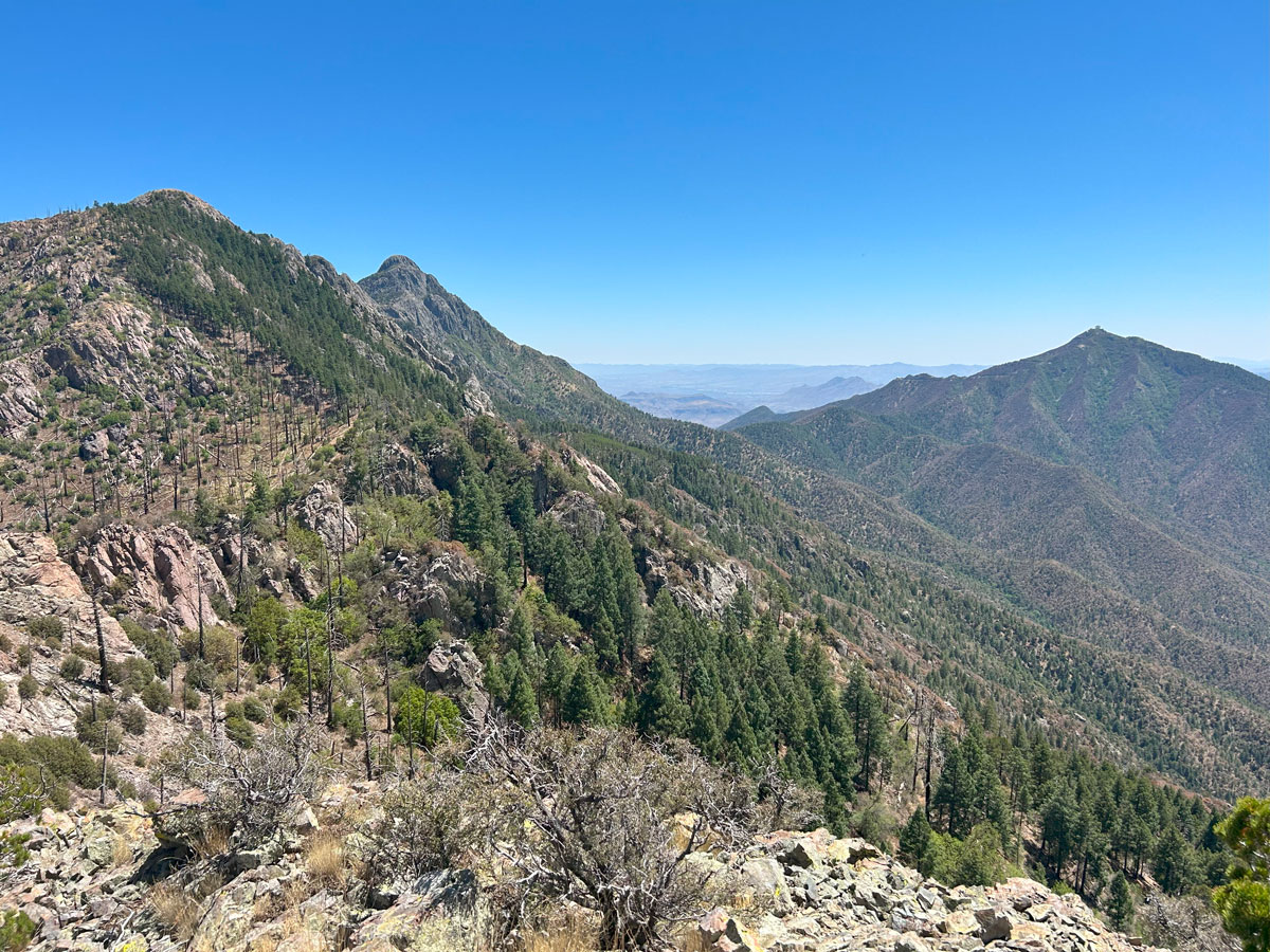
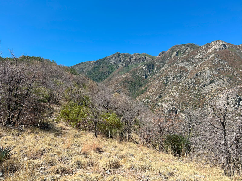
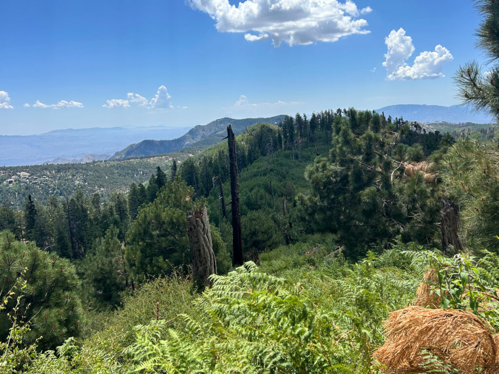
When you emerge from the trees, you’ll get your first great view of McCleary Peak up ahead. Yeah, those little hills you were looking at earlier, those weren’t it. You’ve still got more than four miles and 3,000 feet of elevation to go up. Sorry about that.
At about 2.5 miles in, you’ll find the only really decent campsite to be had along the Florida Canyon Trail. There is room for three small tents.
You’re over 6,000 feet of elevation at this point, and that means the trees are starting to show up. I know, there have been some trees all along, but I mean the REAL trees. Ponderosa pine trees that reach dozens of feet up into the sky.
Florida Spring
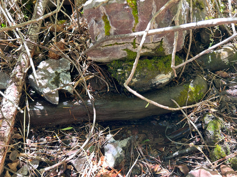
Not long after you enter the real forest, you’ll come to Florida Spring. This spring was running beautifully in May 2020 when we last hiked this trail, but this time in June, it was little more than a tiny puddle. It would have been hard to get water from it.
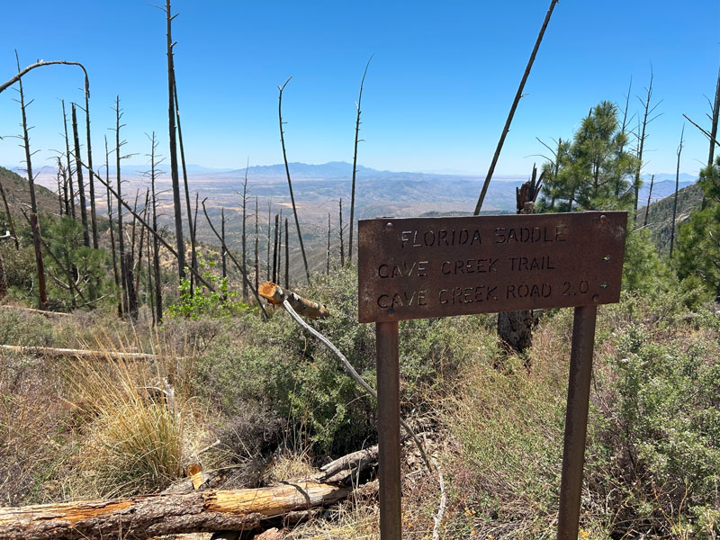
By now, you’re probably wondering where the heck this supposed Florida Saddle is. Well, when you enter the burned area, you’ll know you’re just about there.
Florida Saddle
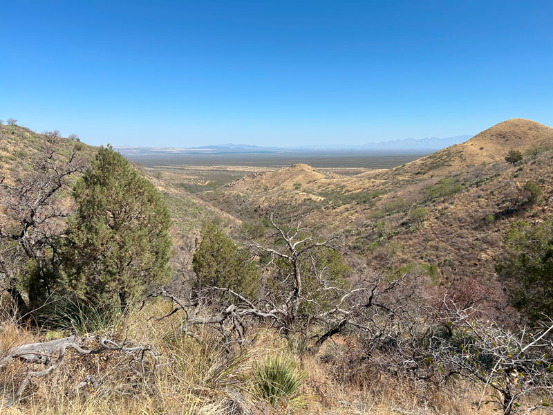
When you arrive at Florida Saddle, you’ll be able to see over the ridge to the southeast into the valley on the other side.
Crest Trail #144
Fork right toward Armour Spring to continue toward McCleary Peak. You’ll only be on the Crest Trail for less than a quarter mile up a few switchbacks before branching off to the right again on Armour Trail #71.
Armour Trail #71
It’s just under a mile to the summit from here, but the sad news is you’ll have to hike down a little bit only to hike back up. I know. Hang in there.
Armour Spring
After descending a few hundred feet, you’ll arrive at the low point where you’ll find Armour Spring. This was also barely dripping, but you could have gotten water if you were determined and desperate.
From this point, you only have uphill left. At the next saddle, look for a use trail that breaks off to the right toward the peak. We had to go over a log to get on track.
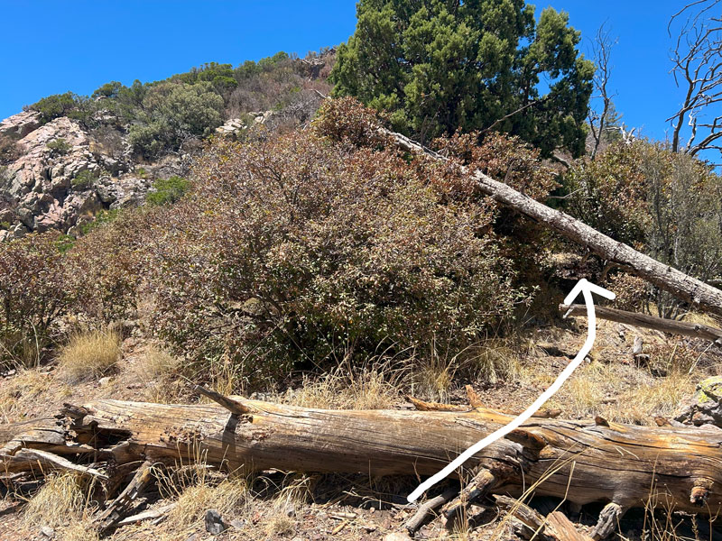
I guess “had to” is a bit of an exaggeration.
The path to the peak was mostly pretty obvious, but it had some tricky spots. At one point, you could go left up the loose rocks or right through the bushes to get past a rocky outcropping.
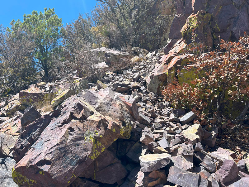
On the way up, we went over the rocky outcropping, and we thought the other way MUST be better, so we decided to try it on the way back. After that little bushwhack on the way back, I decided I’d rather go over. I left both options marked on the map so you can choose your own adventure.
Soon after that spot, you’ll realize you hit a false summit, and you still have a ways to go. Man, that was heartbreaking.
Come on, keep at it. You’re almost there!
McCleary Peak Summit
Just a few more rocky obstacles, and you’ll find yourself at the summit!
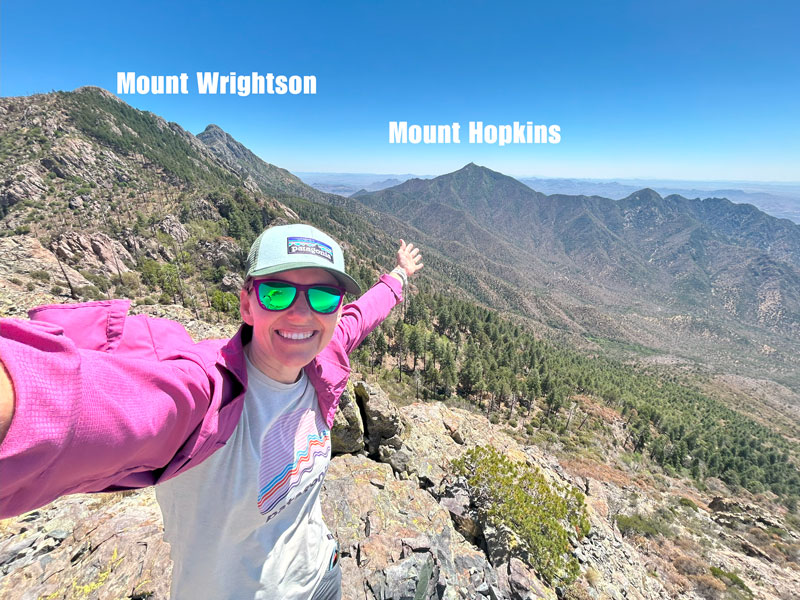
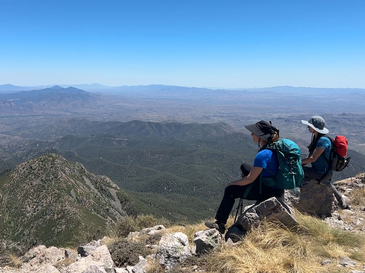
From the summit, you can see the other peaks in the range reminding you that you’re not at the highest point. You’ll be exhausted enough not to care, though, and you can feel satisfied that you actually hiked up more elevation than if you had hiked up Mount Wrightson. Yeah, that’s right, queen (or king). Own your awesomeness.
There is basically no shade at the summit, unless you want to crouch down under a little bush of a tree that you’ll have to share with the resident lizard.
Now, to get back. My Garmin told me I only descended about 300 feet during the hike up, so that’s all the uphill you have left. It feels like more at this point, and the descent seems to drag on, but if you made it this far, it ain’t no thing.
Map & Directions
Location Santa Rita Mountains, Coronado National Forest, Sahuarita, Arizona
Take Interstate 19 south from Tucson to the Continental Road exit and turn left. Turn right on White House Canyon Road and follow it to the trailhead.
Fees/Passes None
Trailhead Facilities None
Recommendations for you
Mount Wrightson | Santa Rita Mountains
Lemmon Loop | Tucson
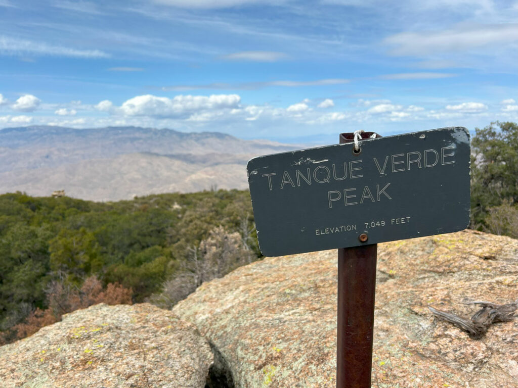
Tanque Verde Peak | Saguaro National Park
Leave a Reply