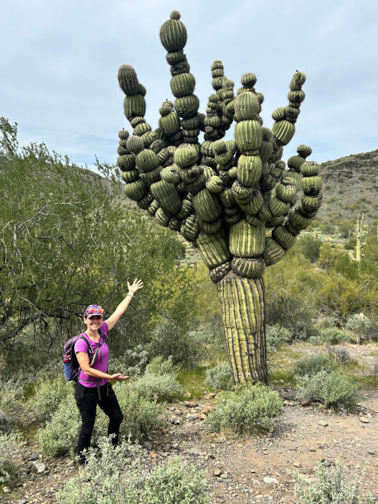
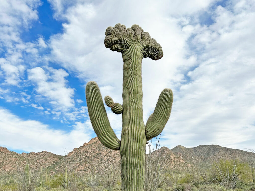
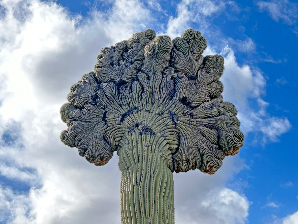
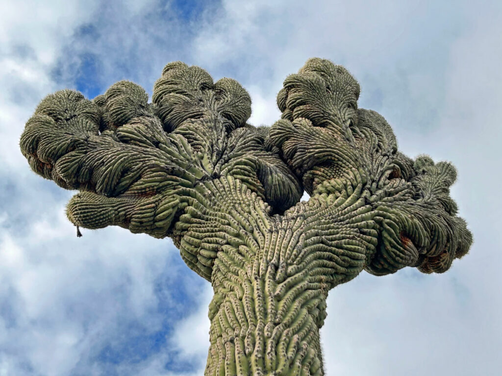
Michelin Man Saguaro
TRAIL STATS
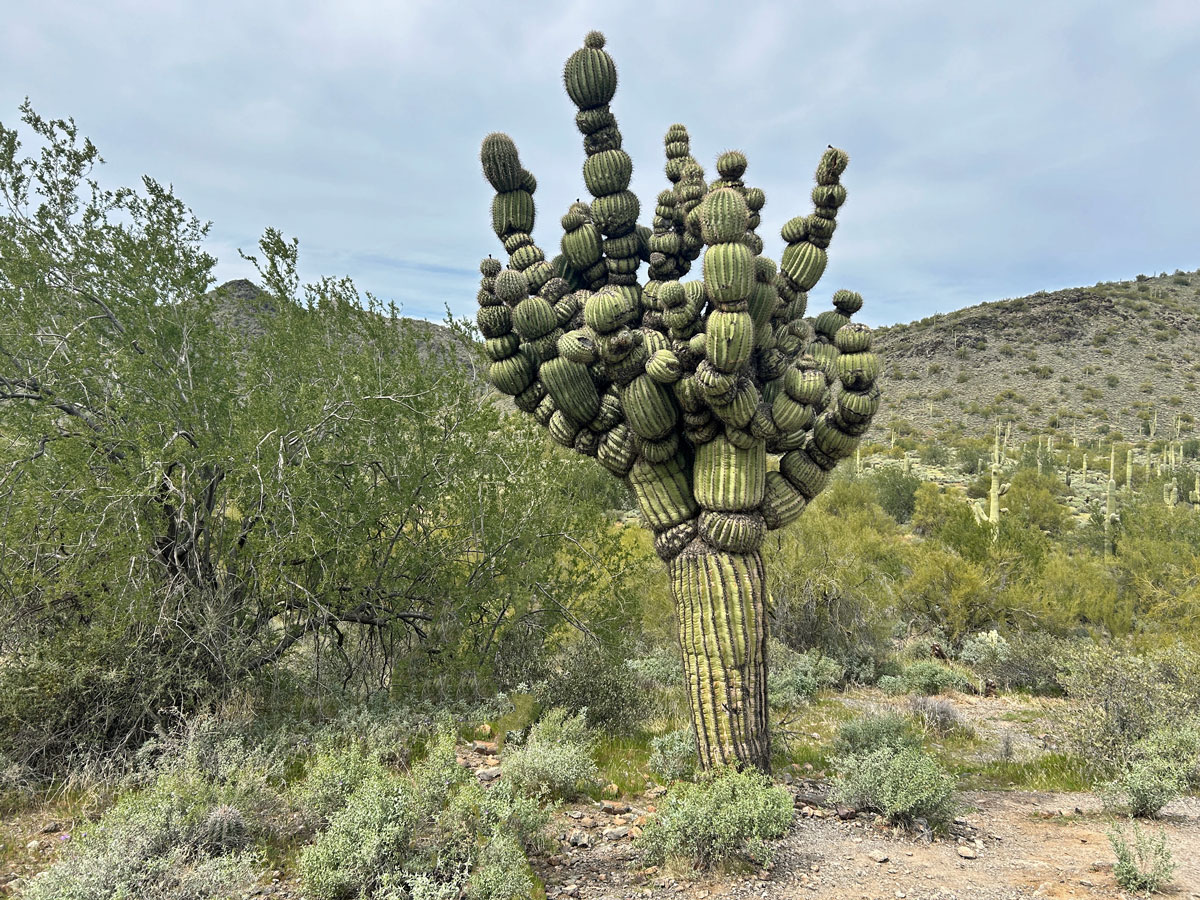
Saguaro cactuses only grow in a very small region of the planet, which already makes them relatively rare and special. So when you get to see a saguaro cactus with a rare mutation called a segmented saguaro, it’s a very special experience indeed! An easy hike along the Slate Trail in Cave Creek Regional Park will get you to a segmented saguaro that locals lovingly refer to as “Michelin Man.” If you want to keep hiking beyond, you can complete a loop that features excellent rock formations made of slate and quartz.
Trail Description
We at WildPathsAZ love our saguaro cactuses, so of course we had to check out the beloved Michelin Man saguaro in Cave Creek. This hike is easy enough for any level of hiker, and you’ll get to see one of the most rare saguaro cactuses around.
The Michelin Man segmented saguaro is located inside Cave Creek Regional Park, so you will have to pay an admission fee to get in unless you have a Maricopa County Parks pass. If you get to the parking lot, and you haven’t passed a fee booth, you may have accidentally gone to the Sonoran Preserve instead. What kind of idiot would do that? Not us, of course. *Avoids eye contact*
Slate Trail
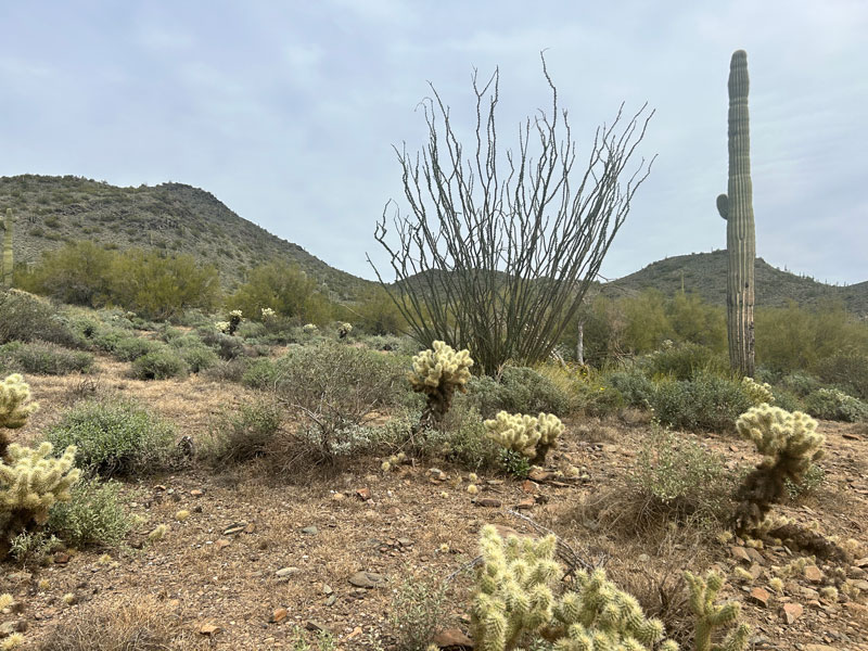
Walk to the east end of the parking lot to start on the Slate Trail. This trail is easy to follow as it gently rolls through desert terrain that is noticeably prettier than what you might find at the Sonoran Preserve, if you had accidentally gone there first. Which, of course, you didn’t because you know how to follow directions.
The key to finding the “Michelin Man” saguaro is to watch for the first bench on the right. Turn right on the spur trail at the bench to go over to the Michelin Man cactus. You can see it from the Slate Trail, but you might miss it if you weren’t looking for it.
Now, that was a pretty short hike, so you might not be ready to turn back yet. There are several trail options in the park, but what we did was make a loop out of the Slate, Quartz, Go John, and Jasper trails.
Loop Option
Additional mileage 2.8
Additional elevation gain 421
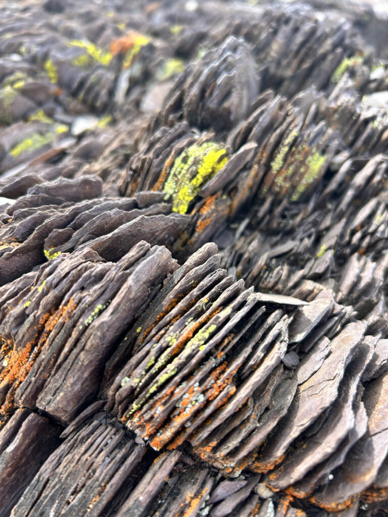
If you choose the loop, continue on the Slate Trail. Soon you’ll notice really cool thin layers of rock everywhere you look. And then, it’ll dawn on that one smart friend, “So that’s why it’s called the Slate Trail!” It is definitely named appropriately.
Up ahead, turn left at the junction with Quartz Trail.
Quartz Trail
So, you’ll be moseying along this trail, enjoying the beautiful scenery, when you’ll suddenly notice a large concentration of white rocks. “Hey, look at all that quartz. It’s beautiful!” And then the smart friend will say, “Well, yeah, that’s why it’s called Quartz Trail.” Brilliant!
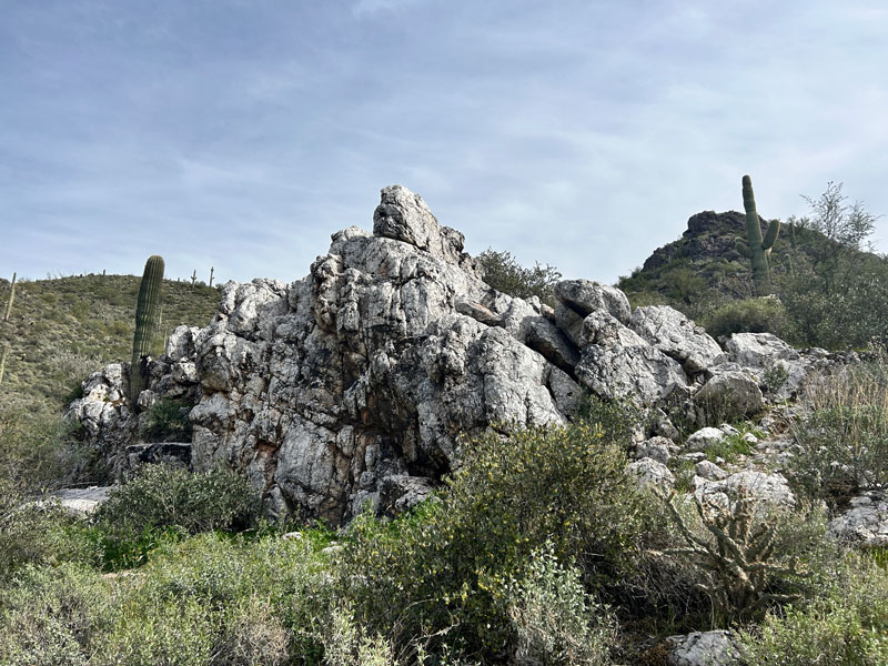
Watch for large outcroppings made of quartz off to the right.
The trail will then begin to ascend to a nice saddle where there’s a great view and a bench where you can enjoy it if you wish.
Go John Trail
At the next fork, turn left on Go John Trail toward the parking lot.
You can stay on the Go John Trail all the way to the parking lot, and walk through the parking lot back to your car. Or, you can take the Jasper Trail connector back to the Slate Trail (I wonder what type of rocks you can find on that trail 🤔).
More Rare Saguaros
If this hike put you in the mood to find more rare saguaros, check out our post on where to find crested saguaros, also called cristates. They’re really cool, too!
Map & Directions
Location Cave Creek Regional Park, Cave Creek, Arizona
Once you enter Cave Creek Regional Park, follow the main park road to a left turn with a sign pointing to the trails. Pass the playground on the left, and then turn right onto a loop and park at the first lot. Google maps link for the Slate Trail parking.
Fees/Passes There is a per-vehicle entry fee to access the park, or you can use your Maricopa County Parks pass.
Trailhead Facilities Flushing toilets, running water at the sinks
Recommendations for you
Sidewinder Trail | McDowell Sonoran Preserve
Coyote Canyon | McDowell Sonoran Preserve
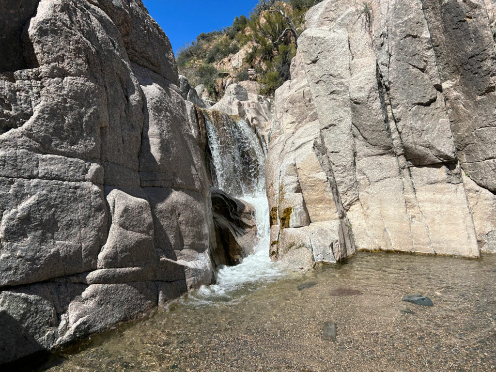
Camp Creek Falls | Cave Creek
Leave a Reply