Preacher Cave
TRAIL STATS
Due to its geology, the Mogollon Rim actually has quite a lot of caves, which often form where water flows such as near springs. This beautiful cave consists of three rooms, the last of which is filled with crystal water and requires a handline to get up to it. Entering or traveling beyond the water is prohibited. The cave is also decorated with flowstone, soda straws, stalactites and stalagmites. Many of these formations have been damaged by unscrupulous visitors, and some of the rooms have graffiti. For this reason, I will not be sharing the exact location of this cave, but I will provide similar information as was already published. Determined adventurers should be able to find it, and if you do, please take care to leave it as you found it.
Caves are fragile, irreplaceable natural wonders. Touching delicate cave formations can easily break them or cause them to stop growing. Graffiti will mar the cave surfaces for centuries. Please do your part to protect and enjoy our shared natural resources.
Trail Description
I’m always so torn when I share a place like this. On the one hand, I was able to visit it because someone else alerted me to its existence. On the other hand, publishing special places sometimes leads to their ruin. So, as a compromise, I decided not to provide a GPS route or coordinates to the cave. Those with a hearty sense of adventure will find satisfaction in using clues to find it, and I HOPE will protect it and keep it like they found it.
I actually found out about the existence of Preacher Cave several years ago, but I had never taken the time to find it. When I tried to look for information about it, I found an article published in the Payson Roundup that gave a general description of the route. It says road 1293 leads to the cave, but if I had relied on that information alone, I’d probably still be wandering around out there.
Road 1293
So our first problem was that the start of road 1293 wasn’t as easy to find as it should have been. The article didn’t help much since signage has obviously changed. The off road map app I downloaded from Tonto Recreation Alliance should have gotten me there, but apparently there was some user error. Oops, we actually parked one road farther north than we should have, but I didn’t realize it because the road I parked on still linked up with the correct road. Imagine my surprise when we were hiking out and the car was not where I thought it was. No problem, we just hustled north on the paved fire control road to find it.
The next problem was that the article said to follow road 1293 for 3 or so miles, so we were surprised when we found ourselves at a dead end (with a fun swing in a tree). Turns out, the road no longer goes through as mapped. This is where GPS is critical! My Garmin GPS map showed no road at all, so the app I downloaded combined with the RouteScout map helped us find our way to the continuation of road 1293. We looked at a satellite image of our location and went cross country to a nearby dirt road that connected us back up with road 1293. Giving a mileage estimate is tough since we went cross country, but if you were to follow the theoretical path of the nonexistent portions of 1293 (which we tried to do on the way back), it would indeed be around 3 miles to the turn off for the cave.
I didn’t try this, but since these roads are obviously still in use, I am sure you can find a road that will lead you there without going cross country at all. Next time I go, I am going to try to drive the whole way.
Turnoff
If you were somehow able to follow the theoretical path of 1293, the turnoff for the cave is a little less than 3 miles in. The article said to look for a dead tree. Good luck with that! We weren’t sure what that meant, but on our way out, we did actually see there was a pretty substantial dead tree near where we turned off. Whether it’s a good landmark is up for serious debate, but we noted there were NO cairns. We did not add one, either. However, there was a pretty decent trail that headed uphill to the right. It’s clear many people have gone up there in the past.
Preacher Cave
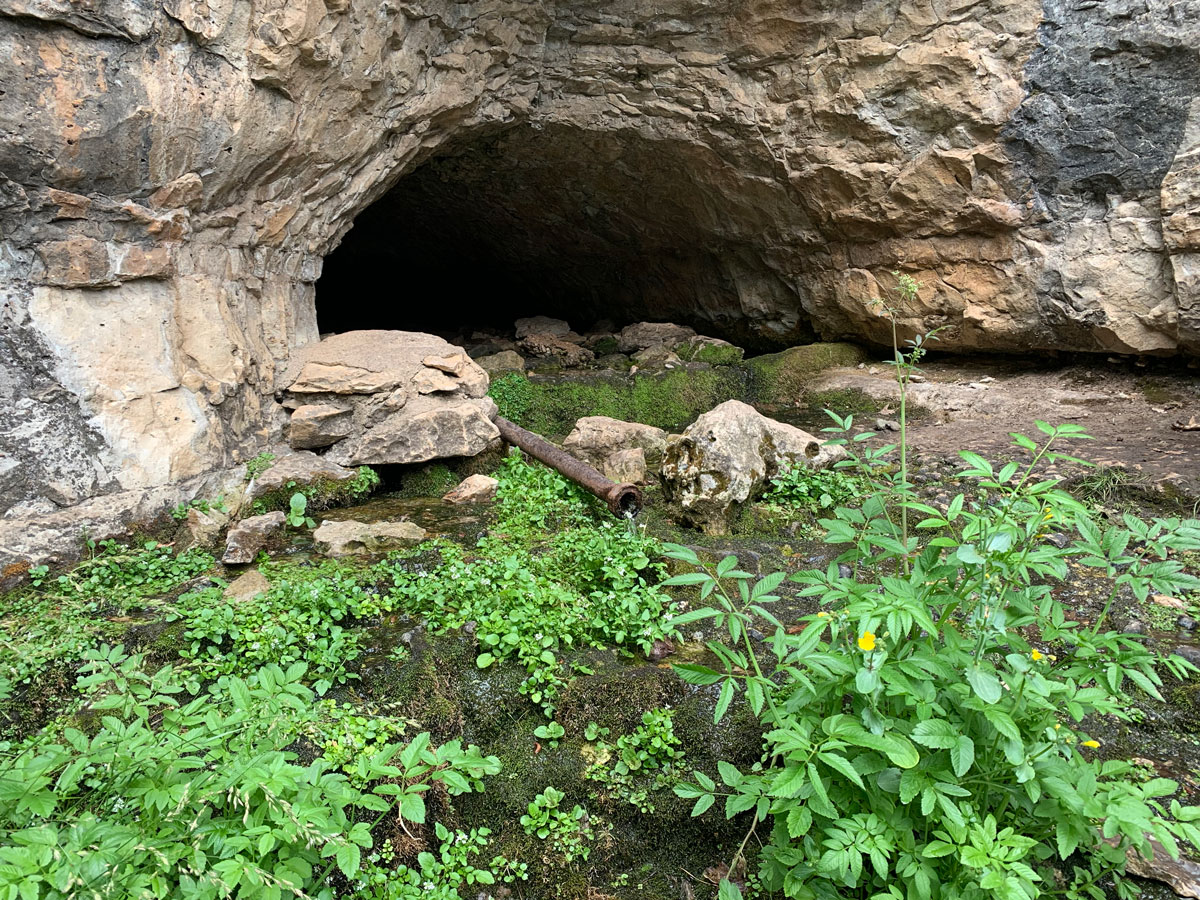
The entrance to the cave is down in a depression.
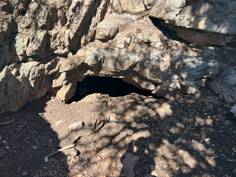
The only comment on the article in the Payson Roundup said a bear and her cub had taken up residence in the cave and warned not to go. We took that with a grain of salt, but we still were cautious to check for animals.
No sign of animals.
To get into the cave, you’ll have to crawl (or plank walk), so don’t wear your best clothes. After exploring this cave, Fawn’s pants will never be the same (of course, I said that after the Illusions Canyon trip, and yet somehow she still wears them).
First Room
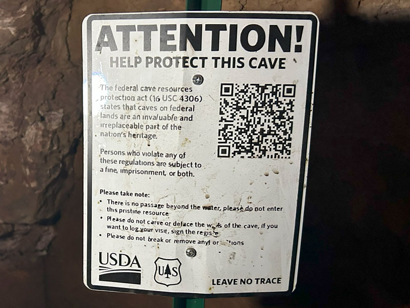
Inside the first room, you’ll find the cave register where you can leave your mark without defacing the cave. There is also a sign with the rules.
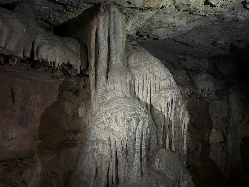
This room has magnificent flow stone.
Second Room
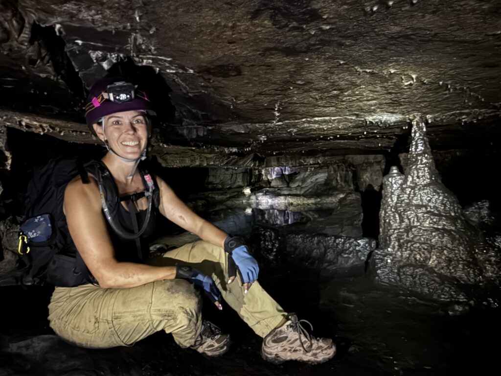
To get to the next room, you’ll go to the far end of the first room and climb over a higher point before descending a really slippery slope into the second room. Helmets helped us out a lot here.
While you’re on the higher ground, look up at all the little soda straws on the ceiling and the zillions of drops of water that look like a sky full of stars in the light of your headlamp.
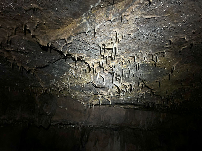
On the floor of the second room are cones that look like large stalagmites that might have been broken off at some point. There is also a wall-like structure that looks like it might have once contained a pool. I’m no cave expert, so please feel free to correct or add information in the comments below! Regardless, it was all so beautiful.
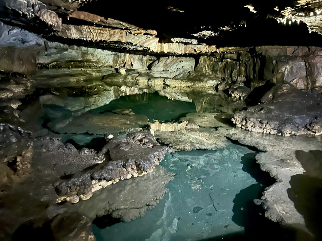
Third Room
At the back of this room is a short but steep, slippery slope that most people will not be able to get up without help. Luckily there was a handline in place that we used to help us. The ceiling is low up there, and you can go a very short distance to look into the beautiful pool at the end of the cave. Entering the water or traveling beyond it is PROHIBITED.
On the way back down, just slide on your shoes down the slippery part and hope for the best. There are a couple other fun things to explore while you’re there. Be sure to take it all in before you crawl back into the sunlight.
Map & Directions
Location Tonto National Forest, Payson, Arizona
From Payson, head east on Highway 260 until the turn for Tonto Village. Turn left and park at the start of road 1293 (or drive it?).
Fees/Passes None
Trailhead Facilities None
(No map provided)
Preview this Hike
Recommendations for you
Pivot Rock Spring | Mogollon Rim
Coconino Railroad Tunnel | Mogollon Rim
Spruce Mountain | Prescott
Leave a Reply