Secret Mountain
TRAIL STATS
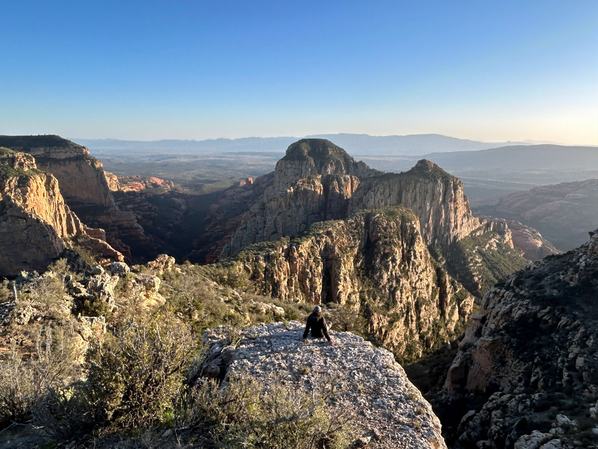
Secret Mountain provides the absolute best views over the canyons of Sedona, but there is a price to pay. The trail hasn’t seen maintenance in years, and fallen trees create a constant series of obstacles. However, most hikers will find it tolerable to visit the water tanks, Secret Cabin, and the Secret Mountain Vista. A few will even find it worth the effort to hike to an incredible viewpoint over Hart Well Canyon, but only true gluttons for punishment will want to venture beyond that point into the burned portions.
Trail Description
There are two ways to access Secret Mountain Trail.
- 2wd option Start at Loy Canyon west of Sedona and make the strenuous 5-mile journey up the rim to the junction with Secret Mountain Trail.
- 4wd option Take a maze of forest roads to the trailhead. It’s too hard to explain. Just google “Secret Mountain Trailhead.”
We are currently 4wd challenged, so we hiked up Loy Canyon, which was a great hike and honestly much more pleasant than Secret Mountain. Just keepin’ it real, folks.
Loy Canyon Trail #5
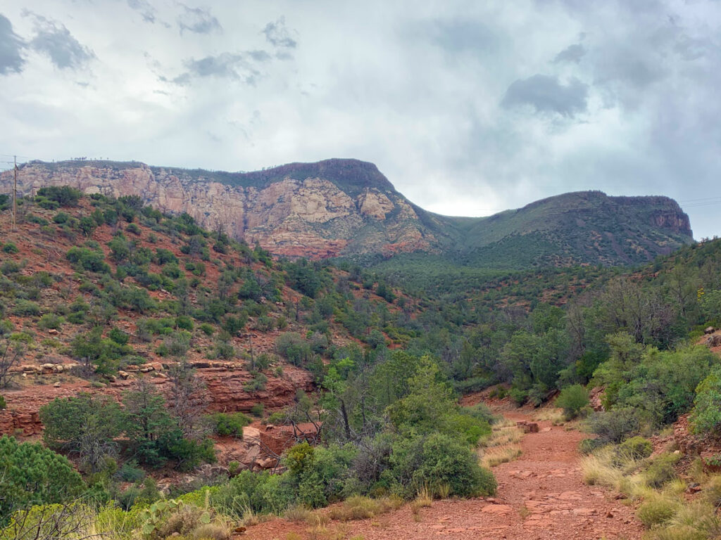
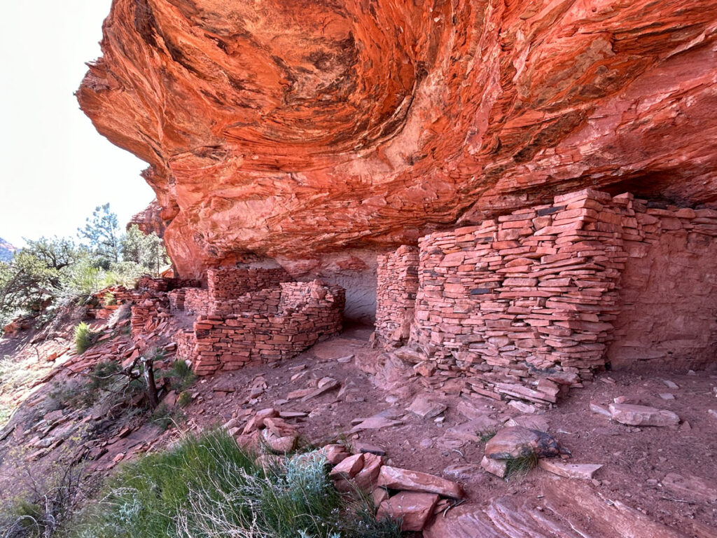
The first three miles of this trail are easy and have a good amount of shade from the trees in the canyon. Plus, there are Native American petroglyphs and ruins here that are interesting if you have time for a side trip or two. The last two miles are steep and have drop-offs, but provide excellent views of the canyon.
See Loy Canyon Trail for all the details.
Secret Mountain Trail #109
When you finish the steep climb up Loy Canyon, you’ll come to the junction with Secret Mountain Trail and the saddle. Even though the views there are obstructed by trees, the temperature cools down a lot, and it feels so good to reach that point.
Enjoy the feeling, cool down, and recharge. The next part is going to be a bit difficult.
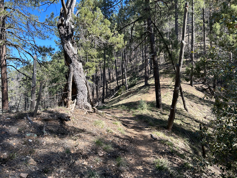
You’ll begin heading up the mountain in front of you and soon discover that there are a lot of downed trees blocking the path and that a landslide took out part of the trail. I’m not saying it’s going to be fun, but there are a couple things ahead that might make the struggle worthwhile.
Johnson, Concrete, and Mason Tanks
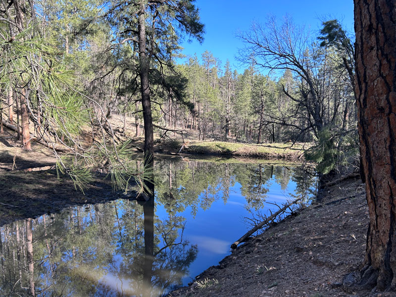
After fairly recent rain or snowmelt, you will find water at one or more of the tanks along the next part of the trail. Johnson is off the trail a little, so you’ll need GPS, but it provided a lovely oasis after that warm climb up Loy Canyon.
Concrete and Mason are farther down and visible from the trail. We hadn’t had precipitation in a couple weeks, but still found quite a bit of water. I looked at the water reports from the past, and it seems they usually have water in spring, but are often dry in summer and fall. Don’t depend on them unless you have good reason to believe they’ll have water.
Secret Cabin
Farther along the trail, you’ll drop down next to a small creek, which also had a little bit of water when we went. There you’ll find the remains of Secret Cabin, which is known to be the home of pioneer polygamists escaping prosecution.
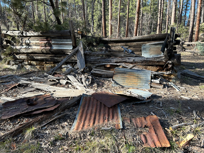
There are also tales of horse thieves using it as a hideout. If the condition of the trail then was anything like it is now, I could see why they felt no one would ever find them.
Secret Mountain Vista
Just beyond the cabin, you’ll climb back onto a high point where you can walk out on Secret Mountain Vista and get a great view of Loy Canyon.
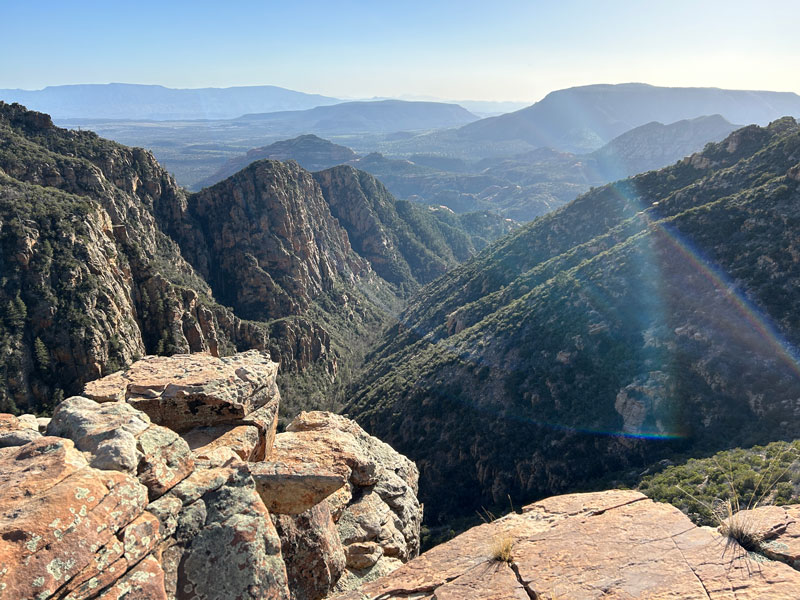
For most hikers, this is going to be a great place to turn around. You’ve seen the water, the cabin, and a nice view. What more do you need?
“The Balcony”
Additional mileage 1.0
Additional elevation gain 264
If you’re up for a little more, I can say I thought it was worth it to reach the area above Hart Well Canyon where we camped (Camp 4 on the map). It passes through an area with significant blowdown, but most of the trees in this part of the forest are alive and standing.
The benefit of pressing on is that you’ll get to experience my little rocky outcropping I named “The Balcony.” A thin fin of rock juts out into the canyon and provides epic views—it’s a perfect place to watch the sunset.
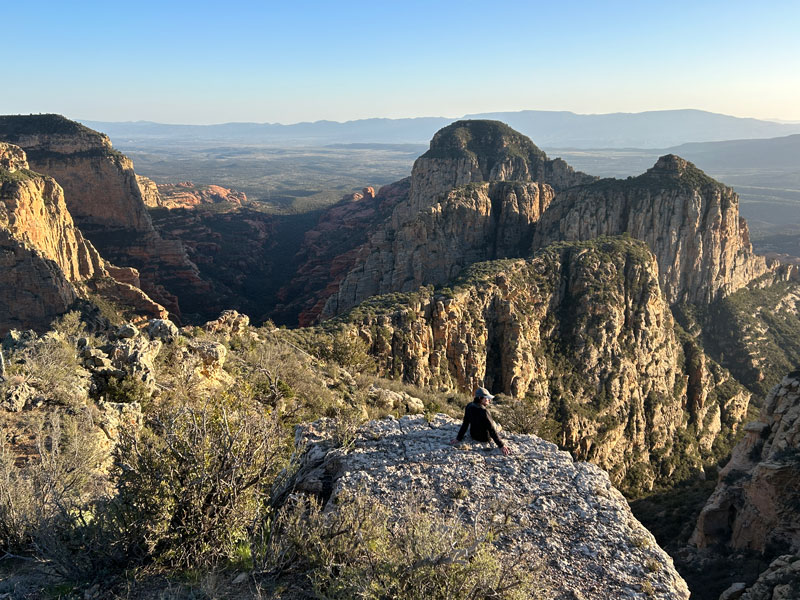
If you continue on the trail past that point, you can just subtract two stars off my rating right now. (You turned back, right?)
Be ready to enter a burned area with lots of downed trees and plenty of bushwhacking. The going is slow, and even though the trail is there, it is very faint, and you’ll probably need to rely heavily on GPS to keep you on track. I had to go around A LOT of trees, so my track doesn’t stay on the trail exactly. You may find tracks from other sources to be more accurate. Maybe.
You will get glimpses of the canyons below every now and then, but mostly you’ll be looking at a lot of dead trees, thorny bushes, and manzanita that tries to block every view you might ever hope to have. If Hell has trails, I’m pretty sure they’ll be like this.
Long Canyon
Additional mileage 2.8
Additional elevation gain 532
Star rating ★
If you made it to the end of the trail, you are a hardcore hiker. Congratulations, you nut! You’ll notice my track doesn’t quite go to the official end of the trail, and that’s because I’m not quite as nutty as you (but almost).
The views of Long Canyon are really nice, but I can’t say they’re worth the intense effort. Save yourself the trip and enjoy my picture.
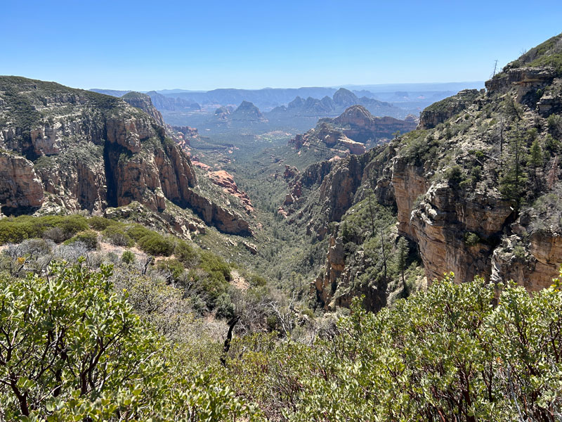
When your joy at reaching some kind of payoff wears off, reality sets in that you still have to make it back.
All I can say is, good luck to you.
Camping
There are a lot of flat spots where you could probably make a camp on Secret Mountain, but I marked a few that I felt would be the most useful.
- Camp 1 This is a small, dry camp at one of the switchbacks on the Loy Canyon Trail. It has a couple of trees and epic views down canyon.
- Camp 2 Right next to Secret Cabin is a nice campsite, and you may have water if the nearby creek is running.
- Camp 3 If you’re more into the views, there’s a camp just before you walk out onto the Secret Mountain Vista. It’s not far from Camp 2, so you could get water there if the creek isn’t dry.
- Camp 4 This is a large campsite with a log for sitting, flat and sandy spots to put multiple tents, and plenty of trees. The benefit here is that it’s located next to what I like to call “The Balcony,” which is a rocky viewpoint I found that has the best views we saw the whole trip.
- Camp 5 If you’re hardcore enough to continue past Camp 4, you have the option of this campsite which is situated right next to the edge of the rim for fantastic views right from your campsite. There are no trees in the campsite itself, but you can find some nearby.
Water may be scarce or nonexistent, so plan ahead.
Map & Directions
Location Red Rock Secret Mountain Wilderness, Sedona, Arizona
From Sedona, take Highway 89A toward Cottonwood. Turn right on Forest Road 525 and follow it to the Loy Canyon Trailhead.
If you’re starting at Secret Mountain Trailhead, Google it.
Fees/Passes None
Trailhead Facilities None

Leave a Reply