Telegraph Pass
TRAIL STATS
A hike up the Telegraph Pass Trail rewards you with nice views of the city without being too difficult. If you’re not in the mood to make it to the top, you can still enjoy the petroglyphs near the bottom. Or, if you want more, you can connect with the National Trail and take a short side trip up to the lookout structure or make a longer trip up to one of the lookout points near the summit. The versatility of this hike means you can tailor the perfect adventure.
Trail Description
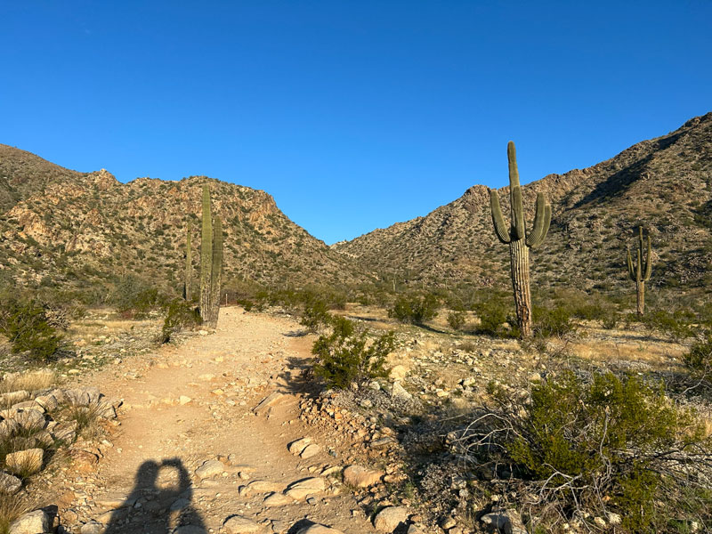
Located on the south side of South Mountain, Telegraph Pass Trail is one of the more moderate trails in the area that will still give you great views. The first part of the trail is roughly paved, offering steady footing for those who need it, while the upper portion gets steep and rocky for those seeking more of a challenge. There’s something for all levels of hikers here.
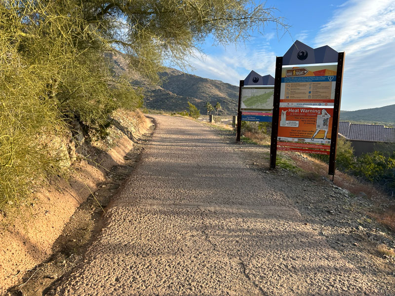
Desert Foothills Trailhead
Park at the Desert Foothills Trailhead, which is also known as the Telegraph Pass Trailhead. There are nice restrooms with running water. Note that the gate for this trailhead closes at 7pm, although the trails at South Mountain stay open until 11PM.
Telegraph Pass Trail
The beginning of this trail is wide and roughly paved (so don’t bring your rollerblades!).
The paved portion continues for just under half a mile with only a 50-foot elevation gain to the junction with the Desert Classic Trail. From that point, you will have a nice view up the canyon, but not much else. To get to the good stuff, you have to keep left and continue onto the dirt path.
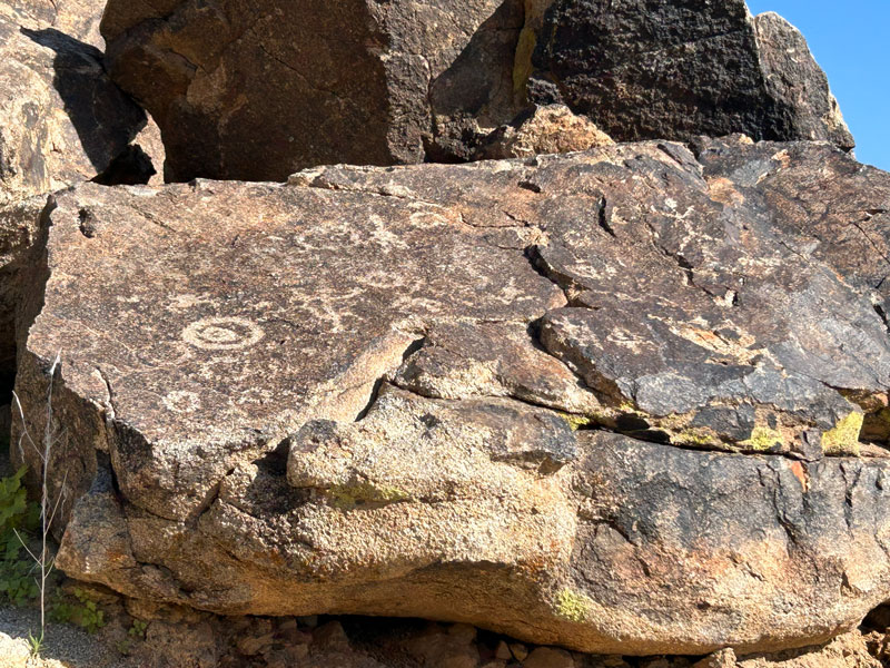
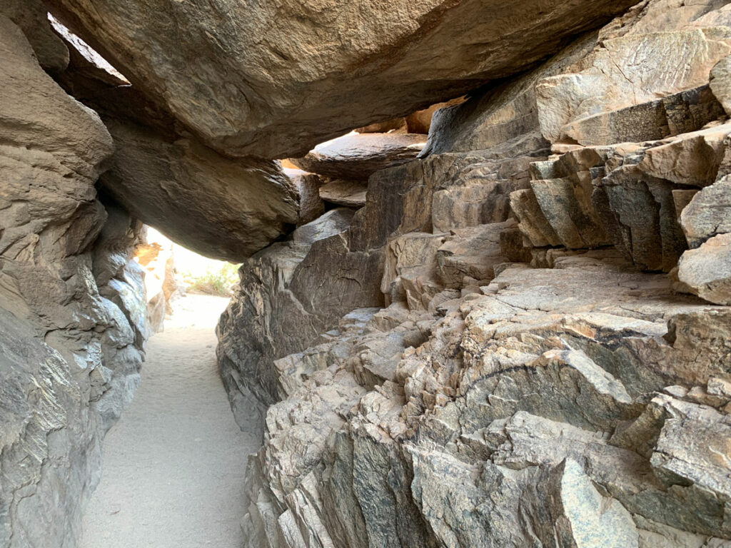
Petroglyphs
The trail continues its gentle uphill slope for a little over a quarter mile to where you will be able to see some petroglyphs. Even if you don’t plan to go all the way up to the viewpoint, it’s well worth the effort to see these petroglyphs. They’re a total of around 3/4 of a mile from the trailhead. Remember to help preserve these petroglyphs by not touching.
Beyond the petroglyphs, the trail starts to get steeper and rockier. This is where your friends start to question whether you told them the truth about this hike. In under a half mile, you’ll gain more than 300 feet, making it a bit of a burner. It’s short, though. Come on!
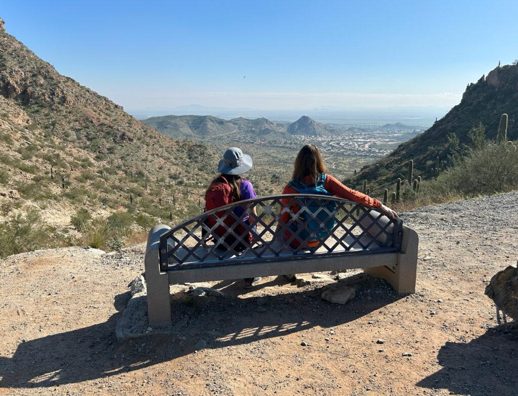
At the top, you’ll get to see what all that huffing and puffing earned you. Views!
Although, it might be a bit of a disappointment to discover it’s right next to the road that goes to the summit of South Mountain. “You mean we could have just driven here?” Well, yeah. But is that any fun?
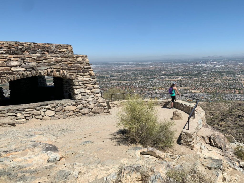
National Trail Lookout (optional)
Additional Mileage 0.9
Additional Elevation Gain 236 feet
If you’re not out of energy yet, and you’re determined to get a view only hikers can get, turn left onto the National Trail and start heading uphill toward a lookout. You’ll be able to see it perched high up to the left.
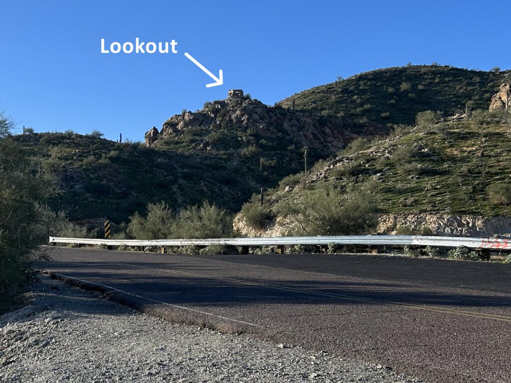
At first, the trail will seem to pass right by the lookout. Trust me, DO NOT question this and try to find your own way up. If you do, you’ll be embarrassed when you realize the National Trail goes right up to it. Don’t ask me how I know. Be patient and go the easy way.
The lookout offers a fun little stop with great photo ops.
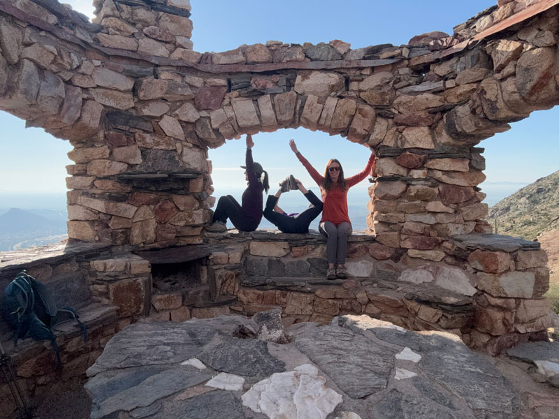
It was Christmas time, and we were trying to spell holiday words. Can you read it?
If you want to go farther. . .
From here, you can return the way you came or connect with trails to the Gila Valley Lookout, Dobbins Lookout, or the Buena Vista Lookout to add mileage to your trip (a lot of mileage). These routes are not included in the map below, but they are options.
Be forewarned, though, that a paved road goes to all of those lookouts, which means trash and people.
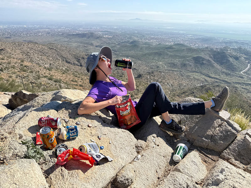
Don’t worry, after we collected all this junk and had a fun photoshoot, we threw it all away. There are garbage and recycling receptacles in the parking lot, after all. Geez, people!
Map & Directions
Location South Mountain, Phoenix, Arizona
Take Loop 202 to 17th Avenue and go north. Turn left on Chandler Boulevard and then right on Desert Foothills Parkway. Go until you see the Desert Foothills Trailhead parking area on the right.
Fees/Passes None
Trailhead Facilities Bathrooms with running water
Recommendations for you
Lost Ranch Loop | South Mountain
Hidden Valley Loop | South Mountain
Dobbins Lookout | South Mountain
Leave a Reply