Weatherford Trail
TRAIL STATS
Take the longer, more gradual, less crowded route to Humphreys Peak on Weatherford Trail, or simply stop at the saddle between Doyle Peak and Fremont Peak to take in expansive views of the Inner Basin, Humphreys Peak, and the surrounding Kachina Peaks Wilderness. Continuing on to the Humphreys Saddle, you’ll enjoy that top-of-the-world feeling as you hike past Fremont Peak and Agassiz Peak on your way to Humphreys Peak. This can be done as a backpacking trip if you camp at Doyle Saddle or Fremont Saddle.
Trail Description
Most people are in such a hurry to get to Humphreys Peak, the highest point in Arizona, that they completely overlook the Weatherford Trail. It’s a shame, really, because the section of trail between Humphreys Saddle and Fremont Saddle provides stunning views without all the crowds heading to the peak. This trail was closed for several years below Fremont Saddle due to the Pipeline Fire in 2022, and evidence of the burn will be all around you. However, the rows of creamy white trunks have their own kind of beauty, and the aspen trees and wildflowers are quickly filling in.
Schultz Tank Trailhead
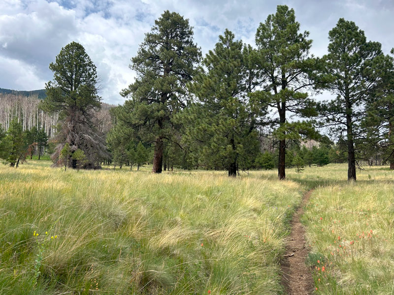
The Weatherford Trail begins at the Schultz Tank Trailhead and skirts along the edge of the Kachina Peaks Wilderness boundary as it gradually climbs up toward Weatherford Canyon. The entire trail was once a road that was supposed to go all the way to Humphreys Peak, but never made it past Humphreys Saddle. Because of this, the trail is fairly wide in a lot of places and easy to follow. Along this section of the trail, it’s mostly ponderosa pines with occasional glimpses of the peaks ahead.
At the junction with the Kachina Trail, which comes in from the left, you’ll finally enter the Kachina Peaks Wilderness.
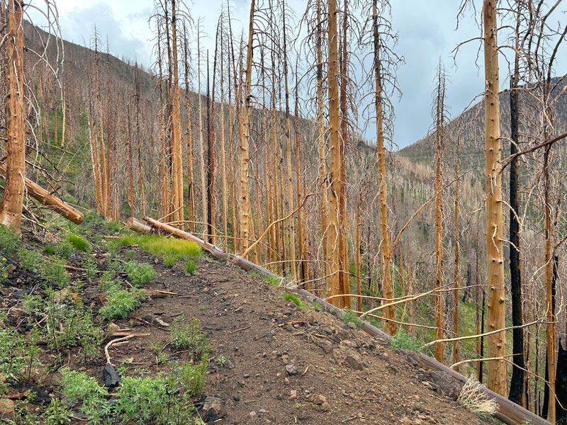
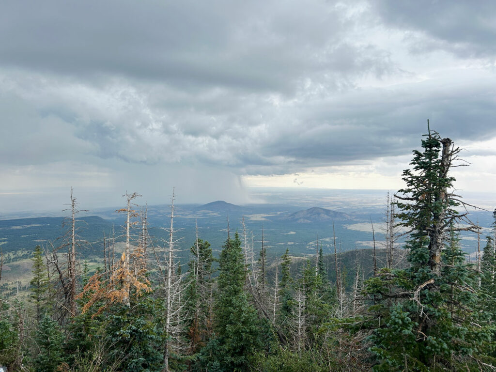
From here, the trail gets steeper and begins a series of long switchbacks on the way up to Fremont Saddle. You’ll now be entering the area that burned during the Pipeline Fire, and the devastation from the fire will be evident all around you. What was once a healthy, green forest has been reduced to barren trunks with young aspen surrounding their bases.
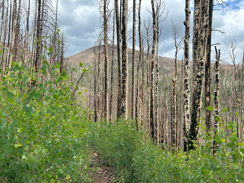
The black and white trunks are pretty in their own way, and the bright green leaves surrounding the trail remind you that life goes on.
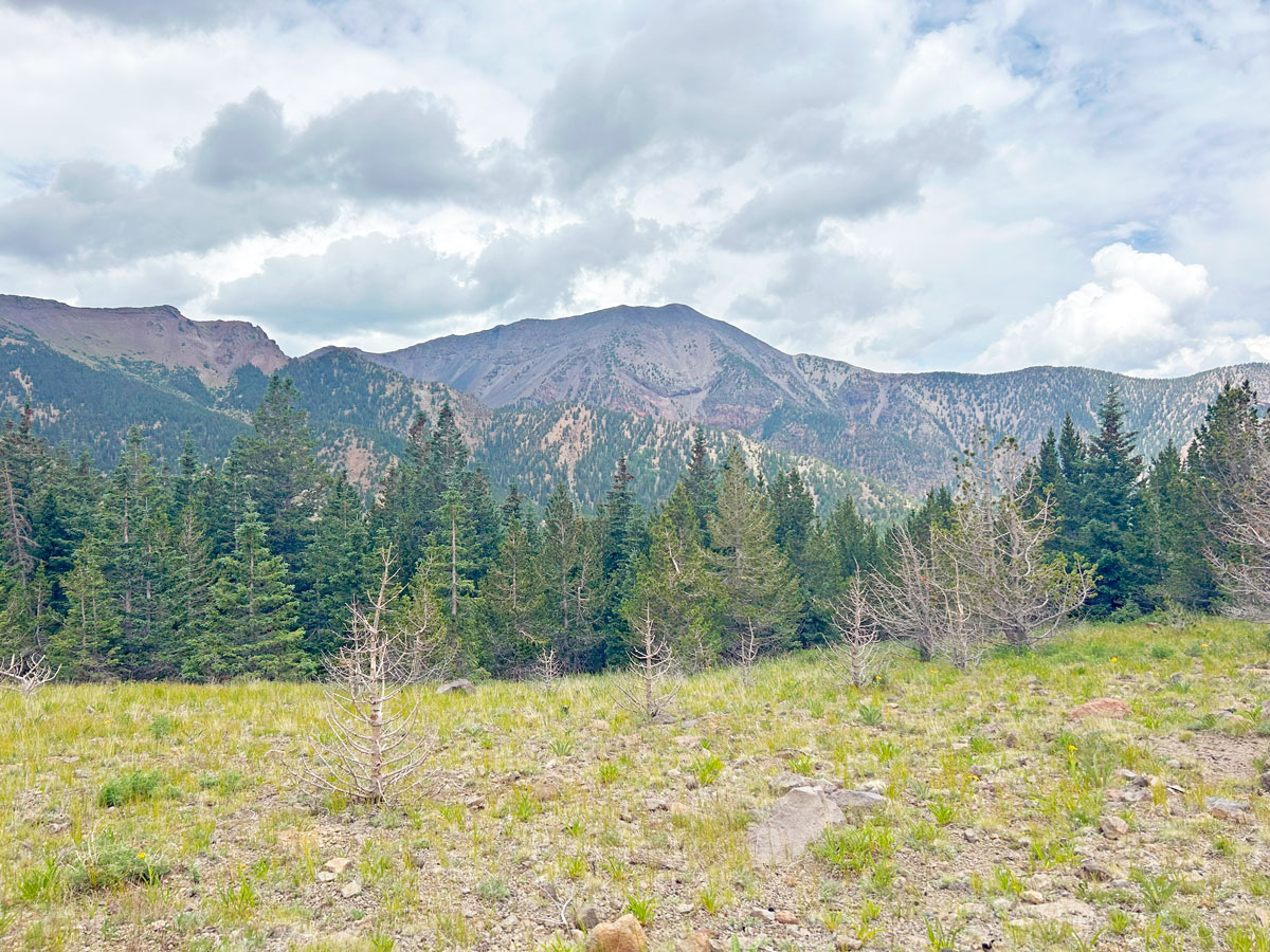
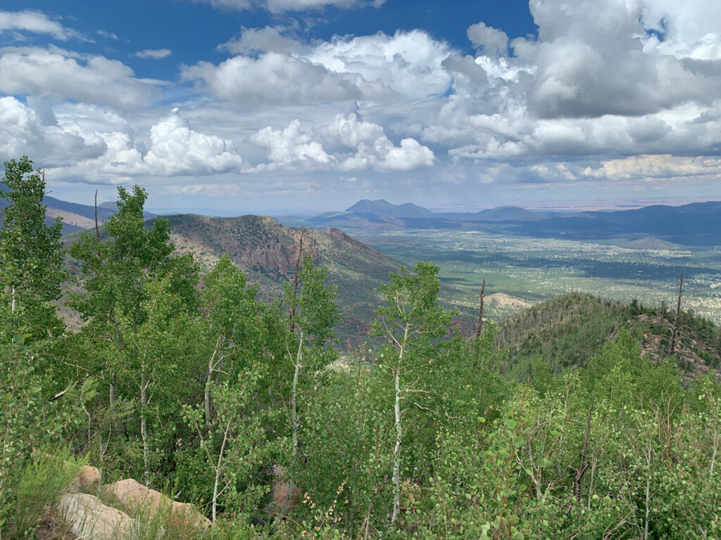
Near the upper part of the switchbacks, you’ll cross open grasslands with wildflowers galore and massive views down into the valley below.
Up ahead, Fremont Peak.
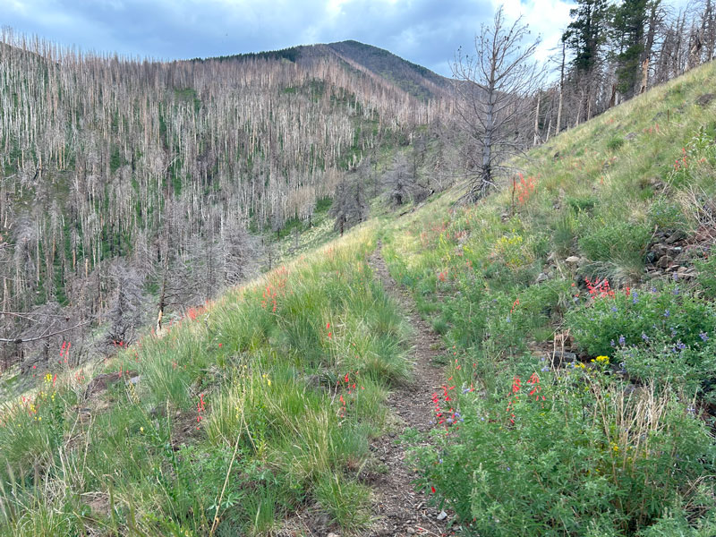
As you approach Fremont Saddle, the dead tree trunks once again surround you, and you’ll see legions of dead trees all along the flanks of Doyle Peak.
It is a little sad because the last time I was here was in June of 2020 when all of these were green and vibrant. Still, with all the wildflowers that abound, the interesting contrasts on the burnt trunks, and the distant views, you’ll be hard pressed not to find yourself happy.
Fremont Saddle
Now for the confusing part. For whatever reason, the saddle between Fremont Peak and Doyle Peak is called Fremont Saddle, while the saddle on the other side of Fremont Peak closer to Agassiz Peak is called Doyle Saddle. Perhaps these were mislabeled long ago, but the names have stuck.
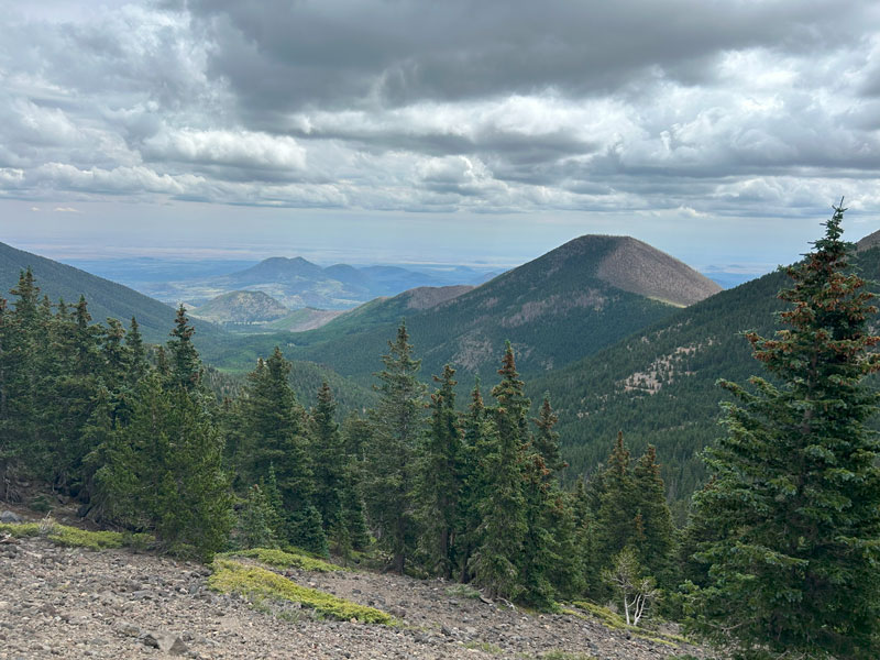
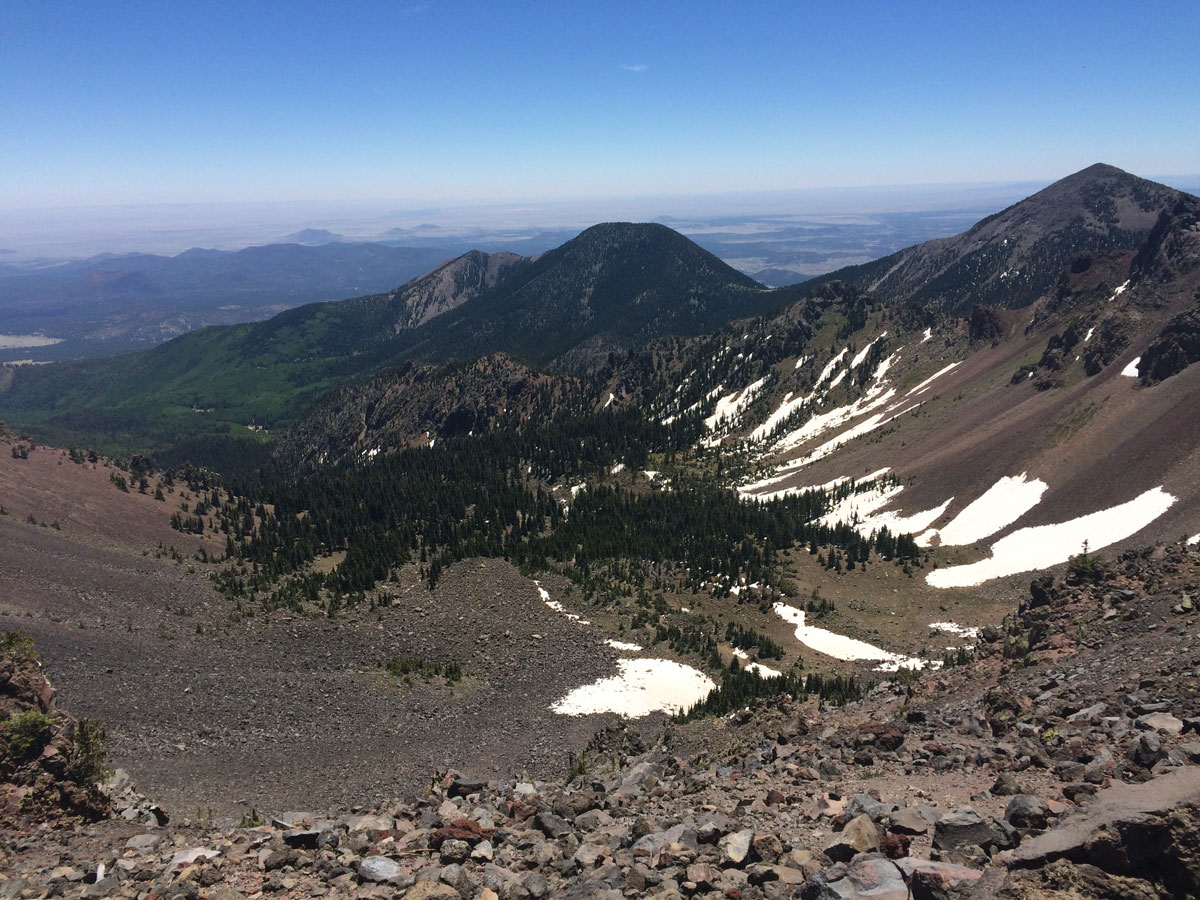
From Fremont Saddle, you’ll get your first view of Humphreys Peak and the Inner Basin.
Yeah, if you’re heading to the summit, you’ve still got some work to do. For most day hikers, taking in the view at the saddle and then heading back to the trailhead will be the perfect day. Going all the way to Humphreys Peak is 22.9 miles round trip and only suitable for the really hardcore (aka crazy) people.
Continuing to Humphreys Peak (optional)
Additional mileage 9.2
Additional elevation gain 2291
From Fremont Saddle, you’ll now enter the Inner Basin.
The good news is that the burn area ends at Fremont Saddle, and you’ll enjoy a healthy, green forest from here onward. Weatherford Trail dips down a little before steadily climbing along the north flank of Fremont Peak.
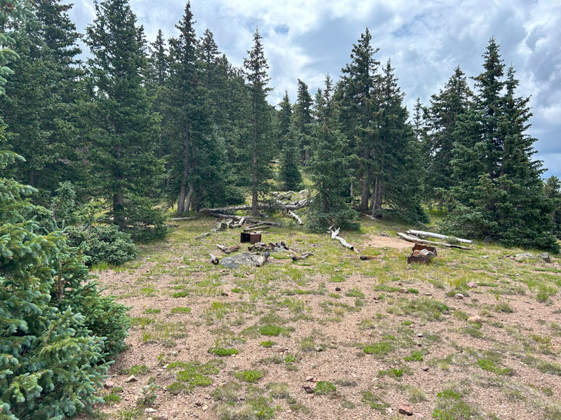
Doyle Saddle
After another 1.8 miles, you’ll arrive at Doyle Saddle, which has a nice campsite with plentiful living trees. And some unexplained random junk that looks like it’s been there for decades.
As you continue, you’ll hike up above the tree line and start to get more of those expansive views that you came for. It’s really hard to overstate how beautiful this section of trail is.
Weatherford Trail continues past Agassiz Peak and eventually lands you on Humphreys Saddle. It’s likely you’ve enjoyed a good deal of solitude up until this point, but now you join all the people hiking up to Humphreys Peak.
Humphreys Trail
You’re now at 12,000 feet and may be feeling the effects of the elevation. If you start to have symptoms of acute mountain sickness, such as headache, dizziness, and nausea, the best way to get relief is to descend.
Continue straight along the ridgeline to head toward Humphreys Peak. Any sign of a forest soon gives way to an alpine tundra with loose rocks and tiny plants. Hiking off trail here damages the fragile ecosystem and carries a hefty fine of $500, so don’t do it.
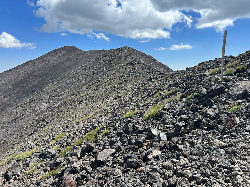
Follow the trail, the crowds, and the signs toward the peak. There are a few false summits on the way, each one more heartbreaking than the last, but eventually you’ll find yourself at the highest point in Arizona. Congratulations!!
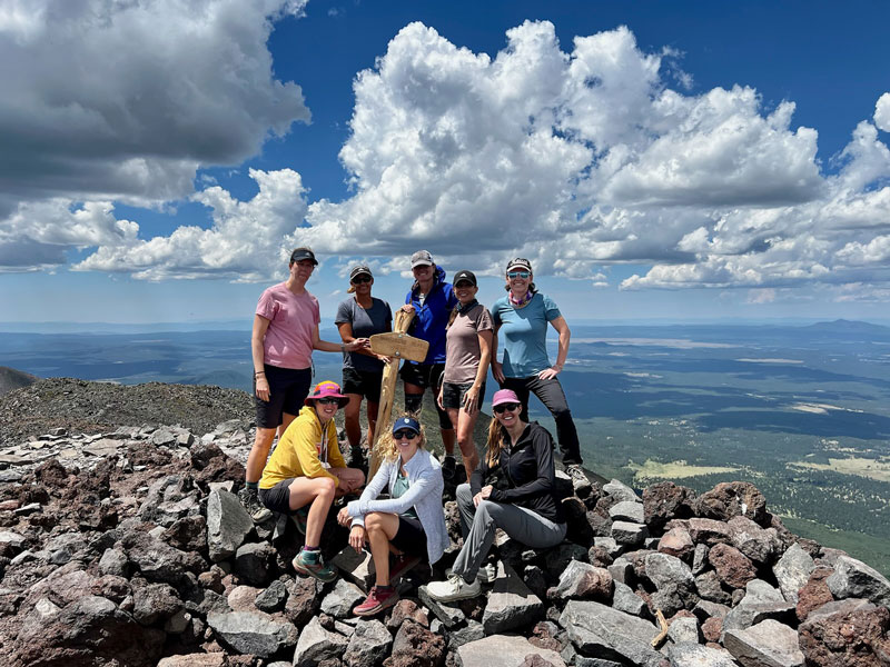
On a clear day, you can see all the way to the Grand Canyon. How’s that for awesome? Now to get down. Just 11.5 miles to go, unless you’re so over it that you decide to hike down on Humphreys Trail and catch a ride back to Schultz Tank Trailhead. I mean, I wouldn’t blame you.
Backpacking Information
If you’re backpacking, Fremont Saddle is your first decent opportunity to camp. Since the fire, the saddle is pretty exposed with little shade or protection from the wind, so if you can, you should definitely keep on going until Doyle Saddle.
The elevation at Doyle Saddle is just under 11,400 feet, and no camping is allowed above that elevation, so this is your last (and best) opportunity to camp. The only downside is that the trees block most of the view.
No camping is permitted in the Inner Basin, which means there’s also no camping allowed between Fremont Saddle and Doyle Saddle.
Neither campsite has any water sources.
Map & Directions
Location Kachina Peaks Wilderness, Coconino National Forest, Flagstaff, Arizona
Google Maps Schultz Tank Trailhead
Fees/Passes None
Trailhead Facilities None
Recommendations for you
Humphreys Peak | Flagstaff
Elden Lookout | Flagstaff
Kendrick Peak | Flagstaff
Leave a Reply