Cabin Loop Trail
TRAIL STATS
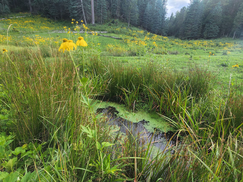
Visit six historic Forest Service cabins on the Cabin Loop Trail as you wander through a magical forest on the Mogollon Rim. Since the Houston Brothers Trail runs through the middle of the loop, you can choose to do just one half of the loop or the entire thing. If you go late in an active monsoon season (August), you might be treated to abundant mushrooms, meadows filled with wildflowers, wild raspberries, sparkling streams, thick ferns, misted valleys, and maybe even a summer rainstorm.
Trail Description
I honestly thought this hike would be a monotonous walk through ponderosa pines on a bed of dry, brown pine needles. I could not have been more wrong. Maybe it was because we’ve had a lot of rain this summer, and we even had some rain during this hike, but there were many moments on the trail that you could have convinced me I was somewhere in the Pacific northwest.
It was that beautiful. No lie.
Overview of Cabin Loop
The Cabin Loop Trail is a series of connecting trails and forest roads that form a 25-mile loop that travels between historic cabins once used by the Forest Service.
See this overview map for the locations of the main trailheads and cabins.
There are several places you can begin the loop, but the main choices are General Springs Cabin, Buck Springs Cabin, and Pinchot Cabin. We chose to start at Pinchot Cabin because we were planning a two-day trip, and I thought camping on the edge of the rim would be incredible (it was). Plus, that way we could take Houston Brothers Trail back to make it a half loop if we found ourselves struggling.
Clockwise or counter-clockwise?
We had read that counter-clockwise was a more gradual ascent, but we chose clockwise for mileage reasons, and now we think that either way is about the same. The eastern half of the loop is going to have lots of ups and downs no matter which way you travel!
Which half of the loop is easier?
If you only want to do a half loop, the western loop is easier by far (Houston Brothers, General Crook, and Fred Haught trails). There is a lot less elevation change on this segment.
If you want more of a challenge, choose the eastern loop (U-Bar, Barbershop, and Houston Brothers trails).
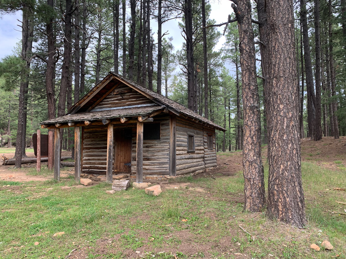
Pinchot Cabin
If you’re Googling directions for Pinchot Cabin, it will tell you to turn on forest road 95B, which, as best as we could tell, is not an existing road. Park your car near the sign for Houston Brothers Trail on Forest Road 139A and find the trail toward Pinchot Cabin.
Near the cabin is where the U-Bar Trail breaks away from the Houston Brothers Trail. Even though the entire trail is well-marked with signs and posts, there are a lot of roads crisscrossing the area, and it’s easy to miss trail forks. GPS is a really great idea. We took a quarter mile walk of shame back to a fork we missed even with GPS.
U-Bar Trail
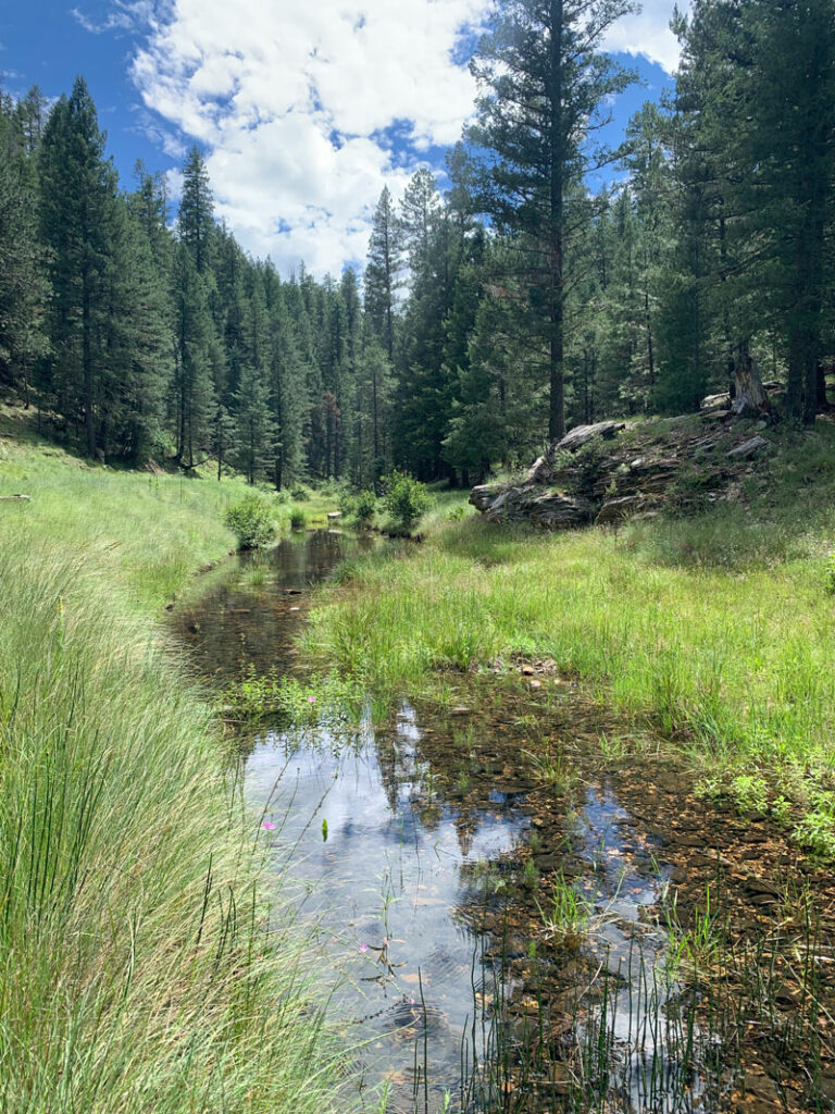
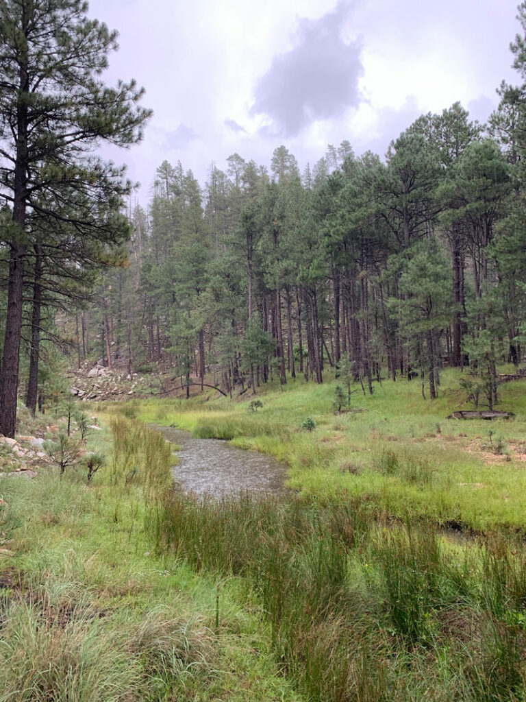
If you were expecting mostly flat, U-Bar is going to teach you differently. The trail goes down into valleys and then usually almost immediately back up on the other side. Repeat, repeat, repeat. The benefit here is that if it’s been raining, there is water at the bottom of almost all of them, as well as verdant meadows and wildflowers.
Dane Spring
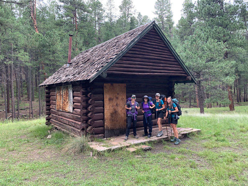
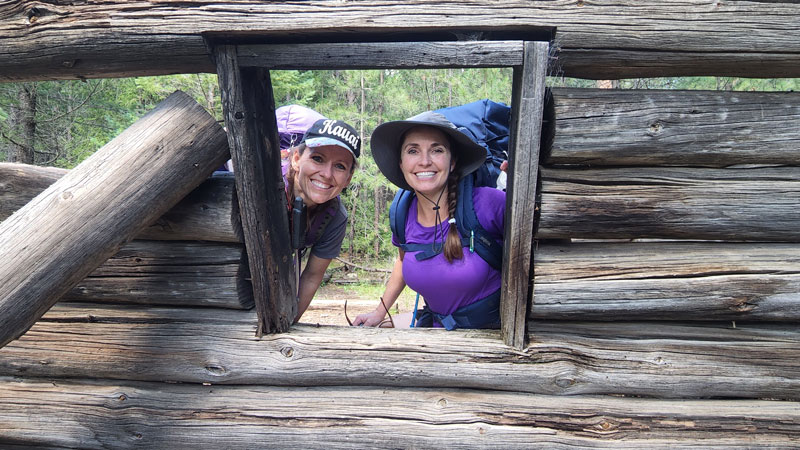
Six miles from Pinchot Cabin, you’ll come to the ruins of Dane Spring Cabin. Most of our party was completely uninterested in checking it out, but April and I figured we may never be there again, so we just had to go inside.
Near the cabin is a spring that hopefully has water running out of the pipe. Even though we weren’t very far into our hike, I decided to fill my empty water bottle there. Later, when everyone else was filtering from a pool on the ground, I was very thankful I had.
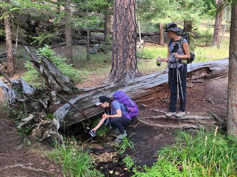
Words to the wise Fill up every single empty container you have at Dane Spring. It’s some of the best water we found. Don’t forget to filter it, too.
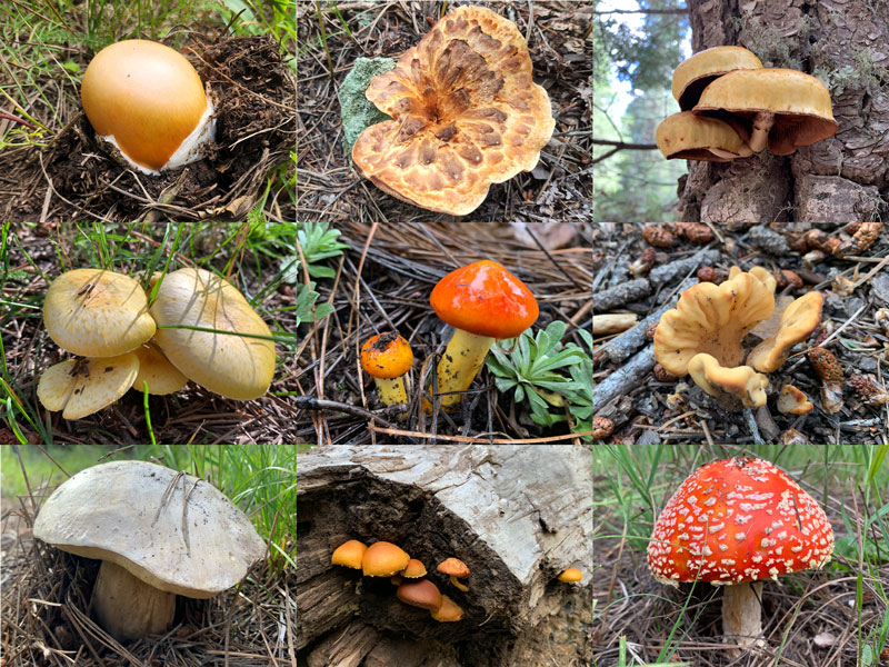
If it’s been an active monsoon year and you’re visiting in late summer, there might be more mushrooms along the trail than you’ve ever seen in your life. And April might be blurting out, “Mushrooms make me happy!” which sounds questionable in most situations, but here it was perfectly normal. Papa Smurf? Are you in there?
Barbershop Trail
Almost nine miles from Pinchot Cabin, you’ll come to a major intersection with fancy signs and everything. Here is where you can add three miles to your trip by turning left to visit Buck Springs Cabin. Or, if you already have too many miles planned for the day like we did, you can skip it all together and head down Barbershop Trail. It’s more of the same up and down, so don’t expect much relief from elevation changes.
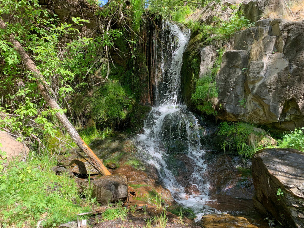
Barbershop Spring
We had seen Barbershop Spring marked on the Forest Service map, so we figured it must be a reliable water source and planned to fill there. If you were hoping for a refreshing gush of water coming from the mountainside, you’re going to be disappointed. It was more like a pretty pool of water surrounded by thick greenery in a scenic valley.
Thankfully, the water was clear, which cannot be said about all the water sources on this loop, so I’m just gonna say it again. . . fill ‘er up!
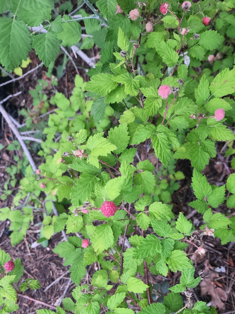
Keep your eyes open in summer for wild raspberries. I had forgotten to pack fresh fruit, and these made for an extra special treat along the way.
Houston Brothers Trail
By the time we reached Houston Brothers trail, it was close to dusk and the forest became even more magical than before in the twilight. Houston Brothers Trail follows a seasonal stream and therefore has dense vegetation and captivating beauty.
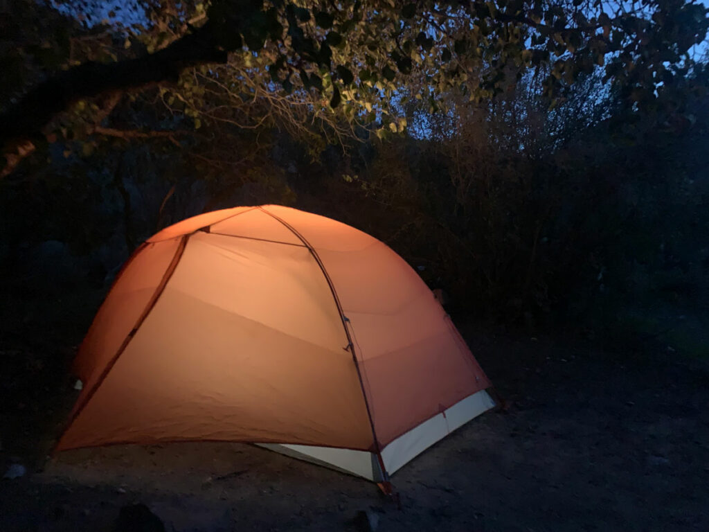
If you’re doing the half loop, this is the trail you’ll use to cut the loop in half. But we had come this far, and we were committed to camping on the rim, so we headed south toward Forest Road 300 and set up camp just as darkness fell.
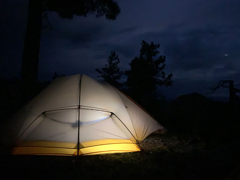
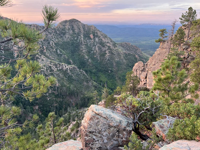
The benefit of camping on the rim is the glorious view below, and if you’re lucky enough to have a sleepless night like Hillary did, you just might experience the sunrise up there in heavenly solitude.
General Crook Trail/Forest Road 300
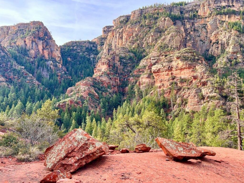
Some maps make it look like General Crook Trail is distinct from Forest Road 300, but we couldn’t find it, so we just followed Forest Road 300 to the turn for General Springs Cabin. The views along this stretch are magnificent, so don’t forget to look away from the forest road and take it all in. The Mogollon Rim is one of Arizona’s true gems.
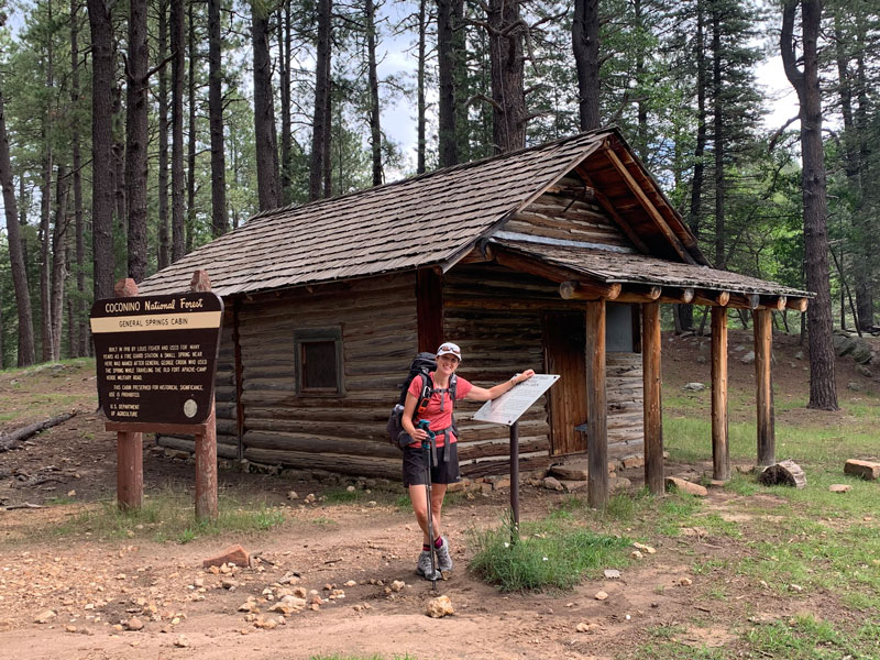
General Springs Cabin
You’ll turn at the commemorative plaque for the Battle of Big Dry Wash and head a short way down a road to General Springs Cabin. This cabin is restored, and you can go inside to check it out. I hope this doesn’t need to be said, but please don’t vandalize it in any way.
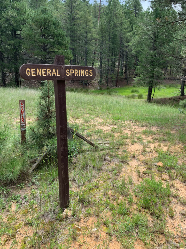
General Springs
Once again, the spring by this cabin was on the main map, so we figured it would be a good place to fill up. Our topographical maps showed the location of the spring to the northeast of the cabin, but we looked all around and found nothing. The Forest Service map showed it to the southeast of the cabin, so we looked there and we found a pool of water. Later, Hillary discovered this sign along the east side of the road that we had missed. The pool of water we found was directly back toward the drainage from this sign.
It was better than nothing, but this water was yellow and had a film on top. Ew. Even after filtering, it was discolored. God gave us eyelids for a reason. Just drink.
Fred Haught Trail
If your water situation isn’t dire and you know it’s been raining recently, it’s likely you’ll be able to find clearer water along the intermittent stream that parallels the Fred Haught Trail.
Even though our amateur meteorologist friend told us we wouldn’t have rain, it rained on us almost the entire way. The clouds, the rumbling thunder, and the sprinkling rain made for a very cool and pleasant journey along this section.
The elevation gains here are far less dramatic than on the eastern side of the loop, so it was mostly a casual meander through a beautiful landscape.
The washed out road
We found ourselves on an unused forest road when the road abruptly ended at a drop-off into the valley below.
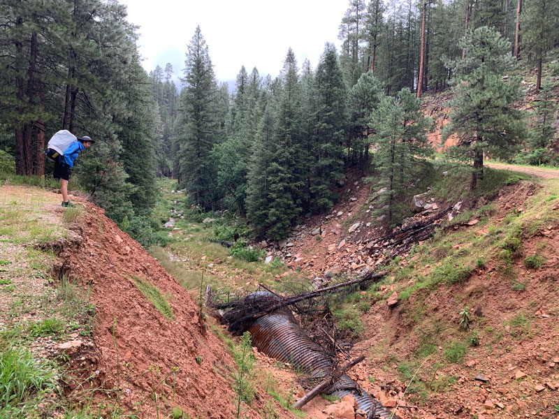
Keep walking until you find a steep (and maybe slippery) use trail that leads down into one of the greenest sections of the trail yet. It’s really like you’re in a rainforest, and there might be wild raspberries to eat on the descent.
The good news is you’re almost back to Pinchot cabin. Just follow that unused road for a little longer until you find the fork for the last segment of the trail.
The better news is that even if you didn’t see much wildlife along the way, you might see multiple herds of elk on the drive out. Because a magical hike couldn’t end without that.
Map & Directions
Location Cabin Loop Trail System, Mogollon Rim, Coconino National Forest
Pinchot Cabin start From Payson, head north on Highway 87. Turn right on Forest Road 95 and travel about 11 miles. Then turn left onto forest road 139A and park near the sign for the Houston Brothers Trail.
General Springs Cabin start From Payson, head north on Highway 87. Turn right on Forest Road 300 (Rim Road) and travel about 12 miles. The turn left toward General Springs Cabin at the intersection with the memorial plaque for Battle of Big Dry Wash.
Fees/Passes None
Trailhead Facilities None
Preview this Hike
Recommendations for you
KP Creek Loop | Blue Range Wilderness
Secret Canyon | Sedona
Six Great Arizona Backpacking Trips
Leave a Reply