Brown’s Mountain
TRAIL STATS
A quick hike up Brown’s Mountain gives you great views of the surrounding mountains and McDowell Sonoran Preserve. All the elevation gain comes near the end, but it doesn’t last too long, which makes it a good choice for an moderately easy peak. The curious can take the loop to visit the ruins of historic Brown’s Ranch.
Trail Description
Brown’s Ranch Road
From the trailhead, you’ll follow Brown’s Ranch Road, which isn’t actually a road anymore. This section is very easy hiking through flat desert, but the downside is there will be bicycles coming through, so watch for those.
At that well-signed junction for Brown’s Mountain Trail, turn left.
Brown’s Mountain Trail
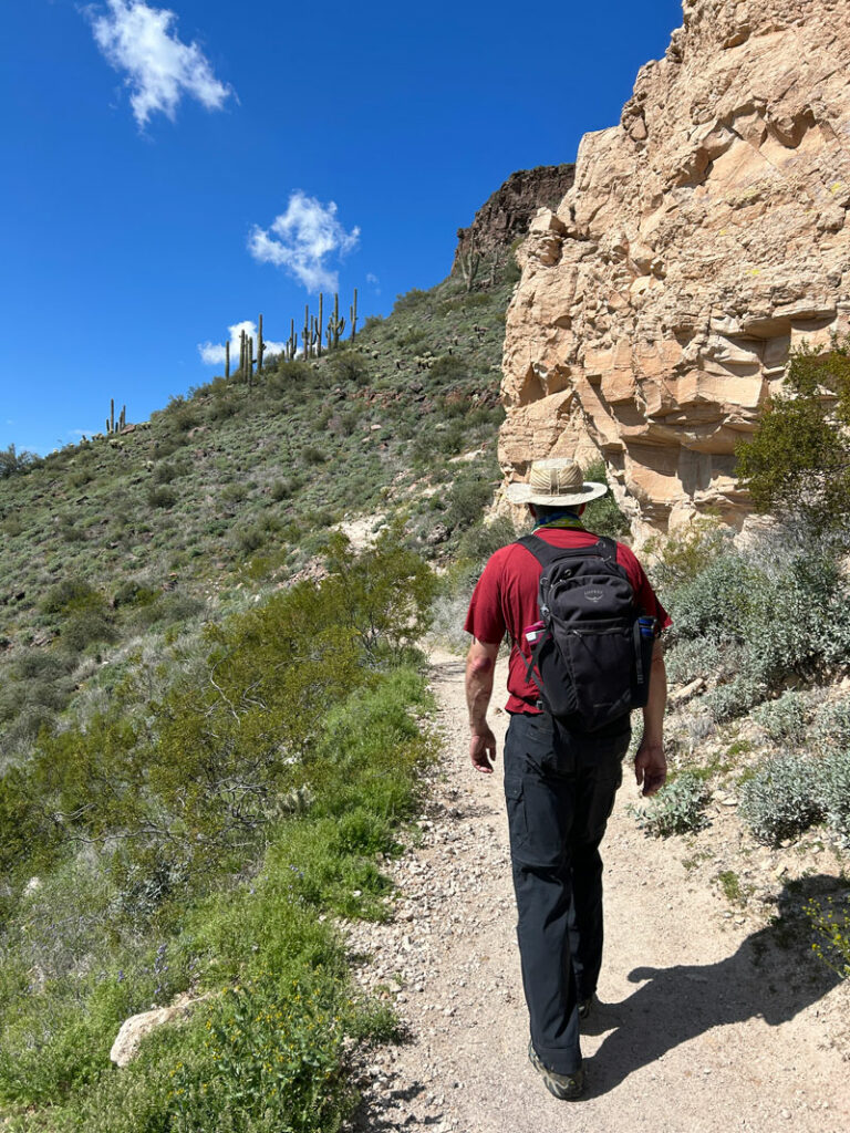
The trail becomes more narrow here, but that doesn’t make it bicycle free, so keep your eyes out for them. Luckily, the cyclists are nice folks who announce themselves.
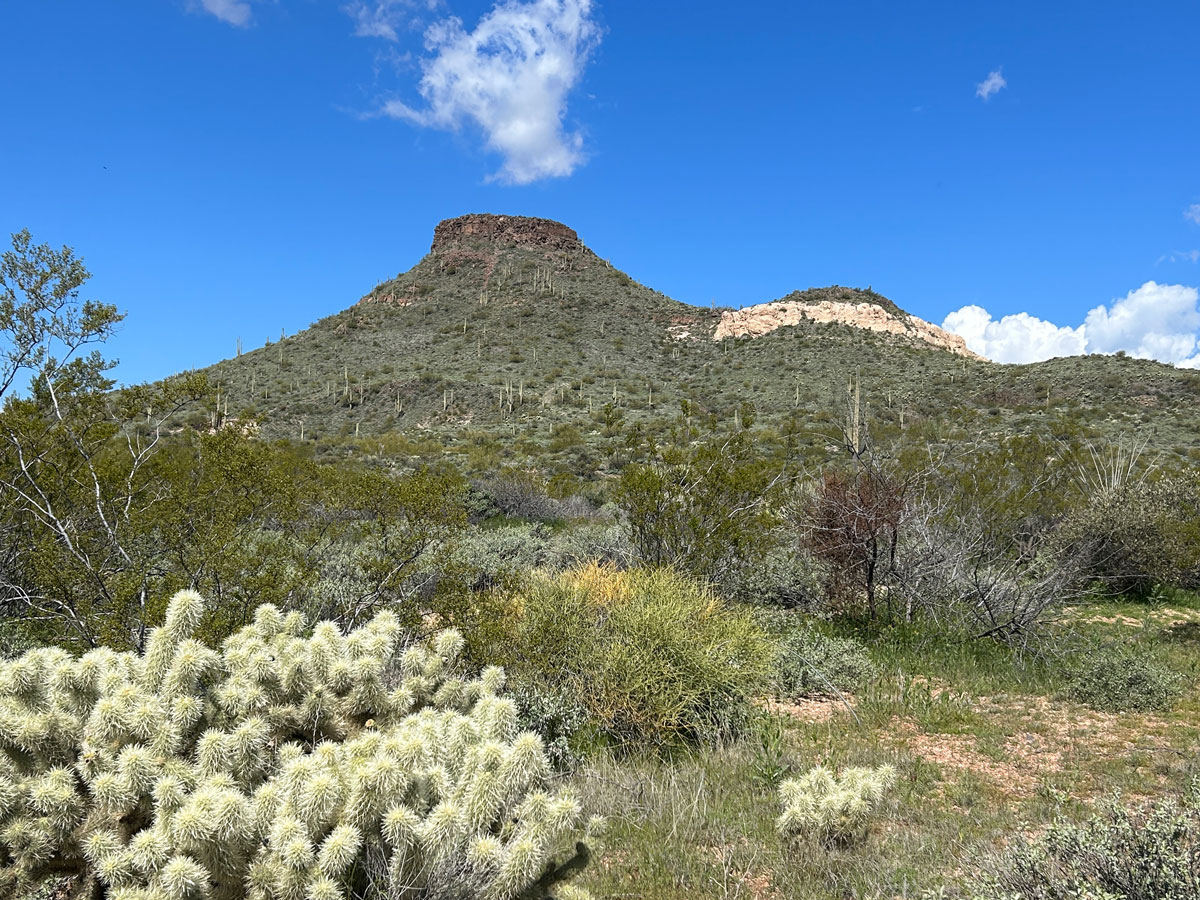
The trail will begin to climb up the flanks of Brown’s Mountain toward a small saddle. At the saddle, you’ll come to another well-signed junction with the spur trail that heads to the summit.
There’s also a short spur trail at this junction to a scenic overlook, but since you’re headed to the summit, you might as well wait for the best views.
Brown’s Summit Spur
The final push to the summit is steep, but it also becomes more scenic with bigger views and pretty cliffs adjacent to the peak. The steep section is very short, so it won’t be long before you’re soaking in the views.
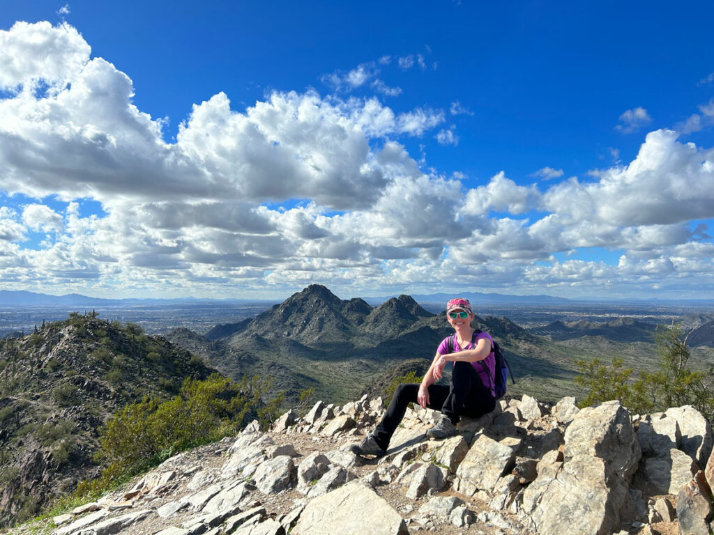
As soon as you reach the flattish top, there will be a fork where you can choose to go right to the highest point and some pretty cool photo ops. . .
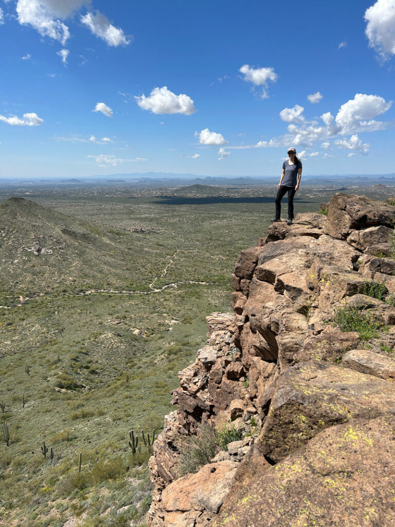
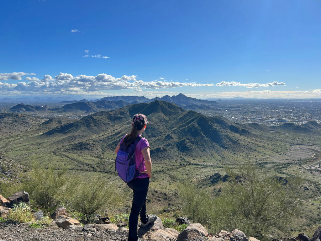
. . . or left to what my husband thought were better views. From here, you can see Four Peaks, Weaver’s Needle, Red Mountain, and Tom’s Thumb all in one epic panorama.
The view from Brown’s Mountain
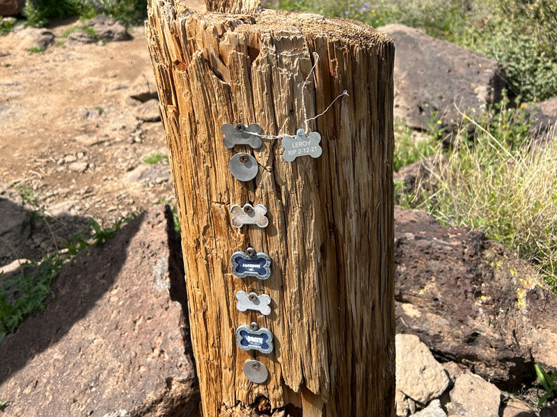
But wait, there’s more! A strange little pet cemetery. Aw, poor Leroy.
Optional Loop and Visit to Brown’s Ranch
Additional mileage 1.4
Additional elevation gain None
After enjoying the summit, you can go back down the way you came or go back to the junction with Brown’s Mountain Trail and turn left. This will take you down the back side of the mountain where you can turn right onto Upper Ranch Trail to get back to Brown’s Ranch Road. Turn right and follow the road all the way back to the trailhead.
BUT, when you get to the junction with Corral Trail, you can look around to your left for the remnants of Brown’s Ranch. Google Maps has the location completely wrong, so I totally missed it. If you go, drop a note in the comments and send me a picture!
Map & Directions
Location McDowell Sonoran Preserve, Scottsdale, Arizona
Take loop 202 to the Pima exit and go north. Turn right on Dynamite Blvd and then turn left onto Alma School Parkway and follow it to the trailhead.
Fees/Passes None
Trailhead Facilities Restrooms and water
Recommendations for you
Sidewinder Overlook | McDowell Sonoran Preserve
Dixie Peak | Phoenix
Shaw Butte and North Mountain | Phoenix
Leave a Reply