KP Creek Loop
TRAIL STATS
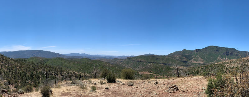
If you’re in need of some wilderness therapy, a loop of Grant Creek and KP Creek in the Blue Range Primitive Area in eastern Arizona has got you covered. Lush meadows, abundant wildflowers, shimmering aspen, towering pines, rushing creeks, and the occasional waterfall are just some of the treats to be found here. You might go a whole weekend without seeing another soul due to the remote and rugged nature of this place, but its wild character also comes with a price. Trails are faint and not well-maintained, so there is some route-finding and fallen wood to negotiate.
Trail Description
I’ve lived in Arizona most of my life, but I had never ventured to this remote area of the state before now. Did you know there is a Blue River in Arizona and there’s even a small town called Blue out there in the middle of nowhere? Population 36.
The original plan was to hike trail 101 along the Blue River, but that plan was squashed when I went to throw my gear in the back of the Expedition and discovered I hadn’t ever gotten the flat tire fixed! I needed a new plan quick. Though Hannagan Meadow didn’t look much farther up the 191, the winding road meant another hour of travel time. After more than 5 hours from home, we pulled into the lot. It was Memorial Day weekend, and ours was the only car there.
Hannagan Meadow
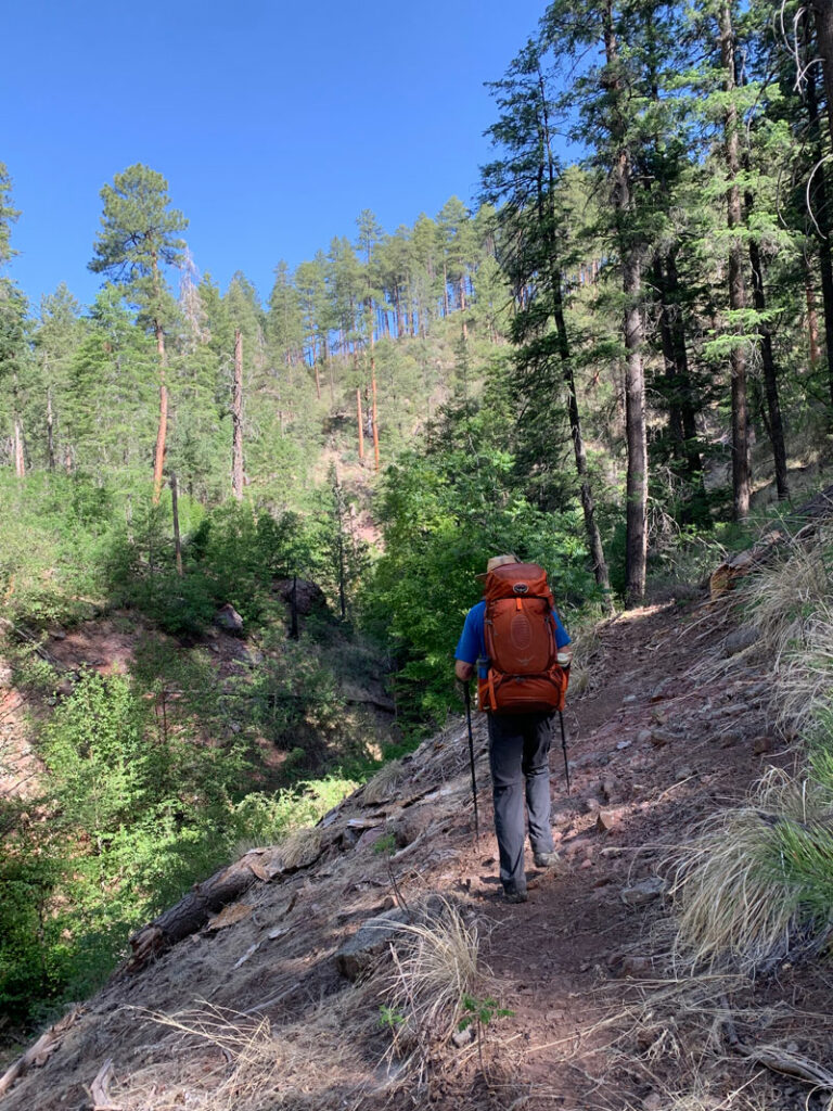
From the Hannagan Meadow trailhead, you’ll start off on the Foote Creek Trail (#76A), but very quickly you’ll fork right onto Steeple Trail (#73). “But wait! The map says the fork is farther down!” Yes, yes it does. And maybe that map should be pitched in the trash because we spent many frustrating and fruitless moments trying to follow the topographical map only to realize it’s just not that accurate. Sometimes you’ll be on the mapped trail, sometimes you won’t, but I did you a favor because every time we got off trail, I walked it back to make sure the map I gave you is accurate. When in doubt, follow my track. And say a little prayer.
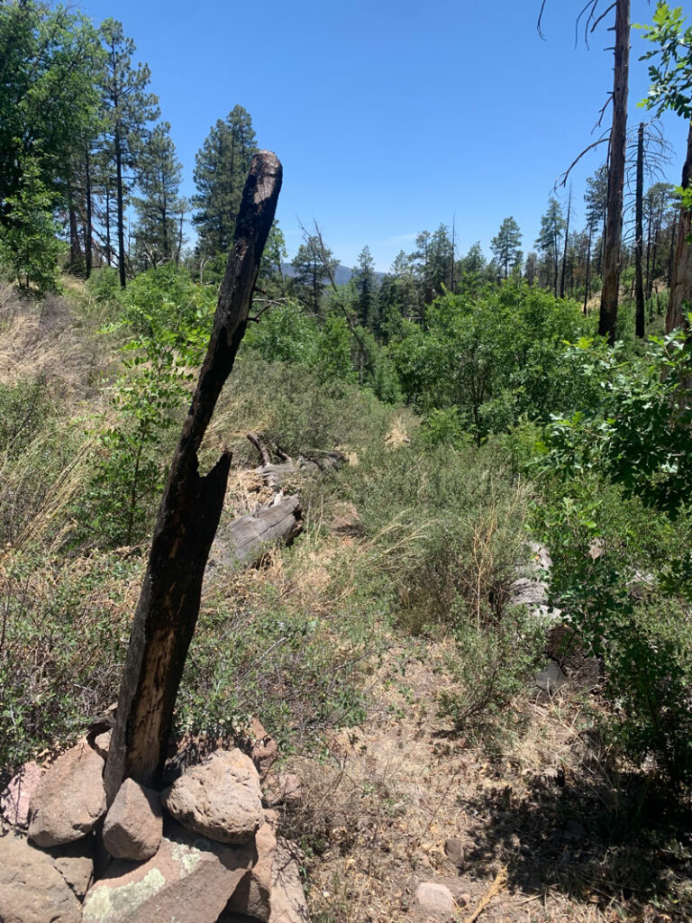
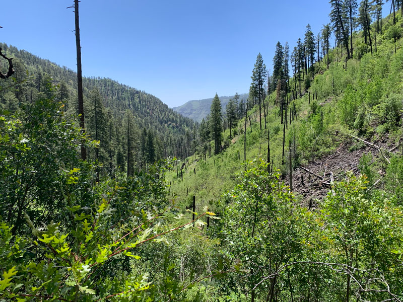
This part of the hike passes through an area that was severely impacted by the Bear Wallow fire of June 2011, which was set by an unattended campfire. Eleven years later, we are still living with the consequences. Be on the lookout for the trail that forks to the left in an open area that had huge rock cairns when we went. This is the beginning of Upper Grant Creek.
Upper Grant Creek Trail (#65)
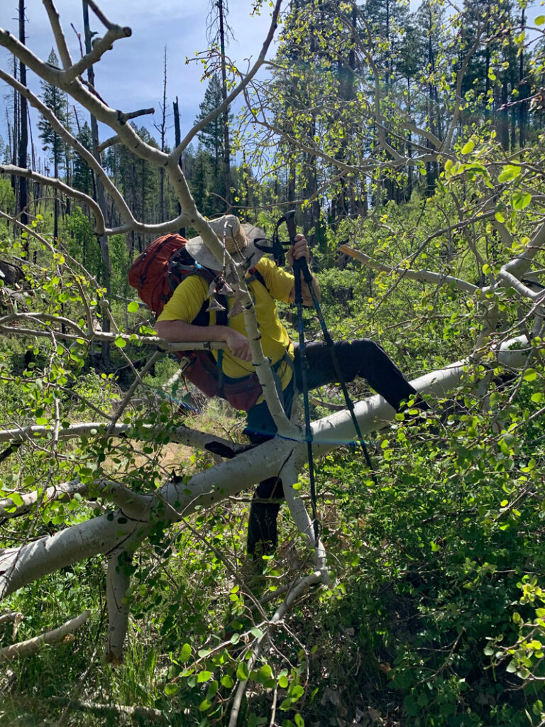
This is where the going starts to get real. Almost right away, you’ll encounter a lot of deadfall and find yourself going under, over, and around log after log.
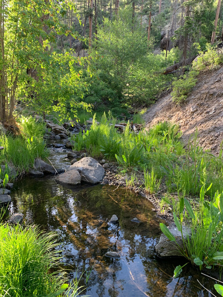
The upper reaches of the creek were dry, but soon we began to encounter pools, and a little farther down it became a running creek. Grant Creek is a perennial creek that was flowing pretty well even in a dry year like this one. The beauty of the area almost makes you forget about the gymnastics involved in making your way down this rugged trail. Almost.
The dilemma here is trying to decide on a picture to post. It’s so thick with green here that I couldn’t stop taking pictures, but none of them really captured the experience of being so wholly swallowed up in the forest. It wasn’t just the sight of the happy trees, nor the sunlight and shadows engaged in their magical dance. It was the fresh smell of the pines, the peaceful sounds of the creek and singing birds. And me, my feet, moving along the path and connecting with it all.
There really isn’t much in the way of campsites along this section of the trail, so when we discovered a nice flat spot among the trees just before the junction with Paradise Trail, we decided pretty quickly it would be our home for the night. And really, sometimes the most simple accommodations are the ones that we savor the most.
Did you bring your hammock? Me neither! And there I was before the trip talking about how my pack didn’t seem that full. (Kicks self.)
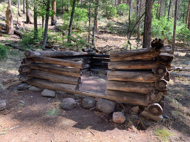
Grant Cabin
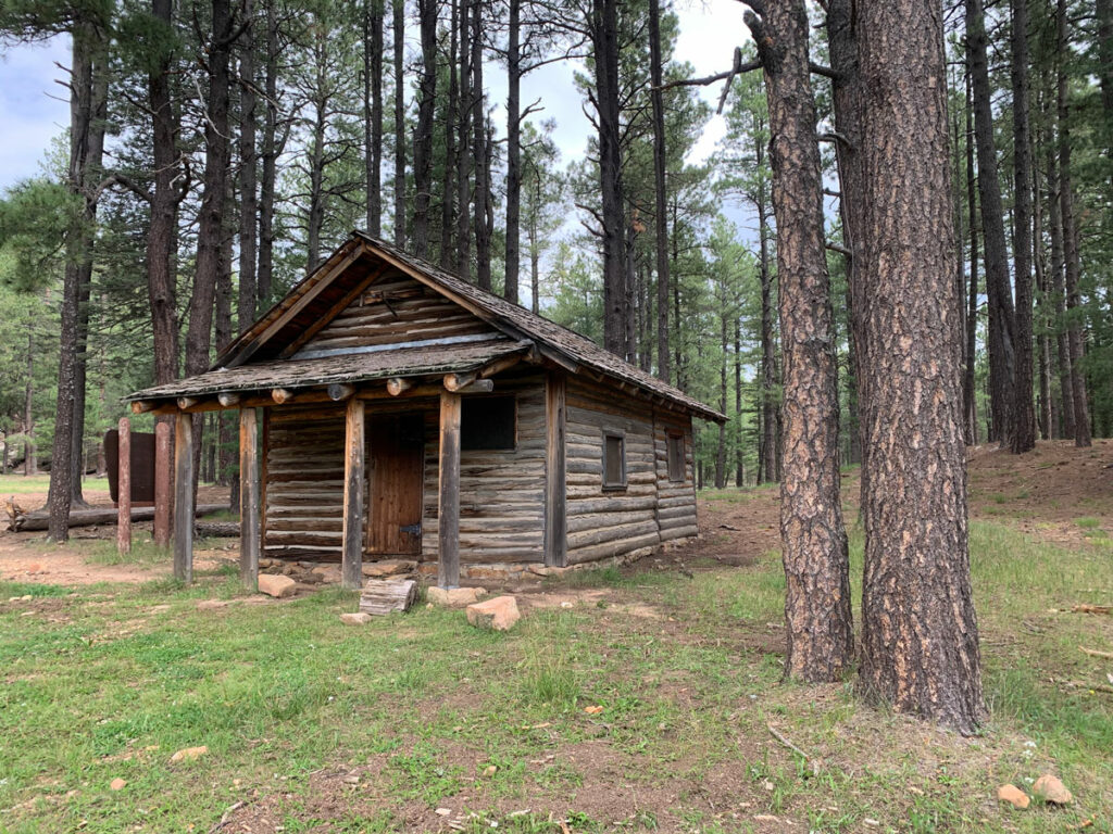
The next morning, we made our way down to the trail junction and discovered a group we had seen near the trailhead the day before. They staked out a nice, large campsite near the remains of an old cabin.
Apparently, they were just as confused as us about the map situation, so they were exhausted after hiking unnecessary miles the day before. After hearing their route along Foote Creek Trail wasn’t any easier than ours, and knowing it was longer, we felt satisfied that we had opted for the trail along the creek.
Paradise Trail (#74)
When you get to Paradise Trail, you will leave the creek and start making your way along a more dry area with less vegetation. It’s a little sad at first, but what you give up in dense forest, you make up for with expansive views of the Blue Range.
The trail gets tricky here, and when you’re looking for the hairpin turn on the last leg toward Steeple Trail, take note. At the windy saddle where it looks like the trail continues up to a small peak in front of you, there’s a large cairn under a tree to the right. I’m not one to boss people around, but make the turn there or suffer the consequences. Or maybe the trail ahead somehow connects up, but we couldn’t figure out how.
The next trick is finding the junction for Steeple Trail because it is NOT where it’s marked on the topographical map. Unless you want to slide down a sketchy slope, cursing the crazed lunatic who thought this was a good place for a trail (even though this person doesn’t exist since it ISN’T a trail), just continue until you get to a burned out sign, and then make your turn onto a very nice, if ill-mapped, trail.
Steeple Trail (#73)
Soon you’ll begin to parallel Steeple Creek, which was dry at first, then nasty moss-filled stagnant pools, then finally a little trickle. I wouldn’t count on this creek having water in the dry season, but it has some really shady, large campsites.
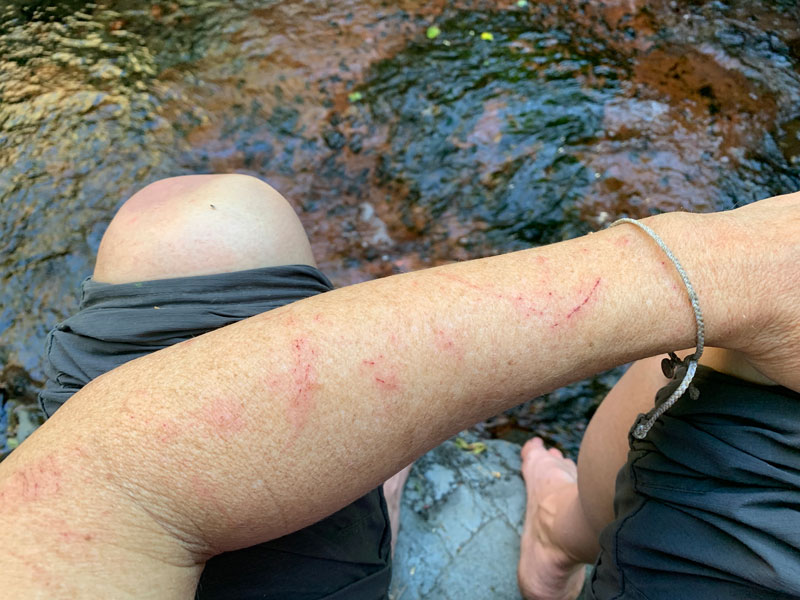
And, of course, a well-defined use trail tricks you into going straight to the creek and the campsites, at which point you’ll be totally off the trail. After pushing your way through a suspiciously dense thicket, you might glance at the map, which will show you off the trail, but you’ll question it anyway because it hasn’t really been reliable in the first place. And for that error in judgment, you’ll pay a heavy price in bushwhacking, frustration, and maybe a rolled ankle.
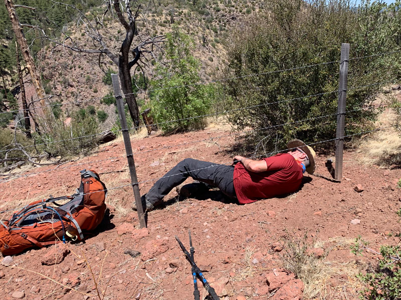
Annnnnnd you’ll also be rolling under a weirdly well-maintained barbed wire fence instead of passing through the gate. I mean, it could be amusing.
Or, you’ll just follow my edited track and happily continue on your way. The choice is yours.
KP Trail (#70)
The start of the KP trail isn’t well-defined, but once you get on it, it’s probably the easiest to follow of the whole trip, and that’s a welcome change. It still doesn’t follow the topographical map exactly, but as long as you stay on the worn path, you’ll be fine.
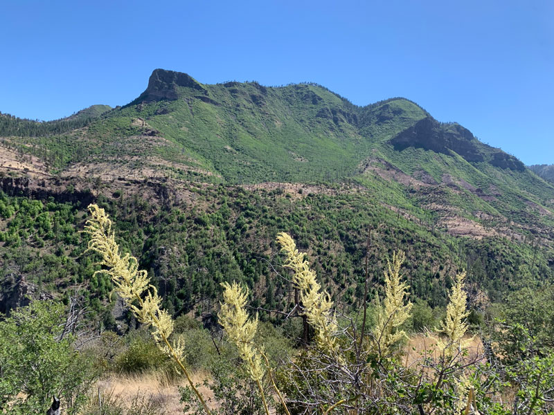
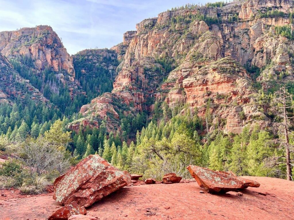
Approaching KP Creek affords more impressive views of verdant mountains and rocky peaks. We saw that there is a loop trail up to Blue Peak, which sounded like a fun side trip with an incredible view, but after seeing just how high these peaks are, we knew it was wishful thinking. Clearly, I didn’t read the stats on that one.
Don’t make my mistake and get yourself too excited for KP Creek. I know it’s dry and sunny, but trust me when I say you can see the drainage looooooong before you’ll actually get there. The trail goes along the flank of the mountain for quite a while as it gradually descends. It feels a little bit cruel, I know, but it’s no doubt saving you from a steep descent. Hang tough because when you finally hit that creek bed, it’s going to be a little extra sweet as you’re back in the loving arms of the dense forest.
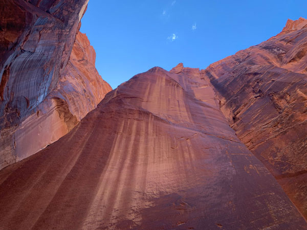
From there, the trail will take you up on the steep banks again and again as it makes its way up the canyon, only crossing the creek a handful of times. Sure, the map makes it look like you’ll be pretty much in the creek the whole way, but that map is straight up evil. I found the canyoneer in me staring longingly at the rushing water below. There must be another way, I thought, and I’m sure you could make it happen if you were willing to get wet in a freezing creek as you make your way over logs and slippery rocks and other water hazards. But still.
Even though you aren’t right by the creek most of the time, the hike is just beautiful and gives you birdseye views of the water rushing through the tree-lined canyon. I comforted myself by remembering that a smooth, dry trail makes the going a lot easier and faster.
The day had been long, so we settled on camping at the first place along the creek that looked doable. It was a tight fit and was right next to what I like to call Spider Haven, but pleasant. We went to the creek to soak our tired feet and assess the damage inflicted by the bushwhacking. It was more like a dip than a soak because that water was COLD. But it dulled the pain as our feet gave in to blissful numbness.
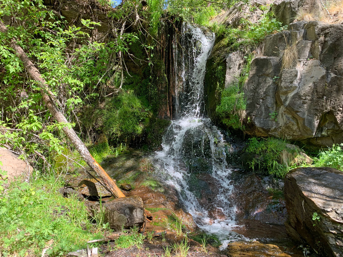
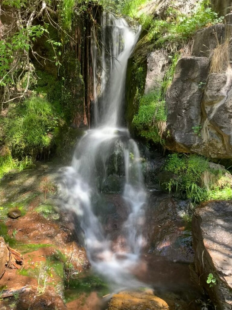
The next day was more of the same, hiking along the steep flanks of the canyon while looking at the beauty of the creek below. The incline of the trail is gradual but unrelenting, but the benefit of this steeper grade is that you’ll start to get glimpses of waterfalls. Luckily, the trail is close enough to a couple of the waterfalls that you can make your way down and enjoy them. Worth it!
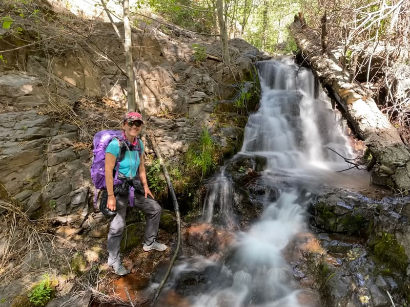
Right before the junction with North Fork KP Trail is this little beauty. Getting to it is a little bit of a trick, and the best way might be to cross over the top of it and come down the other side.
You’ll also be treated to possibly the tallest trees in Arizona. I’ve never seen any taller ones, anyway. I didn’t see any trees here on the Champion Tree Registry, but maybe I should nominate one of them!
North Fork KP Trail (#93)
Stay right at the fork after the waterfall, and you’ll be on North Fork KP Trail for the final stretch out of the canyon. The next time you cross the creek, make sure you have all the water you need to make it back to the trailhead because eventually the creek will dry up. You’ll start to get back into the area that was severely burned in the fire, so the trees are small, but the views behind you are sublime.
Eventually, the trail will turn and start to climb out of the canyon. After a few switchbacks, the going gets easier as the uphill push finally relents into a gentle stroll along an old forest road. The trail will terminate at a trailhead not marked on Google Maps. If you’re really lucky, someone will be there, and you can beg to hitch a ride back to your car, but more than likely you’ll just use the restroom and then make your way across the highway to the Aker Lake Trail, which provides a much safer alternative to walking the highway.
Aker Lake Trail (#17)
Of course, I’m a genius, so I thought instead of crossing the highway, I’d follow a dirt road as a shortcut. Some maps show this road continuing after it crosses the highway, but the ugly truth is that it turns into a branch-laden mess, so we cut through the trees over to the Aker Lake Trail. If you’re up for a tiny bit more bushwhacking, it’ll save you a little distance, but the easier route is to walk the Aker Lake/KP Connector (#17A) across the highway to the Aker Lake Trail (marked as the recommended route on the map below). The Aker Lake Trail is very well-defined, mostly clear of downed trees, and a very pleasant and easy walk through beautiful forest.
Alternative Return Trail
We chose the Aker Lake return trail because it looked a lot shorter than the traditional loop route. If you want to avoid the highway all together, once you get to the trailhead for KP North Fork Trail, continue on as it takes you along the KP Rim trail. At the junction with Steeple Trail (#73), turn left and follow it back to Foote Creek Trail. Make a left, and then you’re just a hop, skip, and a. . . nevermind, that’s probably not a good idea.
Now if only Dairy Queen were a little closer.
Map & Directions
Location Blue Range Primitive Area, Alpine Parcel, Apache-Sitgreaves National Forest, Hannagan Meadow, Springerville, Arizona
There are a couple trailheads you can use to access this trail. We chose Hannagan Meadow, but you will go to both on this route, so it’s up to you.
Hannagan Meadow Trailhead
There’s no quick way to get here. You can come through Show Low and Springerville, and then go south on Highway 191 until you get to the left turn for Hannagan Meadow Trailhead. Alternatively, you can come up north from Safford on Highway 191 and follow a long, winding road until you get to the right turn for Hannagan Meadow Trailhead.
Trailhead Facilities Pit toilets. No water.
Alternative Trailhead
The other trailhead isn’t even shown on Google Maps, but it’s located just north of the Aker Lake turn off on the opposite (east) side of the highway. Except, even though we saw cars there and used the unlocked (and in good condition) pit toilets there, the Forest Service map shows it as closed, so you might want to check with a ranger first.
Trailhead Facilities Pit toilets. No water.
Recommendations for you
Secret Canyon | Sedona
Paria Canyon | Vermilion Cliffs
Cabin Loop | Mogollon Rim
Leave a Reply