
Camelback Mountain
TRAIL STATS
Camelback Mountain is a Phoenix classic hike with great views of the city that everyone has to do at least once. With a carefully observant eye, you can also visit a hidden cave that you’ll probably have to yourself. If you are prepared for a challenge and don’t mind sharing the trail with a lot of other people, you will be rewarded.
Trail Description
We have a love/hate relationship with Camelback Mountain. It’s a pretty cool hike, a great workout, and easy to get to. It’s also super popular, so sometimes it’s hard to park and crawling with people, and we’ve been when the trail up the mountain was a solid line of humans. In truth, it’s a 4-star hike, but the crowds do take away from it a little sometimes.
Echo Canyon Trail or Cholla Trail?
Route choices for summiting Camelback Mountain:
Echo Canyon Trail – 2.3 mi, 1440 ft gain
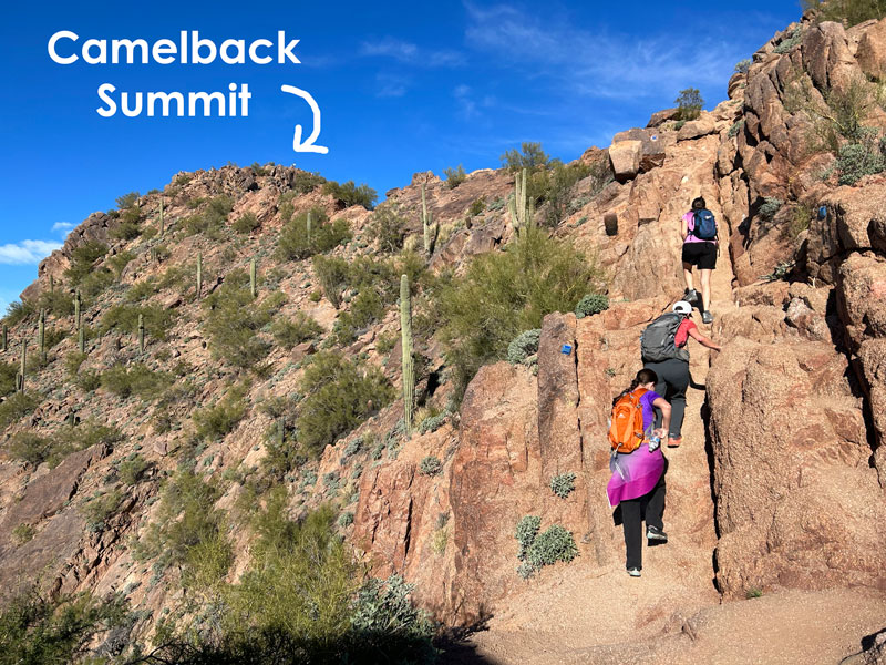
This is by far the most popular route. It is very steep, has railings in place to help with the steepest sections, and carries the most bragging rights. You may be wanting to cry on the last section when you have to climb a steep, boulder-filled trail that never seems to end. The trail stats at the top of this page are for the Echo Canyon route.
Cholla Trail – 2.9 mi, 1409 ft gain
Cholla Trail is longer and slightly less steep, and you may be wanting to cry on the last section when you have to follow the ridge with some mild exposure. Really mild. I just needed to give you a reason to cry. Camelback can do that to you. But in general, this trail is slightly easier compared to Echo Canyon (still not easy, though).
Break the Camel’s Back – 5.2 mi, 2849 ft gain
If neither trail is enough for you (you’re hardcore!), or your friend Heather is forcing you to, then you can go up one, down the other, and then back up and over again. I feel like I should unfriend her now.
Echo Canyon Trail
The first half a mile or so of the trail is not as steep or rocky as what you will encounter later on, and there’s even some places with benches to rest. If this part has you wondering if this hike was a good idea, stop now and maybe enjoy Bobby’s Rock Trail or some relaxation at a ramada. It’s a beautiful place to spend time, whether at the summit or not.
We continued on, testing our patience behind the hordes of folks making their way up in what looked like a zigzagging line for Pirates of the Caribbean. Soon we were on the stairs made of railroad ties and then the steep rock face with a railing to help people with their footing. I have to admit that my first time up there, this seemed really cool, and I tried sliding on my stomach on my way down (not highly recommended–the thought is better than the reality). Shoes with good traction are really helpful here, but any sturdy shoes will do because, well, there’s a railing!
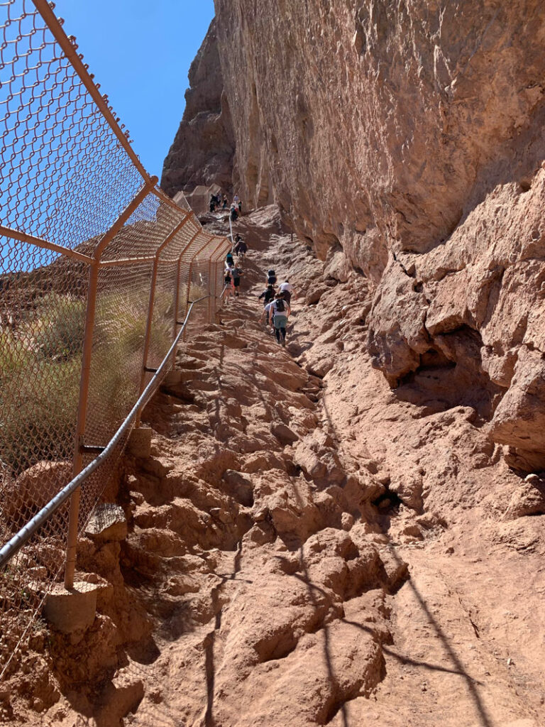
Once you finish that, you’ll be thinking you’re pretty awesome, but I have to warn you that my least favorite part of the hike is ahead, so get off your high horse because you’re not done yet. You’re about to climb steeply up some boulders for maybe a quarter mile or so, and it’s pretty unrelenting.
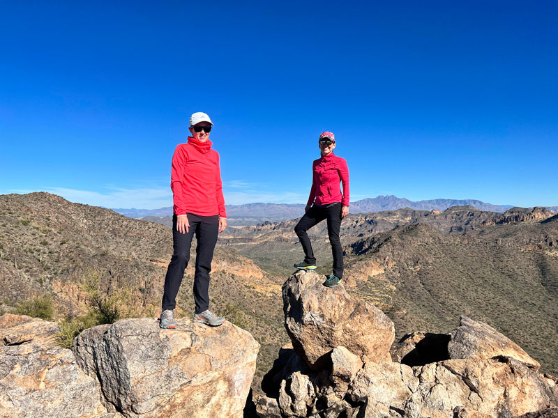
Camelback Mountain Summit
Beyond that section, you can start to feel like maybe you’ll actually make it! SInce it was Heather’s first time, I tried my best to discourage her and exaggerate the false summit, but she hung in there and stayed happy the whole time. I don’t get it. There was so much to be grumpy about: crowds, feeling like barfing, trash on the trail. At least it was a beautiful day. That was enough to push me to the summit. We were NOT alone.
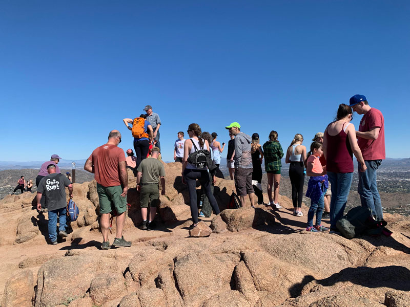
We were finally able to sit down to enjoy the view, only to look down and see a fresh banana peel. WHAT THE HECK? By the time Heather found a fourth banana peel, she lost it and made a public service announcement in front of everyone at the summit. It was a hilariously satisfying pleasure to watch.
Just please, haul out your trash.
The Cave
On the way down, we visited our secret cave. Despite all those people up there, we had the secret cave to ourselves.
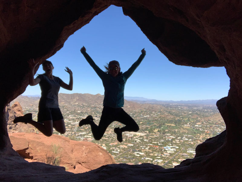
In order to preserve its special character, I’ll let you discover it on your own if you’re so inclined.
Cholla Trail
Cholla Trail is best for those who want a longer but slightly less steep route to the summit. It will still be a challenge, so don’t let the moderate grade and nice stairs on the first section fool you.
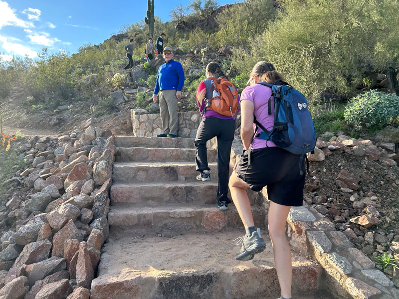
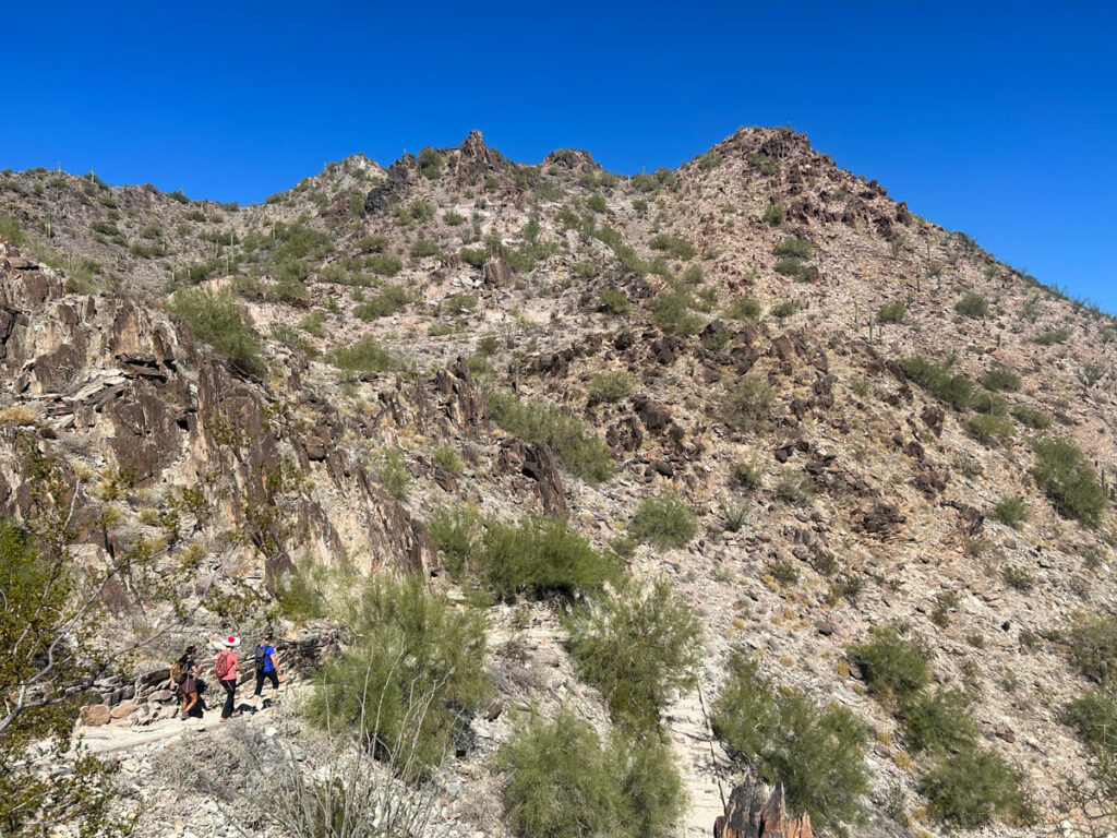
For a while, the trail will be relatively smooth, and you can move along at a decent pace. After you pass a concrete pad, it’s a different story. You’ll be using your hands to help you climb up and over the rocky ridgeline.
Even though this rugged terrain will continue the rest of the way to the summit, this part is actually really cool, and you’ll have views on both sides as you go.
Enjoy the top! (Unless Heather is your leader. Then get a quick drink and get going down the other side—we have a camel’s back to break, people!)
Special Considerations
Safety First and foremost, it’s not just a casual trail up to a nice view. It seems like every concierge in the city must be recommending Camelback Mountain to visitors, and as a result, we have people hiking in Converse, sipping coffee as a trail beverage (and leaving the cups behind), and struggling because they’re out of shape. Let me be clear: it’s steep, rocky, slippery at times, and will require your hands to help you climb. And it’s a desert climate, so bringing water is a must. A crap ton of rescues happen here each year (there’s even a sign warning that the trail is closed during rescue operations), and I’m being dead serious when I say this because I’ve seen rescues underway maybe half of the time I’m hiking there, and I don’t even hike there that often. Please be sure you have the necessary fitness and supplies to attempt this hike (read: WATER!).
Crowds Okay, if that didn’t deter you (you promise you’ll be prepared, right?), then the next thing I will warn you about is the crowds. This hike is extremely popular, probably the most popular hike in Phoenix, so you may be sharing the trail with hundreds of other people, and it may be difficult to find parking on weekends, holidays, and spring break (as we found out). You are not allowed to park in the nearby neighborhoods, so if there’s a sign saying the lot is full, you will need to drive around for a while and come back to check again or park like half a mile away in a legal location and walk. Ew.
Map & Directions
Location Phoenix, Arizona
Echo Canyon Trailhead From the 101, go west on McDonald Drive. After five miles, turn left at the roundabout into the Echo Canyon Trailhead parking lot. Or, from the north 202, go north on 44th St (you may need to exit onto 40th St and go right on McDowell to reach 44th St if coming from the west) and follow it about 5 miles until it turns into McDonald. At the roundabout, turn right into the Echo Canyon Trailhead parking lot.
Cholla Trailhead From the 101, go west on Chaparral to Invergordon Road and turn right. Parking for the Cholla Trailhead is along Invergordon Road. You remember how to parallel park, right?
Trailhead Facilities Restrooms and drinking fountains are at both trailheads.
Echo Canyon Trail shown in magenta. Cholla Trail shown in yellow. GPS is not needed because the trail is well-marked, and you just follow the crowd.
Preview this Hike
Recommendations for you
Ten Awesome Arizona Peaks that Aren’t Humphrey’s
Thompson Peak | Fountain Hills
Piestewa Peak | Phoenix
Leave a Reply