Clover Creek Canyon
TRAIL STATS
In the southeast corner of the West Clear Creek Wilderness lies the small tributary of Clover Creek, a leisurely forest stroll with a few campsites that would make for a short and easy backpacking trip. There may be water in a wet season, but more than likely it’ll be mostly dry until you eventually start seeing pools of water as you get farther in. There is no destination here, so go until there’s too much water and bushwhacking for your liking. Watch for elk!
Trail Description
The fortunate among us will bring a high clearance vehicle to access the trailhead, but we are currently lacking one, so we parked at a pull-out on highway 87 and made a sketchy descent to the meadow below to connect with the parking area and the trail.
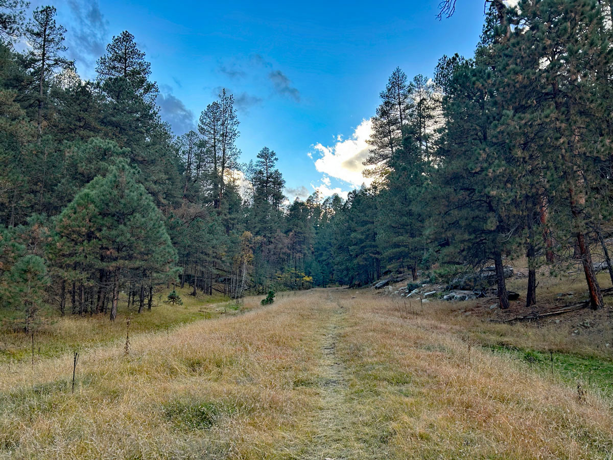
Clover Creek Canyon Trail
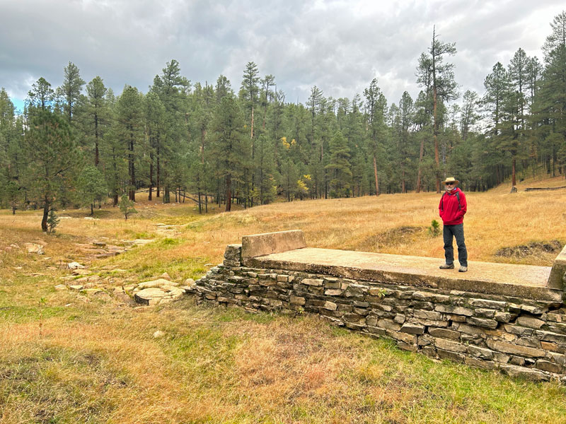
At the parking area, there is a fence to keep vehicles from proceeding, but this clearly used to be a forest road, as evidenced by “Aslan’s altar,” as we called it.
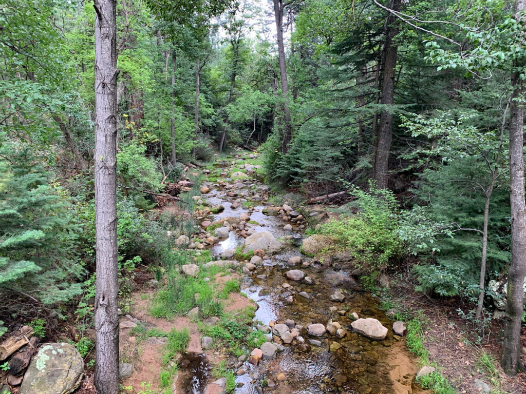
The Clover Creek Canyon trail is pretty well defined, and from the “altar,” you’ll make your way left to follow the creek bed. We went in late fall when the leaves and grass were mostly yellow, but it looks like it would be very pretty in the summer.
There are a few areas that would make really nice campsites if you would like to make this into a short backpacking trip. Maybe with the kids?
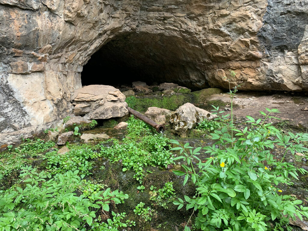
Cool Overhang
The next unusual thing is this cool overhang, and you’ll probably be tempted to leave the trail to go check it out. Hey, why not?
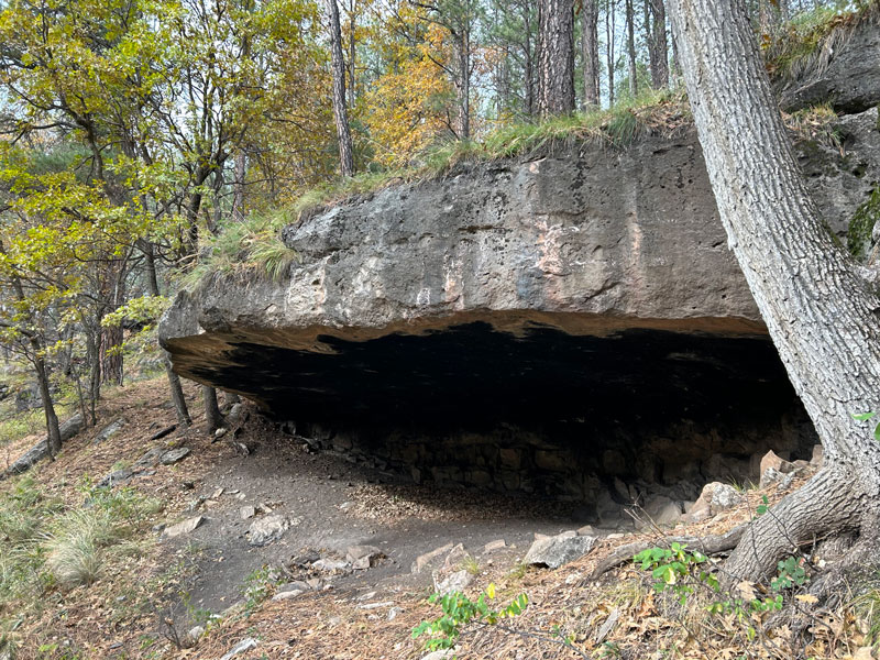
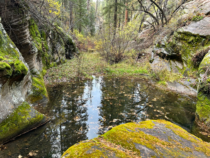
As you continue to follow the creek bed, the walls of the Clover Creek Canyon will begin to get more tight and vertical, and you might start thinking there has to be a cave in there somewhere. I checked several recesses, but no caves.
Eventually, we got to a pool of water that would be difficult to go around, and we were running low on light, so we decided to turn back, but you can go as far as your little heart desires. Just be aware the trail will become less defined and the bushes more intrusive.
Retrace your steps back to your vehicle, enjoying the way the light filters through the trees.
Map & Directions
Location West Clear Creek Wilderness, Coconino National Forest, Payson, Arizona
From Payson, take highway 87 north to Forest Road 142. Turn left and at the next junction turn right and fork right to stay on Forest Road 142. Google Maps will lead you astray because Forest Road 616 no longer exists.
Fees/Passes None
Trailhead Facilities None
Recommendations for you
Pivot Rock Spring | Mogollon Rim
Pine Canyon | Mogollon Rim
Coconino Railroad Tunnel | Mogollon Rim
Leave a Reply