Granite Mountain
TRAIL STATS
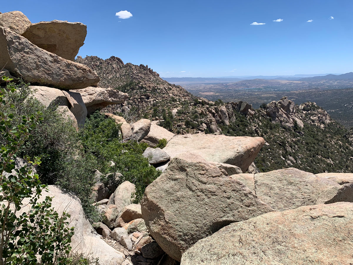
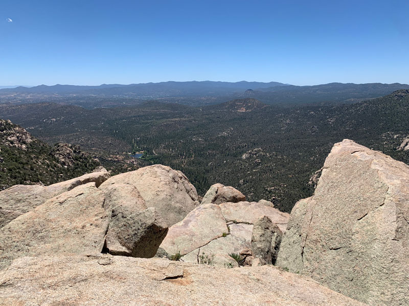
True to its name, Granite Mountain features gigantic granite boulders in astonishing arrangements and large slabs of rock with few trees. What it lacks in trees and shade, it makes up for in personality and views. The peak provides and fun scrambling opportunity for those who crave more adventure while those who just want to enjoy the views can stay below.
The difficulty rating is based on a scramble to the peak. If you are planning to stay just below the peak, it’s probably a 2. The only steep part is at the switchbacks, but overall it’s a moderate hike with some large boulders to step up onto.
Trail Description
While hiking Spruce Mountain the week before, I noticed a unique looking mountain in the distance, and I wondered if I could hike it. After a quick search, I discovered this trail to the top of Granite Mountain. The first time you lay eyes on it, you’ll know it’s different. The typical ponderosa pine forests surrounding Prescott are replaced with huge granite slabs and boulders sometimes bigger than a car.
Granite Mountain Trail No. 261
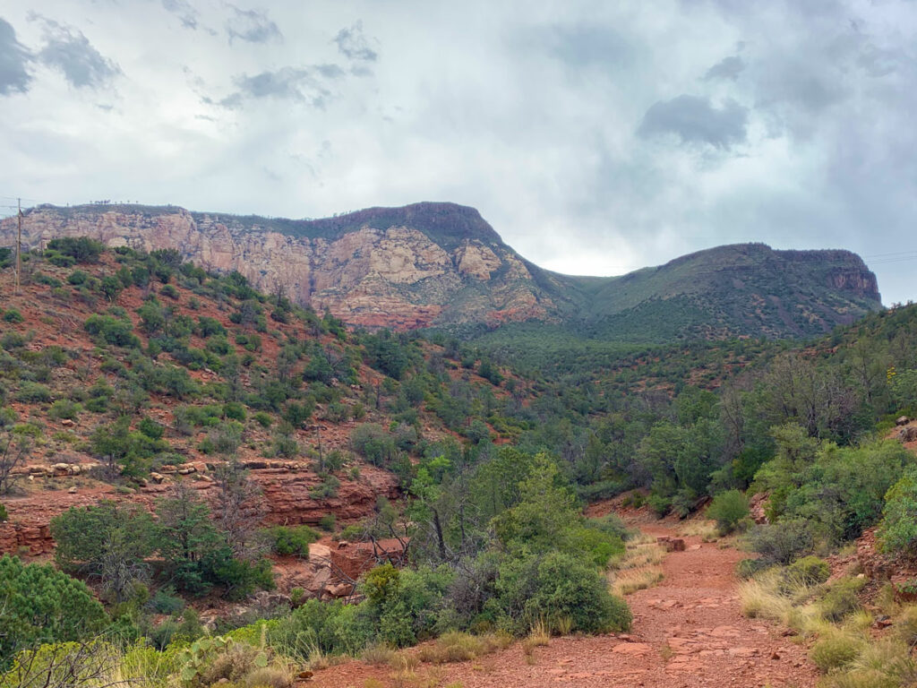
Google might try to send you down Forest Road 374b, but the road is actually closed, so you’ll want to park in the Metate parking area of the Granite Basin Recreation Area. The trail begins right at the lot, and if you want to take the shortest route like we did, you’ll actually fork left onto forest road 374b for a short while before rejoining the official trail a little farther up. Or, you can fork right and follow the official trail as it goes close to Granite Basin Lake.
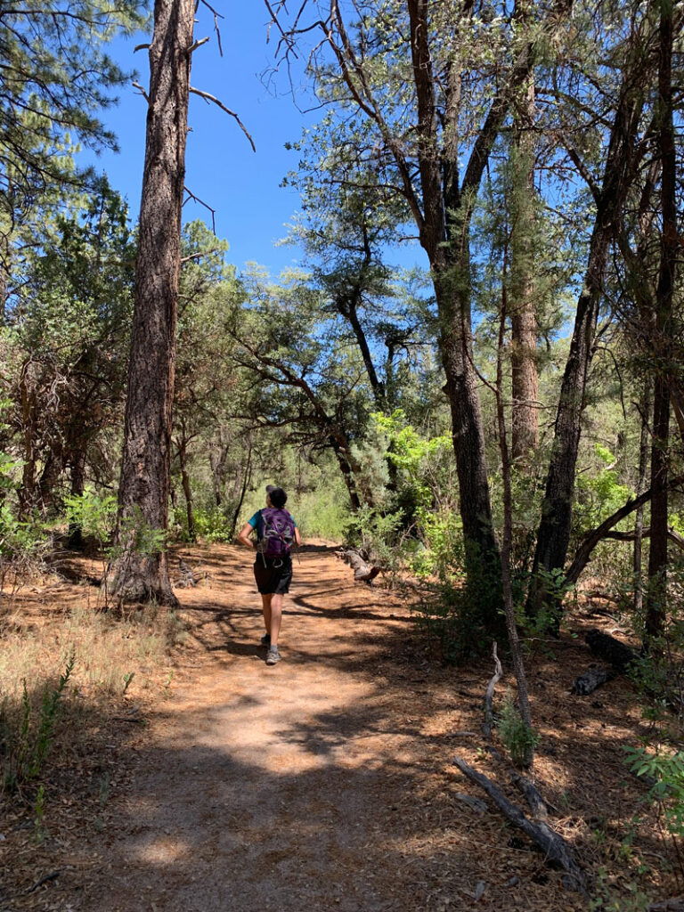
The trail starts off fairly flat as it goes along the base of the mountain through a pretty forested area with lots of shade. Through the breaks in the trees, you’ll get glimpses of the granite behemoth towering above you that you’ll soon be ascending. Are you getting pumped? Get ready because the switchbacks will soon be upon you!
The Fence (and the Switchbacks)
When you reach a fence with a gate, you’ll know it’s game time. You may be tempted to go through the gate and continue your leisurely walk along the base of the mountain, but you’re no slouch, right? You’re king (or queen) of the mountain, and you want to stand on top! As soon as you make that turn, you’ll be heading up the switchbacks toward victory.
There’s little shade on this section, and there are boulders you have to step up like stairs, but it’s well maintained. The reward for your effort is interesting boulders and increasingly better views as you near the top. Go on, climb a few. You know you want to.
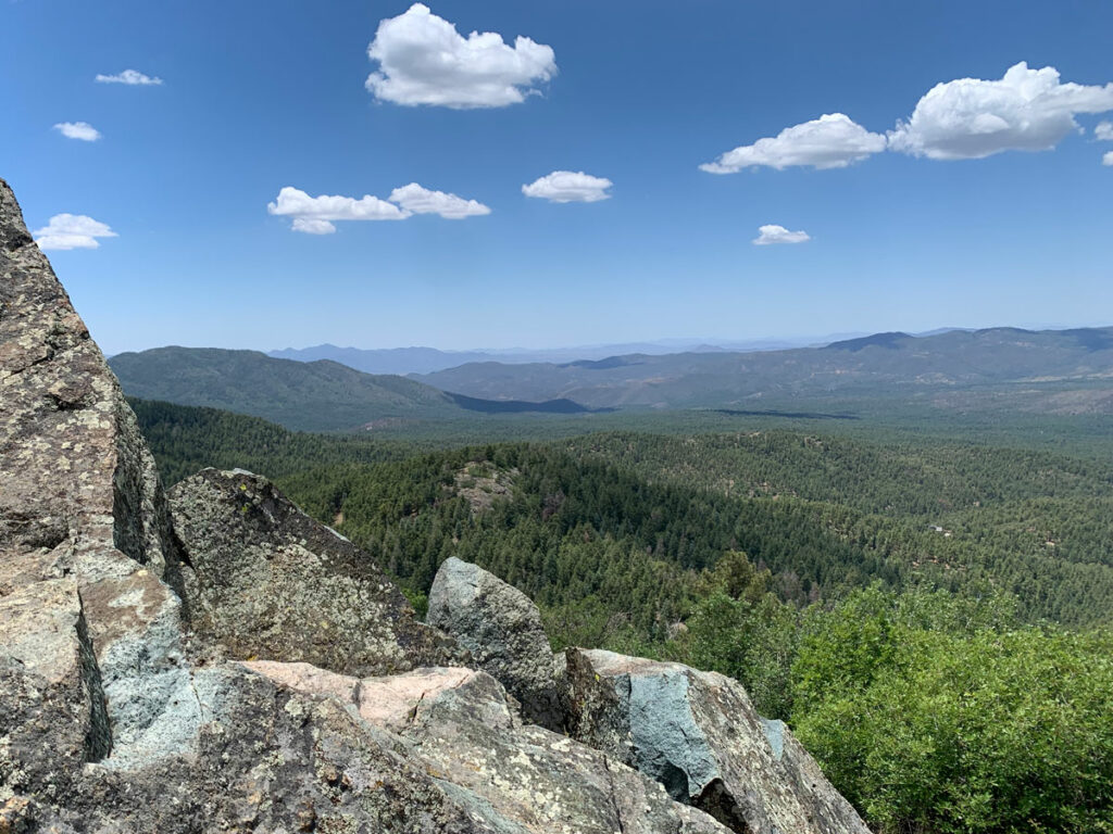
Eventually, the switchbacks will end and the trail will start flattening out again as you approach a nice saddle with a view to the other side. Don’t get too comfortable, though. You’re not there yet! And don’t follow the spur trail to the left—it doesn’t go anywhere.
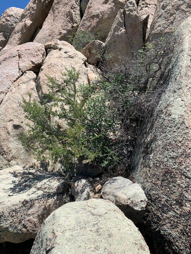
I know when you see all the dead trees up there you’re not going to believe this, but there are some live, shady trees coming soon. I’ve got the shade marked on the map because after hiking in the sun on a warm day, that just might be the best spot on the entire trail.
The Peak
I don’t know if it was just coincidence or if it’s always like this, but as you approach the peak, a miracle starts to occur. Wind! And lots of it! With the shade and the wind, you’ll be refreshed and ready to tackle the scramble to the top. Right?
Still no? That’s okay, you can stay with Heather below the peak and enjoy the nice views while everyone else joins me at the tippy top.
How to Scramble to the Top
Okay, if you’re still reading this, you’re my type of hiker! Boulders are meant for climbing, and climb we will. I am not claiming this is the only way or even the best way to get to the top, but it’s the way that worked for me.
Just after you get to the main viewpoint where most people stop, it kind of looks like the trail continues through what I like to call the “wedding arch.”
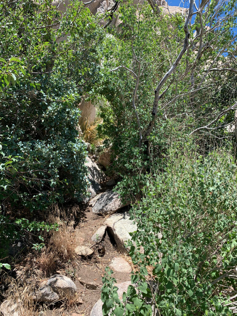
Right after that, the trail disappears and everything turns to boulders. You’ll want to make your way to the left over some boulders like you’re circling it to the left.
Yep, go this way.
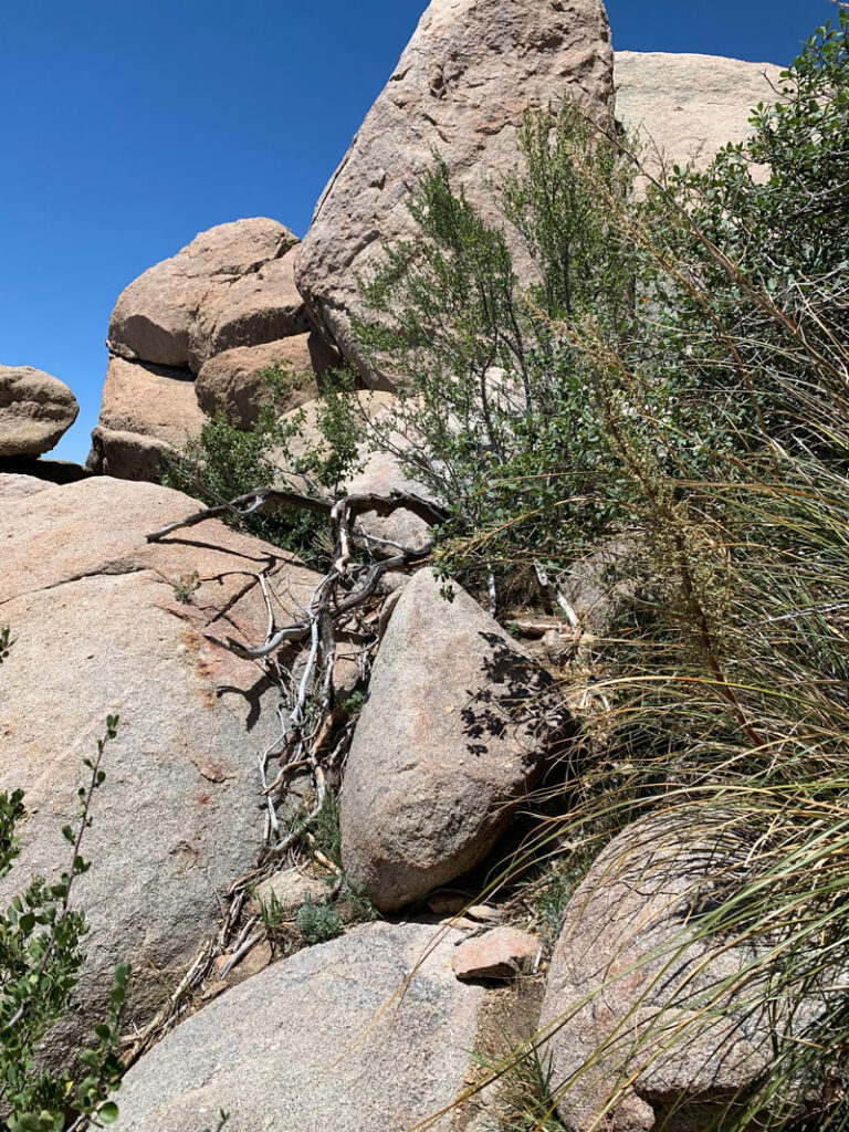
Over these rocks. . .
Now here’s where it starts to get a little more hairy. After this bush, you’ll come to a chest high rock that, as Heather says, you’ll have to “belly flop” onto. And once you do, you’ll climb up around the left side where that smaller boulder is stuck.
If you know Heather, you’d be really proud she did that.
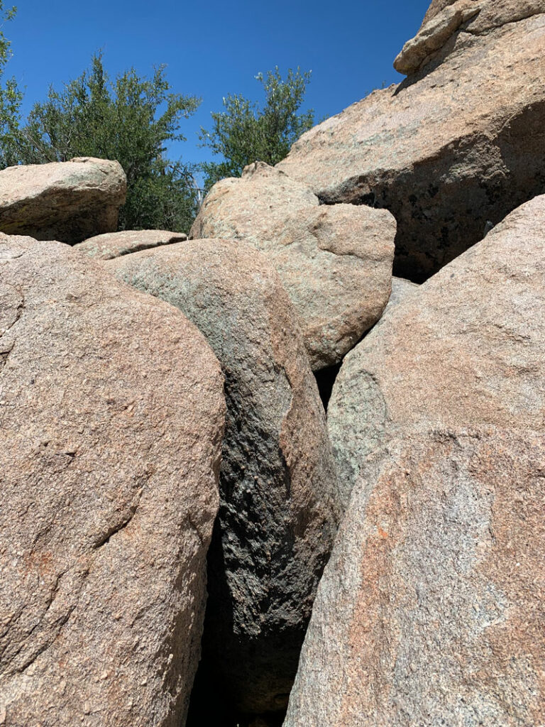
It was right after this that Heather said she was stuck. What? Why? Well, here’s the crux. You’ve got to find whatever holds you can, or wedge yourself between a rock and a hard place, and make your way up that crack. The boulder in the lower right provides protection against a major fall, so you’ve got this!
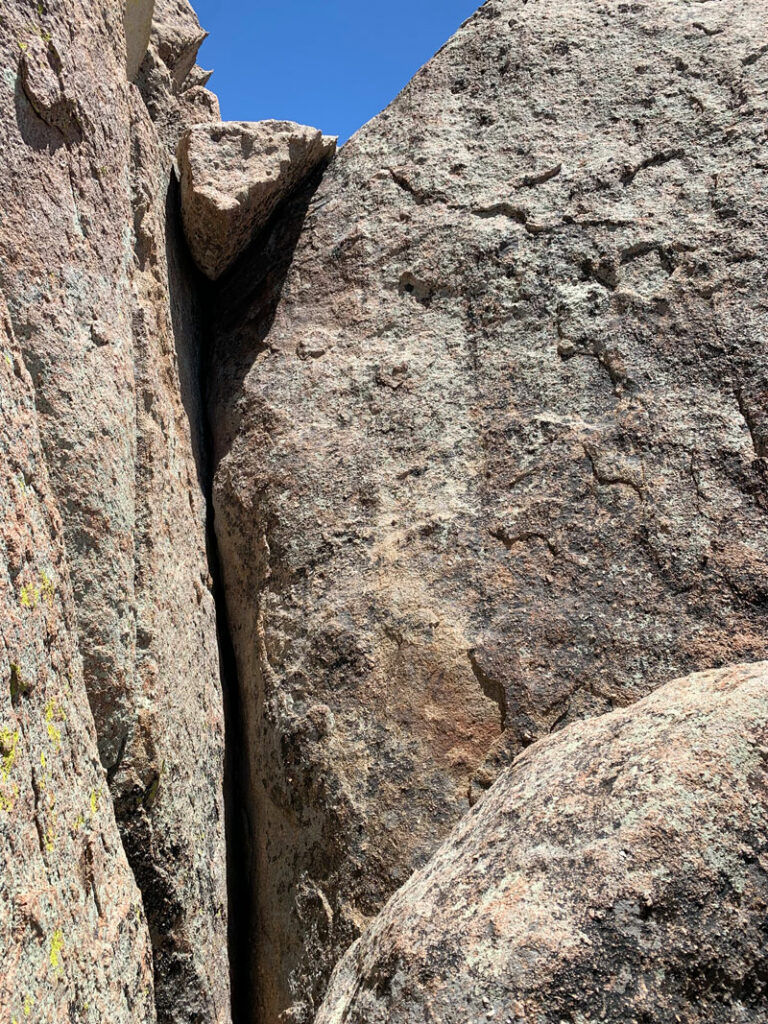
Once you’re past “the crack,” you’re practically there.
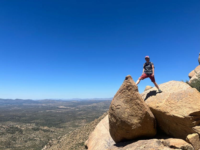
The True Summit
Okay, it’s not the summit, summit. The bad news is you’ll see from up there that you’re not on the highest point of the mountain, but it feels pretty good anyway. Enjoy the view!
Since your friends are down below at the rock of shame, you won’t have anyone to take your picture, so you’ll have to settle for some fake summit pictures down a little lower.
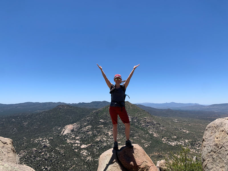
It’s okay, we all know you’re the coolest.
Map & Directions
Location Granite Basin Recreation Area, Prescott National Forest, Prescott, Arizona
From Prescott, take Iron Springs road northwest and make a right on Granite Basin Road. Follow it until it becomes a one-way loop and continue to the Metate parking area on your left.
Fees/Passes You must pay a $5 to park here, payable in cash using the provided envelope, or display an America the Beautiful Pass. Wednesdays are free!
Trailhead Facilities Pit toilets available.
Preview this Hike
Recommendations for you
Ten Awesome Arizona Peaks that Aren’t Humphrey’s
Spruce Mountain | Prescott
Wilson Mountain | Sedona
Leave a Reply