Marcus Landslide
TRAIL STATS
On the Marcus Landslide Trail, you’ll hike to a relatively recently discovered landslide that’s the second largest in Arizona. While it is interesting to learn about the geology of the area from several interpretive signs along the way, the highlight of the trail is the unusual rock formations. You’ll see several examples of mushroom rocks, plus visit Submarine Rock where you can go underneath into a grotto below.
Trail Description
Most people who arrive at the Tom’s Thumb Trailhead are there to hike to its namesake, Tom’s Thumb. In fact, that was exactly what we had planned when we arrived, but the Marcus Landslide Trail caught my eye as I was heading to the restrooms. I had heard of it before, so I became curious and asked the volunteer if it was worth it. She enthusiastically assured me it was, and now that I’ve done it myself, I have to say she was right.
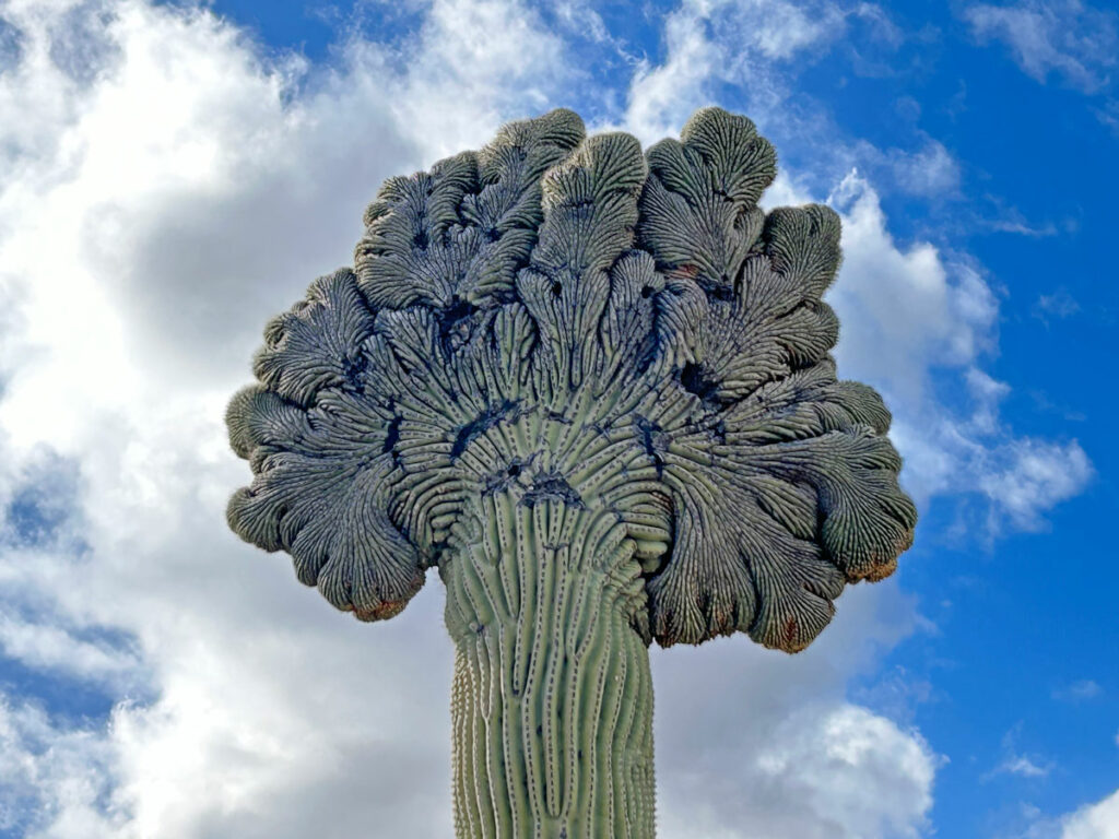
There are so many unusual rock formations to look at along the trail, including the mushroom rocks that seem to be straight out of a Dr. Seuss book. Interpretive signs explain how the landslide occurred and point out geological features. Plus, there’s an enormous boulder called Submarine Rock on the loop at the end that has a grotto you can walk into. So if you were expecting a boring stroll around the mountain, you’re in for a pleasant surprise.
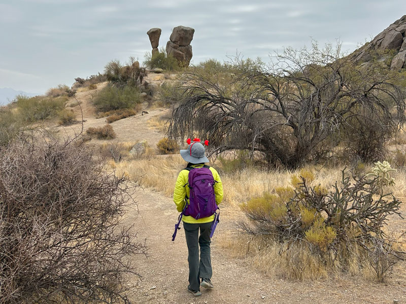
Marcus Landslide Trail
From the parking area, the Marcus Landslide Trail breaks off to the left before you even reach the restrooms. The trail is mostly flat as it begins making its way around the base of the mountain. Before half a mile is up, you’ll arrive at Mushroom Rock.
From a distance, this rock formation looks like it is about to topple over any moment, but when you get closer, you’ll see that won’t happen any time soon. A short, steep spur trail takes you right up to it.
Soon after Mushroom Rock, you’ll come to the junction with Rock Knob Trail.
The enthusiastic volunteer at the preserve recommended the Rock Knob Trail and suggested the possibility of connecting that with Pemberton Trail and Boulder Trail to extend our hike. Those trails cross into the McDowell Mountain Regional Park, and we decided to try them out just to see. This added almost 3 miles of really boring desert terrain, and I found myself wishing I had a mountain bike to speed up the process. So, I guess she wasn’t right about everything. Learn from us, and stay on the Marcus Landslide Trail.
All along the way, you’ll see interpretive signs that have some pretty interesting information. I tried to mark most of them on the map, but you really can’t miss them. I’ll highlight some of my favorites.
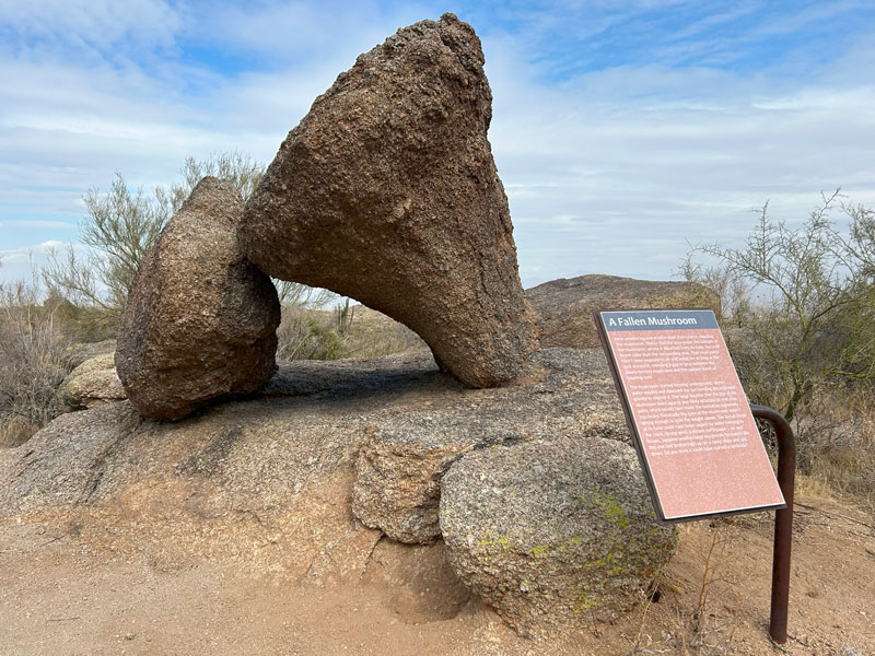
Fallen Mushroom
After a mile in, the fallen mushroom will be off to your left. A sign explains the erosion process that created this cool feature.
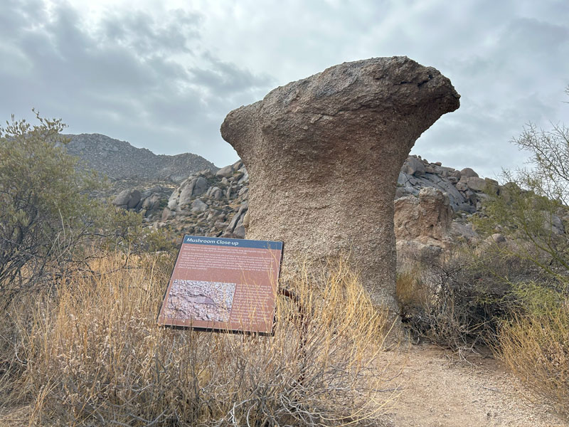
Mushroom Close-up
Not far beyond the fallen mushroom is the mushroom close up.
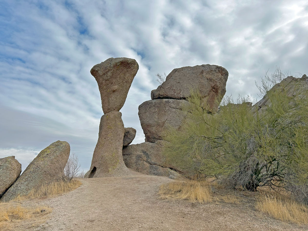
Once you pass the junction with the Boulder Trail, you’re close to the Marcus Landslide area. There will be multiple signs and some viewing tubes that try to direct your attention toward the geological features explained in the signs.
Honestly, it was still a little difficult to figure out what we were looking at with the viewing tubes having such a large field of vision, but we did our best.
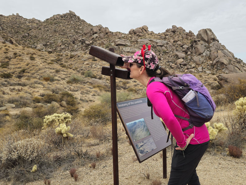
(Don’t judge me for my heart headband. It was almost Valentine’s Day, okay? Just trying to spread some love.)
If you aren’t a geologist, you wouldn’t have known there was a landslide there at all. I guess that’s why it wasn’t discovered until 2002. The signs did help us see some of the geological evidence of the landslide, but most of it was left to imagination.
A short distance later, you’ll come to the loop, and you can go either direction. The people ahead of us chose left, so we chose right. That ended up being a good choice because we met them on our way around and had a good conversation.
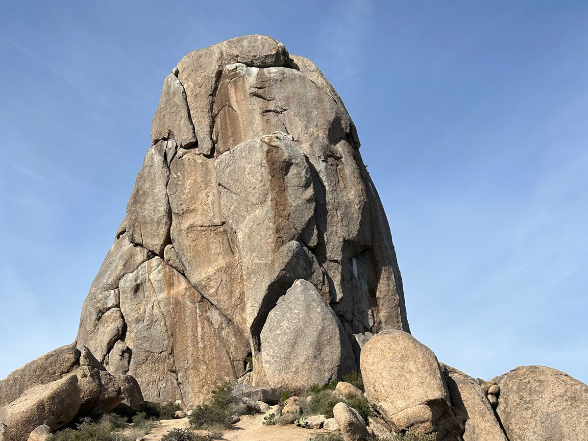
Submarine Rock
On the back side of the loop, you’ll see a sign pointing to Submarine Rock.
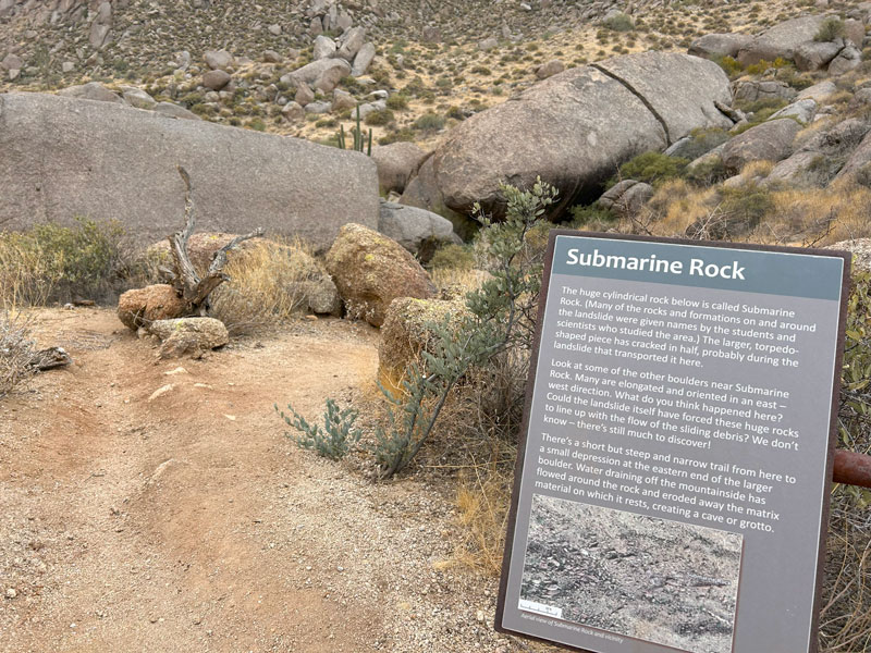
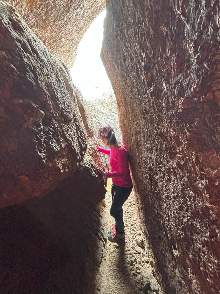
Definitely take the little trail down to it because you can actually walk through a narrow corridor underneath it. It’s pretty cool!
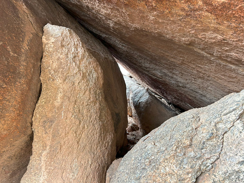
Keep going, there’s more. This reminded me of Fat Man’s Pass.
And this is where my logical thinking ended. I decided to stem up these two rocks and get on top, putting my hand in a pile of rodent turds in the process. Once on top, I leaped over to the next rock and then spent some time trying to figure out how to get down. I just can’t help myself sometimes.
All I’m saying is, it’s cool. Go down there.
Four Peaks and Superstitions Viewpoint
Continuing counter-clockwise around the loop, we visited more interpretive signs including one at a very nice viewpoint. If it hadn’t been such a cloudy, hazy day, we would have had nice views all the way out to Four Peaks and the Superstition Mountains from this viewpoint. I guess I can’t have everything.
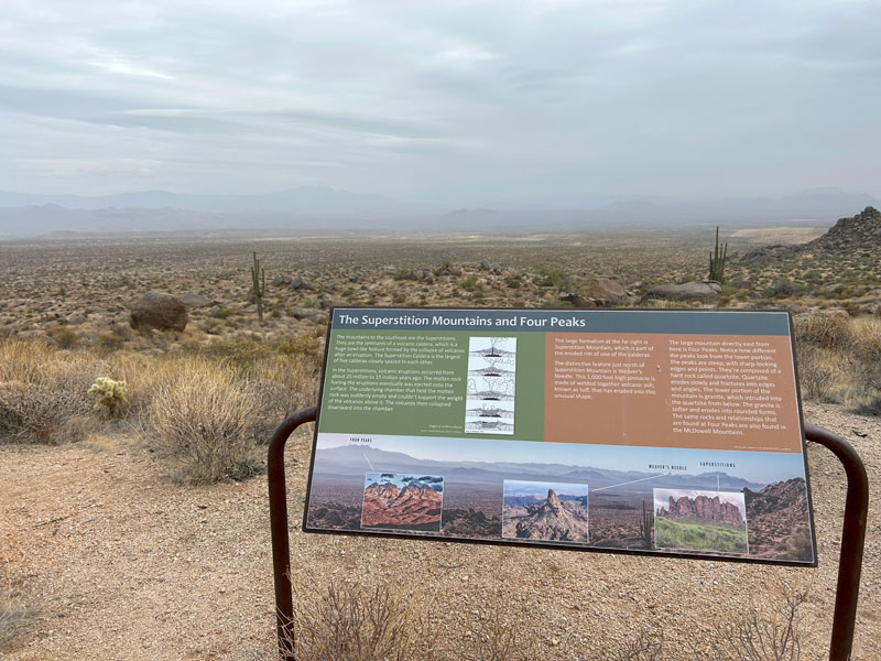
We did learn some interesting facts about the volcanic origins of the surrounding mountains, so there’s that.
Soon after, you’ll finish the loop and take the Marcus Landslide Trail back to the parking area.
Map & Directions
Location McDowell Sonoran Preserve, Scottsdale, Arizona
From the loop 101, take the Pima Road exit. Go north to Happy Valley Road and turn right. Turn right on Ranch Gate Road and then right again on 128th street and follow the many signs to the trailhead. Trails close at sunset.
Fees/Passes None, though they do accept donations.
Trailhead Facilities Restrooms, but no water
Recommendations for you
Tom’s Thumb | McDowell Sonoran Preserve
Brown’s Mountain | McDowell Sonoran Preserve
Sidewinder Trail | McDowell Sonoran Preserve
Leave a Reply