McDowell Mountains Traverse
TRAIL STATS
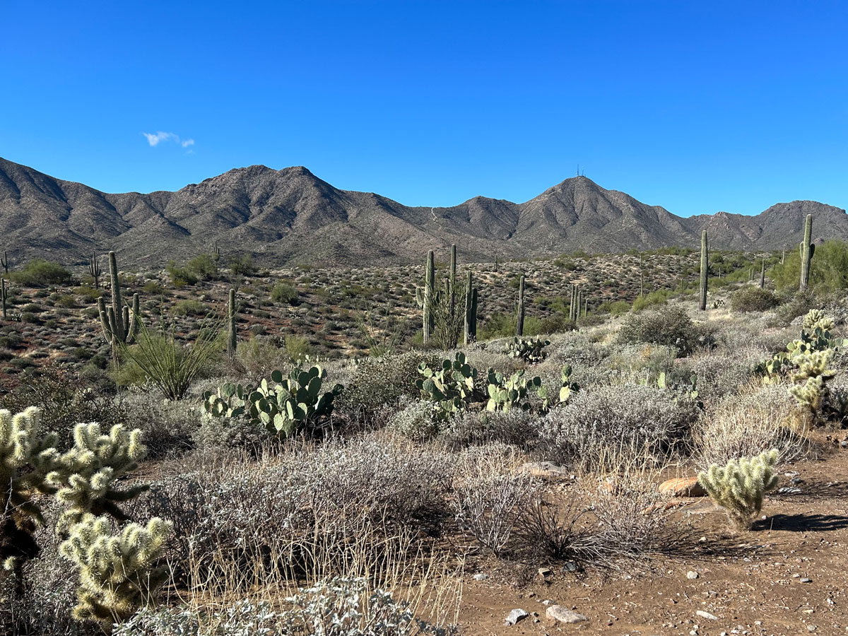
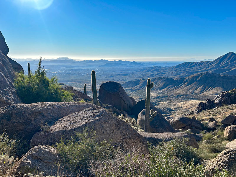
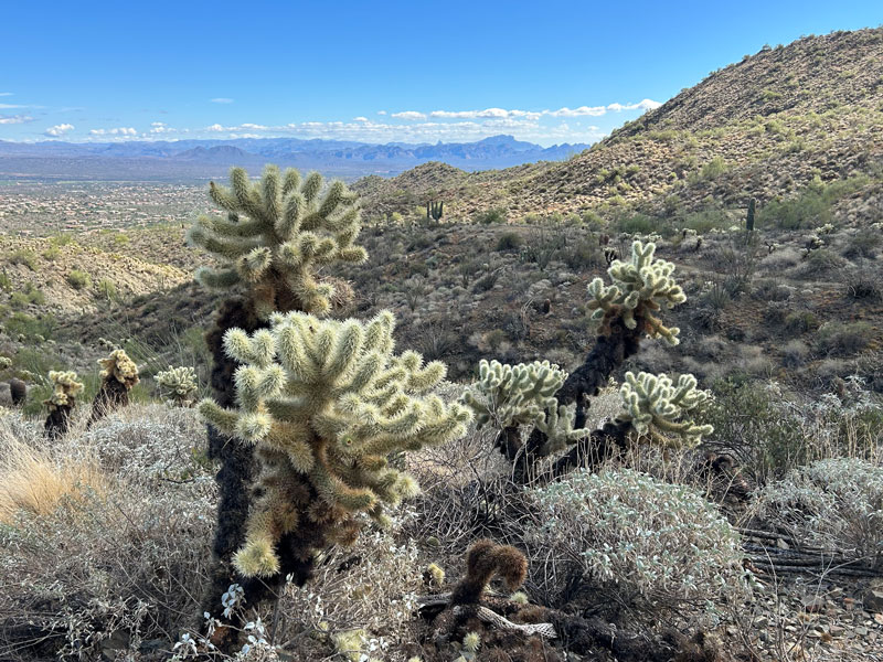
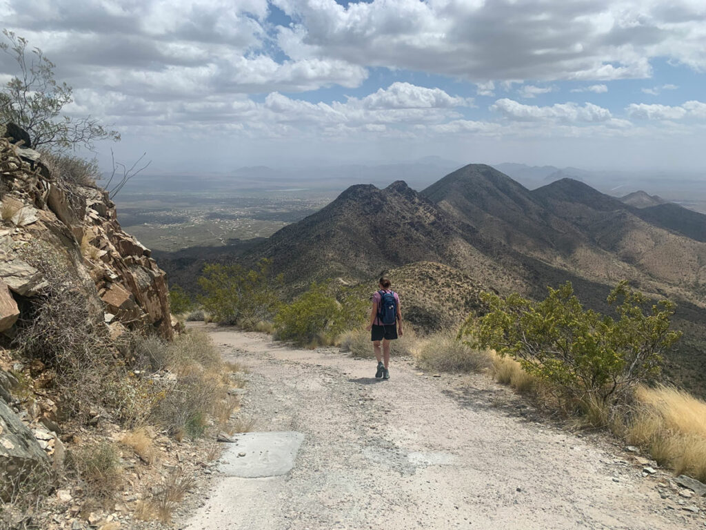
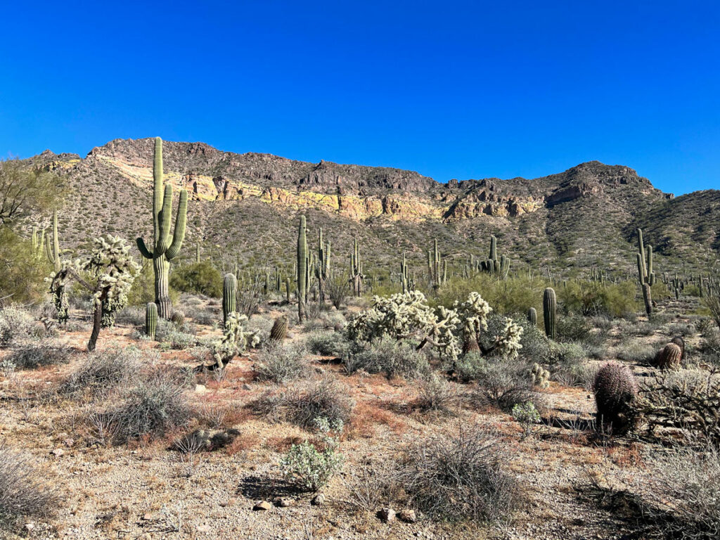
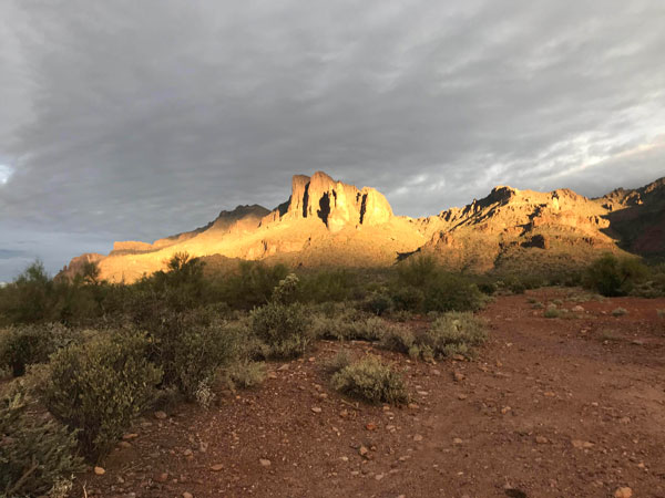
The McDowell Mountains Traverse travels the entire length of the McDowell Mountain range between Tom’s Thumb Trailhead on the north side and Sunrise Trailhead on the south side. Also known as McDowell Mountain Rim to Rim, I changed the name here because there is no rim, and you’re not even on the ridgeline. You’ll simply be enjoying beautiful desert vistas, including the Superstitions and Weaver’s Needle in the distance, as you journey through these mountains from end to end. Trails close at sundown, so plan to be done by then.
Trail Description
You can choose to start this hike at the north end at Tom’s Thumb Trailhead or the south end at Sunrise Trailhead. We started on the north end for logistical reasons, so this guide will describe that direction. Keep in mind that trails close at sundown, so plan to be done before then.
Which direction should I travel?
My pick: north to south
If you start at the north end, you’ll get the steepest part out of the way at the beginning, you’ll have to gain less elevation overall, and the views of the distant mountain ranges will always be before you. The downside is you will also finish the most natural parts of the hike first and have to endure city views and possibly the sound of construction in Adero Canyon toward the end.
Tom’s Thumb Trail
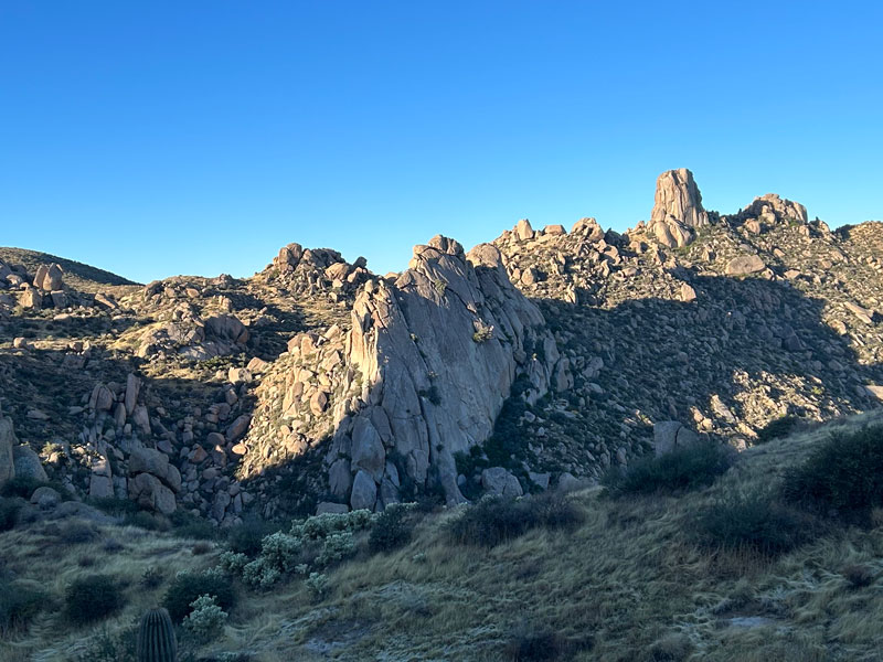
This hike begins on the trail to Tom’s Thumb, which ascends steeply up the mountain through a series of unrelenting switchbacks. The weird and interesting boulder formations are the draw here, and you’ll have great views of Tom’s Thumb on the way up.
When the trail reaches the main saddle and the Tom’s Thumb Trail continues on to the west, you’ll break away onto the East End trail to continue toward the south.
East End Trail
Be careful here because another trail branches off at the same place, too, and you could end up on some really sketchy stuff like we did. Look for the “East End Trail” sign just a short way down the trail to know you’re in the right place.
This trail is a little disheartening because you immediately lose most of the elevation you just worked so hard to gain, but the views down the other side of the mountain are really beautiful.
Windmill Trail
Once you reach the valley below, you’ll intersect with the Windmill Trail and go left toward McDowell Mountain Regional Park.
Coachwhip Trail
When you reach the next junction with the Coachwhip Trail, you’ll turn right. There’s a bench here for resting.
Dixie Mine Trail
At the intersection with the Dixie Mine Trail, turn right toward Dixie Mine and Thompson Peak. It sure feels like you’re going straight back the direction you came from, but soon it’ll turn toward the left. You’ll travel along Thompson Peak Road for a short distance with Dixie Mine visible off to the right.
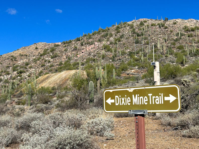
At the steep part, keep an eye out for the continuation of the Dixie Mine Trail on your left. I mean, unless you want to summit Thompson Peak. It’s a butt kicker, so only go if you’re hardcore (and maybe feeling a little crazy today).
Sonoran Trail
Sonoran Trail breaks off to the right. The sign says it’s difficult, but if you’re the type to take on the McDowell Mountain Traverse, it’ll be a breeze.
At this point, let the Bon Jovi dance party begin. “Ohhhhh. . . we’re half way there!”
Upper Sonoran Trail
Eventually the Sonoran Trail splits into two parts: the upper Sonoran and lower Sonoran. Both trails will get you to the same place. The upper Sonoran is three-tenths of a mile shorter with a little over 100 feet more elevation gain than the lower and is rated as difficult, but seriously. Seriously. The trail raters here are big on exaggeration.
Try your hardest to soak up the beauty of the desert here because the worst part is coming.
Promenade Trail
At the end of the Sonoran Trail is the Promenade Trail, which is basically a dirt road. If it’s just annoyingly easy for you, there is the option to cut the corner by taking the Western Loop Trail off to your right just a short distance down the Promenade Trail.
Bathrooms at the Adero Canyon Trailhead
If anyone needs a bathroom break or a water refill, keep going on the Promenade Trail down to the trailhead in Adero Canyon. It adds a very short distance and a little bit of elevation.
Andrew Kinsey Trail
Whether you stuck with the Promenade Trail or cut the corner on the Western Loop Trail, you’ll end up at the intersection with the Andrew Kinsey Trail. This is literally the most annoying trail on the route. They are building in this canyon, so the landscape has been destroyed to make way, and the sound of construction will be your ever present companion.
Sunrise Trail
I know you really wanted to make a right at the Sunrise Trail and get away from the construction, but I’m sorry, you have to turn left. It’s okay, though, because you really are almost to the other side of the mountain.
There’s a spur trail for Sunrise Peak if you’re in the mood, and once you pass it, you’ll start seeing a lot more people who are headed up there.
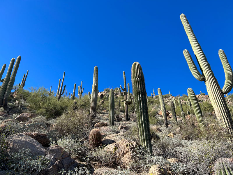
But more importantly, you’ll drop down the other side of the mountain and begin to see a lot more very beautiful desert views of the mountain.
And a TON of saguaros!
There are steep sections along this part, but you won’t care because you know that parking lot is about to burst into view. Woohoo! Sure wish there was a bathroom here.
My crazy idea for next time. . .
Next time I do this hike, I’m thinking of summiting all the peaks that have trails along the way: The Lookout near Tom’s Thumb, then the thigh burner up Thompson Peak, then the spur trail for Sunrise Peak at the end. In that case, I think I’d take a right on Windmill Trail instead and take the Bell Pass Trail to Prospector to the Jeep Road up to Thompson.
What do you think? If you try it, drop me a comment below!
Map & Directions
Location McDowell Mountain Regional Park, McDowell Sonoran Preserve, Scottsdale, Arizona
Tom’s Thumb Trailhead
From the 101 north, take the Pima Road exit and turn right. Continue several miles to Happy Valley Road and turn right again. After the road bends to the left, turn right on Ranch Gate Road. Then turn right on 128th Street and follow it to the Trailhead.
Sunrise Trailhead
From the 101 north, take Shea Blvd and turn right. Follow for several miles and then turn left on 136th Street. Then turn right on Via Linda. Just before the gated community, turn left into the parking lot. There’s an overflow parking lot before that, but you won’t need it because you’re leaving super early, right?
Fees/Passes None
Trailhead Facilities Pit toilets available at Tom’s Thumb Trailhead; water available at Sunrise Trailhead. All trails close at sundown.
Preview this Hike
Recommendations for you
Thompson Peak | McDowell Mountains
Pass Mountain Ridgeline | Pass Mountain/Usery Mountain Park
Superstition Ridgeline | Superstitions
Leave a Reply