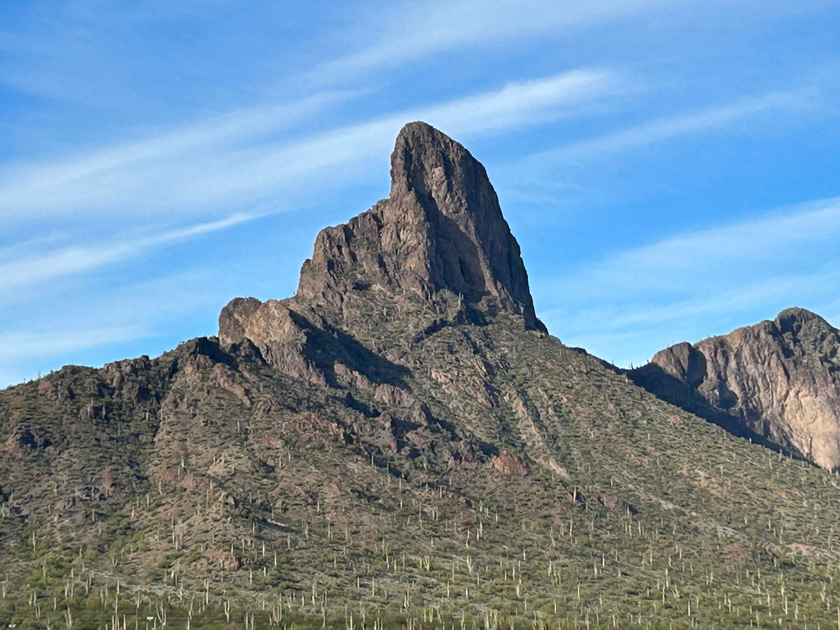
Picacho Peak
TRAIL STATS
If you’ve ever driven between Phoenix and Tucson, you’ve no doubt seen the prominent shape of Picacho Peak next to the interstate. Rising 1500 feet from the desert floor, it offers outstanding views in every direction, even if Interstate 10 ruins it a little. There are two options for summiting the peak, but both will require you to use metal cables installed in the 1960s to get to the top. It’s an exciting adventure no matter how you do it.
Trail Description
Picacho Peak lies within Picacho Peak State Park, a park that is popular with winter visitors and showcases the history of the area, which was the site of the westernmost battle of the Civil War.
The park has a few short trails, but most people go there to hike to the peak, and there are two options for getting there.
Hunter Trail or Sunset Vista Trail?
Hunter Trail is shorter and a bit more strenuous, and it has some additional interesting parts of the trail that adventurous people won’t want to miss. It’s also in the morning shade, so if it’s hot out, Hunter Trail is the way to go. This is the most popular choice.
Sunset Vista Trail is longer and meanders through the desert for a couple of miles before getting to the peak. If you want a longer hike, want to see more of the beautiful saguaro and cholla cactuses that adorn the area, or want to stay warmer on a chilly morning, Sunset Vista Trail is the best choice.
Hunter Trail
If you’re taking the Hunter Trail, you’ll want to turn left at the Barrett Loop after entering the park to get to the parking for Hunter Trail.
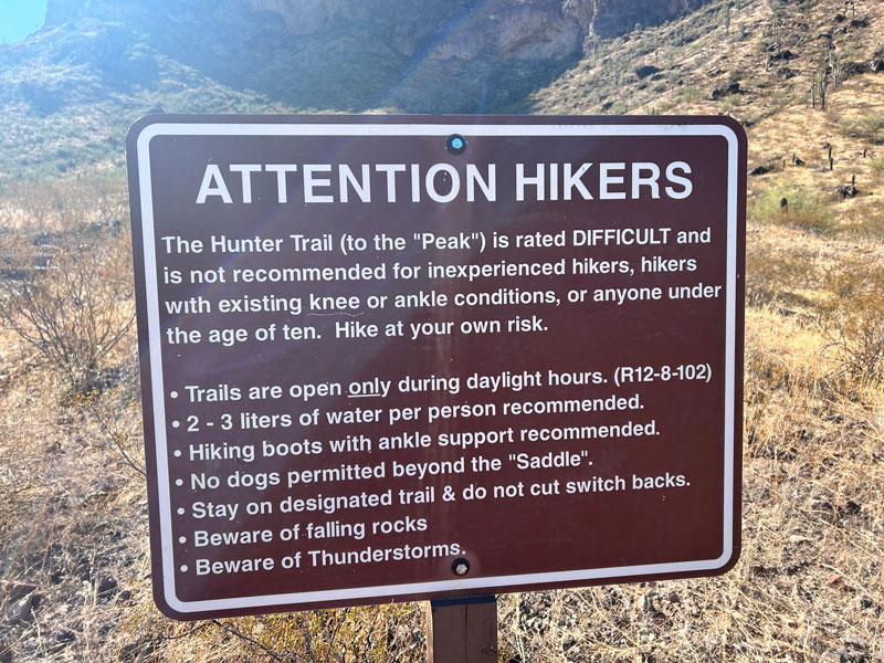
At the start of this trail, there is a warning sign.
Starting up the trail, you’ll be headed straight toward the mountain, following small white arrows when you see them. Up ahead, it will start to look like it’s impossible to get up the sheer cliffs ahead. When you get closer, you’ll see that you’ll need to make a large switchback to the left to gain access to the path to the saddle (see the map).
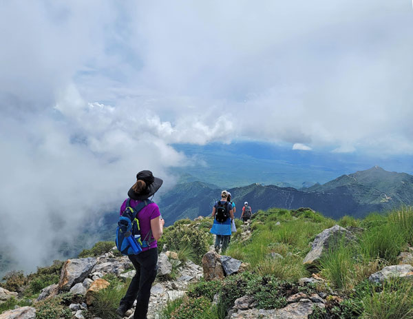
Once at the saddle, you’ll feel amazing and accomplished until you learn you have to go back down a couple hundred feet on the other side. It’s also the first section you’ll encounter that has cables, and even though it sucks to lose elevation, it can be kind of fun.
There are some steps made of railroad ties to help with footing, and some spots with rock overhead, so watch your noggin.
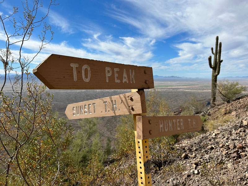
At the bottom of this long cabled section, you’ll make a turn to the left. Around the back side of the mountain, you’ll eventually find this sign where the Hunter Trail and the Sunset Vista Trail meet. From here on out, the remainder of the route is identical.
The Cable Climb
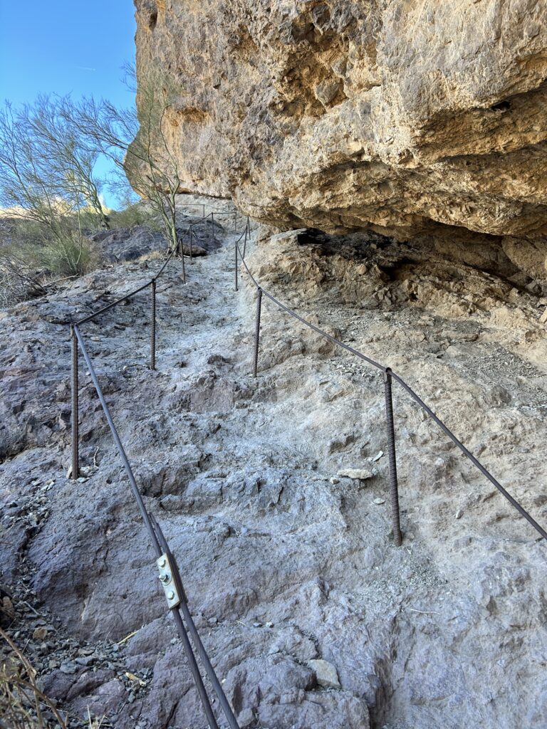
I’d love to show you detailed photographs of all the cabled sections, but we were so busy taking videos that we kind of forgot to get pictures. I know, what kind of blog is this?! All I’m saying is you should watch the video (link below) for many reasons.
I do have this one picture to give you an idea of what the cables are like.
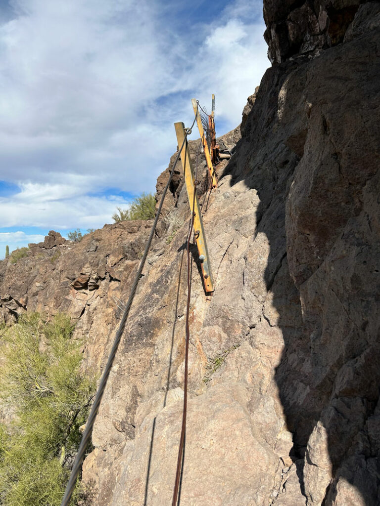
Being that using the cables is pretty much mandatory, gloves are a great idea. The cables actually feel pretty safe, and only those with serious fear of sketchy things will want to back out. Take a deep breath and keep going. The summit views are worth it!
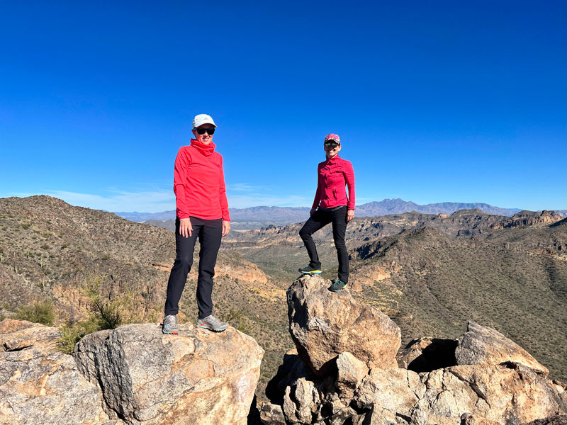
The Summit
After the last cabled section pictured above, you are almost there! The last little push to the summit has some loose footing, and a bunch of trails kind of crisscross each other. Pick your favorite path, and get this peak in the bag.
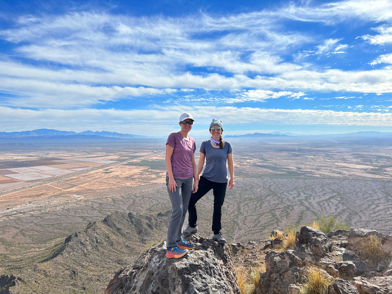
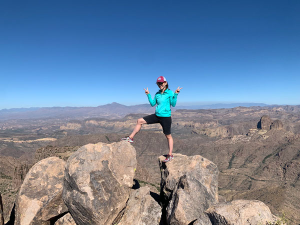
Toward the far side of the peak on the left is this rock that makes a great photo op, if you can balance on it. Just me, my bestie, and the valley more than a thousand feet below. Awesome.
Sunset Vista Trail
Additional mileage 2.9
Additional elevation gain -77 feet
Because the Sunset Vista Trail is longer and lacks the disheartening downhill section you have to do on Hunter Trail, it is a bit less strenuous.
If you’re going with Sunset Vista, head to the last parking lot in the park. The trail starts with a short uphill section in the foothills and soon crosses over to the back side of the mountain, giving you views of Picacho Peak up ahead.
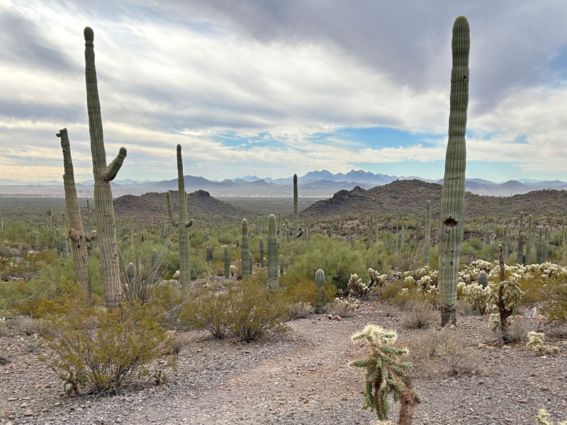
The section of the trail is fairly flat and well-maintained, traveling across washes and wandering through a magnificent cactus garden. Desert lovers and photographers will prefer this more scenic, laid back route with views of the mountains in the distance.
After the first two miles, it’ll start to get a lot little steeper as you close in on the peak.
Just one short cable section on this trail before you get to a sign where the two trails merge into one before the push to the summit. From there, the routes are identical. Read the description above under “The Cabled Section” heading for more details.
Map & Directions
Location Picacho Peak State Park, Tucson, Arizona
From Phoenix, take the I-10 south until you see the exit for Picacho Peak State Park. No, not the exit for Picacho. That’s a town filled with nut orchards (don’t ask how I know).
Fees/Passes Entrance fee covers 4 adults, and each additional adult is extra
Trailhead Facilities Restrooms and water available, but not exactly right at the trailhead. Use your p-style with caution (watch for overly concerned rangers).
Hunter Trail is the pink route, Sunset Vista Trail is the green route. Both routes are included in the GPX and KML files.
Preview this Hike
The video shows the Sunset Vista Trail, but both trails converge before most of the cabled sections, so this can be helpful for those hiking Hunter Trail.
Recommendations for you
Ten Awesome Arizona Peaks that Aren’t Humphrey’s
Mount Wrightson | Santa Rita Mountains
Peak 5057 | Superstition Mountains
Leave a Reply