Watson Lake Loop
TRAIL STATS
Take a journey around the entire circumference of Watson Lake on this scenic loop. You’ll pass through a wonderland of lumpy rock formations called granite dells, enjoy a lush oasis while watching water gush out of the Granite Creek Dam flume, and have wonderful views of the lake. Be aware, the lake is stinky at times, and much of this trail is on a boring road. For a shorter version, simply go clockwise until you’re satisfied and then return.
Trail Description
Not knowing much about this trail ahead of time, we parked at the Peavine Trailhead. That ended up adding about half a mile of boring dirt road to our hike, so if you’re on foot like us, definitely park at Watson Lake Park instead. We make mistakes so you don’t have to (map updated to show preferred parking for hikers).
But since we parked there, this guide will describe our hike counter-clockwise starting at Peavine Trailhead.
Peavine Trail
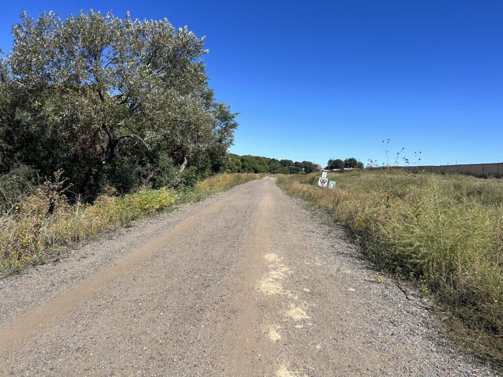
I guess the one good thing about parking at the Peavine Trailhead was that we got the boring road section out of the way at the beginning by going counter-clockwise. I mean, we questioned whether or not this hike would even be worth it when we started.
After about a mile, we started getting glimpses of the lake, and that got our hopes up. There are numerous places along the trail where you can follow a short path to a view of the lake.
It’s along this section that you’ll want to be on the lookout for a trail on the left that leaves the road to get on the Watson Lake Loop Trail. Unless you want to stay on the road a bit longer, but why?
Watson Lake Loop Trail
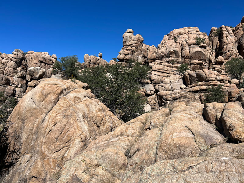
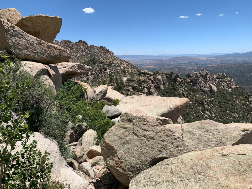
Once on the trail, the going gets a little slower since you’re hiking more ups and downs along more rugged terrain, all while looking for painted white dots to show the way.
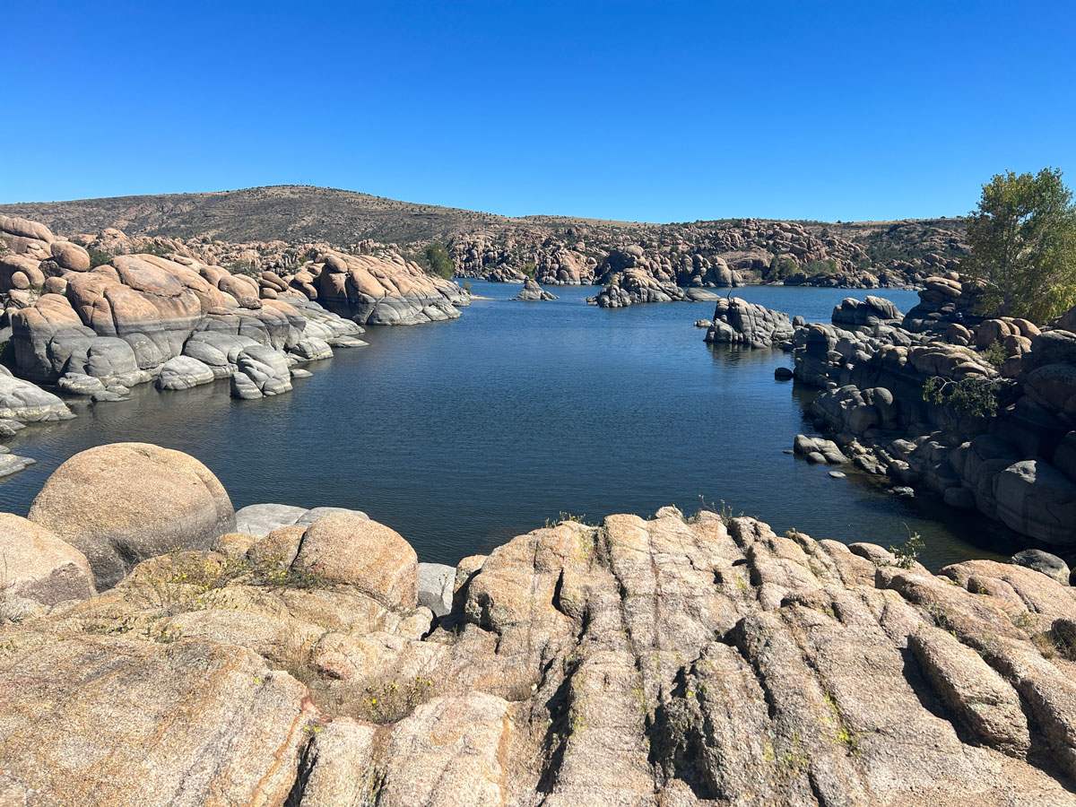
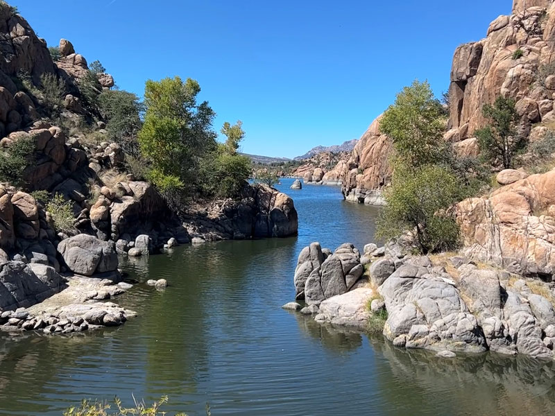
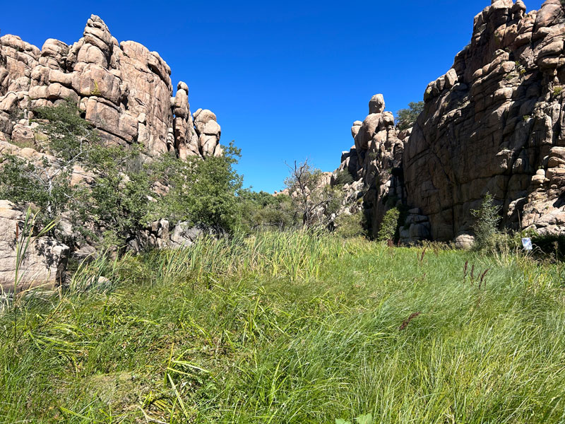
Toward the northern end of the lake, you’ll pass through other-worldly rock formations called the granite dells.
There are a few side trails to explore in this area if you so desire, so check a map.
Granite Creek Dam
In the middle of this rocky wonderland, you’ll suddenly find yourself in a lush oasis. What?!
This is where the Granite Creek Dam lets water out of Watson Lake. If you go up and to the left, you’ll get an awesome view of the water shooting out of the dam (we didn’t have time to get a picture, but we saw it from far off, and it looked cool!).
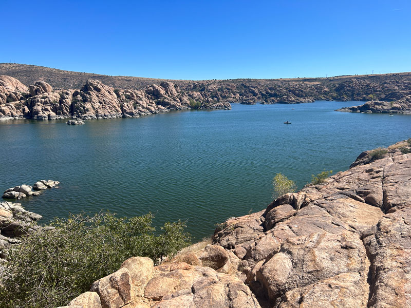
As you come around the other side of the lake, you’ll have a lot of expansive views of the lake, and you might be considering a paddleboard or kayak adventure next time. Forget swimming, though, since it’s prohibited due to high levels of pollutants. Every now and then a strong breeze would bring a nasty smell to remind us of that.
This is a popular area that’s close to the parking area, so people have made trails every which way. White dots help you stay on the path, but GPS can also be helpful.
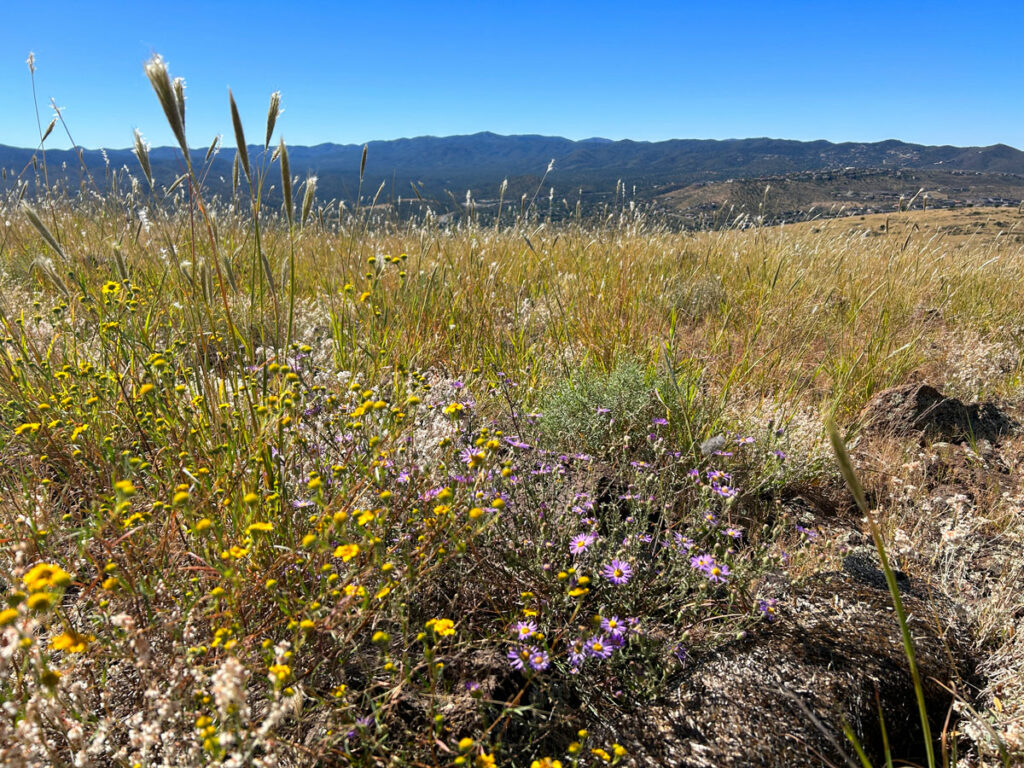
Once you pass the Watson Lake Park main parking area, there are no more granite dells, and the trail becomes flat and easy to follow. Large trees, wildflowers, and some bridges give it a little character, but the cars zooming nearby disturb the peace.
The good news is, if you parked where we did, you’re almost done.
Clockwise or counter-clockwise?
If you park at Watson Lake Park, going clockwise will get you to the best of the trail first. You’ll start with views of the lake, a visit to the dam and flume (“waterfall”), and a trip through the granite dells, ending with the dirt road and flat trail.
Additional information
No swimming is allowed in Watson Lake, but you can rent kayaks, canoes, and stand up paddleboards at the lake from Prescott Outdoors.
The park has additional amenities like picnic areas, barbecue grills, a playground, boat ramp, horseshoe pits, disc golf course, and more. See the website for more information.
Map & Directions
Location Watson Lake Park, Prescott, Arizona
From Prescott, travel north on Highway 89. Turn right on Watson Lake Park Road and follow it to the parking lot.
Fees/Passes There is a daily fee you can pay with a credit card at the kiosk. Parking is free on Wednesdays.
Trailhead Facilities Restrooms and water available
Recommendations for you
Glassford Hill Summit | Prescott
Granite Mountain Hotshots | Wickenburg
Granite Mountain | Prescott
Leave a Reply