Wind Cave
TRAIL STATS
Though it’s more like an overhang than a cave, Wind Cave is a popular hike in Usery Mountain Regional Park that leads to a nice viewpoint overlooking the city. The trail can be narrow and rocky at times with loose gravel, but is generally suitable for most people with an average level of fitness. More adventurous hikers have the option to continue on the unmaintained trail to the summit (highly recommended).
Trail Description
If you’re wanting to do this hike because you want to see a cave, don’t bother. Head on over to Wave Cave or Broadway Cave instead. While Wind Cave isn’t much of a cave, it is a beautiful hike and provides a nice view of the city. Even better views can be had if you go past the cave and visit the Wind Cave Summit. It’s not much more effort, and the views are 360-degrees from up there. Just plan on that because it’s worth it!
Most people who do this hike will enter Usery Mountain Regional Park and park their car right at the trailhead. It’s the shortest, easiest option. However, if you’re doing Wind Cave as part of a longer hike like Pass Mountain Ridgeline or Pass Mountain Loop, you’ll want to park elsewhere and skip the fee. The trailhead in the park has flushing toilets, drinking fountains, and water filling stations. Nice!
Wind Cave Trail
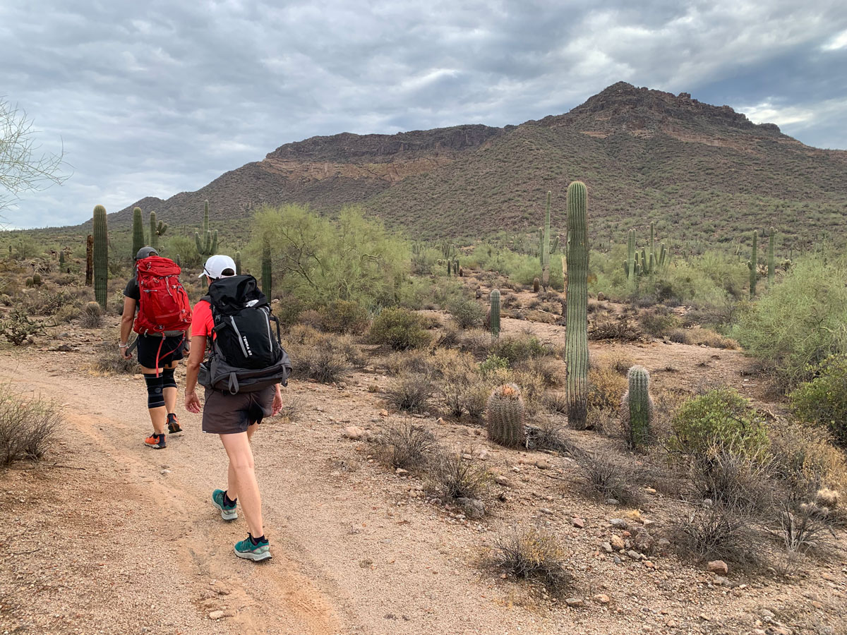
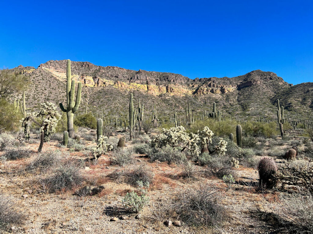
The trail begins as you pass the bathrooms. There is a junction right away, and you’ll want to go straight ahead to continue on the Wind Cave Trail. The other trail makes a loop around Pass Mountain and will make a great hike for another time. Up ahead, the mountain looms above you, and it will be near impossible to distinguish where Wind Cave is if you haven’t been there before.
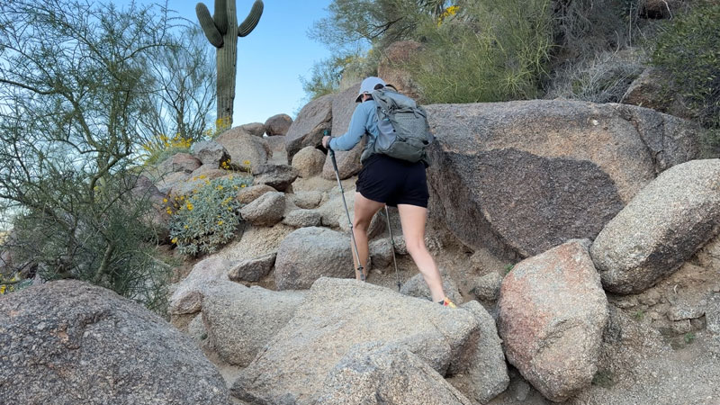
The trail starts off wide and gradual with an unusual number of benches. I guess a lot of people must enjoy sitting and staring at the mountain. Can’t blame them! Soon the trail begins a steady, moderate uphill climb, but it never gets terribly steep or treacherous. The trail is very easy to follow due to the high number of visitors, so you will most likely have company on this trail. As you get to the higher part of the trail, the trail is full of boulders.
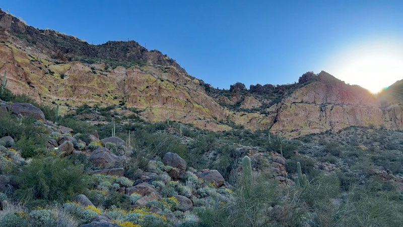
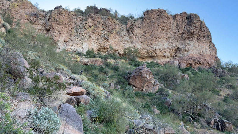
As the trail approaches the yellow cliffs ahead, it turns to the right toward the Wind Cave. If you look and listen, you might be able to see people who are already up in the cave. At that point, you’ll be saying, “That’s a cave?” Well, yeah, according to the name.
This part of the trail is a little flatter right up until the final climb up into the cave. When you arrive, a sign that says, “Wind Cave” points you to the left because if you were looking for an actual cave, you’d probably keep going.
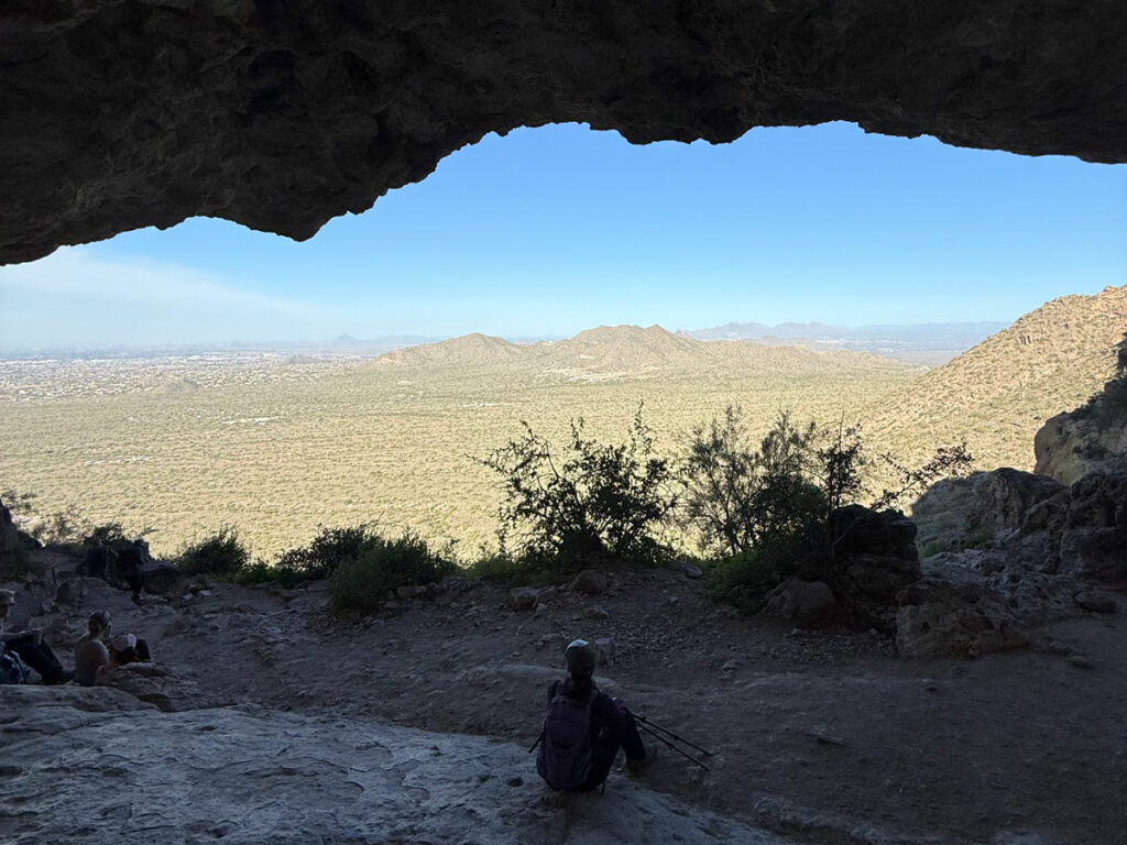
Wind Cave
The “cave” provides a large area for hikers to sit in the shade and enjoy the view. Do watch for bees, as we have seen hives in the cave.
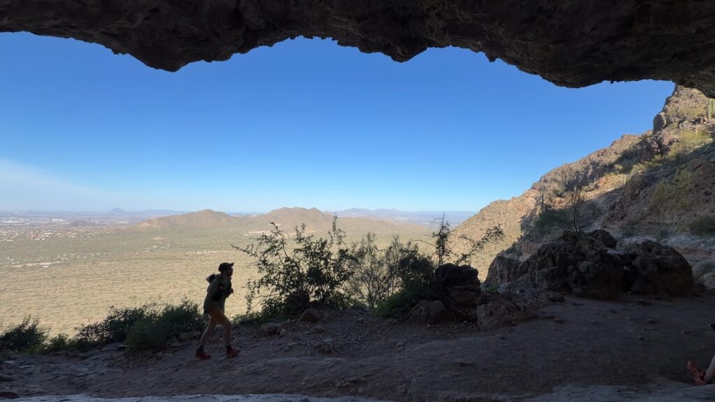
No, no, no, don’t say, “That looks like a pretty big cave.” I was using my 0.5 camera, guys. It’s all camera tricks.
Wind Cave Summit Trail
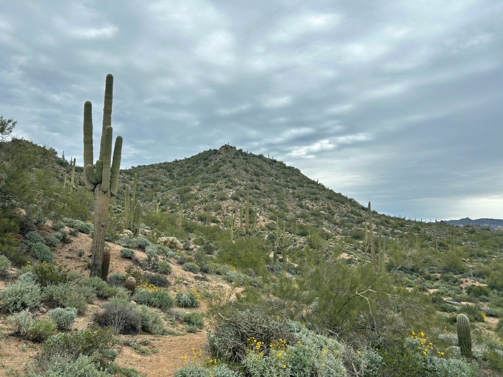
When you got up to the cave, you went left. If you go right, you can continue to the summit. It’s about a quarter mile farther, and we think it’s definitely worth the extra effort. A rickety old homemade sign warns that continuing is risky and you’re hiking at your own risk beyond that point. Not sure what that means (was I hiking at someone else’s risk before?), but it’s really not much more difficult than the trail you’ve been using up to this point. It’s just not maintained.
Even though some bonehead decided to paint blue arrows up there, the trail is harder to follow, so you will want GPS to be sure.
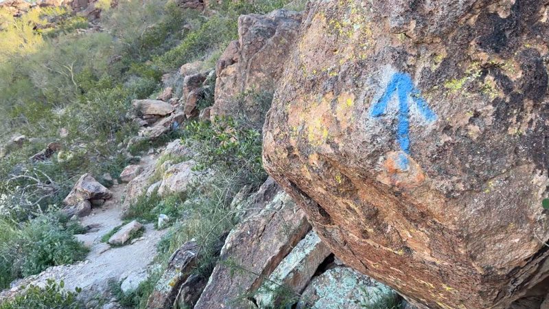
The trail heads south along the cliff for a while before making a u-turn and heading north again, this time up higher on the cliff. Then the trail makes a right turn to go up to the saddle. Once you can see the other side of the mountain, you’re on the saddle, and it’s a short hike to the right to the top.
Wind Cave Summit
The view up there is 5-stars! Where you could mostly see the city from the Wind Cave, you can see the mountains on the other side from the summit, including Four Peaks!
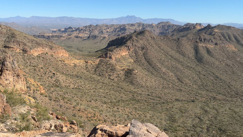
My picture doesn’t do it justice. The views are 360-degrees, and there are some big rocks that make a great place for a photo op. Aren’t you glad you put in the extra effort?
Map & Directions
Location Usery Mountain Regional Park, Mesa, Arizona
Google Maps Wind Cave Trail Parking Area
Fees/Passes Usery Mountain Regional Park charges a per vehicle fee to enter.
Trailhead Facilities Restrooms and water filling stations inside the park.
Recommendations for you
Pass Mountain Loop | Pass Mountain
Pass Mountain Loop | Pass Mountain
Lone Mountain (EJ Peak) | Pass Mountain
Leave a Reply